

fountainguy97
-
Posts
1,029 -
Joined
-
Last visited
Content Type
Profiles
Blogs
Forums
American Weather
Media Demo
Store
Gallery
Posts posted by fountainguy97
-
-
5 minutes ago, Holston_River_Rambler said:
Looks like the 6z Euro came north with the precip. for superbowl Sunday. Still not like the GFS, but a small step for it.
Yeah 06z euro trended NW “only” by 200miles haha. IMO gfs family is on top of it. It nailed the heavy snow across NC while euro and others didn’t find it until a day or two out.
-
WOW guys. Look at this gefs trend. Gfs I have to say was the first model to find the NC snow system. Can’t ignore an entire model family. MiddlE TN gets in the game on several gefs members

-
 1
1
-
-
Interesting that there are still 4-5 GEFS members with a significant snow for the 84-100 hr storm. Seems like that system still has some wiggle room. A lot of energy up at H5 that could change. Although no OP support to be found. Likely a no show.
-
1
-
-
Added 1.25 since 8am. Seems to finally be tapering off. Occasional gust to 20 makes it brutal outside.

-
7
-
 1
1
-
-
14 minutes ago, Bigbald said:
Guessing Beauty Spot and Pleasant Garden are well smashed right now, may try and hike up to PG via Rattlesnake Ridge Trail this afternoon.
With 6 going on 7 here at 2000ft surely a foot on the peaks.
Not to mention there was already snow up there. Unaka mountain has been snow topped for most of January besides those few days into the low 60s
-
2 minutes ago, tnweathernut said:
1 inch across north Johnson City. Around 2” in parts of south Johnson City and between 3-4” in Unicoi. Also Erwin (city) has between 2 and 3”. Still snowing this AM (9:30) across parts of Washington and Unicoi County.
.Wow. I guess up My area up rock creek in Erwin really really loves this NNW flow.
adding another inch currently
-
6
-
-
6” on the dot this morning. It’s COLD out.
Moderate snow now.

-
7
-
1
-
-
Visibility is low right now. Some seriously heavy rates. .3-.5 mile visibility (I have plenty of house lights to judge by)
-
3
-
-
Some nice back building to the west of Knoxville last few frames.
-
2
-
-
This final piece looks like the best snow producer for us all. You can see our old piece pulling away and the new purple “push” of moisture rolling in.
matches with Radar as well.


-
2
-
-
Just measured plenty of 3-4” marks. So we will go with 3.5. Lots of blowing around. Hopeful to hit that magic 6” mark tonight.
-
4
-
-
3 minutes ago, John1122 said:
I am always interested in seeing the Micro climates here that show up in these situations. It's really rare to see snow coming from the direction it is now. 90 percent of the time you'd see a band rolling off Lake Michigan pointed down across Northern Kentucky in a NW flow situation. It's rare to see Erie involved and see High Knob making a snow shadow to the SSE.
Yeah seems like my backyard is eating this NNW flow up. It’s crazy to see the micro climates around. Literally 3 miles down the road into Erwin probably has half of what I have or even less.
-
1
-
-
27 minutes ago, Holston_River_Rambler said:
Good looking slug of moisture dropping in from OH:
Looks like John will be right on the western edge, so me and The CumbCo folks are probably out. Fountainguy is probably gonna get hammered by it.
Looks like the final energy lobe will be moving in soon. Already see radar beefing up one more time across our area.
This one has the best chance for accumulating outside the “prime” NW locations as it has the coldest temps to work with. Let’s get you guys some snow!
-
1
-
-
Heaviest of the night so far. It just keeps coming.

-
5
-
-
A whole night of this?


-
6
-
-
Heavy snow now. 27 surface temp and 850s are approaching -10c. Flakes are decent size and coming down in buckets.
ground smoothing over. Wonder what the ceiling is for this event.... several hours left..
-
3
-
-
Working toward 2” quickly here. Temp down to 27. Lot of moisture left

-
6
-
-
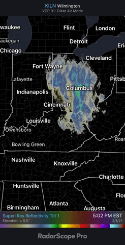
Look at those deep greens training into the Smokys. Wow
-
2
-
-
Pouring here. 28.7 degrees and just had a gust of 17. Roads covering again.
coming up on an inch soon-
5
-
-
can see the flow starting to pull more toward our classic NW direction as the ULL is sweeping through. Full on NW regime will begin over the next few hours!
-
1
-
-
8 minutes ago, tnweathernut said:
How do you do at 1950? Most upslope events get really good around 2500........... so just curious. My office in on N Main Avenue, so we don't get in on the elevated fun too often.
We moved and are now right above 2k
") . yeah we do ok here. I can usually score 40-50% of what the top peaks around me get. Depends alot on the exact flow here too I think NNW is best since the path from JC down to Erwin is pretty clear. I've seen moisture pile up in the valley from that way. Helps pad the annual averages atleast.
. yeah we do ok here. I can usually score 40-50% of what the top peaks around me get. Depends alot on the exact flow here too I think NNW is best since the path from JC down to Erwin is pretty clear. I've seen moisture pile up in the valley from that way. Helps pad the annual averages atleast.
Erwin proper is always in a snow hole from high peaks all around it. We are out of Erwin and up the mountain just enough to not live in the mountain shadows 24/7
-
2
-
-
3 minutes ago, tnweathernut said:
I think this afternoon it was supposed to fill in and find better snows in northeast TN. Still probably have to get to tonight and hope we keep enough moisture around. I think we will around Erwin to south JC (north and west of that it will be a toss up hoping for renegade snow showers breaking containment). I am guessing roads will be a mess tomorrow morning for anyone with a hint of upslope to their area.
seems like it. Models only had 1-2inches for most of this area before 7pm. bulk comes with the better rates tonight
-
looks like another batch of moisture building in.
-
1
-
-
30 minutes ago, Stovepipe said:
Approaching moderate rates now with dimes mixing in.
.Radar is looking great over that way. 20-25dbz is pretty good in this setup.
Temp down to 30.9. Super small flakes but a billion of them. Roads white. My 2wd truck cringes at driving to work in a second.
-
1
-


February/March 2021 - Frigid or Flop? Pattern/Longterm Forecast Thread.
in Tennessee Valley
Posted
12z nam more amped and consolidated. Expect a decent NW shift incoming.
Also looks very similar to the GFS 06z