

fountainguy97
-
Posts
1,112 -
Joined
-
Last visited
Content Type
Profiles
Blogs
Forums
American Weather
Media Demo
Store
Gallery
Posts posted by fountainguy97
-
-
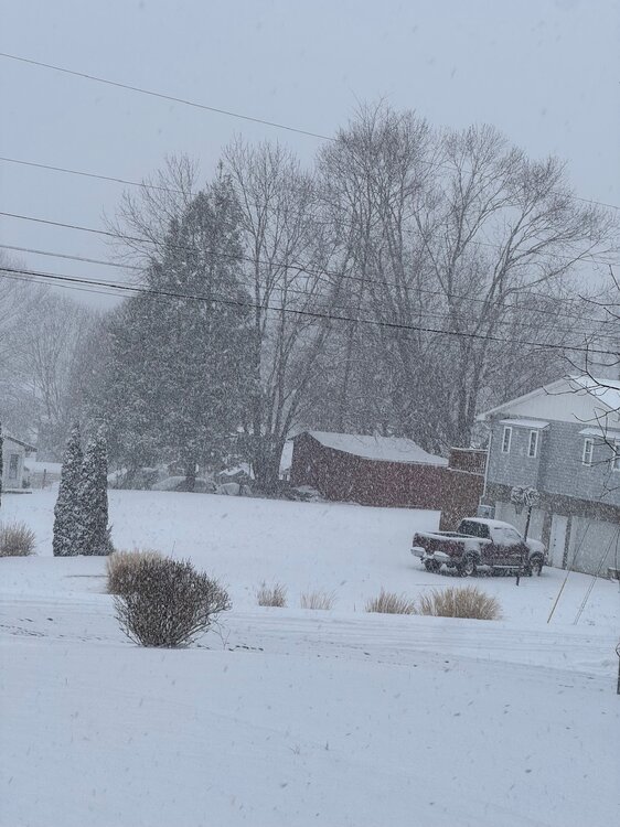
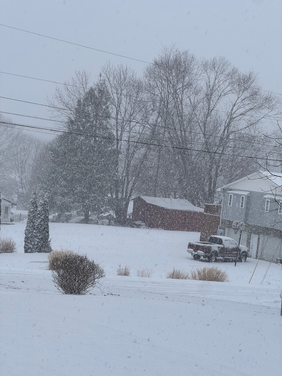
Decided to try out Imgur so I don't have to constantly delete photos out of the threads. Here is a short clip of the snow!
-
 3
3
-
 1
1
-
-
8 minutes ago, Math/Met said:
Similar rates here. I have just over 3 inches of accumulation now, so about .5 inch increase in about 45 minutes.
Probably closing in on 2" here. 3" looks likely given radar. Rates are even harder now.
-
6
-
-
It's ripping pretty good as far as NW events are concerned. Probably .5 or .75 inch per hour rates currently. It's 17 here and that NW flow is squeezing out every drop of moisture in the lower levels.
-
8
-
-
37 minutes ago, PowellVolz said:
Interesting little piece of energy rounding the base of the trough that’s headed towards ETn. It’s on the low and ML water vapor. Not sure it actually causes any lift but….
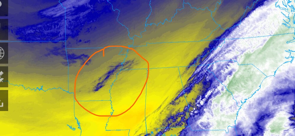
also the CAA behind the trough looks healthy and it looks like we will be really close to the right exit region. 500mb maps show some separation in the right exit region so diversion aloft may help some assuming the same effect that can increase thunderstorms can also aid winter weather.
Always crushing it with the real time obs!
Ratios will be between 15:1 and 20:1 so the chance of an over performer is higher than normal.
-
2
-
 1
1
-
-
My temp has slowly started to fall from a spike of 36. Downslope winds are relaxing.
-
2
-
-
54 minutes ago, PowellVolz said:
It’s not really a ULL (upper level low), it’s more of a short wave on the upper level trough that will swing though tonight. It’s not really a benefit to the valley, more in the foothills, plateau and mountains.
Yeah my bad on the terminology there lol.
-
1
-
-
Woke up to a nice dusting most of which has already melted off. My eggs were always in the ULL basket with this one. That February sun is no joke. 12z suite is fairly tame in regards to the energy coming through tonight maybe a generous 2-3" across the typical NW prone areas with 3-5" on the peaks
-
2
-
-
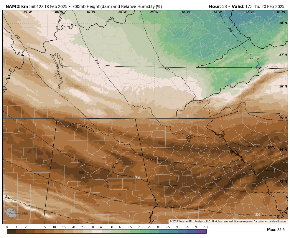
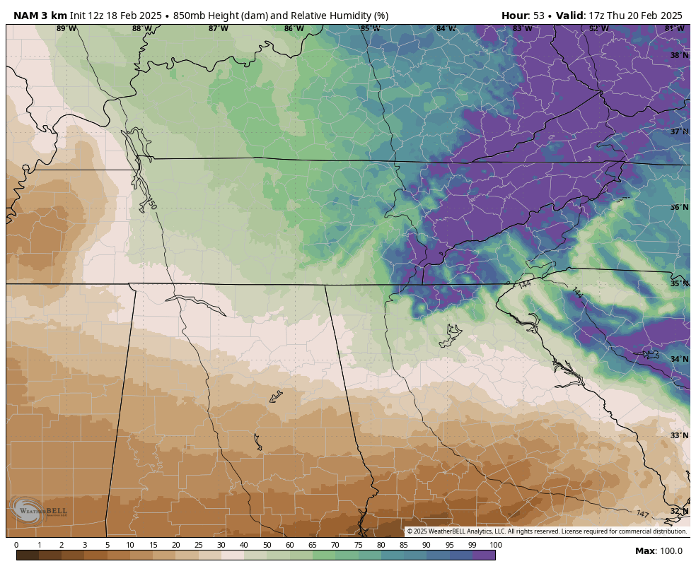
Indeed the place where snowflakes go to die appears in full force tomorrow as both the hrrrr and nam have a minor downsloping wind for the valley through the day.
I said earlier today don't be shocked when the valley and east is a bare ground going into tmrw evening. It'll be very similar to last event. Except hopefully when the flow backs we get a nice shot of cold NW snow


-
3
-
-
Areas west of the valley cash in tmrw morning. Don't get frustrated when tmrw the valley and points east struggle with precip and downslope issues.
our show comes as the flow backs and that Vort swings through.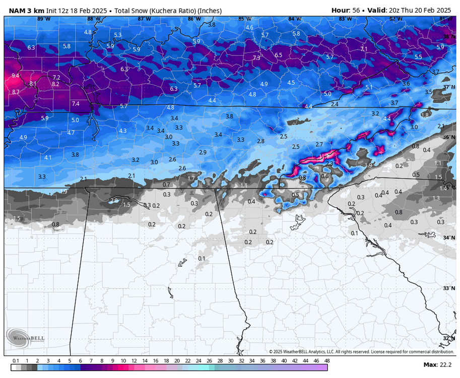
-
1
-
-
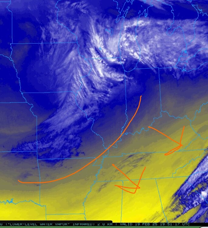
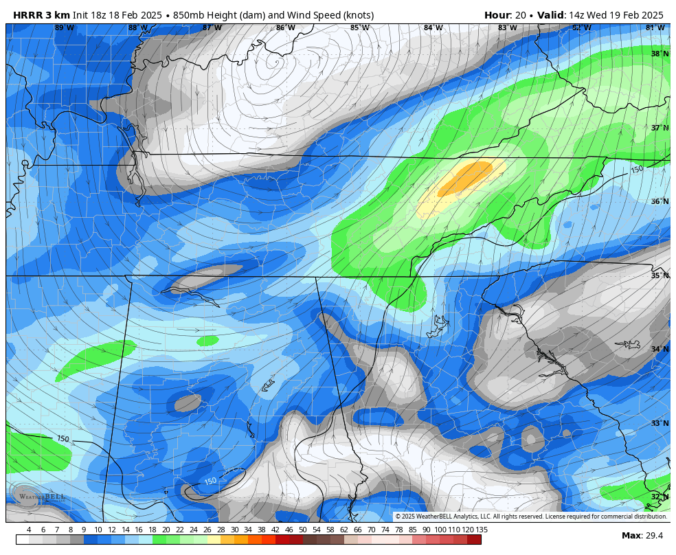
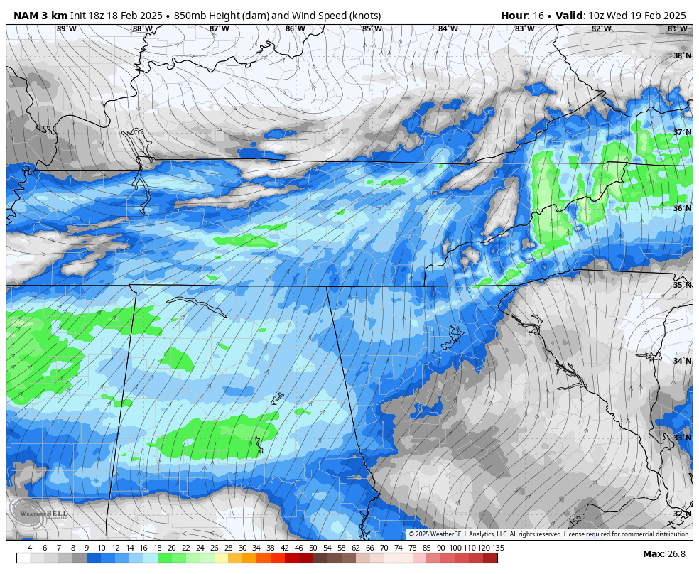
Hrrr and nam finally seeing the significance of the ULL passage. In my experience when you see NW events with moisture into the 700mb layer it typically ends up being a pretty significant event.
3km nam has 20-30knt of 850 flow and temps in the teens during these frames. It would stack on quickly.


-
2
-
1
-
-
16 minutes ago, Carvers Gap said:
That is what it is. I think NE TN will get as much or more from it. The 12z has the same. Slight tick north.
Yeah that's the only player we can get anything of note from at this point for E and NE regions. The initial precip shield is doomed to the transfer. Maybe a very lucky few get 1-2" Wednesday morning at best.
-
2
-
-
28 minutes ago, John1122 said:
The Euro went from .6 or so to .15 QPF in the last 24-36 hours. Just horrible luck and I've no doubt it's going to be correct because whatever is the worst case here, has been correct this winter.
Yep that's just how it's been the last few winters. If I've been taught anything by the last 3 winters it's just sit back and let it ride.
I used to get so spun up about storms and crash out when they inevitably went poof. It's still frustrating for sure but my mindset now is that I'm just a spectator with no control over any of it. Just going to let it ride and enjoy what we do get.
Even with the downslope fiasco and the warm nose issues and now this transfer this winter has been exponentially better than the last 2 for my backyard.
-
11 minutes ago, *Flash* said:
I don't hate my location with the midweek system. Just sucks to see another case of weakening energy ahead of the transfer. Seems like our area is ideal for losing juice. This is a primary reason why our 4-6+" last month turned into a 3-5" situation.
Yeah what a brutal transfer. Wish we could get back to the earlier phase solution but it is extremely unlikely at this point.
almost completely blanks Western NC.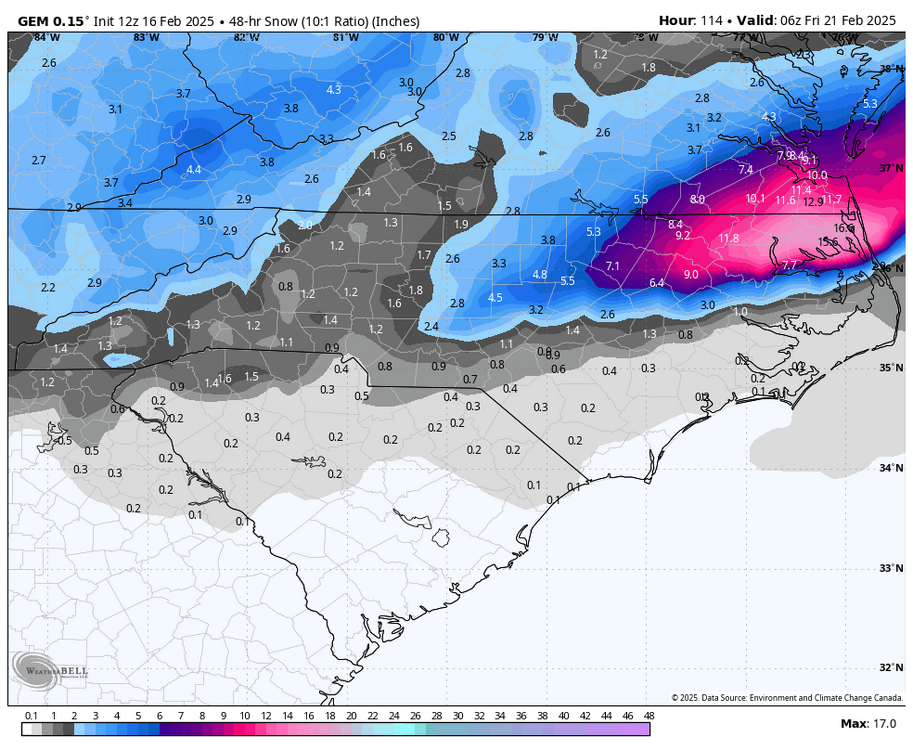
-
1
-
-
Yeah models trending flatter and a late phase. Keeps us much drier.
-
Thread started for next week!
-
4
-
 3
3
-
-
Can we get a true Miller A pass with no warm nose? Trends today are good!
-
9
-
-
12z trends aren't bad. CMC and gfs moving toward the more broken up 2 phase event. Intial precip and then backfill. Vs a single amped storm.
euro went toward the gfs camp at 06z too.
Seems like that is the obvious way we score with this one. Let that second wave of precip blossom in the cold sector and avoid the warm nose push by a full phase amped system.
-
2
-
-
Man another storm with an absolutely brutal warm nose for eastern areas. This has been the winter of warm nosing and downslope lol.

-
1
-
1
-
-
Ensembles are still useful at this range. 12z euro is actually better.
I wouldn't worry about a small amount of suppression at this range. Not until inside 72 hrs.
-
3
-
-
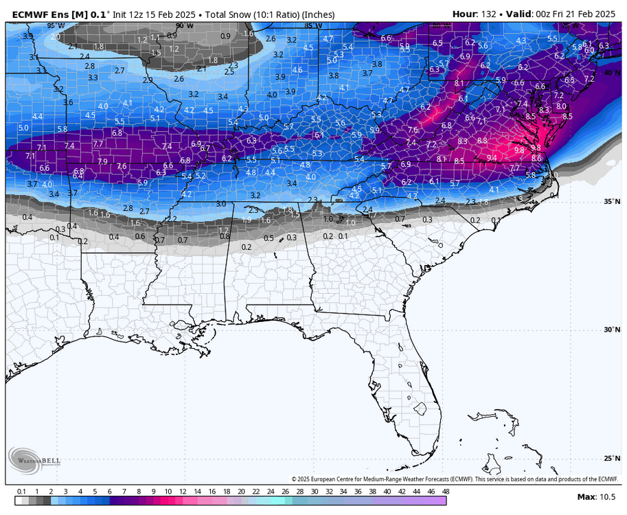
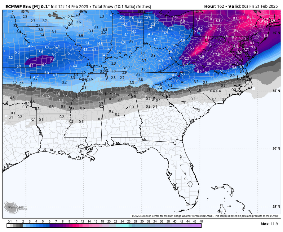
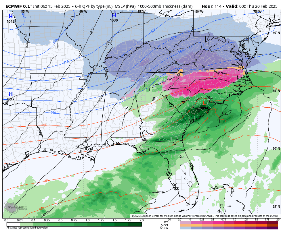
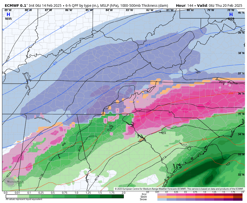
Wow. Just like that overnight the CMC, EURO, UK have a monster storm for TN. Good agreement overnight.

-
7
-
-
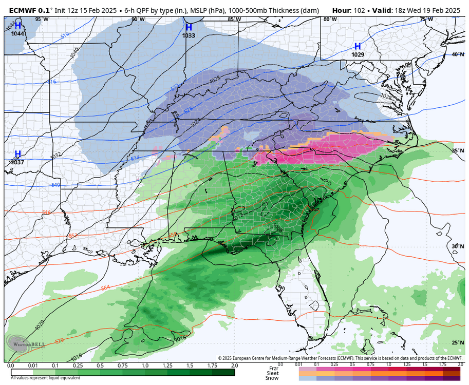
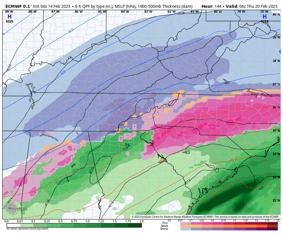
BIG CAD signature on most models around the 210 timeframe. I don't think Eastern areas like these setups at all. Warm straight up the gut of the valley.
-
2
-
-
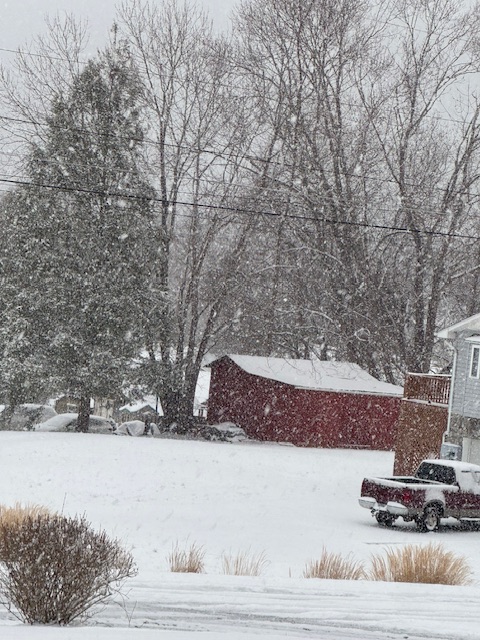
Wow absolutely ripping right now!!
-
4
-
-
33.1. Amazing what a nice healthy DGZ and moisture support can do for rates. Already heavier snow than anything the last storm did here.
-
3
-
-
37.9 here. Seems like most of my accumulation will come from the cold NW flow. Not sure much of this daytime stuff will have a chance to accumulate.
-
1
-


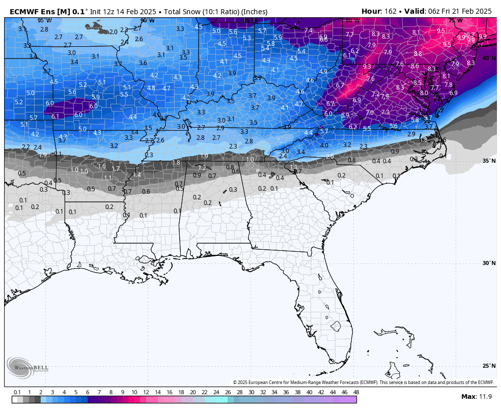

2/19-2/20 Miller A Magic?
in Tennessee Valley
Posted
Here is a Timelapse of the NW showers rolling through today!