

wasnow215
-
Posts
2,078 -
Joined
-
Last visited
Content Type
Profiles
Blogs
Forums
American Weather
Media Demo
Store
Gallery
Everything posted by wasnow215
-
Temps dropping now-if snow doesn’t end will start accumulating soon
-
So basically none of them are great. GFS is probably a “.500 ball club” this winter season so far and Euro is “10 games under .500”. (In baseball terms not football haha)
-
NAM seemed like moderate to heavy snow here from 3-5?
-
Can’t see pictures. Unless it’s a WHITEOUT! Lol
-
GFS better for tomorrow
-
It’s possible but no models really showing anything NW of Williamsburg now.
-
OZ NAM snow depth is maybe 1.5”.
-
3-5??
-
Euro basically no snow. Even tomorrow just about nothing on snow depth map. Crazy
-
Around which time? 1/27 ish?
-
So much weak sauce compared to just 48 hours ago on the models.
-
About an inch more for RVA compared to 18z by snow depth US weather maps. Blend with models across the pond and I think good chance plowable snow. 50/50 at this point.
-
I think we see 2-4” min
-
14:1 ratios Kuchera also
-
Jan 21 - 22 Weekend SE VA and Eastern Shore Snow
wasnow215 replied to stormtracker's topic in Mid Atlantic
I like it where it is. Here in Central Va haha -
-
Year it does. 6” at 84 and still snowing.
-
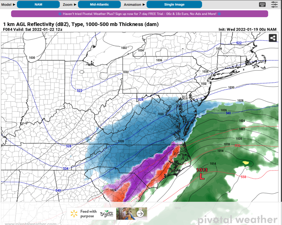
0z NAM decent for Thursday
-
Jan 21 - 22 Weekend SE VA and Eastern Shore Snow
wasnow215 replied to stormtracker's topic in Mid Atlantic
Precip over at 90 hours? -
NAM 12z pretty much takes away Thursday now and revs up the storm starting Fri
-
Saw that too! Interesting. I remember living in S Jersey before the Prez Day weekend blizzard in 2003. Sat morning had 2-3”. Sunday morning the big one started and got 20 more inches.
-
0z NAM big hit for THURSDAY. 6” in spots.
-
It’s fantastic. The posting was horrible leading up to yours. Lol. Rare here but I though it’s was gonna suck by a lot of the posting. Onto the GFS.
-
Which way.?
-
Started in Glen Allen


