

Mikeymac5306
-
Posts
694 -
Joined
-
Last visited
Content Type
Profiles
Blogs
Forums
American Weather
Media Demo
Store
Gallery
Posts posted by Mikeymac5306
-
-
Snow has let up to a more moderate fall here in West Chester. 30 degrees.
Guestimating 3 inches so far.
-
 1
1
-
-
1 minute ago, Ralph Wiggum said:
We r in the line of fire. Heaviest band setting up pretty much over us maybe a hair N if you do a loop and look at the axis starting to pivot and deform band beginning to form.
This is what is passing through here. Have not seen it snow this hard in a while!
-
Ripping here in West Chester. Had about a half inch in Exton when I left the house. Roads getting covered fast.
-
3 minutes ago, RedSky said:
Dude we stealing other regions snow, we will have to go into hiding after this
Like watching the Niners fold last night and the Eagles fans trolling the daylight out of them all day today.
-
If these short range models verify and I have to use my snowblower I would be content to call the season over.
-
1
-
-
15 minutes ago, Ralph Wiggum said:
Pics or it didn't happen
-
 2
2
-
 1
1
-
-
59 minutes ago, ChescoWx said:
NWS upped my totals to 3" to 7" but down the road in Exton only 2" to 4"....elevation impacts?
I don't even thing MBY is even in a WWA right now..
As warm as it is now I still can't see more than 2"3" on the grass here by lunchtime Tuesday.
-
Batting .600 as well. Nice bit of info!
-
1
-
-
On another note.... If you haven't been outside today please go out and enjoy! 56 degrees now in Dub C.
-
Looks like 12 hrs of white rain for MBY. Maybe some slop on the grass.
Yeah the PD storm still looking suppressed. Fantasy land has yet another Cleveland Steamer.
Time to get one more round and the check please to cash out of this mess of a Winter with almost nothing but staring at glorious 384 hr ensemble runs.
-
 1
1
-
-
57 minutes ago, Kevin Reilly said:
It is on an island by itself unfortunately. Ukie, Euro, CMC, ICON vs. GFS and GEFS AT least we can say there is still a chance!
History has shown the GFS cave to the Euro which I believe it will sometime tomorrow.
-
3 minutes ago, Albedoman said:
this is snow map for positive snow growth is doable if it holds for a couple of days however a few runs are not enough to convince me of this being believable. We have burned way too many fricking times. When the NAM/Euro shows this three days out , then I am all in
Your right. I grabbed the wrong one. Apologies.
I'm with you. These fantasy maps are killing everyone, and then one bad run like last night's 18Z and everyone is jumping off only to hit the trampoline at the bottom and bounce back for this mornings runs.
The good about it is that there is something to track. You may or may not like the outcome.
-
12 hours ago, stormtracker said:
Fucking human pendulums up in here. I'm dizzy.
Suicide by trampoline.
Everyone was jumping last night after 18Z and hit the trampoline back up to the 0Z and 6Z runs.
Weather tracking is fun isn't it?
-
1
-
3
-
-
21 minutes ago, snobal said:
anyone have snowmaps for 6Z run ?
Again a ways out so take it FWIW
-
1
-
-
That 6Z run... Hoo boy!
-
12Z runs punt the V day storm way north. Takes it to Pittsburgh then transfers off the Jersey coast. Congrats to the NE.
PD is in play though. Didn't look like much change there.
-
2 minutes ago, mitchnick said:
I looked at everything before coming in here and knew Bliz would be busy. Buckle up my friend, you've got a lot of work ahead of you this week and hopefully beyond!
-
1
-
-
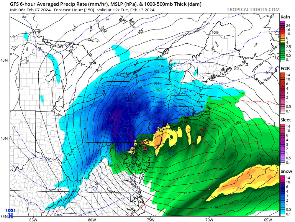
Are we not interested in a 973 low over Wilmington Tuesday?
-
1
-
1
-
-
5 hours ago, RedSky said:
All 3" of it
Yeah too far south and too far out as of right now. The trends are north though right? It's trackable.
-
13 minutes ago, zenmsav6810 said:
Wiggum criteria for 2/14?
ICON is the only thing right now showing a borderline mix. GFS and CMC show a fringed rain storm.
Still a week out so this has time to change
-
4 minutes ago, Scarlet Pimpernel said:
Nobody from another forum is allowed to mess with or troll us!!

-
1 hour ago, Ji said:
It’s better than knowingNobody knows if they don't know anything or not.
-
1
-
-
41 minutes ago, Ralph Wiggum said:
I know I took a break at the right time when I return and the chat is focused on Kamu's shrinking snow pile, honeybees, and sunflower seeds/millet/wild bird food.
Nothing has changed from the thought I posted last week. Tantalizingly close tease 12th-15th (still think more wet than white, could be wrong). Pattern change happens at HL....stj becomes active and kicks a wave under us (suppressed?) 18th-20th. Bigger shortwave in the stj moves east after the 21st and will likely be the first legit threat for a juiced southern storm 23rd give or take. Then weeklies Continue the look into the first part of March with maybe a pattern-ending large threat as the calendar flips...give or take a couple days....but that is wayyyy out in fantasy land.
Biggest takeaway for now....patience still. Not over yet.
384 hrs away from another great run at 384 hrs. Keep fighting the good fight!
-
1
-
-
23 hours ago, rclab said:
Liberty you just triggered me to look it up. Old saying, ‘necessity is the mother of invention’. Stay well, as always …..

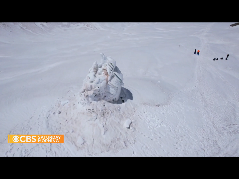

Looks like one of those drippy sand castles you make at the beach.
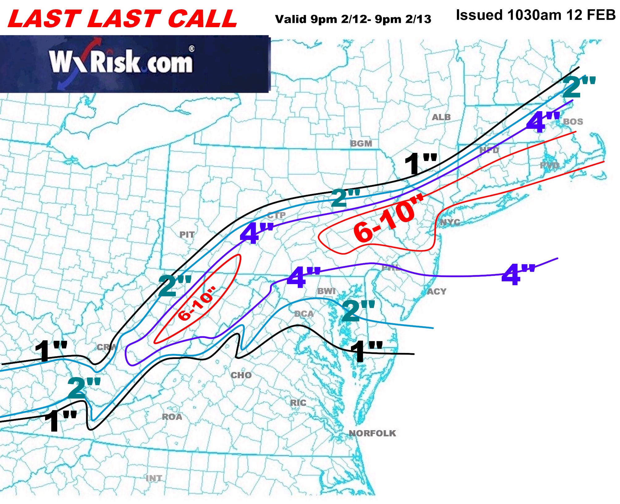

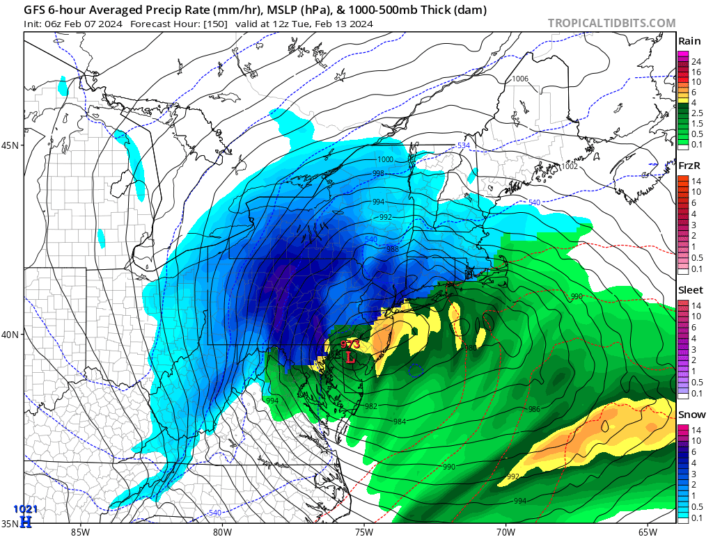
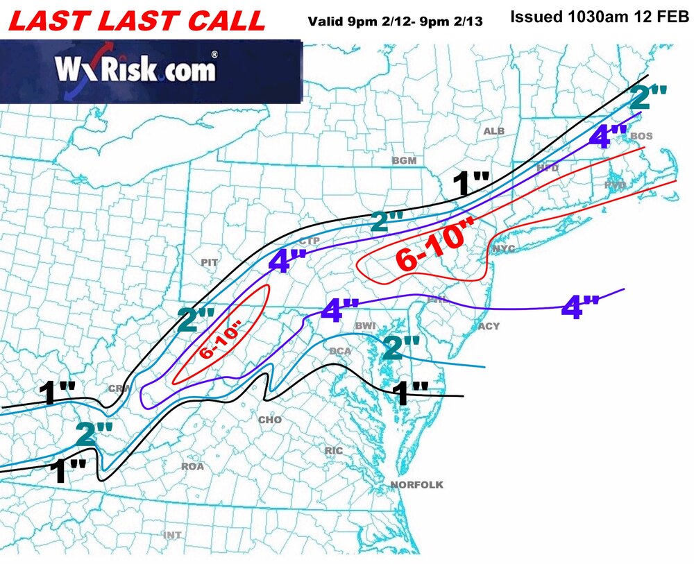
2/13 rain to snow event
in Philadelphia Region
Posted
All done here. Looks like a solid 5 inch shot for West Chester. 31 degrees.
If the sun comes out this afternoon, a lot of this wil be melted.