TWCCraig
-
Posts
2,604 -
Joined
-
Last visited
Content Type
Profiles
Blogs
Forums
American Weather
Media Demo
Store
Gallery
Everything posted by TWCCraig
-
 96/69 Sea breeze showing up on the immediate south shore. Slowly crawling, hope it stalls there
 -
95 on my new station. Loving the accuracy Should get close to 100. Probably 97-99
-
89/74 Skyrocketing, I'm not expecting 100 here but should get close. ISP may reach 100
-
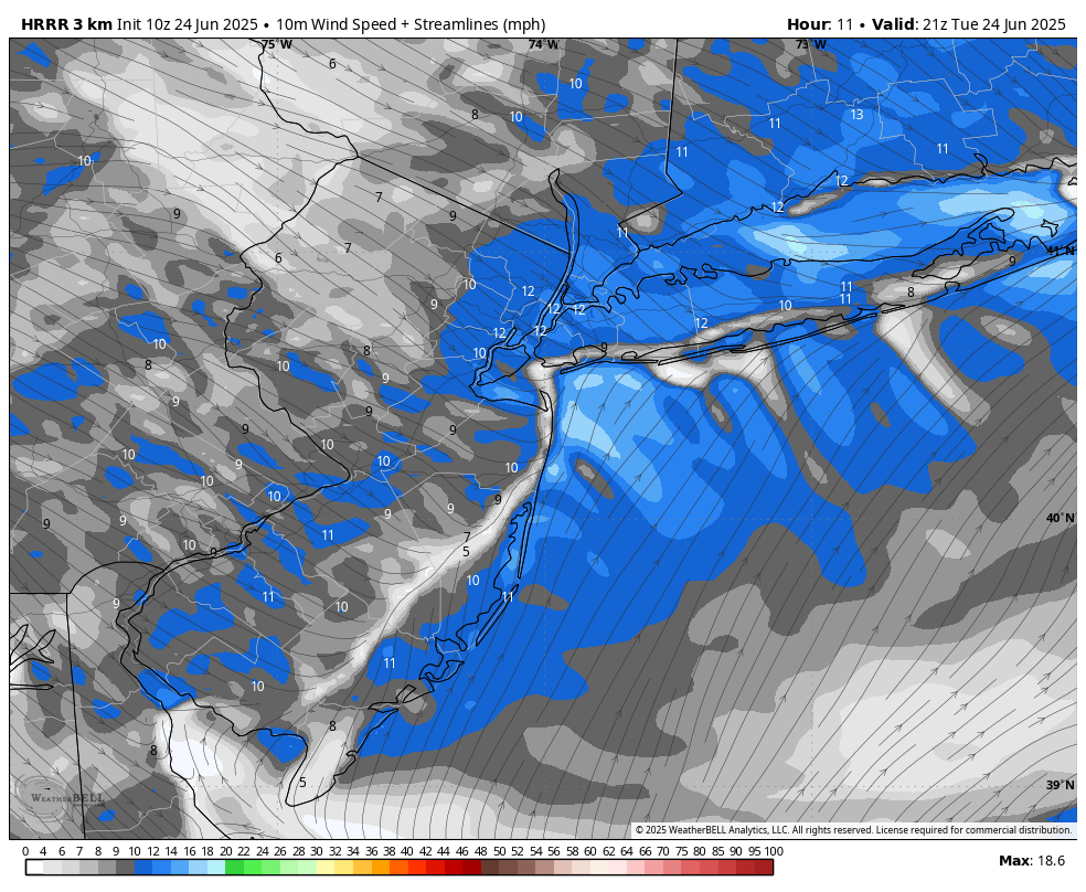
HRRR has the sea breeze staying close to the coast. This should help coastal locations approach and exceed 100

-
79°F dew point at JFK and still 90 degrees. 78°F dew point here, the sea breeze isn't bringing any real comfort. Not with dew points near 80
-
Sea breeze made it to my station. Peaked at 90.2 down to 89 now
-
HRRR has mid 90s for the island before the sea breeze kicks in in the early afternoon. The NAM doesn't even have Islip hitting 90 today, that will horribly bust lol
-
86/74 Pretty uncommon for this part of the south shore to have no sea breeze all day and temps this warm this late. Would be interesting to see if we're cooler this time tomorrow Most models have a sea breeze developing in the early afternoon, will effect mostly NYC and points east
-
Been beautiful since late morning, say around noon, out in Suffolk. Nice sunny and hot and no sea breeze. Still humid so you can definitely feel it
-
92 at Westhampton, rare hot spot for today https://mesowest.utah.edu/cgi-bin/droman/meso_base_dyn.cgi?stn=KFOK&unit=0&timetype=LOCAL
-
87/73 Feels like 94 here. ISP is at 90 already! Substituted a couple degrees cooler for higher humidity
-
The cloudiness from the MCS was somewhat modeled for today, but they dropped the ball on the rain completely. Latest GFS actually has more showers tonight.
-
Thats 2pm Monday, GEMLAM only goes out 48 hours
-
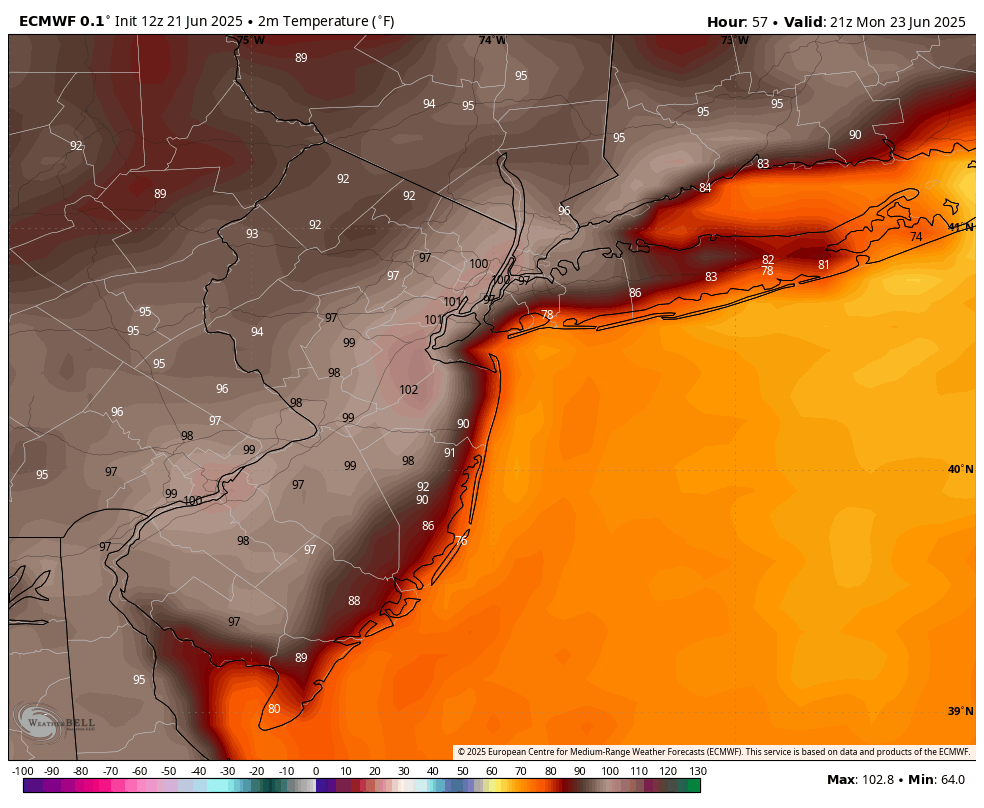
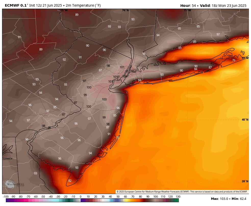
I think the Euro is too hot for places like the city and inland. RGEM has 98 for Monday in NYC, don't think NYC will see 100 Monday. Mid to upper 90's likely
-
Still has 100 for NYC at 5pm, cools off fast though after this. I don't know if I buy the 74 at East Hampton lol, that realistically would be more like 76-78
-
Yea that's why you can't take the numbers at face value out here. Globals aren't like the higher resolution models. The GFS thinks JFK is in the ocean. JFK should at least be in the 90's there
-
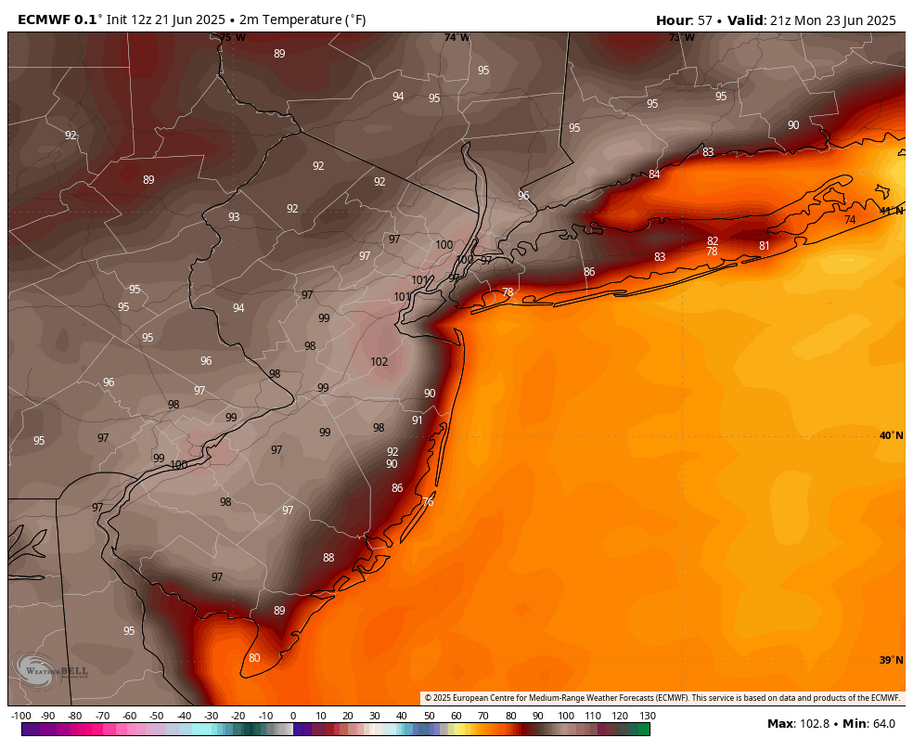
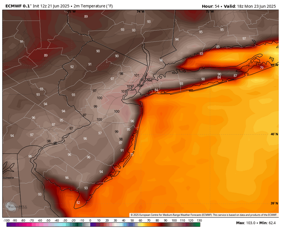
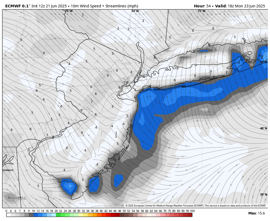
12z Euro for Monday 2pm temps and wind. Has sea breeze but not as dramatically cool
-
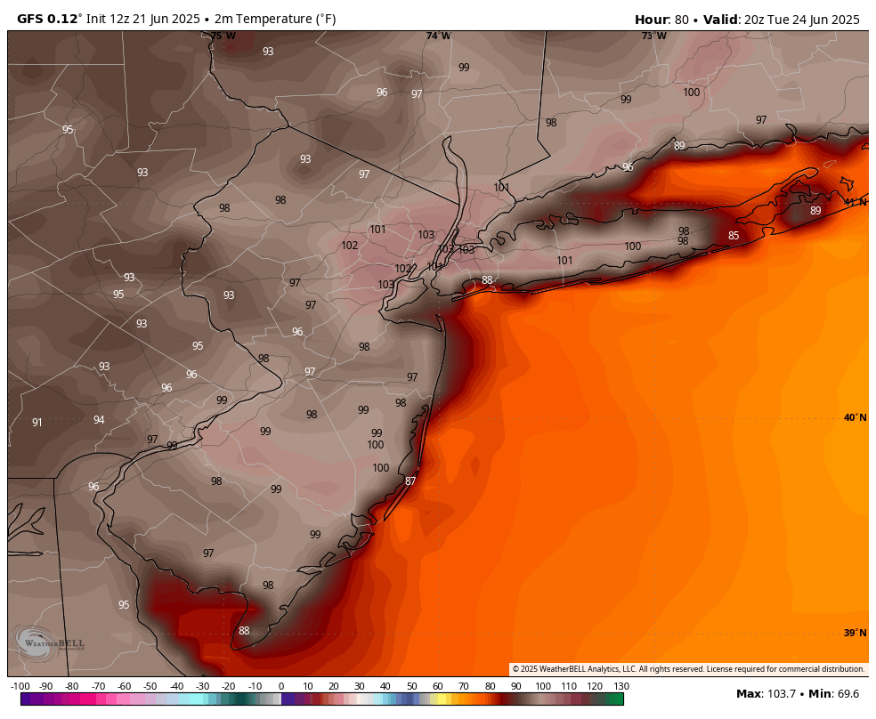
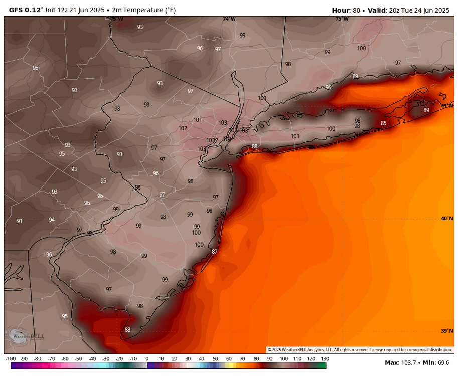
100 to ISP on the 12z GFS on Tuesday. Monday will have a sea breeze. Tuesday is the only real chance at 100
-
The NAM always overdoes the seabreeze, I would never use that. Also, as someone who lives out here, I never use raw numbers off of a global model for temps especially this time of year, you'll never be right. You think today's Euro was correct with today's forecast out here? Today's 12z Euro had a high of 79 for Shirley and 80 for ISP for today, Shirley hit 84 and ISP hit 85 officially. Today's 18z GFS never had Westhampton over 80, all wrong. GFS doesn't even have the resolution to "see" Westhampton properly if you're looking at maps I prefer to use hi-res models in the short term, you get a much better idea of the kind of temperature gradient to expect and wind direction. I love the GEM-LAM (HRDPS) for this although it can be a little too warm sometimes. HRRR isn't bad either, but the NAM is way too cool most of the time.
-
Yea I can recall many times in the past where it's 90+ degrees with a southerly wind off the water in June, and that's in modest heat waves
-
We've done it plenty of times here in June, even May it's possible. NAM only goes out 84 hours to Tuesday 2am so I'm not sure how you can see Tuesday afternoon
-
63 south of ISP and the Great South Bay is close to 70. I'm pretty close to the water, cooler than most and I'm at 81 right now with a sea breeze, so the sea breeze only does so much. The winds Monday and Tuesday look light and you have a bit more solar insolation around the solstice than you do a month from now. https://www.ndbc.noaa.gov/station_page.php?station=44025
-
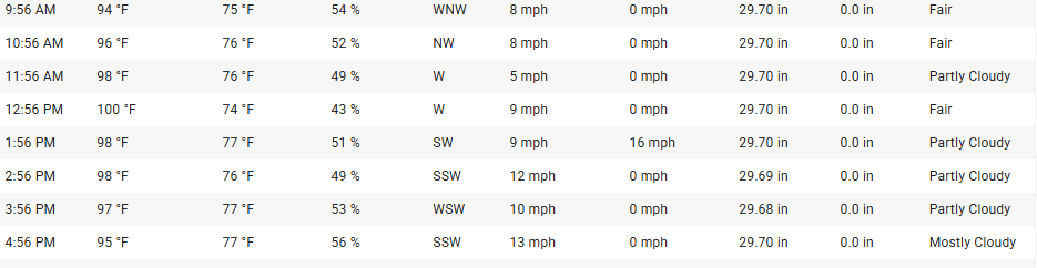
Sea breeze for Monday was sniffed out over the past couple of days. The hottest day will be Tuesday, looks like it will start off with offshore flow then a sea breeze develops, for coastal locations at least. Still will be brutal even with the sea breeze. I can see this being similar to 7/22/2011 where ISP hit 100 before the sea breeze, but still had temps in the mid to upper 90's after the sea breeze. I don't think dew points will be as high as they were in 2011. Also possible that we fall just short of 100 ISP on 7/22/2011:
-
Probably gusted no more than 30mph here with 0.09" of rain so far. Fell apart pretty fast as it headed east
-
83/75 Actually hit 84 before 10am when there was more of a westerly wind