
IntenseBlizzard2014
-
Posts
3,188 -
Joined
-
Last visited
Content Type
Profiles
Blogs
Forums
American Weather
Media Demo
Store
Gallery
Posts posted by IntenseBlizzard2014
-
-
22 Dec 2018 1011.39 1005.10 13.34 9.15 2.81 21 Dec 2018 1011.94 1005.35 14.89 8.83 2.36 20 Dec 2018 1012.71 1007.00 10.33 8.53 1.91 19 Dec 2018 1013.25 1008.05 7.68 8.40 1.63 18 Dec 2018 1014.64 1006.70 21.90 7.89 1.49 Now it's staying steady from the previous update. Perhaps it hit a secondary ceiling? Then another potential tank?
-
11 minutes ago, NEG NAO said:

Okay. Let's get real. When do you think we will reverse?
-
 1
1
-
-
1 hour ago, SnowGoose69 said:
The 18Z NAM looked like it was headed for something decent but it washes out right as it nears the Delmarva. It’s possible the energy crossing the Great Lakes is causing problems
The energy at the lakes is probably absorbing the energy associated with the low near the Delmarva.
-
2 minutes ago, Brian5671 said:
remember last year? Went below freezing 12/25 and was largely bitter cold right through the blizzard to break the pattern...1/6
This year seems to be the opposite. So a post NYD storm may break the ice.
-
26 minutes ago, Brian5671 said:
another cutter around the 28th so more warmth like today. Definitely wiping out the negative departures of the 1st 10-12 days
Doesn't matter anyway. That's what a typical El Nino does. So it sounds like the coupling is starting to take effect. La Nina Decembers are typically colder.
-
21 Dec 2018 1011.94 1005.35 14.89 8.83 2.36 20 Dec 2018 1012.71 1007.00 10.33 8.53 1.91 19 Dec 2018 1013.25 1008.05 7.68 8.40 1.63 18 Dec 2018 1014.64 1006.70 21.90 7.89 1.49 17 Dec 2018 1013.56 1006.50 17.33 6.56 1.17 The SOI is rising once more. The El Niño is being influenced by other external sources. Perhaps the MJO?
-
14 minutes ago, bluewave said:
I want to wait until one of the reliable models holds something cold within the 120 hr mark. The models have been in full push back mode since they lost the record MA snowstorm for us in early December.
We have to wait and see what the SSW does. That is if there is one coming. There's a high chance anyway.
-
-
20 Dec 2018 1012.71 1007.00 10.33 8.53 1.91 19 Dec 2018 1013.25 1008.05 7.68 8.40 1.63 18 Dec 2018 1014.64 1006.70 21.90 7.89 1.49 17 Dec 2018 1013.56 1006.50 17.33 6.56 After a significant drop in the SOI, a slight rebound happened today.
-
1
-
-
7 minutes ago, qg_omega said:
It's actually meaningless at this stage, just noise and a no storm is just as likely
With a more El Nino like upper-level flow coming near New Year's, I would be careful to say that. It's more likely to hit or become an inland runner. Much like the late week storm.
-
1 hour ago, NEG NAO said:
what are you talking about ???

The signal is definitely there. This all depends on the EPO and NAO.
-
1
-
-
2 minutes ago, SnowGoose69 said:
Didn’t we have an SSW last February that led to the March fiascos here? It felt like the impacts from that were almost instantaneously felt
It should be felt by the 31st.
-
28 minutes ago, donsutherland1 said:
That the weeklies head toward a classic December-February El Niño/EPO-/AO- 500 mb pattern is quite exciting. Below is a chart showing that pattern:
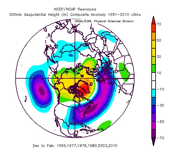
Overall, things still remain on track for a snowy to very snowy winter in the region. Cities including Albany, Binghamton, Boston, Detroit, Harrisburg, Hartford, Islip, New York City, Newark, Philadelphia, Richmond, Scranton, and Washington should do well in terms of snowfall once the pattern develops and then potentially locks in.
I'm eying the 31st to the 2nd. An East Based NAO and -EPO/+PNA signature shows up at that time.
-
1
-
-
The wind is so powerful due to the backside of the upper-level low next to Maine. Also, the pressure gradient from the high pressures that stretch from Lake Superior to Missouri. That's funneling in a lot of cold air. I wonder if the Lake Effect Machine is cranking up right now?
-
Just now, SnowGoose69 said:
One thing of note this year is that seemingly every big storm or even modestly significant storm at day 5-7 ends up happening. That’s classic El Niño. Think how often in La Niña or neutral ENSO winters a good 50% or more of those events end up never panning out
That's going to be interesting when we get in range for the New Year.
-
1
-
-
Just now, SnowGoose69 said:
Even if it happened I’m not sure it’s snow anyway. The Great Lakes low is evident on most of the recent Euro runs and ensembles so the BL would likely torch. That is a classic just inland snow event where Newark and the Bronx get all snow and JFK is mostly rain
Sounds a lot like 2002. Except for the GL low.
-
1
-
-
The latest GFS run has the late week storm running up through the Northern Plains. Then the New Years Storm presumably takes an inland route because of the weak Scandinavian Block and absurd ridging ahead of it from Mississippi on east.
-
1
-
-
Just now, SnowGoose69 said:
I still expect the Euro to lose the Christmas event. Northern stream is too dominant and likely will squash anything that tries to get going. GFS hasnt bit on it one run yet
Well, that sucks.
-
Just now, Rjay said:
It's coming. Dont look at the models for another week.
Yeah. I feel better after checking out the upcoming SSW and possible SOI tank near New Year's Day.
-
1 minute ago, bluewave said:
Not too many. Models are going for a -5.29 sd 500 mb anomaly over the GOM. That would be one of the strongest on record for late December.
http://cms.met.psu.edu/sref/GFS/

I noticed that we are breaking a lot of records recently. Maybe the YTD Rainfall is next?
-
2 hours ago, AfewUniversesBelowNormal said:
The North Pacific pattern continues to be surprising for an ENSO subsurface warming trend for the next week+. I wonder if SOI is once again a more accurate measurement than other? (it was like 19 of the last 19)
Still a +SOI with subsurface warming? Weird.
-
I'm going, to be honest. We need a truly promising sign of Winter's Return. Or it could get ugly through January.
-
 1
1
-
-
Reporting Snow/Sleet here at South Bronx.
-
7 minutes ago, 40/70 Benchmark said:
Okay...so we reach low end moderate in several weeks....how much do you feel that will influence the pattern for the balance of winter? It needs to make moderate extremely soon to be relevent...and the MEI reflects that there is an enormous amount of ground to cover.
A low end moderate can be a bigger influence to our weather. That will override the MJO phases that have been giving us unfavorable conditions for snowfall. Although I don't think a moderate is likely. It's possible. It's going to be close.

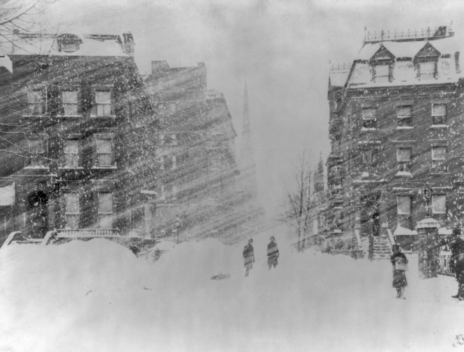
December 2018 General Discussion & Observations
in New York City Metro
Posted
He said in his lifetime (1990s to present).