
IntenseBlizzard2014
-
Posts
3,188 -
Joined
-
Last visited
Content Type
Profiles
Blogs
Forums
American Weather
Media Demo
Store
Gallery
Posts posted by IntenseBlizzard2014
-
-
Wow. The SOI loves to be negative now. That's good news.
12 Jan 2019 1011.02 1007.65 -5.84 3.32 3.14 11 Jan 2019 1012.30 1007.20 2.31 4.19 3.51 10 Jan 2019 1011.56 1008.50 -7.30 4.56 3.75 9 Jan 2019 1011.75 1007.65 -2.40 4.94 3.94 8 Jan 2019 1012.44 1007.80 0.15 5.05 3.98 7 Jan 2019 1012.09 1008.40 -4.33 4.93 3.97 6 Jan 2019 1010.17 1007.40 -8.66 5.15 3.97 5 Jan 2019 1008.86 1008.20 -18.60 5.64 3.97 4 Jan 2019 1009.55 1009.25 -20.30 6.46 4.11 3 Jan 2019 1009.90 1008.05 -13.00 7.42 4.31 2 Jan 2019 1009.71 1007.10 -9.42 7.94 4.48 1 Jan 2019 1009.66 1006.60 -7.30 8.53 4.66 31 Dec 2018 1010.49 1006.85 -0.42 9.23 4.67 -
 2
2
-
-
57 minutes ago, snowman19 said:
I’m going to keep quiet for the remainder of the tracking of this storm so I don’t get accused of anything and I’m not going to give my opinion of what I think is going to happen. All I’ll say is don’t get emotionally invested in this storm
Yeah. I agree. Keep a good distance away from this one. The position of the tPV is the deal breaker with this one.
-
1
-
-
4 hours ago, redbanknjandbigbasslakepa said:
Long range starting to fall apart again. Maybe hitting on the mjo flying through 7/8 back into 5
Nope.
.gif.0db5ed79b920a3700164ebbceb358645.gif)
-
SOI is tanking hard.
4 Jan 2019 1009.55 1009.25 -20.30 6.46 4.11 3 Jan 2019 1009.90 1008.05 -13.00 7.42 4.31 2 Jan 2019 1009.71 1007.10 -9.42 7.94 4.48 1 Jan 2019 1009.66 1006.60 -7.30 8.53 4.66 31 Dec 2018 1010.49 1006.85 -0.42 9.23 4.67 -
2
-
-
3 minutes ago, snowheavyattimes said:
What happened in 2010 Jan-March? I don’t remember.
Mild January, Snowy February (One of the Snowiest February's on Record for much of the area), and then a Stormy March.
-
Officially split down to the stratosphere, with another warming to split them down to the troposphere.

-
1
-
-
58 minutes ago, bluewave said:
This looks like it will be among the warmest first 2 weeks of January during the 2010’s for the CONUS. Good thing this is an El Niño and not a La Niña.


From what I've been reading, we are technically in a neutral ENSO.
-
15 minutes ago, NJwx85 said:
This is hilarious. Prime snow season around here runs from about December 20th to about March 10th. Sun angle isn’t a problem if rates are strong enough, especially in March. By April it’s over but we have a long time to go before then.
Compare this to declaring Summer over on July 3rd because the rest of July looks cool. Give it a rest.
Yeah. Most of February will be fine. The problem is that once we progress to late February into early March, we will need very heavy snow. If it's anything less than that, then we will have a March 2018 repeat. Most likely with less snowfall.
-
2 minutes ago, dmillz25 said:
January 3rd. Lol
Yeah. Once we start February, then we only have a few weeks of good sun angle.
-
I am officially concerned. We are running out of time. We might have one month left.
-
1 hour ago, NittanyWx said:
Huh?
The EPS shuts off dateline convection which, based on recent VP trends, does not seem that farfetched.
So doesn't that mean we have to kiss most of January goodbye? It sure sounds like that.
-
13 minutes ago, redbanknjandbigbasslakepa said:
Appreciate his knowledge and efforts, but just to keep it in the no spin zone, Iso was incorrect on his December prediction. So things could turn around for him but as of now his seasonal forecast has missed the mark.
He acknowledged the problem. The problem will soon turn into the solution.
-
This is looking a bit grim. Looks like late January may be the change to cold and snowy weather.
-
52 minutes ago, NEG NAO said:
looks like suppression pattern to me with most of the metro in below normal precip with the northern jet dominating the patttern and above precip confined to the southeast U.S.
A weak Phase 8 amplitude can introduce cold and wetter conditions. The CPC will eventually see that it's no different for this pattern.
-
1
-
-
2 hours ago, bluewave said:
The only thing that the Euro and GFS agree on is there will be no rush on a strong MJO Push into phase 8. So this is shaping up to be a slow process.


I bet in a few days, the progression of these plots will start to speed up and falter. A mixture of these two would be sufficient.
-
1
-
-
15 minutes ago, NEG NAO said:

The vort at the SW US ejected too late on this one.
-
11 minutes ago, Snow88 said:
NWS CPC
"The Madden-Julian Oscillation crossing into the Pacific in the next few days is forecast to help flip the Arctic Oscillation to its negative phase, leading to increased chances of cold air outbreaks over the eastern US in today's Weeks 3&4 outlook."
There you have it. So stop worrying. Okay? I'm saying this to all of the people that are worried.
-
 1
1
-
-
4 minutes ago, Ralph Wiggum said:
I would rather have near normal temps during prime climo and peak cold rather than strong negative departures as that generally spells an overwhelmed arctic pattern and dry/suppressed pattern but that's just me. Cold is never a bad thing until there is too much.
A winter storm would likely happen as the blocking starts to weaken.
-
4 minutes ago, NEG NAO said:
think its accurate ?
From what I heard, the GFS is terrible in comparison to the GEOS in terms of coupling events.
-
12 minutes ago, snowman19 said:
A SSW doesn’t guarantee a cold east. It could split or displace in a bad spot. It can fail to downwell to the troposphere and couple
Yeah. That's true. The GFS was demonstrating a coupling failure yesterday.
-
1
-
-
Wow. That is one insane jump.
28 Dec 2018 1010.84 1003.60 18.27 9.33 3.79 27 Dec 2018 1008.54 1004.50 1.66 9.23 3.48 26 Dec 2018 1008.83 1005.75 -3.32 9.37 3.39 25 Dec 2018 1009.69 1005.60 1.92 9.48 3.37 24 Dec 2018 1010.56 1005.75 5.66 9.41 3.34 -
1
-
-
18 minutes ago, raindancewx said:
Goliath was a bat-sh&t crazy storm here. I had maybe 2 inches from it, but the drifts from the winds were 0.5" - 8" in places, all slanted, like a kid making a sand castle. We had snow before and after it too, so my 7 inches of snow in Dec 2015 was around for like, three weeks. Very cold here for mid-Dec to mid-Jan that year, warm the rest of the winter.
I wanted to point out that the SOI was near 0 again as of the last update. Also, expecting to see Nino 3.4 come in around 27.6C or 27.7C for December. Very curious to see what the subsurface data comes in at for December too. If the subsurface cools, it has different implications for January v. staying the same or strengthening if you look at the past El Ninos.
The CFS currently shows this for January. I think the CFS may have the right idea for precip, I'm not sure about temps yet. Most of the things I look at imply a very warm and a very cold half to January, but I'm sure in some places one extreme will win over the other.


The CFS isn't that good with the whole SSW portrayal.
-
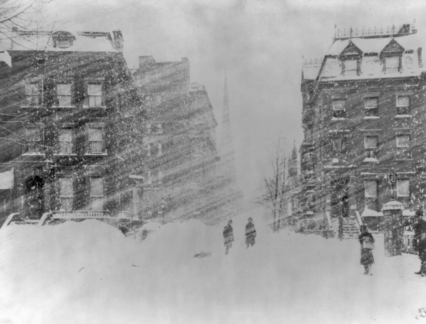
Just now, raindancewx said:
Blizzard warning for...essentially only Albuquerque with the storm. Shades of "Goliath" in 2015. This was Roswell back then -

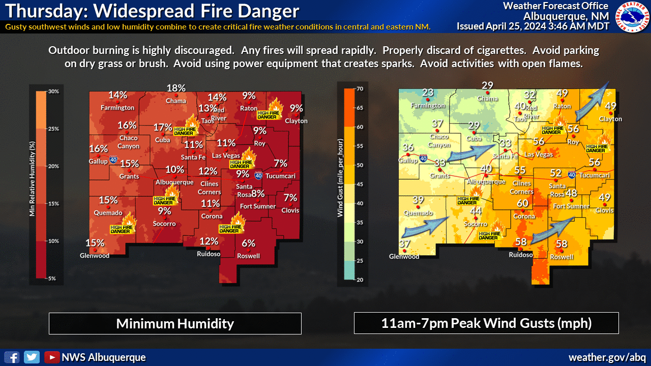
Snow, then crazy wind. I think this is somewhat overdone for snow, I'm at 2-5", with locally less in the SE and locally more on the West Side, but we'll see. I hope they nail this. Measurements in an accurate way may be near impossible anyway. We should see near record cold here for around Fri-Weds. Some areas in the city will get close to 0F at night if the snow verifies.
...BLIZZARD WARNING IN EFFECT FROM 6 PM THIS EVENING TO 6 AM MST SATURDAY...
*WHAT...Blizzard conditions expected. Total snow accumulations of 4 to 8 inches are expected in the Albuquerque Metro area, with the highest amounts expected on the west side of Albuquerque. Between 12 and 20 inches of snow is expected across the Sandia and Manzano Mountains, with locally higher amounts possible. Winds gusting as high as 55 to 60 mph are expected through and downstream of mountain passes, including Tijeras Canyon, shortly after midnight through Friday afternoon. * WHERE...Middle Rio Grande Valley including the Albuquerque Metro Area, Sandia and Manzano Mountains.*
Snow here in El Ninos is negatively correlated to snow in the NE, so will be interesting to see where we finish. We were at 0.8" as of yesterday. Statistically, only half of El Ninos here see more than 7 inches of snow here in the snowiest month between Oct-May, so if we verify at 6"+, this is likely the peak of winter here, and I'd expect a transition to a better Eastern pattern. That said, if we finish with 4-5" from this storm, its more likely than not that another month will beat or match December. I'm increasingly looking at March as that month. There are major hints on the evolution of the pattern with this system. I personally think this part of the pattern resembles Sept nationally in some ways. There will be moments to come when Oct/Nov show up I think, the question is for how long?
That snow was from Goliath? Wow. That's crazy.
-
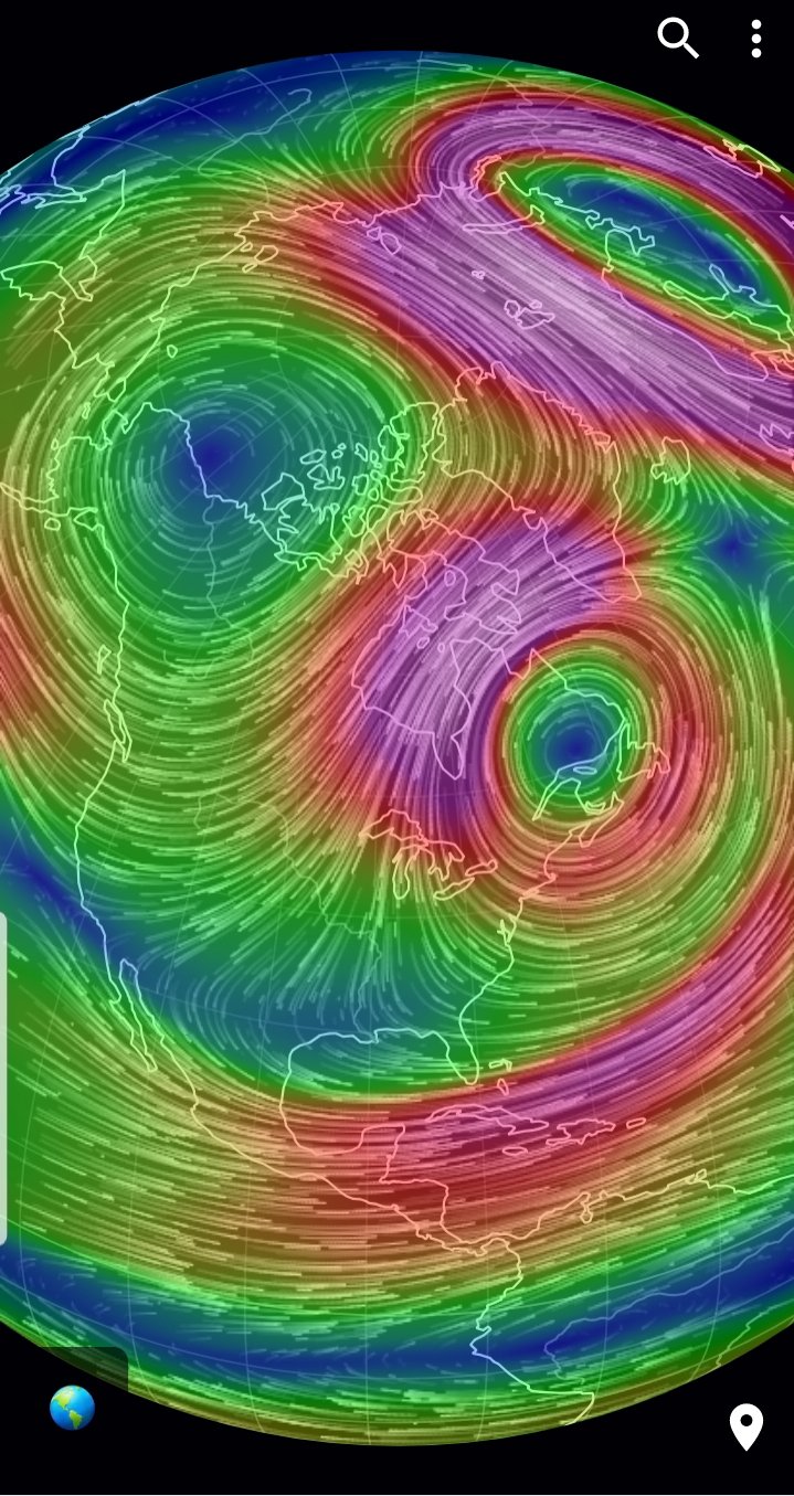
24 minutes ago, bluewave said:
Get ready for some longer range model volatility with the fire hose Pacific Jet development near Japan.

A 930 mB LP to the west of the Aleutians? Jeez.


January 2019 General Discussion & Observations
in New York City Metro
Posted
Nice to see this.