

marsman
-
Posts
318 -
Joined
-
Last visited
Content Type
Profiles
Blogs
Forums
American Weather
Media Demo
Store
Gallery
Posts posted by marsman
-
-
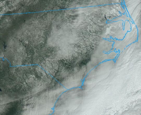
as the clouds clear, snow showing up nicely on sat:
-
 4
4
-
-
1 hour ago, NorthHillsWx said:
Anyone else shovel their snow into shaded areas so the piles last longer?
I did this with the sleet last week, it didn't last

-
3.2" for me in Cary. 20F/15. Absolutely beautiful outside, kids are gonna love it.
-
Friends are reporting 26F in Onslow County, NC... and rain. Ice on all surfaces.
-
 1
1
-
-
5 minutes ago, BigWeather said:
Very light snow in south Cary.
4 minutes ago, CaryWx said:Ok, I will check again and squint hard...
I see a few flurries in south Cary, the band is visible on RadarScope. 27F/19, wonder if I'll be able to clear the driveway with the leaf blower instead of the shovel tomorrow.
-
Someone reported snow/graupel in downtown Raleigh on mPING. Visible on RadarScope.
-
45F, down from a high of 49 at 10am in Cary.
.15" in the bucket so far.
-
44 minutes ago, Brick Tamland said:
It's like being a kid and your parents take you on a secret trip, and you don't know until you get there if it's to Disneyworld or a burnt out wharehouse.
Sorry folks, parks closed. The moose out front should of told ya'.
-
3
-
-
32F IMBY. Breezes are kicking up, knocking ice off the tops of trees - a hazard I forgot about.
-
Still all sleet at 27F in east Cary.
-
-
1
-
-
Light to moderate sleet in Cary, 26F. Friends are reporting freezing rain in Jacksonville, NC.
-
1
-
-
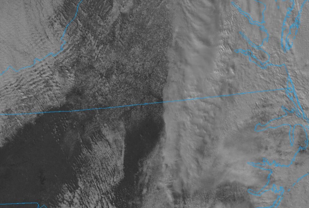
As the storm clears, snow on the ground visible from sat:
-
1
-
-
4 minutes ago, WinstonSalemArlington said:
I told y’all to believe! Below freezing in Winston with snow on secondary roads. What happened to all the NCDOT traffic cams?
They're not coming up for me between Burlington and Greensboro.
-
Temp is 41.5 and falling with 2.21" in the bucket in Cary. Several branches down in the neighborhood, leftover leaf piles have clogged some drains, leaving standing water on some roads.
-
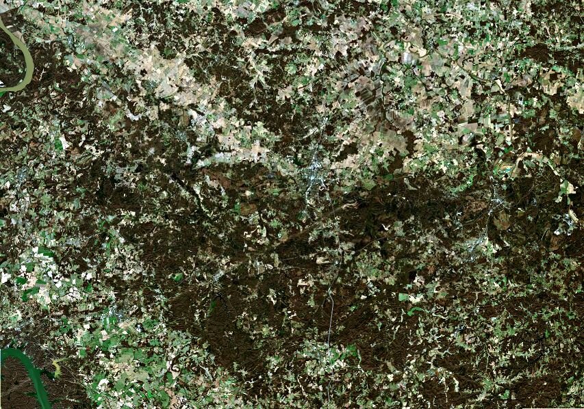
Anyone post this yet? Visible ground scar on a satellite image from Dec 13th. Madisonville, KY is in the center of the map, the Cumberland River is at the bottom left.
-
3
-
-
This dry weather and the piles of leaves along the street are making me a bit uncomfortable...especially when people park their cars on the leaf piles.
-
1.69" from yesterday. 9.18" for the month, 6.5" of that is from 10/9.
-
47F this morning and loving it. Great yardwork day before some football this afternoon. Still need some cleaning up from the 10/9 storm.
-
As of 8am this morning 5.74" in the bucket since midnight. Most of that was between 3:30am and 6:30am. Worst downpour I've seen in a long time.
-
Been keeping an eye out for some purple and pink in the NWS map for the lower 48. WWA for the Yosemite, CA area:
QuoteURGENT - WINTER WEATHER MESSAGE National Weather Service Hanford CA 128 PM PDT Thu Oct 7 2021 CAZ323-080430- /O.NEW.KHNX.WW.Y.0009.211008T1200Z-211009T0000Z/ Yosemite NP outside of the valley- 128 PM PDT Thu Oct 7 2021 ...WINTER WEATHER ADVISORY IN EFFECT FROM 5 AM TO 5 PM PDT FRIDAY ABOVE 7000 FEET... * WHAT...Snow expected above 7000 feet. Total snow accumulations of 4 to 6 inches. * WHERE...Yosemite NP outside of the valley. * WHEN...From 5 AM to 5 PM PDT Friday. * IMPACTS...Travel could be very difficult in these areas due to slippery and snow covered roads. PRECAUTIONARY/PREPAREDNESS ACTIONS... Slow down and use caution while traveling. The latest road conditions for the state you are calling from can be obtained by calling 5 1 1. && $$ BSO
Snippets from the Reno AFD:
QuoteSystem for this afternoon and Friday remains on track with the potential for the first round of snow in the Sierra near and above 8000 feet. Meanwhile, showers and a couple thunderstorms may kick off over western NV this afternoon as instability increases with the approaching low. Best timing for heavier rain/high elevation snow is late tonight into Friday morning as the forcing mechanisms cross into Nevada. Precipitation chances will continue into Friday afternoon with most activity over Pershing, Churchill, and Mineral Counties. ... Snow levels should remain near 8000 feet as the precipitation band moves into the Sierra. Simulations are leaning towards 2-4 inches of snow with localized areas of 6 inches along the Mono County crest if everything comes together. CalTrans is raising travel restrictions for the High Sierra passes this afternoon, main snow impact is to hikers/campers in the backcountry. Rainfall totals across western NV should range from 0.10 to 0.40 inch, with localized amounts near and above 0.50 inch.
-
Forecast looks good for upper 50's in the RDU area tomorrow and Friday night. Gonna have the windows open if that holds true!
-
Just now, smokeybandit said:
Did the surge cam slide down the pole? Its angle looks lower than before
Looks lower here too. Constant beating likely shifted interior or exterior mounts.
-
I was watching the HTV stream at https://www.htv10.tv/livestream.
They might have gone down about 5 minutes ago... been replaying commercials since then.
January 2022 - Obs
in Southeastern States
Posted
Heads up! Seeing ice/snow sheets slide off north sides of the steeper roofs in the neighborhood.