AmericanWxFreak
-
Posts
1,704 -
Joined
-
Last visited
Content Type
Profiles
Blogs
Forums
American Weather
Media Demo
Store
Gallery
Everything posted by AmericanWxFreak
-
-
-
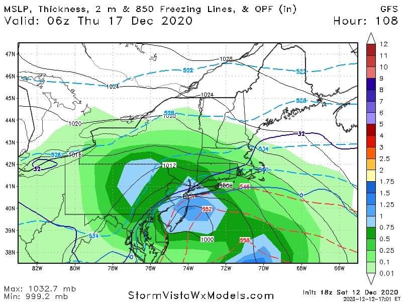
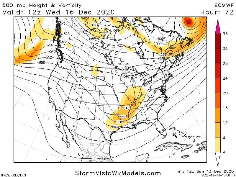
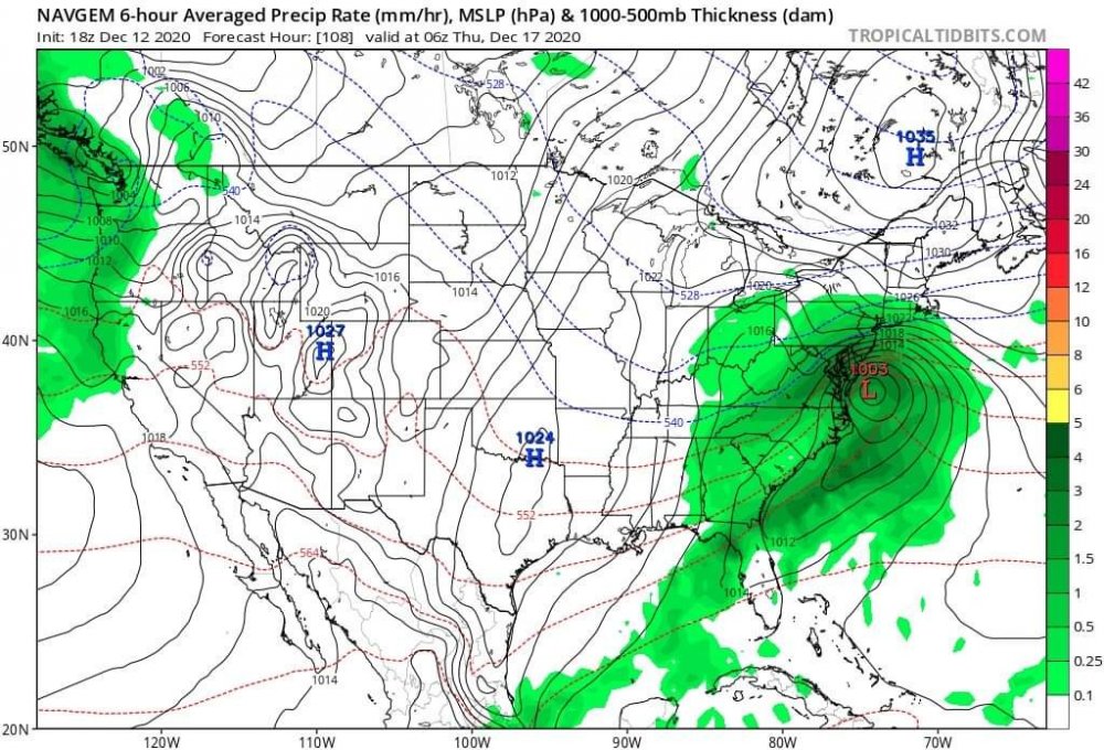
Here we go
-
Don't look at the ukmet
-
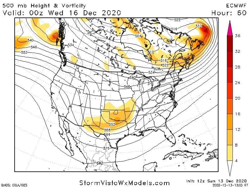
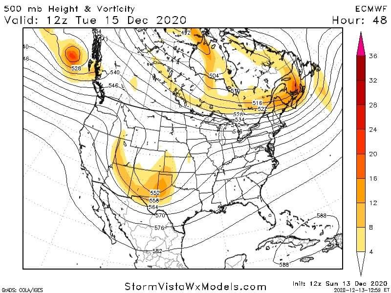
Rgem looks like the NAM
-
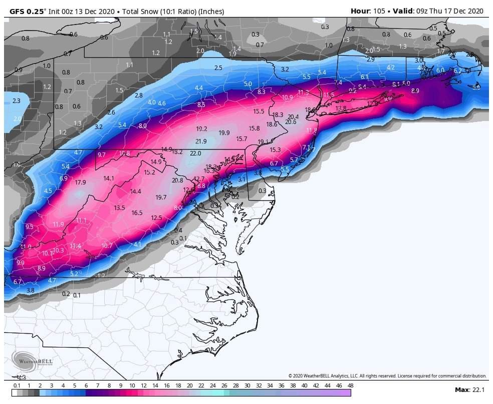
12z Nam looks faster and more amped to my untrained eye, both good things I think
-
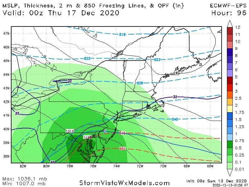
Euro ens
-
-
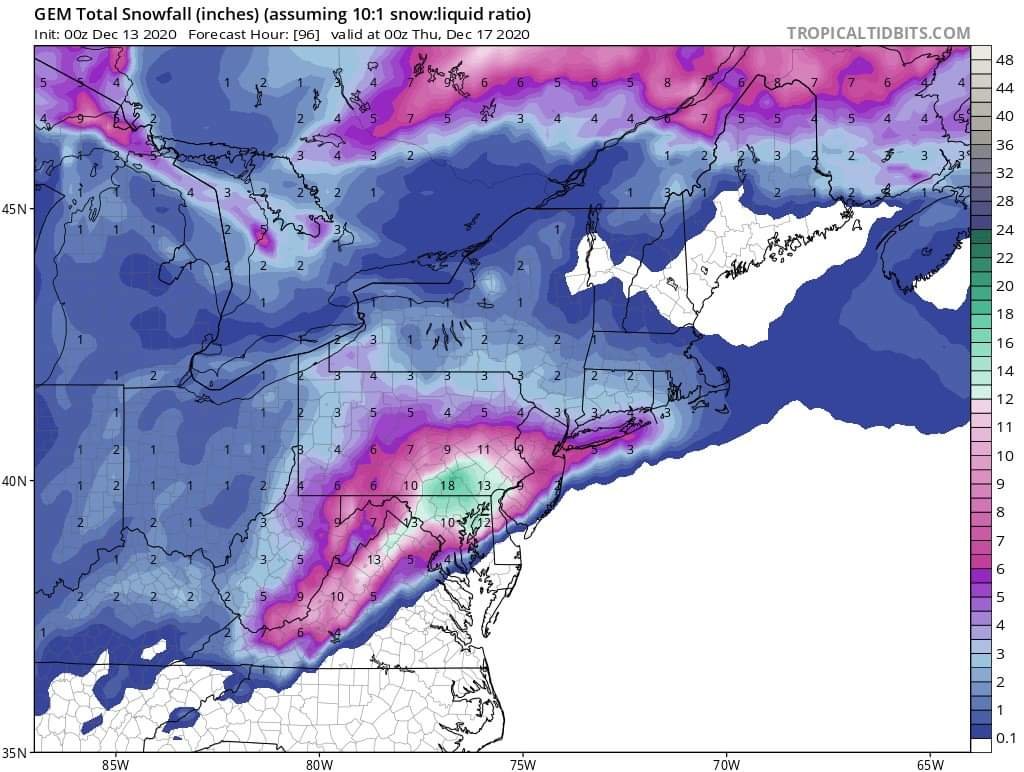
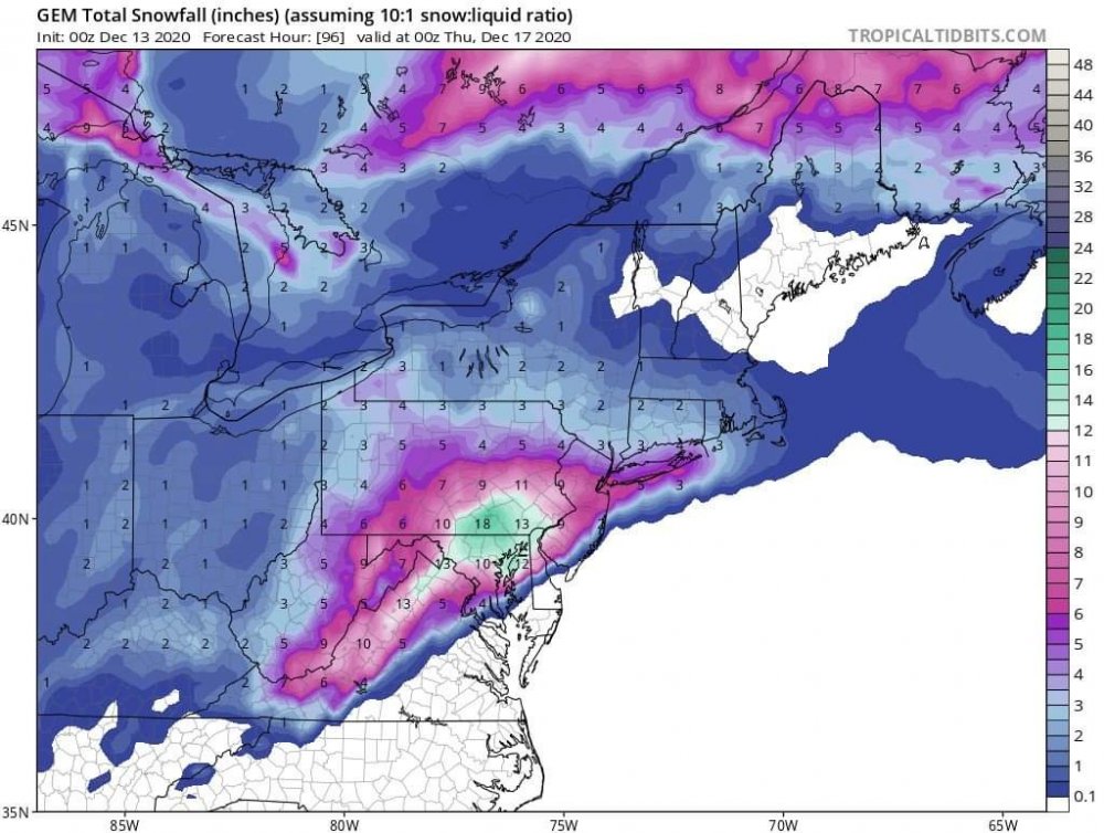
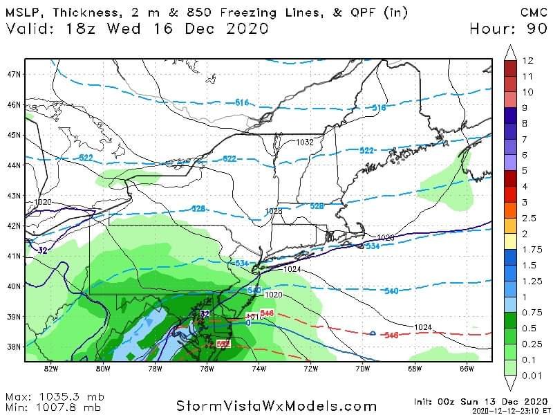
Cmc snow map
-
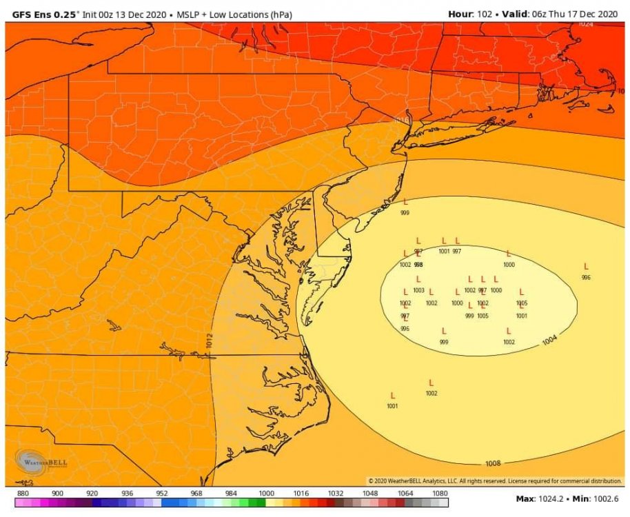
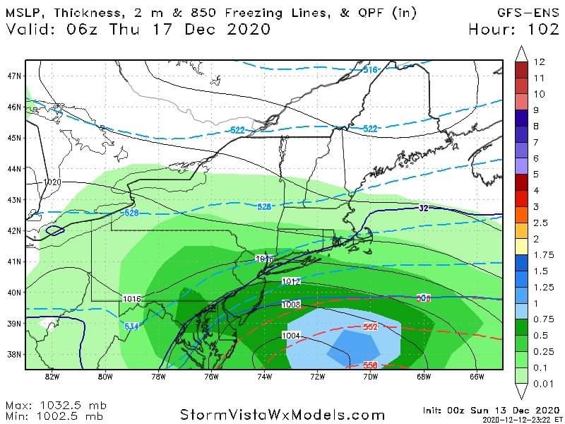
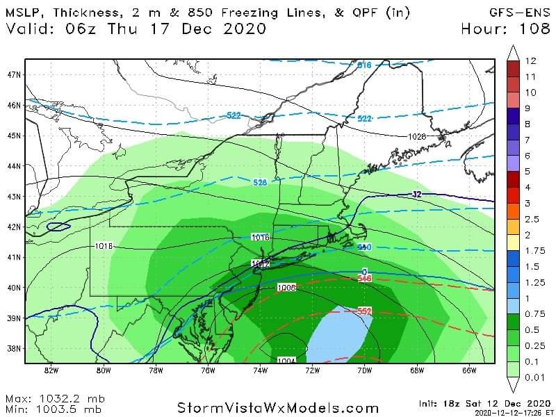
Gfs ens mean
-
GFS ens leaning pretty far SE now lol might have the opposite worry sooner then we hoped
-
-
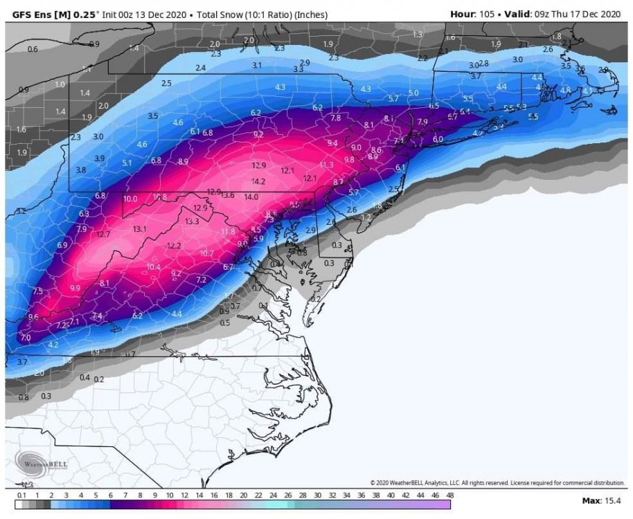
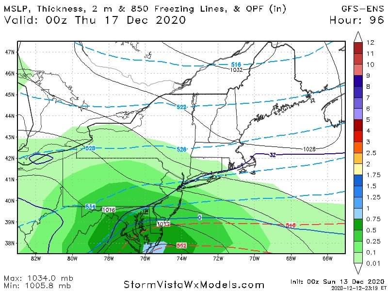
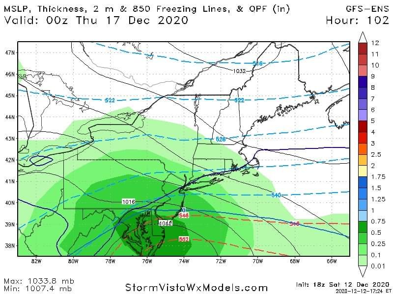
0z GFS ens mean
-
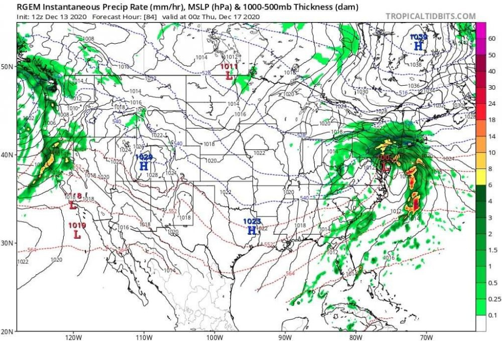
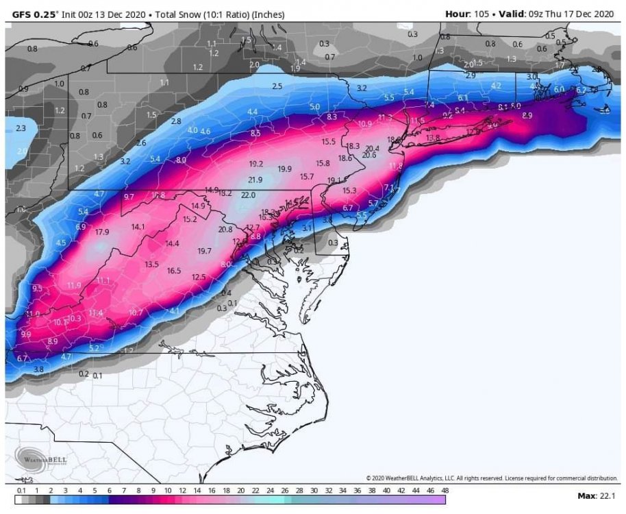
Lol quite the precip field
-
-
-
-
-
Boooom
-
Never doubt its ability to show up....
-
I think we get a DC snowhole tonight
-
I'll break some of the tension in the room
-
-
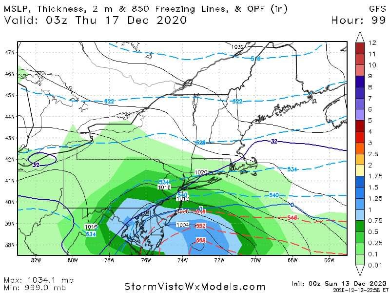
18z GFS ens
-
Welp