

MDphotog
-
Posts
217 -
Joined
-
Last visited
Content Type
Profiles
Blogs
Forums
American Weather
Media Demo
Store
Gallery
Posts posted by MDphotog
-
-
Storm missed the home, slide to the south, but close enough to drop the temp from 97 to 81. I'll take it!
-
 1
1
-
-
12 minutes ago, BlizzardNole said:
So jealous of the folks under that northern MD thunderstorm! I wonder what their temp dropped to
Hoping more pop up later
Westminster (MD Mesonet) Looks like it dropped them back almost to 80. Nice!!!
-
17 minutes ago, nw baltimore wx said:
No way that storm in northern MD holds on long enough to get here, but fingers crossed for something to pop up in front of it.
My eyes might be playing tricks on me, but I think I see a gust front on the radar in the last couple of frames. Fingers crossed it triggers some more storms.
-
Storm just popped on the MD PA border, hopefully the first of many today. Impressive on the satellite view. COD: Satellite and Radar
-
That was a beast of a storm rolled thru us. Numerous small trees down in the road, power out or in and out in town.
.-
2
-
-
51 minutes ago, aldie 22 said:
I know it won't last long but to me this winter will go down as the winter with snow pack. More than 3 weeks with the last batch in January and now for a day or two. Hopefully more next week!
You know, I have to say even though I haven't gotten much in overall snow amounts this year it has to be considered a success. The number of days with snow on the ground has been fantastic compared to the usual snow and quickly melt in the next few days.
-
16 minutes ago, catoctin wx said:
School announcements going up. FCPS Maryland just announced 2 hour early dismissal
Washington County (Maryland) as well. Not sure we really get anything, but I understand the caution.
-
1
-
-
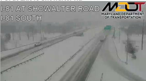
We got about 2in. about a mile or two west of I-81. It was surprising to see how quickly the remaining snow cover dropped traveling east this morning. Even from one side of Hagerstown to the other was a big drop off. Razor thin temp gradient, I guess. I will say we did have some rain mix in, but most of the time when the significant radar returns were overhead it was always snow.
-
Driving from Hagerstown to Frederick on I-70 it was snowing pretty good up on South Mountain through to Braddock Heights. Just a bit of sticking on grass and rooftops.
-
1
-
-
It has some significant dry air to mix out, but given that it should be over warm water and a low shear environment the next day or so, it should intensify some.

Curious, as the dry air is now over water and in a low pressure environment does it start to..uh..”moisten up” or is too much dry air for it to have any measurable effect?
.-
1
-
-
2nd line almost thru, let’s see if the 3rd holds together. Almost 1 in of rain on the night.
Update: 3 line had no light or sound show, but plenty of more rain. Looks like we will end the night with about 1.75”. -
That line of storms between the other two area of storms ripped open like a zipper in minutes. Very cool radar presentation. Think DC-north gets some nocturnal action (hi RR).
Yeah, I wonder what caused that to happen. Hopefully we can get a few lines of storms thru tonight. Good light show and booms going on from a storm just to my NW near Hagerstown.
.-
2
-
-
Was touch and go here for a bit as snow got really really light but now picking back up. Hopefully the HRRR is right and this keeps going for a while longer.
. -
Nothing over head on radar, but I do have light flurries coming down. Of course, with the temps it's sticking to anything.
-
Sleet mixing in near Hagerstown, ouch ouch ouch. Still have good amount of snow though.
-
2 minutes ago, BlizzardNole said:
Moderate rain and 33, oh well. I do believe we'll have an area wide nice hit at some point this winter
Check out this spot near the Hagerstown Airport
Yeah, cold ground has really helped us up here. Roads do not want to stay plowed. Big flakes also helped with that.
-
Maybe between 2 to 3 inches here SW of Hagerstown, still just moderate snow fall.
-
4
-
-
Heavy flakes have been going for a good 30mins or so. Almost covered grassy surfaces, drive way long covered.
-
3
-
-
Getting sleet mixing in now. One thing I noticed already is that it is not melting on the roads (untreated) already seeing the snow/sleet blown around by passing cars.
-
Flurries started a few miles west of I-81, 27.5/23.6dp.
-
2 minutes ago, clskinsfan said:
Only a 7 inch difference here between the NAM and 3K with 10 hours until start time. That model is utter garbage.
That was really weird, maybe it pulled the wrong image somehow?
-
3 minutes ago, snowfan said:
I’d argue that surface temps aren’t necessarily the biggest issue here for many. Especially N/W of the cities. Maybe that will end up not being the case, but every bit of guidance is showing a warm layer above the surface.
Totally agree, but the HRRR was doing something odd, up here in Hagerstown, where the 850 was still below freezing, but we have like 34 - 35 degrees at the surface at 10AM. We shall see.
-
1
-
-
5 minutes ago, snowfan said:
HRRR was no bueno for anyone east of Hagerstown.

Yeah, but look at the temps on the HRRR, I'm already lower than what it has for my location at midnight tonight. It has some major catching up to do.
-
2
-
-
Now down to 27.9/20.4dp also no real wind as of yet.

June Discobs 2025
in Mid Atlantic
Posted
That severe storm in Northern Frederick County keeps growing. NWS gonna need a bigger box....