
frostfern
-
Posts
1,948 -
Joined
-
Last visited
Content Type
Profiles
Blogs
Forums
American Weather
Media Demo
Store
Gallery
Posts posted by frostfern
-
-
3 minutes ago, michaelmantis said:
3ish inches at the end. It all compacted down so much can't really tell. But there was a few hour period where the cotton ball flakes added to at least 3 inches on their own (before compacting down).
I picked up around 5” here, but it was quite variable. Places with lots of blacktop around didn’t accumulate as much compared to surrounding rural areas. Oddly, the rooftops of parked cars seemed to accumulate the most.
-
It looks heavy and wet followed by flash freeze and wind with lake effect white-outs. It will be the worst driving conditions in a long time no matter what the totals are. Any change-over to rain will just make the ice situation worse when the cold hits.
-
 1
1
-
-
11 minutes ago, Lightning said:
I have not heard of Toledo or Monroe ever getting a big east wind LES event. I know it is possible and probably has happened. At MTU (Houghton) a couple of my best LES events were E/ENE winds off Superior but they were not common to get at all.
Its most likely to happen as local enhancement during a synoptic event IMO. Lake Huron definitely contributes to upping totals locally on the east side of the state. It would be more rare to see lake effect bands from the east in the core of an arctic airmass though IMO, as east wind tends to be dry in that scenario (high pressure to the north causes strong subsidence). I suppose it could happen but I not aware of any major cases. Would be interesting.
-
On 1/8/2024 at 5:23 PM, WestMichigan said:
Wish I had one of those for my tractor. They are soooo expensive.
I want a thing with a big blade to brake off packed down snow and ice. Snowblower is kind of useless if you procrastinate and pack the snow down hard by driving over it. With winters lately I’m used to just driving over the snow and waiting for it to melt.
I was not sure it was going to melt before the coming cold so I had to chip it all off manually so that it doesn’t become a skating rink. I somehow injured my rotator cuff shoving the shovel into the ice. Ugh. Maybe should have salted it first to get it softer.
-
I don’t know if I’m getting old and weak or just don’t remember what it’s like to have to shovel. I am hurting today.
-
Is anyone following the unusual storm that caused extreme flooding in Greece? The storm caused up to 20 inches of rain in 12 hours! Its wild for a place that normally gets 25 inches annually. A cutoff low wrapped an “atmospheric river” of extremely humid air originating from the southern Mediterranean into one of the more mountainous portions of the Aegean coast. Its hard to find detailed meteorological info on the event.
-
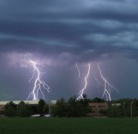
I'm kind of annoyed I didn't just stay home now. I missed a really insane positive CG barrage right over city. My dad told me the picture frames in the house were all crooked because the thunder shook the entire house. The tornadic portion was a ways north, but there was apparently a lot of lighting bolts well to the south. Everyone has commented the thunder was unusually loud and seemed different from normal. I wish I knew some way to get archived lighting data.
-
19 hours ago, Lightning said:
If you look up Spicers Cider Mill on Clyde Rd. I live a bit NE of it. We spent all day cleaning up. Still have some work to do tomorrow. When I can get back online (not on my phone) I will post some pictures.
I was looking at archive from RadarScope. It costs like $15 per month for the Pro version, but I only upgrade before a good event then cancel the next month. That's cool that thomp2mp found a site that offers it for free.
It looks like there were broadly rotating supercells out ahead of the main downdraft / wind-shift line that was moving south. The data shows rotation passing over the area, but it looks like its mostly ahead of the downdraft where the damaging winds are shown coming from the north. Was there two different events, one from the south, then another from the north? The exact time would be helpful.
I think if there was a tornado in your area it was probably a shallow gust-nado type that the radar might not detect. The way the line was absorbing rotating elements definitely gave the wind a boost in some areas. The Williamston and Comstock Park tornadoes were both a result of downdraft-dominant segments catching up to and absorbing supercells. I normally think cell mergers are not helpful for tornado formation, but in this case it looks like they caused a temporary boost. The mergers did limit the track lengths though, thankfully. There probably was enough shear and overall energy for a major long track tornado if a more discrete cell had formed somewhere and remained separate.
-
1 hour ago, HillsdaleMIWeather said:
Webberville got super lucky, the worst part of it went through wooded and cropped areas with insane ground scouring, but even then the city part of it was given an EF-2
On radar it looked at least as strong as the Gaylord tornado last year. Only a tiny part of that path was rated EF-3. The trailer park wreckage was horrific and deadly, but it was only rated EF-2 since that’s just what happens to trailers in a tornado.
-
4 hours ago, Lightning said:
We are wondering if there was a funnel or small tornado came through. Damage is not uniform / similar direction. Some areas it is one direction other areas different direction. There looks like a path as some houses on the lake are not even touched even though they have willows and cottonwood trees (no damage at all) while we have maples that are 1/2 gone now a willow that was leveled by us. Likely will not get power back until Sunday at the earliest. AT&T tower is out so me cell service is sporadic (no sure when this will even post).
Where do you live? It seems there are only two locations being evaluated in the GRR region, Webberville in Ingham County and Belmont in Kent County. Reviewing the radar loops both of them were associated with brief supercells being absorbed into the line from the front.
-
2 hours ago, Lightning said:
That was one intense storm.
 Large tree branches down all over the place. Lost power as I watched one of the branches take out the power lines at my neighbor's house (100' away from my house). Watched my kayak and paddle board fly up in the air and into the lake. Power of mother nature is just awesome.
  Tomorrow is going to be a big clean up day!!! I'll need to find my kayak and paddle board.
  . Thankfully I have plenty of gas for the generator.
Oh no! You didn’t lose any trees did you? There were trees down everywhere in southern Ionia CO.
I ended up south of Portland and it was developing on top of me before I could find anywhere with a view. The area was so woodsy and branches and limbs were everywhere. When I got back to I-96 I thought I was home free but then there was 1.5 hour traffic delay from trees across I-96. I didn’t dare try an alternate route.
There was a tornado warning back at my parent’s place and the sirens went off. They went to the basement, but the possibly tornadic circulation was quite a ways northeast and none of us even lost power.
-
Big tree across I96
-
Stuck in a traffic. Debris on the road.
-
1
-
-
I decided to chase and MBY got slammed. lol. I got screwed because new cells popped up ahead of the line and slowed me down so much I couldn’t get ahead. It caught up. Derecho chasing is just impossible. Incredible lighting but hard to see bolts due to so much rain.
-
 1
1
-
-
Should fill in soon.
-
2
-
-
It was weird seeing light fog at a temperature of 82 earlier today.
-
3
-
-
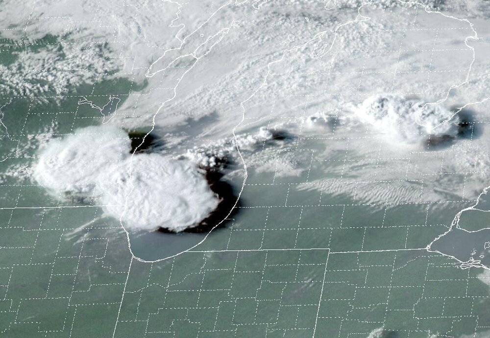
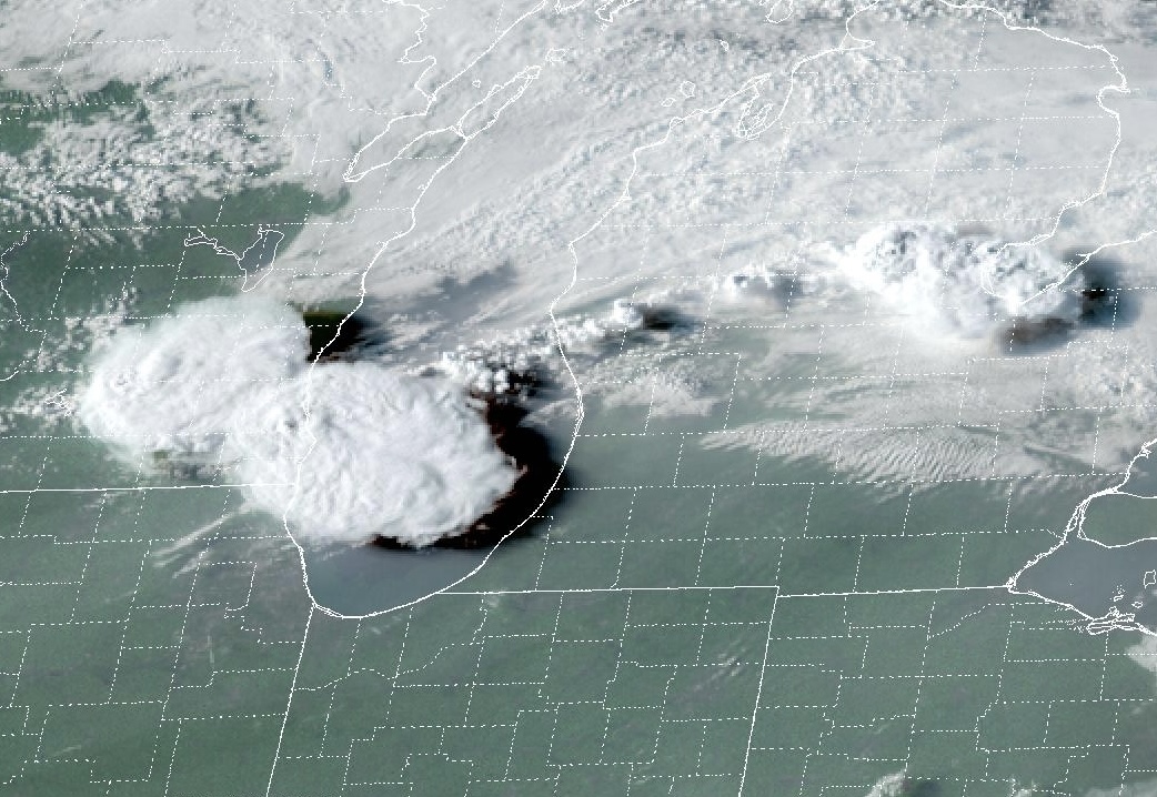
My guess is the stuff around Milwaukee will struggle to move out over the lake because of lake breeze divergence at peak heating, but new convection will form along 131 just north of I-96 around 7 or 8 pm and move southeast.
-
1
-
-
There is a subtle wave at 700 mb over eastern WI. The 700 mb temp drops slightly just ahead of it indicating lift. I think we have to wait for that to cross the lake.
-
I don't know how I missed it. There is some cumulus popping up in the middle of Lake Michigan now.
-
There is initiation in Wisconsin now. A good sign that the cap is breakable. I wonder if SPC will extend the risk there. Hopefully they are writing up a mesoscale discussion.
-
I have time to chase. Just waiting. The sun is coming out and the dewpoint is in the lower 80s with mist in the air. Feels like walking through a warm wet washcloth.
-
2
-
-
2 hours ago, nwohweather said:
Was all of that firing off outflow boundaries? I’ve never seen that in my life where storms over Cleveland built basically a conga line that reached all the way back to Indiana thru outflow. They look like lake effect snow bands
MUCAPE to the west was peaking around 5000 J/kg into the wee hours of the morning. That is insane for this area. There was also a modest E-W oriented low level jet aimed right into it. It intuitively reminded me of a flame building backwards into the fuel.
-
9 minutes ago, Lightning said:
Looking too far east for MBY but I am sure it will find a way to get to Detroit (Wayne county). It just get tiring that something always seems to go wrong when the models are blasting this area.

Been in the UP a total of 12 days this summer and have had far better T-storms up there!!! Time to be Bo's neighbor!!
")
This continues the trend for here this spring/summer. Not all the models were showing that line, but its frustrating the ridge wins out the one time you don’t want it to. There’s plenty of CAPE, but its just hard to get convection going with +12 at 700hpa.
The upper 70s dewpoints are still on the way though. Oh boy. What fun.
-
2
-
-
39 minutes ago, cyclone77 said:
91/77/104 here right now. Dews took a little longer to come back up after dipping to 57 early this morning, but 80+ tomorrow looks like a slam dunk.
Its hard to get 80 degree dews here with the cooler lake and lack of corn directly to the southwest, but 75+ dewpoints may creep in here tomorrow evening for the first time all summer. I remember some upper 70s dews in early June last year and the year before which was unusual. I don’t think the corn wasn’t anywhere near full grown then. This year its barely gotten above 70 and most days its been in the upper 50s or low 60s. Its been very comfortable compared to some years.
1/8-1/10 Potential Winter Storm
in Lakes/Ohio Valley
Posted
It was around 5” here in the grass, 4” on the driveway. I can confirm awful to shovel, especially after putting it off and driving on it. There was some light drizzle yesterday evening during the dry-slot lull, but it was ripping fat flakes the rest of time, even with temps around 33.