
frostfern
-
Posts
1,964 -
Joined
-
Last visited
Content Type
Profiles
Blogs
Forums
American Weather
Media Demo
Store
Gallery
Posts posted by frostfern
-
-
8 hours ago, Stebo said:
The airport got over an inch of rain with several thunderstorms, there is no way you were missed.
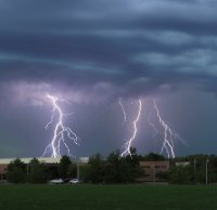
Missed by lightning. Yes it rained. Ugh.
-
 1
1
-
-
4 hours ago, Lightning said:
I'm not upset about this one not being there today. I don't think my family knows how to run the generator

Friday evening looks pretty good for some good thunderstorms.
I’m not upset about missing wind. My favorite storms are those where its perfectly still with big bolts cracking close by before the rain hits. Elevated nocturnal storms are my favorite.
-
 2
2
-
-
4 hours ago, Stebo said:
Judging by how widespread the rain and storms were there in GRR's area I have a hard time believing you didn't get a good thunderstorm
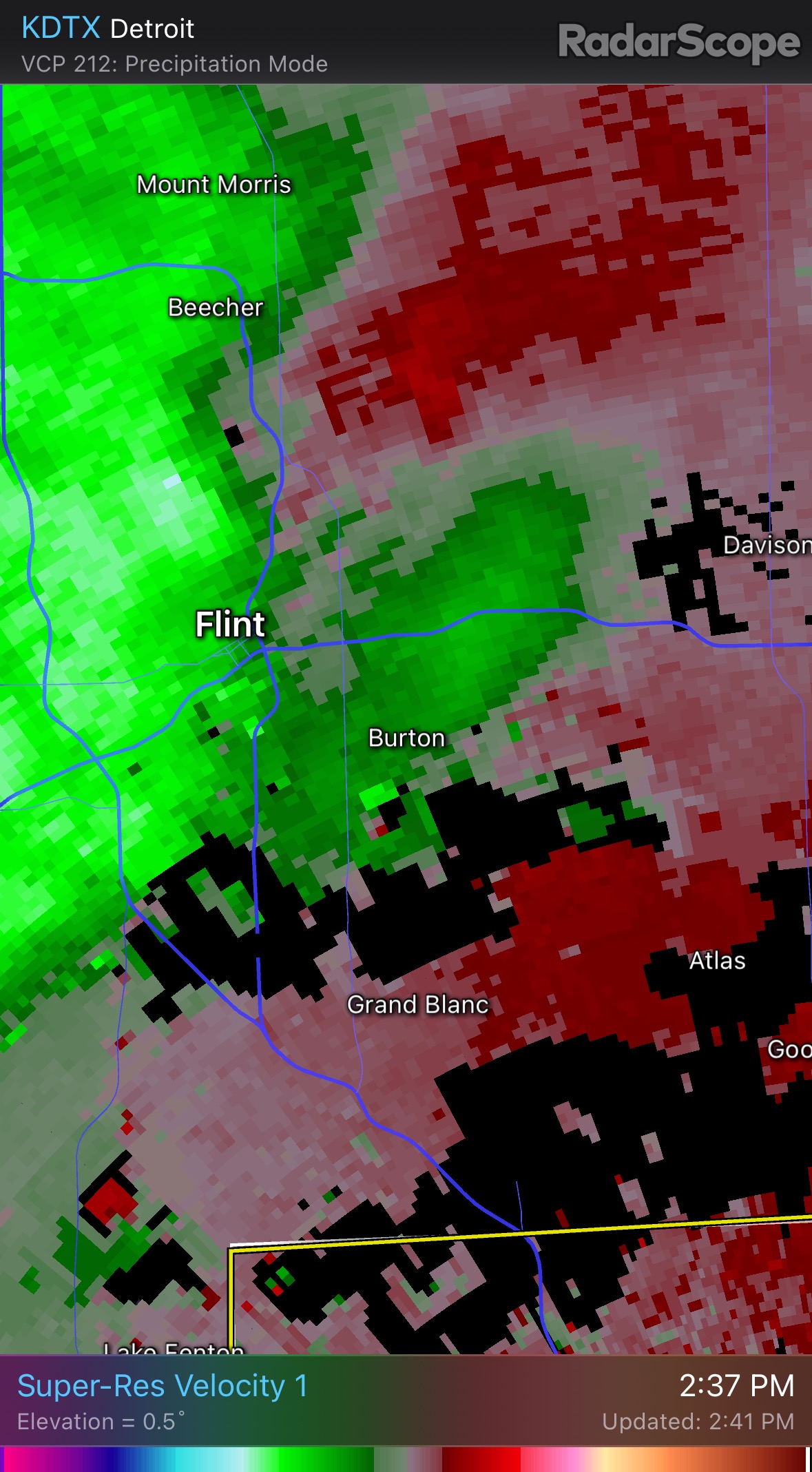
The closest strong storms were 10 miles north and like 30 miles south with the stuff that came around noon. The gap started to fill in with small showers overhead, but they weren’t producing much lightning, just hard rain. The late afternoon training cells were south of me by at least 5 miles. I heard distant booms but couldn’t see anything as it just wasn’t very close. I got a few hard showers early on but the show was mostly from the airport south and east. Airport is 5 miles southeast of me.
-
 1
1
-
-
2 hours ago, Lightning said:
Nearly every system has found a way to put red+ blobs on radar right on Grand Rapids area As I type this Grand Rapids is getting hammered again. I am not sure you will be happy unless your house has been leveled by a EF5.
Umm. I don’t live at the airport. There were some very disorganized clusters with occasional CG lightning about 3-4 miles south and east. Just downpours and soft rumbles from tiny cells right here. Similar to what has happened previously. Wanting CGs close enough to see is not the same as wanting an EF5. Ugh.
-
2
-
-
3 minutes ago, Harry Perry said:
Yeah, I kinda had a feeling this is how today would unfold.
I’d throw the towel in anywhere west of 127 and north of 96. Believe anything that develops to the west will be sub-severe and mainly follow the instability gradient to the south.
Apparently the old MCV still has wind with it even with no deep convection remaining. I don’t even want severe, just one good storm with some lightning strikes within a mile radius. So it looks like one more chance Friday and then back to the perpetual suppressed south and east pattern of this summer.
-
 1
1
-
-
I get a severe warned shower with tops below 30k and no lightning. Weird wake low winds or something. Skip. Just give me a real thunderstorm once this year.
-
2
-
-
zzz…. No good lightning once again.
-
1
-
1
-
1
-
-
The cell headed for Muskegon is looking beefier. Wonder if it will acquire rotation if it gets more surface based eventually.
-
4 minutes ago, Powerball said:
Hopefully, that gap fills in for frostfern's sake...
It will fill in once it gets east of me. Watch.
-
I just hope there is a round 2 on the back side.
-
I’m catching a whiff of burnt plastic smoke this evening. Ugh.

-
If there is a late-morning MCS, it could already be severe, but it will be over once it passes. Then the only supercell/tornado threat will be later in the evening where the southern edge of the outflow ends up. If there is no late morning MCS, afternoon cells could form right on the lake breeze. That scenario would be more interesting.
-
3
-
-
5 hours ago, CheeselandSkies said:
Southern WI removed from the slight risk on the updated Day 2. Lame, but could see it coming based on the model trends. Amazing how literally everything this year has skipped us, except for 3/31 when I was in Iowa going after the bigger fish (
 ).
).
Sent from my Pixel 4a using Tapatalk
I would take several years of no t-storms IMBY just to see that one event though. I've never even seen a tornado in person (if you don't count waterspouts). I have seen some decent supercells with large hail while chasing in MI, but never saw more than scuddy wall clouds.
-
9 hours ago, SolidIcewx said:
The way it’s looking so far anything that does happen you should be within easy driving distance hopefully
The latest models look farther north. Still so hard to predict where something will develop upstream.
-
2 hours ago, SolidIcewx said:
Possible another round Thursday night into Friday. Let’s see where that front sets up
Its just 2 chances that will probably be mostly south of me, then back to the forever trough.
-
1
-
-
I-94 south year.
-
1
-
-
1 hour ago, SolidIcewx said:
Very curious to see how Wednesday will unfold.. very good directional shear. DTX and KIWX had some nice updates
If it starts looking anything like 6-13 last year I might drive south to watch. It looks really juicy, which can lead to a good light show.
-
1
-
-
Still waiting for one electrically active storm this summer up here. SE side has done better.
-
1
-
-
On 7/23/2023 at 4:06 PM, frostfern said:
Finally a flat-topped ridge pattern with stalled warm front potential north of I-80.
Spoke too soon. Feeling yet another miss south.

-
1
-
1
-
-
Finally a flat-topped ridge pattern with stalled warm front potential north of I-80.
-
2
-
-
1 hour ago, Torchageddon said:
I know I'm in a particular screw zone in general but this year I've noticed many setups where the broad line either falls apart or doesn't exist then cells form to the SE of me just a few miles.
I heard one good thunder then nothing, the heavy rains at 5pm - 8 I ended up not getting any at all!
Yea. It’s hard to know the exact cause. I notice in Michigan just 300 feet of elevation will favor one area over another, but those microclimate effects are not as noticeable during organized severe outbreaks as they are with garden variety stuff.
-
2 hours ago, Torchageddon said:
This is hilarious, there is a dry gap in this mega squall with record winds in far sw on and then in Georgian Bay area they typically get these large cells that are tornado warned like this afternoon...guess which of those 3 zones I'm in?


Every time, the cells form just to my east!
 If I had a nickel for the number of times this has happened in 2023!
Lake Huron shadow. But you deserve a weenie tag from Texas Man for complaining about climatology.
-
1
-
-
Its gone now. No idea if it was actually anything.
-

Something trying to form. No warning yet though.

July 26 Severe Weather
in Lakes/Ohio Valley
Posted
It was a poor show. Low clouds blocked the view of any anvil crawlers and CGs were distant. I was waiting to make video but nothing was worthy. Disbelieve me all you want, but purposely twisting my words in order to pull a “gotcha” isn’t clever trolling.