
WVsnowlover
-
Posts
690 -
Joined
-
Last visited
Content Type
Profiles
Blogs
Forums
American Weather
Media Demo
Store
Gallery
Everything posted by WVsnowlover
-
Gonna be close but seems like it may just clip the south side of DC. Pretty cool that many models were insistent on showing a jack down around the northern neck area and that's where the heaviest snow is setting up.
-
DC is going to get annihilated here in around 30 min or so. That band looks legit.
-
Went from basically no chance for a south trend to having it go too far south lol.
-
I just knew this storm would overperform! What a beautiful day. Are mimosas acceptable at this hour? Asking for a friend...
-
Just measured a hair over 3" on the paved driveway.
-
Nice to see the radar filling in between Cumberland and Harrisonburg!
-
Man it's beautiful out there! Eyeballing about 2.5". Congrats to you guys to my east, you are absolutely crushing it! Looks like two storms in a row that you guys do better than us.
-
In the past 24 hours this has gone from 1-2", to 2"-4", to now 3-5". The models have been a lot of fun to watch unfold. Someone is getting 6"+ from this.
-
I met my wife of 11 years there. In fact we got married at the James Rumsey Monument (a small park on a bluff overlooking the Potomac). A lot of my family also went to Shepherd and my step father was a professor there for years (now retired). It really is an amazing small town.
-
It's a perfect place to chase to especially now that they have their own brewery.
-
Absolutely! I used to live in Shepherdstown and worked at the Bavarian Inn for years when I was younger. I was there for the 2009 winter which was incredible.
-
Downtown Harpers Ferry during a snowstorm has to be one of the most beautiful and magical places I've ever seen.
-
Have you been hacked by Jebman?
-
They don't want to bust low two times in one week.
-
Thinking the same here. Very likely my biggest snowfall in two years... let's go!
-
.gif.b211c48a83e2bffbd9270f894bbdc38f.gif)
-
 It can stop that south trend now...
 -
Glad to finally see the excitement start to build for this on here. We're getting to the point where we might want the south trend to stop. Hopefully it can continue to juice up a little more up until game time.
-
Love when they play catch up!
-
2-3" would absolutely be a win considering where we were just 18 hours ago.
-
-
If these trends continue, 1-3" might start to look a little conservative for anyone DC north.
-
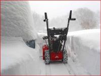
Well, we seem to be fairly locked in on a 2-4" event for most here. Loving the overcast skies today as well. There's been zero melting. Snow on mf snow!
-
All of the above. Like seriously WTF lol.


