Just received this:
Tropical Storm Idalia Local Statement Advisory Number 5
FLZ041-044>046-053-058-141-144-154-159-164-247-254-259-264-347-447-547-647-747-280430-
Tropical Storm Idalia Local Statement Advisory Number 5
National Weather Service Melbourne FL AL102023
615 PM EDT Sun Aug 27 2023
This product covers East Central Florida
**Tropical Storm Watch In Effect for Lake County**
NEW INFORMATION
---------------
* CHANGES TO WATCHES AND WARNINGS:
- A Tropical Storm Watch has been issued for Northern Lake and
Southern Lake
* CURRENT WATCHES AND WARNINGS:
- A Tropical Storm Watch is in effect for Northern Lake and
Southern Lake
* STORM INFORMATION:
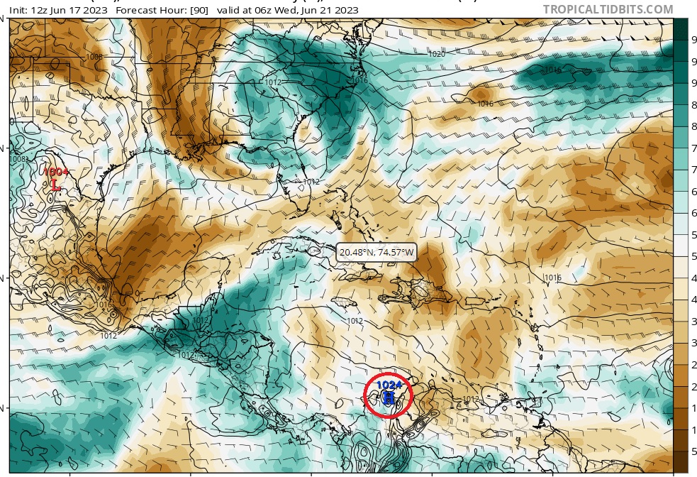
- About 640 miles south-southwest of Leesburg FL
- 20.1N 85.5W
- Storm Intensity 40 mph
- Movement Northeast or 40 degrees at 3 mph
SITUATION OVERVIEW
------------------
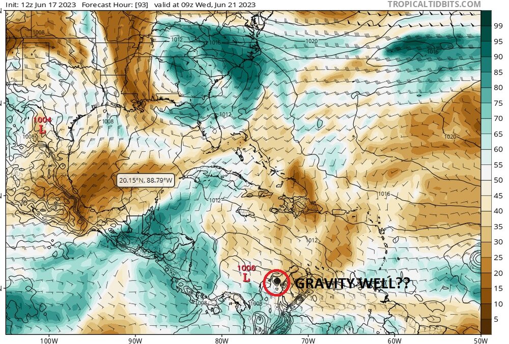
The center of Tropical Storm Idalia is located just over 120 miles
south of western Cuba this afternoon. Idalia is slowly drifting to the
northeast, and motion is expected to remain slow and possibly erratic
overnight, before increasing in speed to the north-northeast on Monday
and Tuesday. The storm is currently forecast to approach the western
Florida Peninsula late Tuesday into Wednesday. Preparations should be
ongoing for at least tropical storm conditions by midweek.
A Tropical Storm Watch is now in effect for Lake County, where
confidence is highest in tropical storm conditions occurring.
Additional watches may be necessary for portions of east-central
Florida in future forecasts.
Moisture associated with Idalia will reach central Florida as early as
Monday afternoon, boosting rain and thunderstorm chances during the
day. Conditions will begin to deteriorate Tuesday afternoon and
evening as Idalia accelerates north-northeastward across the eastern
Gulf of Mexico. As coverage of showers and squalls increases Tuesday
afternoon into Wednesday, the possibility of strong to damaging wind
gusts will also increase. Tropical storm force winds are forecast to
extend outward from the storm`s center, potentially reaching portions
of east-central Florida, including Lake County, Tuesday night into
Wednesday morning. Based on the current forecast track, Idalia will
make its closest pass to east-central Florida late Tuesday night and
Wednesday morning, continuing northeastward during the day on
Wednesday.
While the heaviest rainfall from Idalia is currently forecast to fall
along the Gulf Coast and western Florida Peninsula, gusty squalls will
be capable of torrential downpours, especially Tuesday and Wednesday.
One to two inches of rain from Monday afternoon through Wednesday
night is expected for a large portion of the area, with locally higher
amounts possible. Locations in closer proximity to the center of
Idalia, such as Lake County in east-central Florida, may receive
higher rainfall totals.
In addition to strong wind gusts, a threat for tornadoes is forecast
to develop as the center of Idalia moves into the eastern Gulf of
Mexico Tuesday afternoon, Tuesday night and into Wednesday.
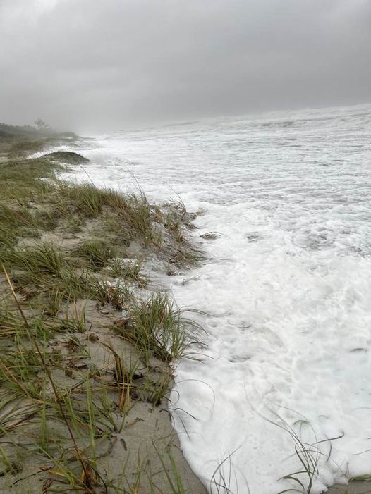
Combined swells from Hurricane Franklin over the western Atlantic and
the approach of Idalia will likely lead to high seas, rough surf, and
an increase in life-threatening rip currents. Eastward adjustments to
the current forecast track would also increase the threat for possible
beach erosion and coastal flooding Tuesday into Wednesday.
Do not let your guard down, especially in locations east of the
current Tropical Storm Watch. Impacts from Idalia will be experienced
far from the center of the storm. Now is the time to ensure your
hurricane supply kit is stocked and your safety plan is in place.
As Idalia becomes better organized over the next 24 to 36 hours,
additional changes to the current forecast are possible. Eastward
shifts in the forecast track would increase the potential for impacts
locally, so continue to monitor the latest forecasts from the National
Hurricane Center and National Weather Service in Melbourne, Florida.
POTENTIAL IMPACTS
-----------------
* WIND:
Prepare for hazardous wind having possible limited impacts across
East Central Florida. Potential impacts include:
- Damage to porches, awnings, carports, sheds, and unanchored
mobile homes. Unsecured lightweight objects blown about.
- Many large tree limbs broken off. A few trees snapped or
uprooted, but with greater numbers in places where trees are
shallow rooted. Some fences and roadway signs blown over.
- A few roads impassable from debris, particularly within urban
or heavily wooded places. Hazardous driving conditions on
bridges and other elevated roadways.
- Scattered power and communications outages.
* FLOODING RAIN:
Prepare for dangerous rainfall flooding having possible significant
impacts across Lake County. Potential impacts include:
- Moderate rainfall flooding may prompt several evacuations and
rescues.
- Rivers and tributaries may quickly become swollen with swifter
currents and overspill their banks in a few places, especially
in usually vulnerable spots. Small streams, creeks, canals, and
ditches overflow.
- Flood waters can enter some structures or weaken foundations.
Several places may experience expanded areas of rapid
inundation at underpasses, low-lying spots, and poor drainage
areas. Some streets and parking lots take on moving water as
storm drains and retention ponds overflow. Driving conditions
become hazardous. Some road and bridge closures.
Prepare for locally hazardous rainfall flooding having possible
limited impacts across the remainder of East Central Florida.
* TORNADOES:
Prepare for a tornado event having possible limited impacts across
East Central Florida. Potential impacts include:
- The occurrence of isolated tornadoes can hinder the execution
of emergency plans during tropical events.
- A few places may experience tornado damage, along with power
and communications disruptions.
- Locations could realize roofs peeled off buildings, chimneys
toppled, mobile homes pushed off foundations or overturned,
large tree tops and branches snapped off, shallow-rooted trees
knocked over, moving vehicles blown off roads, and small boats
pulled from moorings.
* SURGE:
Direct surge impacts from Idalia are not currently anticipated at this
time. However, larger swells and surf combined with Hurricane Franklin
will bring a threat for minor coastal flooding and beach erosion.Locations
more vulnerable to coastal flooding and beach erosion, such as portions
of the Volusia County coast, should stay updated on the latest
forecasts.
PRECAUTIONARY/PREPAREDNESS ACTIONS
----------------------------------
* EVACUATIONS:
Listen to local officials for recommended preparedness actions,
including possible evacuation. If ordered to evacuate, do so
immediately.
* OTHER PREPAREDNESS INFORMATION:
Now is the time to check your emergency plan and emergency supplies
kit and take necessary actions to protect your family and secure your
home or business.
When making safety and preparedness decisions, do not focus on the
exact forecast track since hazards such as flooding rain, damaging
wind gusts, storm surge, and tornadoes extend well away from the
center of the storm.
When securing your property, outside preparations should be concluded
as soon as possible before conditions deteriorate. The onset of
strong gusty winds or flooding can cause certain preparedness
activities to become unsafe.
Closely monitor weather.gov, NOAA Weather Radio and local news
outlets for official storm information. Listen for possible changes
to the forecast.
There is a threat from tornadoes with this storm. Have multiple ways
to receive Tornado Warnings.
* ADDITIONAL SOURCES OF INFORMATION:
- For information on appropriate preparations see ready.gov
- For information on creating an emergency plan see getagameplan.org
- For additional disaster preparedness information see redcross.org
NEXT UPDATE
-----------
The next local statement will be issued by the National Weather
Service in Melbourne FL around 12 AM EDT, or sooner if conditions
warrant.
$$
Schaper