

AfewUniversesBelowNormal
-
Posts
4,753 -
Joined
-
Last visited
Content Type
Profiles
Blogs
Forums
American Weather
Media Demo
Store
Gallery
Posts posted by AfewUniversesBelowNormal
-
-
Pretty cool, I'd put a watch there too. It's not going to develop though. Global warming, that's why.
https://radar.weather.gov/Conus/northrockies_loop.php -
I can see more evenening out of the 2013-2016 El Nino. There's probably a really strong El Nino coming up in the next 10 years.
-
Looking at this graph the tendency may be La Nina for another 1-2 years. Aesthetics are 60% chance it falls in the Fall I think, although it will be hard to cool the subsurface disregarding Weak La Nina chances.
SOI is also up since 1998.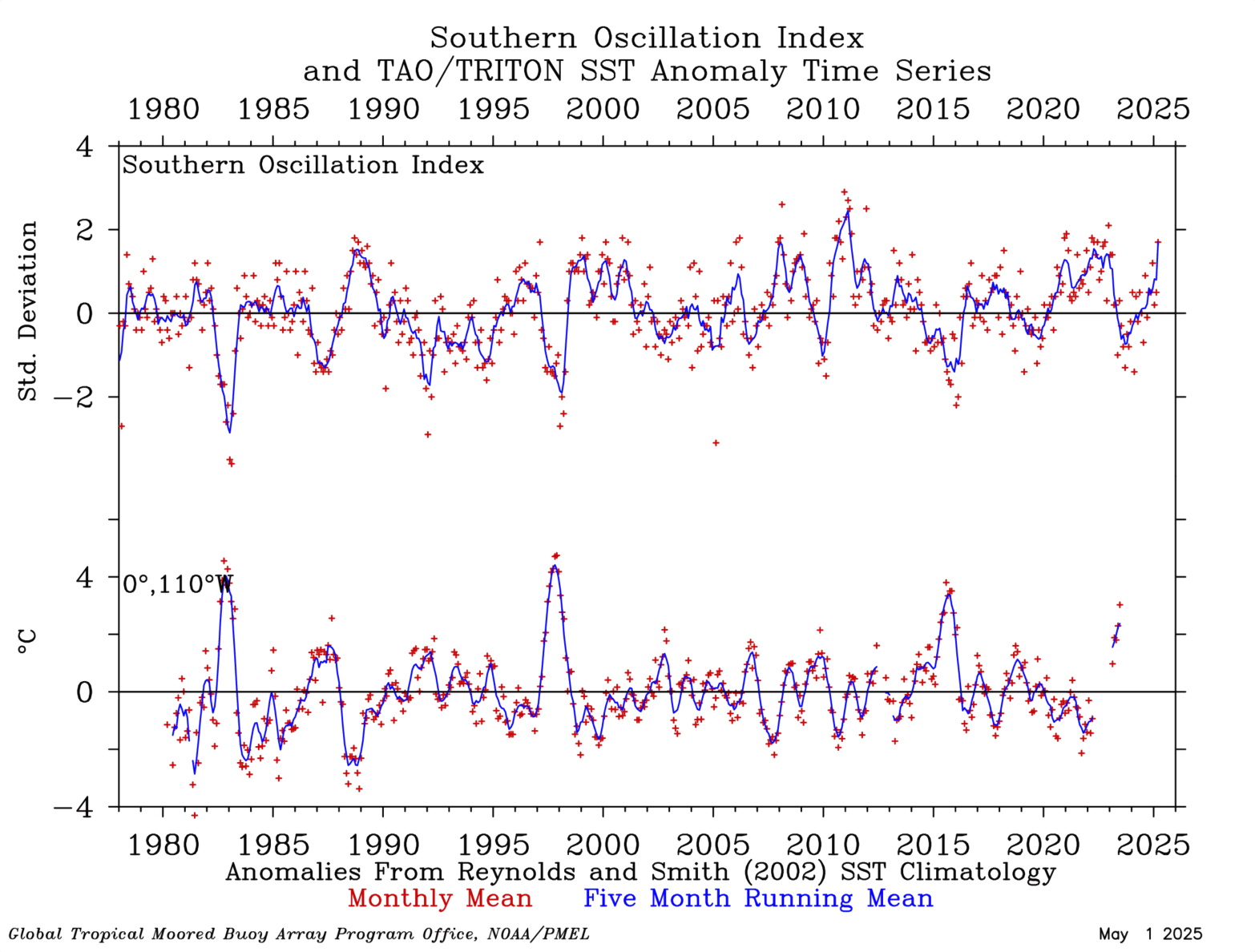
-
If it stays at +Neutral/weak El Nino range, A lot more options globally, where I think a stronger Nino would have narrowed it down quite a bit in this post-2013 pattern.
-
Atlantic SSTs are cold, El Nino conditions since April, basically really above average precip. I'm just pointing out a pretty significant pattern change.
-
 1
1
-
 1
1
-
-
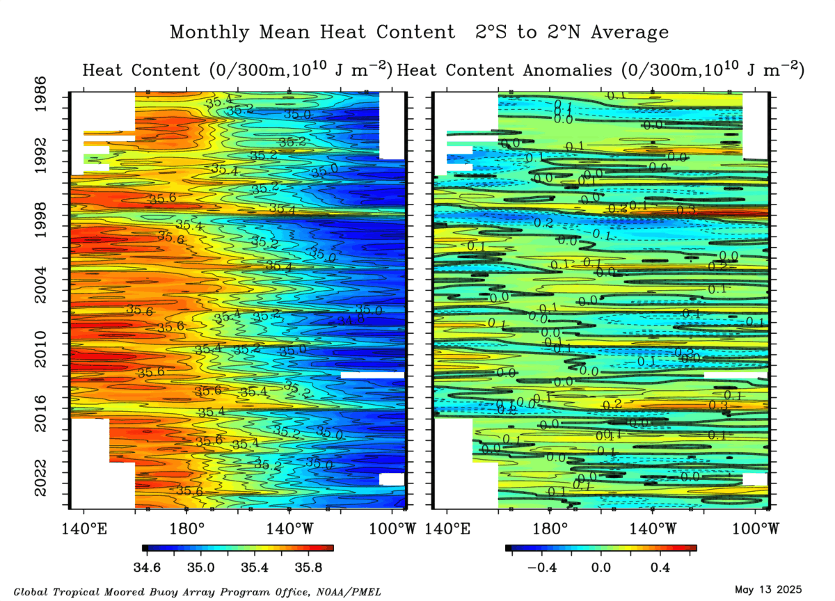
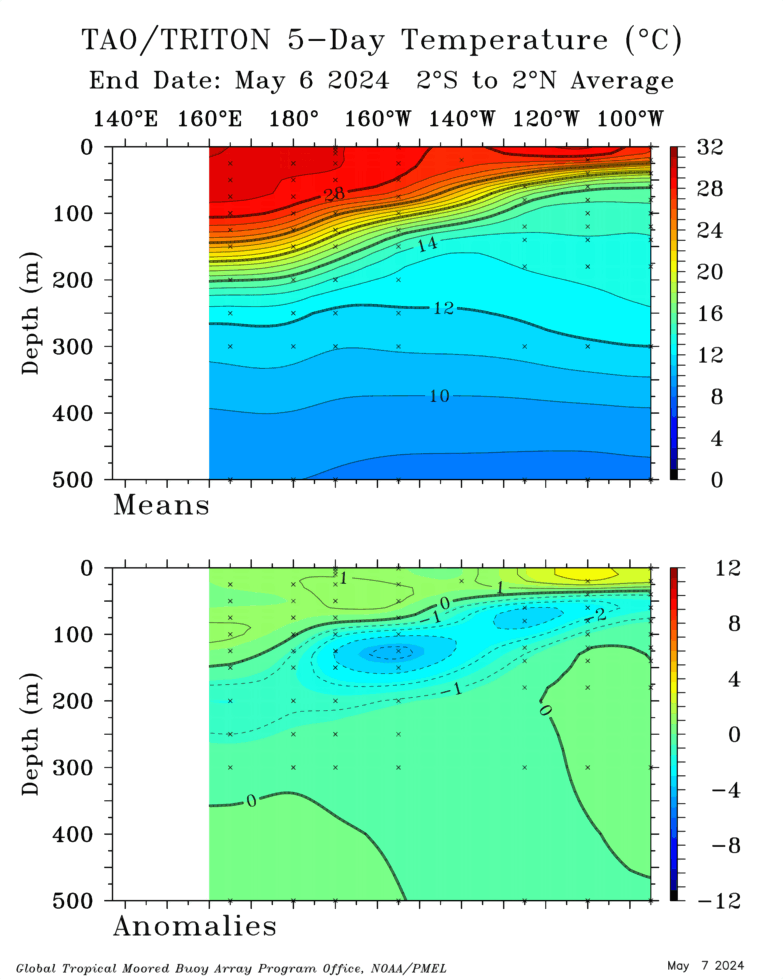
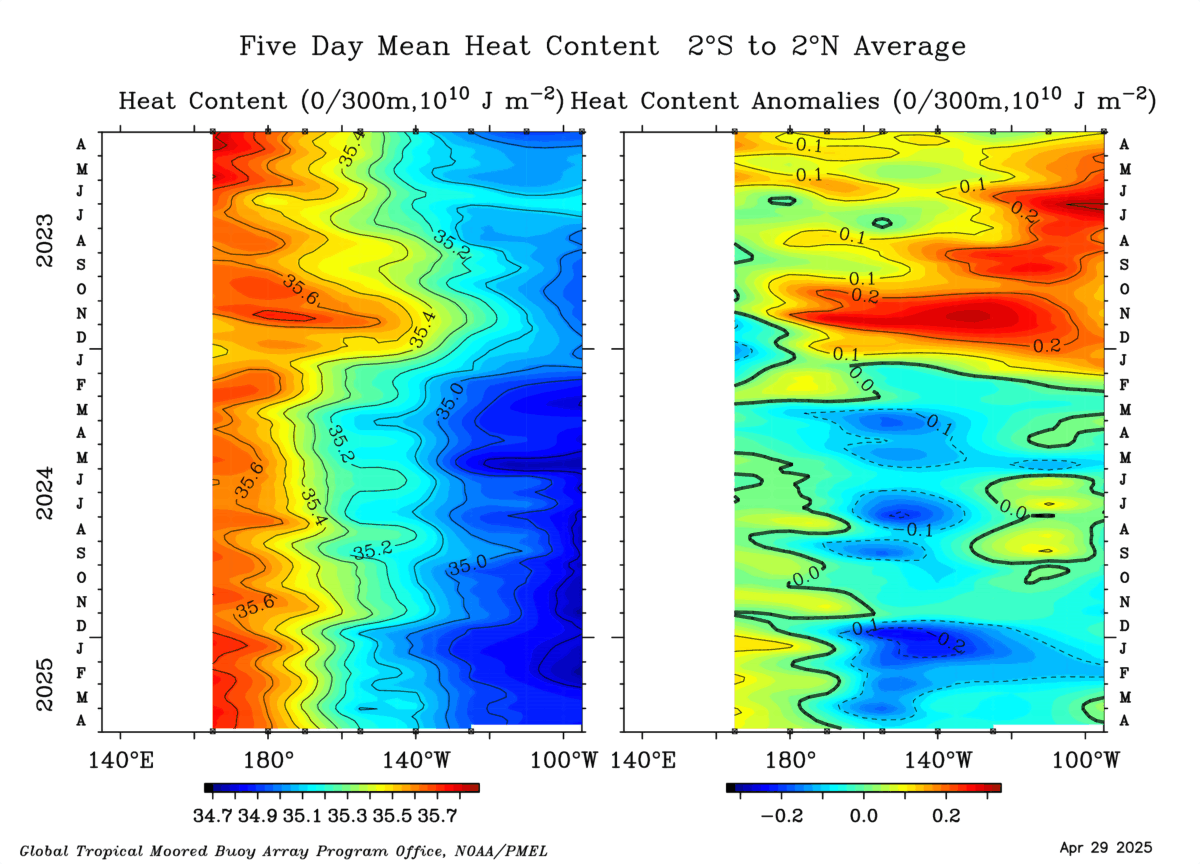
Furthermore, this subsurface warmth building in the west (~140E) is a sea-saw to La Nina conditions in time.

(I cant get it to animate.)
http://www.cpc.ncep.noaa.gov/products/precip/CWlink/MJO/enso.shtml
-
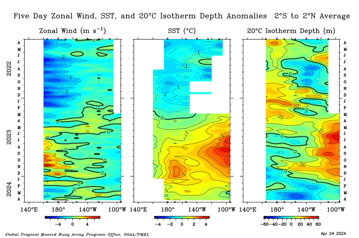
Check it out, I wonder what's going on? This is last year-like and a definite trend in the last few days.
-
Trending away from El Nino

-
So this cold pool around -200m may stop the El Nino altogether
-
GFS ensembles are trending more northern-US ridge, constant above average. Maybe a derecho setup down the line. It's kind of trending away from El Nino.
-
Moderate is possible. Subsurface warmth is backbuilding west now.
-
Long term GFS ensembles even have a +PNA so..

-
1
-
-
11 hours ago, Mdecoy said:
Its only June 13th.
It's a saturated airmass. The tropical Atlantic ridge goes much further west.
-
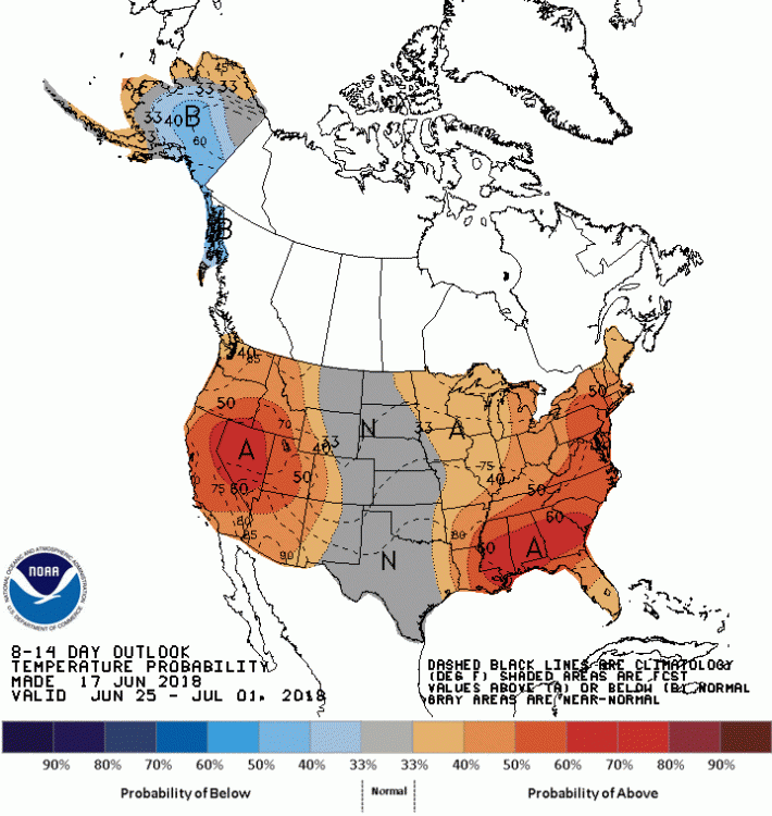
Looking really good for Winter. Weak El Nino and huge bias for Hudson Bay-south trough/+PNA/-EPO pattern right now, the Summer through...
-
What an awful year for storms. The worst, probably ever. The air has this constant ice-cube-like tint. Call it natural or whatever, I think it's a reason for the clouds.
-
Updating my prediction to Weak El Nino peak. The cold in the subsurface near 180 degrees is concerning for stronger than +0.8 ONI trimonthly high.
-
-
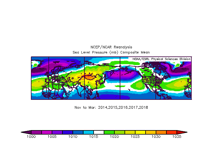
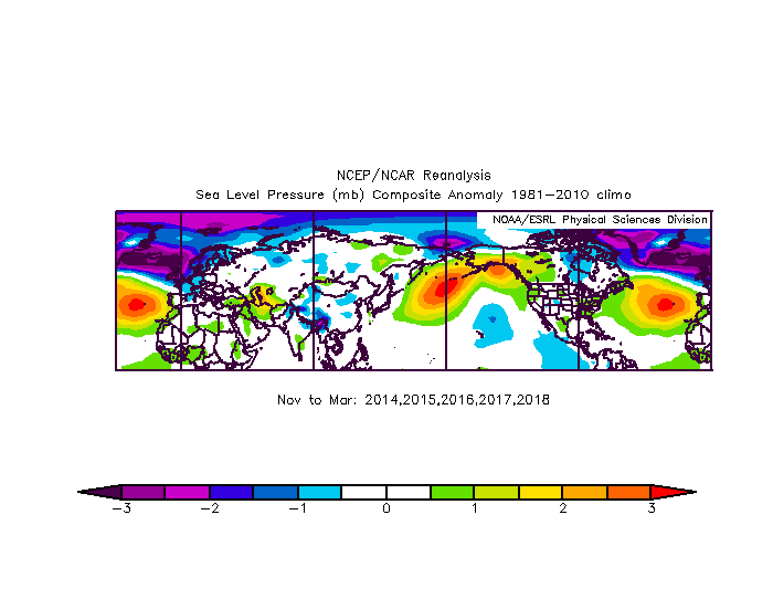
Check out this strong +PNA which you usually don't see in La Nina, 52-46-2 (Nino-Neutral-Nina). Then the NAO is positive and this whole evolution is really developing-El Nino-like
http://mp1.met.psu.edu/~fxg1/ENSHGTAVGNH_18z/ensloopmref.html -
It goes something like every event that has broke in June-July peaks in October-November or later. Subsurface looks like a 2 month warming at least.
-
The upper midwest one's aren't that impressive. -50 in Chicago? Big deal. I bet the further south has some better extremes. I bet the western 1/3 of the country has some better extremes.
-
On 6/2/2018 at 10:36 AM, AfewUniversesBelowNormal said:
When the subsurface warm pool reaches a peak in surface warming, it looks like a GOA Low is on models. I wonder if this will happen. (I think not)

Yeah, not a big deal. More -PNA duality than anything else. Surface SST trend doesn't necessarily correlate to North Pacific +PNA, although sometimes shown on models. Easy 3-5 day bias-correction I think

-
There's been two substantial anomalies in April and May. On Feb 21, 2018 when Washington DC had 500mb heights of 591dm, breaking its old record of 583, there was a major PV in this area.
-
On 4/7/2018 at 11:14 AM, AfewUniversesBelowNormal said:
Hadley Cells expanded north, Polar Vortex shifted
Hadley Cell Atlantic, Hadley Cell Pacific
-
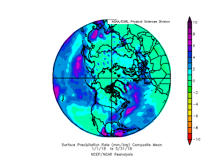
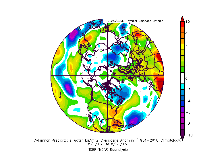
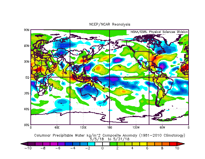
A lot of water in the Hemisphere right now

2018 Mid-Atlantic General Severe Discussion
in Mid Atlantic
Posted
You can pretty much guarantee the AMO will be rising for the next few months. With a continued strong Atlantic ridge, expected cold thunderstorm activity through the Summer.