mahantango#1
-
Posts
5,427 -
Joined
-
Last visited
Content Type
Profiles
Blogs
Forums
American Weather
Media Demo
Store
Gallery
Everything posted by mahantango#1
-
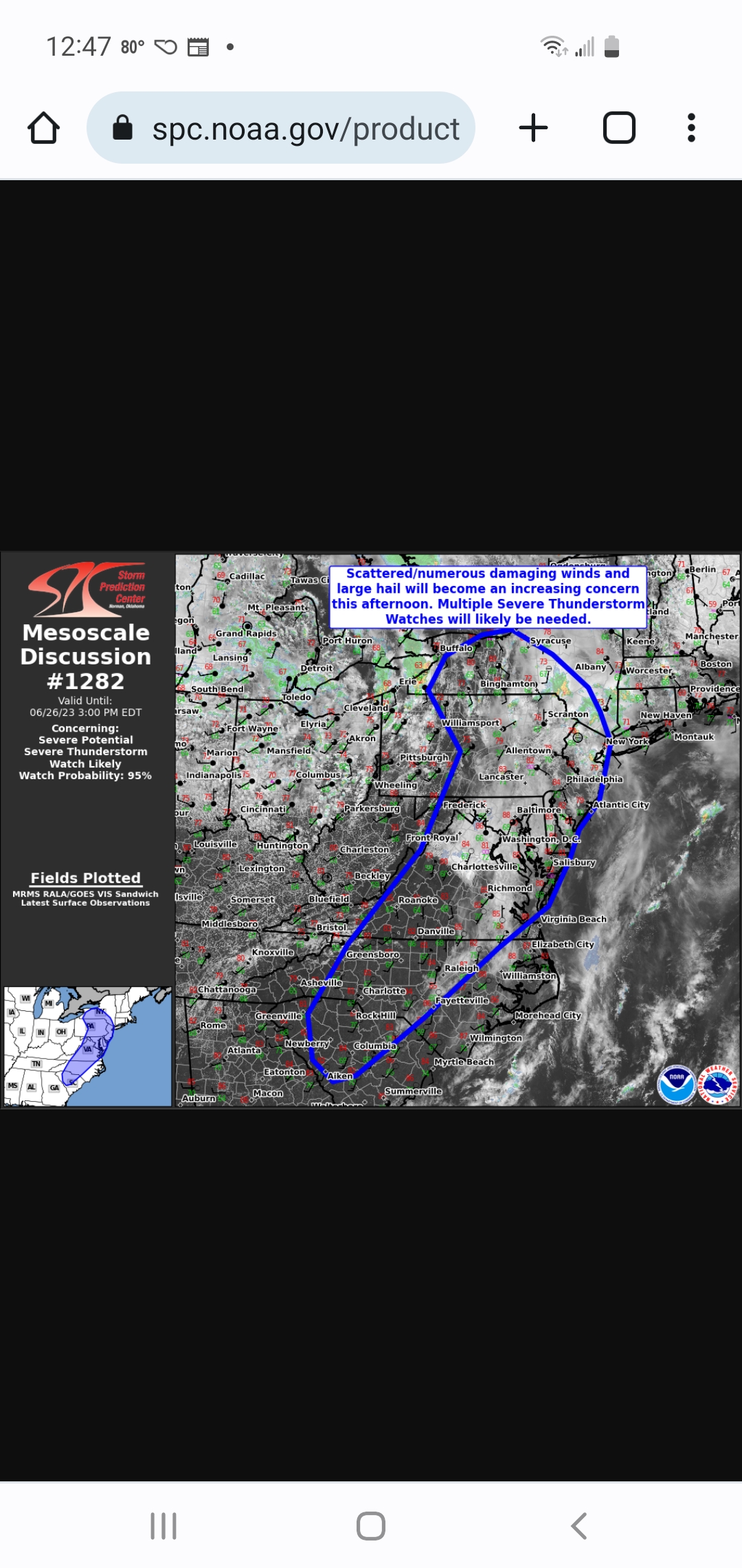
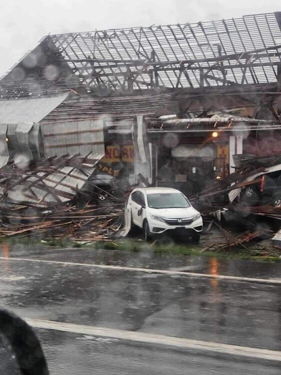
Video of roof being tore off of fireworks store in Lewisburg, pa. This shouldbe the right link. .https://fb.watch/lxJNyhmRvx/?mibextid=Nif5oz
-
Fireworks store in Lewisburg, PA and report that skylights were ripped off of Walmart too.
-
Picked up .52 rain from tornado warned storm no hail here but one hell of a lightning strike that was too close to the house. Hail was about a little over 2 miles from my place or less.
-
Yes all ok, they put vehicle under church pavilion. He was headed to work. He works in the burg for CRW. He said it was quarter size hail.
-
My son said there was big hail a half mile from Berrysburg, he lives there
-
You have to send that heat east to your fellow weather friends in this thread so they can really enjoy it with these 70 plus dewpoints.
-
73.0 dp here.
-
1.48 in of rain overnight. Went to bed around 11:00pm last night and it just started raining. Was surprised by the number this morning. Went back and looked at the weatherstation data and between 10:30pm and 1:30am is when all the rain fell.
-
I wonder if severe thunderstorms will occur today and heavy rainfall too. No sun here as of now.
-
My yearly total stands at 17.01in of rain.
-
Hopefully we get some rain and not a deluge. 2 days ago my garden was actually too wet. It had dried out some now.
-
Looks like I'll close out June with 4.43in of rain.
-
Yep, it smells like a campfire this morning
-
Which one are you favoring? And where's the Euro?
-
A few drops of rain... but it was a great lightning show!
-
Great lightning show now.
-
Severe thunderstorm warning for me just issued
-
Still no storms here unless the one coming gets me
-
-
They expanded the enhanced risk further west.
-
Hopefully that will change in the next few days. Sun is finally starting to burn through the clouds here.
-
I have 4.26 in. Of rain for June so far. With most coming after the 10th of this month. My garden has plenty of moisture now with the rainfall and the irrigation that was done before the tenth
-
Time will eventually tell.
-
I'm wondering if the sun will come out today. overcast here.
-
Had thunderstorm @2am that dumped .30 very quickly.