

FLweather
-
Posts
2,419 -
Joined
Content Type
Profiles
Blogs
Forums
American Weather
Media Demo
Store
Gallery
Posts posted by FLweather
-
-
Both the GFS and HWRF came a little further west with the 0z runs.
Big bend of FL north of Tampa and Clearwater.
GFS the strongest of the 2. 968mb prior to landfall.
HMON targeting SW FL.
Canadian the outlier and the weakest never makes landfall in FL. But skirts east of Miami as a marginal TD/TS.
Imo FL still very much in the possibility of having landfall some where. A Irma style track very possible.... SW FL landfall right up the middle of the state.
-
Elsa definitely showing her colors tonight.
LLC and mid and upper levels stacking.
Will be a hurricane sometime early in the morning tomorrow mid day.
-
 1
1
-
-
6 minutes ago, Tezeta said:
Yeah I guess Irma counts…but tbh I consider it a fake 4 in the keys and a fake 3 at Naples. It isn’t quite red meat enough but it’s hard to get that on the western coast.
Irma wasn't fake. That's for sure.
-
1
-
-
4 minutes ago, Tezeta said:
What are you going to do when you get a real storm? I feel like all of western Florida except the charley zone is in for a rude awakening sometime soon.
Exactly been a long time since 2004.
-
11 minutes ago, hlcater said:
I’d lean bearish on near term intensity. Having such a fast forward motion and attendant strong fetch on the northern side is going to favor a very lopsided system even if shear and dry air are negligible. I suspect that the system will appear reminiscent of some of those later season gulf storms from recent years that suffer from the same issue, just rotated 90 degrees. Think the best shot for respectable intensification is after FH48 when this is in the eastern Caribbean and slowing down.
You can already see that the strong flow aloft is not going be much of an issue.
And the lower levels will start slowing down as the ridge breaks down ahead of the incoming troughs.
Minimal shear aloft plus the surface ridge axis splits and creates a "fork in the road"
This storm will start slowing down. Before it curves. Eastern GOM or EC of FL.
-
4 minutes ago, Prospero said:
Crackling at the moment.
You ready for the 4th and a hurricane party?
We might have a Matthew and Irma track going on.
-
WV really starting to show Elsa wrapping up.
Kinda in a way... I do see a GFS solution. Tightly wound compact system.
Needless to say Euro is the outlier.
The organization tonight. I highly doubt that this goes to nada.
-
Water vapor confirms dry air being shut off at the mid and upper.
Also confirms that the system is trying to become stacked and symmetrical.
-
25 minutes ago, cptcatz said:
Little speck of -80° cloud popping up...
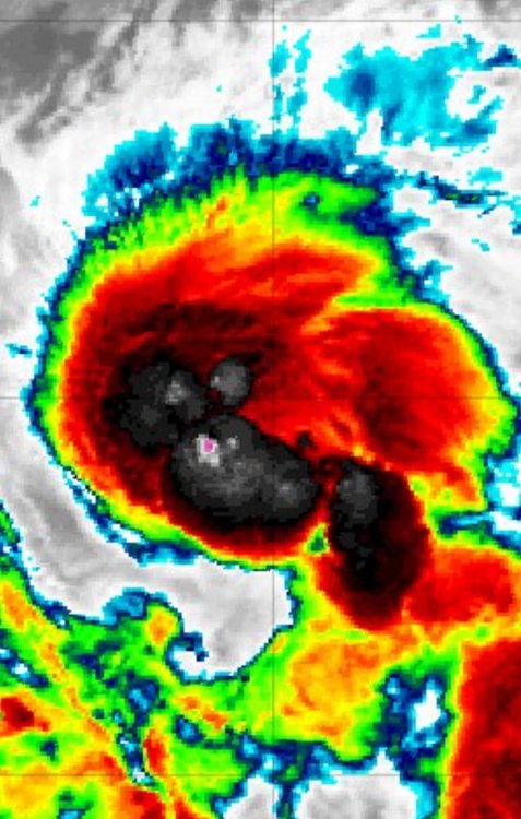
I've been watching that. The organization this evening has improved greatly over the last few hours.
I think that judging by the satellite. Mid and UL becoming stacked with the LLC.
But by 5am advisory looking at a stout TS/min hurricane.
-
Elsa definitely under going a strengthening phase atm.
Convection becoming more centered and symmetrical.
-
9 minutes ago, Windspeed said:
Convection is trying to wrap upshear around the LLC. The mid-to-upper easterly flow might be starting to amplify now. We'll see if that can counter the high speed low level flow somewhat for less of a deep layer tilt to the vortex. May still remain somewhat weak regardless.

Going to be interesting tonight.
Definitely could see some strengthening tonight.
The convection is trying to pull around the center and water vapor shows further development possible over night.
Plus the dry air to the NW is being cut off.
-
 Hurricane Party right after the 4th of July.... Sounds about right.
HWRF 990mb approaching sw FL.
That would be a low end cat 1.
-
Tropical storm Elsa as of lastest advisory.
40mph Max sustained
-
1
-
-
1 hour ago, Windspeed said:
No.

Very healthy storm via satellite.
Wouldn't be surprised this gets a name today, especially if recon goes out.
Looking at the models track wise... Very similar to Irma. Strength wise they're all over the place.
Euro being the outlier.
-
6 minutes ago, Windspeed said:
Beven has a high degree of uncertainty on intensity mainly due to the strong easterly flow that will be kicking hard as this system traverses the Caribbean. A potential motion of 22 kts is screaming. That being said, if PTC 5 develops faster in the short term and increases intensity potential for the Lesser Antilles, it could maintain itself within that fast embedded flow. Anything from a weak TS to a Cat 2 by the time this his south of Haiti. So yes, a very problematic intensity forecast for now.
Another thing to watch is the afternoon convection across FL and GOM states.
There has been persistent trough axis across FL and GOM last week or so.
So the ridging can only push this but so far west, before the easterly flow gives up.
The stronger and faster this develops can make a huge difference too.
It could slide up the EC of FL or somewhere over the eastern Gulf/West.
I have a feeling 2020's younger brother wants to play this year too.
-
This has definitely been the oddest system in quite some time.
Not very often you see a direct landfall and westward trajectory into that area.
Usually it's a skirt and skoot along that area of coast line.
-
I'm shocked
But that's a TS tonight on satellite.
With out question. Broad circulation but obviously a small compact LLC. Near the flare up.
-
1 hour ago, Vice-Regent said:
That disturbance south of Bermuda should bring something to your area in 7-10 days.
Not the area of development.
Cant really believe the NHC would give that a 10 percent.
Along an elongated trough axis extending south into the GOM stretching down to the Yucatan.
Central GOM is to watch.
-
Tonight's convection associated with the weak front combined with East Coast and West Coast Seabreeze collisions.
Have spun up a mid-level and surface LP off of Clearwater, St Pete.
-
1
-
-
4 hours ago, NorthHillsWx said:
Watch the low pressure system that has formed off the Carolina coastline. Very common spot for quick spin ups
Good eye on the broad scale of things.
But not really the location to be watching.
Looking at satellite and radar. I think a broad large scale trough axis trying to setup off the Carolina,GA Coast across Florida into the GOM.
So just judging by the models and possible quick spin up possibility maybe central and northern GOM stretching down to the Yucatan.
-
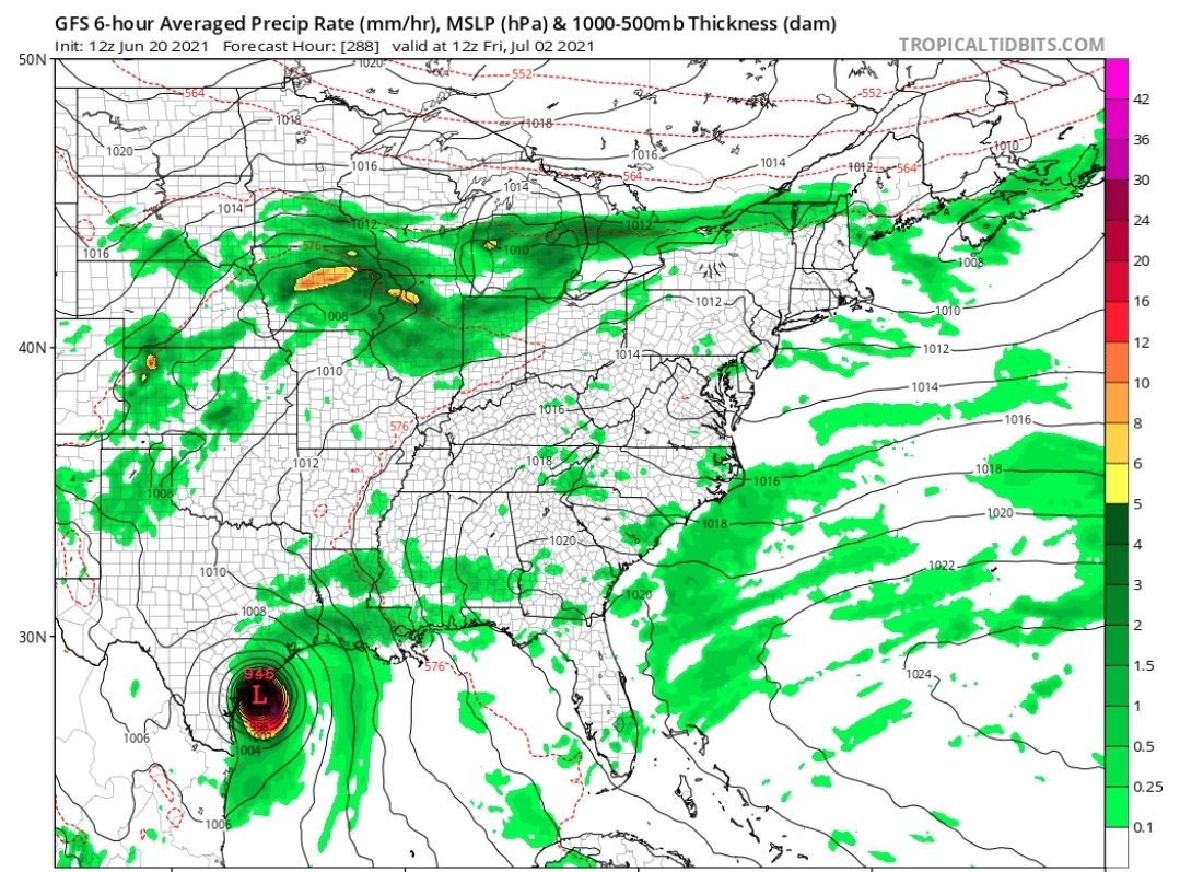
The 0z GFS back at it with a developing TC entering the GOM roughly 200-220 hours out.
Something to watch in the BOC.

-
26 minutes ago, cptcatz said:
Well that's interesting

Lol.
But interesting enough the Canadian has some kind of entity also the last 2 runs.
Something to watch for again coming out of the BOC?
Just looking at the the pattern over the last week +/- . We might be locked into the next 2-3 weeks.
-
I highly doubt that this will get named between now and 11pm.
You can clearly see how separated the surface is from the upper levels.
The mid level vortex just made landfall 1.5 hours ago. Just slightly after 4pm ET. SE of N.O.
Current location is SW of N.O.
Now since the Mid level is over land all cards are off the table.
-
2
-
-
This storm has alot to go model wise.
Definitely going to be a lopsided TD/TS.
Looking at the models. They are off to tonight's presentation on satellite.
Any reformation will likely be a good jump to the east. Likely south southeast of Mobile and Pensacola.
Judging by satellite only a very deep healthy anti cyclonic ATM centered south and east.
Outer edges of the trough showing up over Texas.

Hurricane Elsa
in Tropical Headquarters
Posted
If it runs parallel and offshore along Cuba the mountains can enhance the lift and help strengthen the storm.
But after watching last night... Not really shocked it became a hurricane today.
Will be interesting to see what nocturnal intensification happens tonight.
As the upper levels cool off from the solar radiation today.