
Bostonseminole
-
Posts
13,944 -
Joined
-
Last visited
Content Type
Profiles
Blogs
Forums
American Weather
Media Demo
Store
Gallery
Posts posted by Bostonseminole
-
-
9 minutes ago, user13 said:
966 on current pass
yeah, I mean it can be just as bad with a steady strengthening storm, you don't always need RI
-
 1
1
-
-
-
10 minutes ago, Bostonseminole said:
this gets closer to Tahoe and it could be trouble, already close to Strawberry, a nice little town I visited with my kids often when I lived in Sacramento.
I guess, this is what might save tahoe
-
7 hours ago, powderfreak said:
That smoke in Tahoe has been wild. I know most of the ski areas have had to shut down all summer activities due to poor air quality. That’s a huge economical hit for all businesses in the Tahoe summer tourism season to get that in August.
this gets closer to Tahoe and it could be trouble, already close to Strawberry, a nice little town I visited with my kids often when I lived in Sacramento.
-
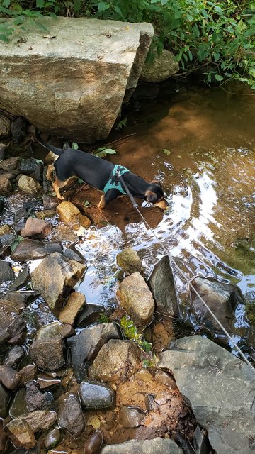
20 minutes ago, BrianW said:
Wife and I adopted this rescue pup from Georgia. Its my first dog and what an experience. Such a great bond. He loves going down to the river.
AWESOME, congratulations!
-
1 minute ago, Damage In Tolland said:
Couple more inevitable bumps north on the north trend and this will turn into congrats Dendy. Wait for it

btw is the OP, why would anyone look at that so far out..
-
 1
1
-
-
Just now, Damage In Tolland said:
Couple more inevitable bumps north on the north trend and this will turn into congrats Dendy. Wait for it
GFS and EURO looks pretty similar with JP anywhere south of NH border right now
-
-
Just now, jojo762 said:
The circulation has tightened greatly on IR the last 15 minutes with miniature hot-towers going up on the north and east part of the circulation.
https://weather.cod.edu/satrad/?parms=meso-meso1-14-48-1-100-1&checked=map&colorbar=undefined
-
1
-
-
the rich at the airport
-
 2
2
-
-
eye back open pressure down to 970
F. Eye Character: Open in the south
G. Eye Shape & Diameter: Circular with a diameter of 17 nautical miles (20 statute miles) -
Just now, Damage In Tolland said:
Scroll back a few days ….
I believe you.. until we get past IDA, I don't expect to see anything like that, after Ida we move to fall.
-
-
lol i hope nobody called a dew of 50 in August, but Dews in the 50's was right on
-
1 hour ago, CoastalWx said:
Muggy?
yeah, nothing muggy about tonight
-
968.7 on latest pass
-
2
-
-
18z GFS looks wet 2-4"
-
Just now, hlcater said:
I'm not sure why everyone seems to be so convinced that the storm is struggling. It's deepened more than 12mb since this morning. I'm not really sure what people expected?
seems pretty steady strengthening to me, even if it gets stronger, slowly next 12 hrs it will be a CAT 4
-
1
-
-
definitely seeing the convections finally wrap around the center, let's see if it holds
-
F. Eye Character: Closed
G. Eye Shape & Diameter: Circular with a diameter of 25 nautical miles (29 statute miles)-
3
-
-
caldor fire keeps creeping east
-
1
-
-
there you go, last pass ~982
-
-
6 minutes ago, Tezeta said:
Wait, why are they going west?
i assume they are going up to baton rouge and then west from there
SNE "Tropical" Season Discussion 2021
in New England
Posted
glad we don't use that model but always fun to see