

Rtd208
-
Posts
12,682 -
Joined
-
Last visited
Content Type
Profiles
Blogs
Forums
American Weather
Media Demo
Store
Gallery
Posts posted by Rtd208
-
-
Not in all cases but usually in these potential high end flood events NE NJ and the NYC metro are where the heaviest rainfall amounts and the most serious flooding occur. We'll see if that is the case this time around.
-
 2
2
-
-
-
There are going to be alot of people caught off guard by this storm IMO. People just don't pay attention or care no matter how much you get the information out there. Tomorrow mornings commute could be a nightmare if some of these higher rainfall amounts occur.
-
Flood Watch just issued here from late tonight thru late Friday night.
-
1
-
-
-
This is something I said back on Monday. Some of the rainfall amounts being put out by the models are very concerning but tough to pinpoint.
-
56 minutes ago, ineedsnow said:
Fake frost.
-
1
-
 1
1
-
-
5 hours ago, wdrag said:
Just re-running this post from 9/24. Other than the 00z/27 NAM, this looks to be correct for what seems like a pretty big event Friday in the NYC subforum, particularly se NYS/CT/LI/coastal NJ with a potential for mdt coastal flooding at the highest of the high tide cycles, as well widespread 1/4-3" of rain with isolated 5'? 00z/27 RDPS has 6". Best axis of max rainfall uncertain but it looks like PA/Catskills least likely for R+... nose of the inverted trough and organizing low pressure off the mid Atlantic coast the culprits. EPS from 18z/26 is even larger than what am showing from last Saturday.
Also, it still seems to me that we're in general onshore flow here in the NYC subforum, especially NJ/LI through the first week of October, although I could see a day of north or north-northwest.
Depending what the models show today maybe it's time for a separate storm specific thread? The 00z UKMET was certainly interesting.
-
Picked up 0.15" of rain for the day yesterday.
Final 4 day rainfall total 3.45"
-
Picked up 0.15" of rain for the day yesterday.
Final 4 day rainfall total 3.45"
-
1
-
-
44 minutes ago, Rjay said:
Maybe something like this
 1 minute ago, jm1220 said:
That’s crisp(y) alright.

-
2
-
-
Picked up 0.81" of rain for the day.
Storm total so far 3.30"
-
Picked up 0.81" of rain for the day.
Storm total so far 3.30"
-
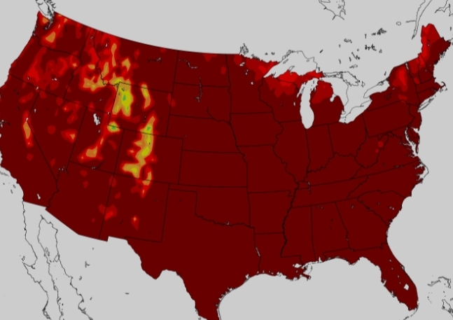
A good portion of the NYC metro area is pretty water logged with all the recent rain we have had. Something to consider going forward if we get more storms/heavy rainfall especially in the short and medium range.
-
A good portion of the NYC metro area is pretty water logged with all the recent rain we have had. Something to consider going forward if we get more storms/heavy rainfall especially in the short and medium range.
-
A good portion of the NYC metro area is pretty water logged with all the recent rain we have had. Something to consider going forward if we get more storms/heavy rainfall especially in the short and medium range.
-
1
-
-
Picked up 0.60" of rain so far today.
Storm total so far 3.09"
-
Picked up 0.60" of rain so far today.
Storm total so far 3.09"
-
1
-
-
Picked up 0.45" of rain so far today.
Storm total so far 2.94"
-
1
-
-
Picked up 0.45" of rain so far today.
Storm total so far 2.94"
-
Picked up 1.18" of rain for the day.
Storm total so far 2.49"
-
Picked up 1.18" of rain for the day.
Storm total so far 2.49"
-
1
-
-
Picked up 0.79" of rain so far today.
Storm total so far 2.10"
-
Picked up 0.79" of rain so far today.
Storm total so far 2.10"
-
1
-
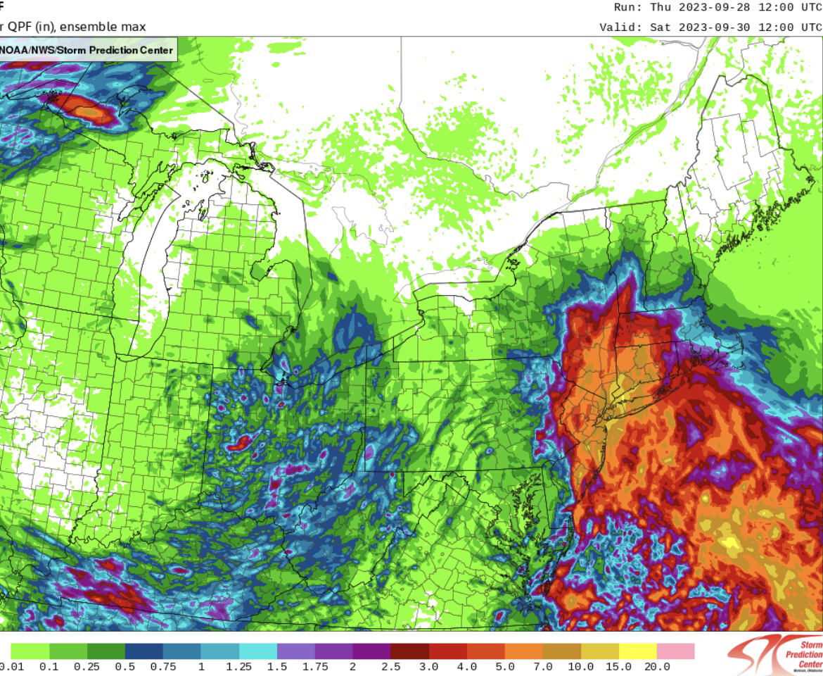


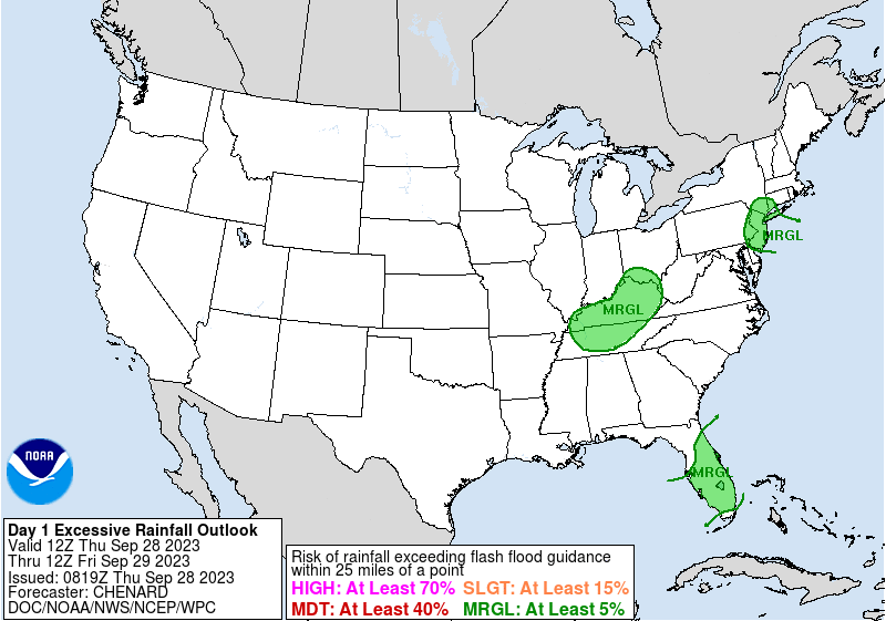
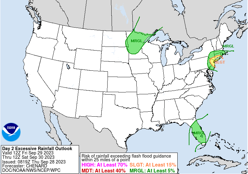

Another big Sept rain event between roughly midnight Friday morning and midnight Sunday morning (bulk 9/29-30/2023)
in New York City Metro
Posted
I have to give @wdragkudos for seeing this storm potential early on.