

Snowstorms
-
Posts
3,925 -
Joined
Content Type
Profiles
Blogs
Forums
American Weather
Media Demo
Store
Gallery
Posts posted by Snowstorms
-
-
13 minutes ago, Hoosier said:
Chicago, Milwaukee, Indianapolis, Detroit and Toronto all had 10"+... some of those places way more than 10". What other storm does that?
Probably the only spread the wealth storm we've had in the last 25 years. Read an article that regarded the Blizzard of 99 as being one of Chicago's worst blizzards ever.
-
What an epic storm. We need a repeat. Over 20" locally and the first in a series of storms that plastered Toronto over the following 2 weeks with over 40" of snow. They had to call the army. I was a little kid so I don't remember but I do recall being home for a week from school lol.
-
12 minutes ago, hawkeye_wx said:
Iowa City picked up a solid 4" of snow this afternoon. I did not see a flake in Cedar Rapids.
That's about 15 inches in Iowa City this week.
That's sweet. I'm guessing you're more than half way to your seasonal average already? Glad somebody in this sub was able to score big with this event.
Happy New Years!
")
-
 2
2
-
-
6 hours ago, michsnowfreak said:
Detroit finished December with 9.6" of snow, exactly normal. Season to date 13.1". I received 10.4" of snow, 13.8" on season. It was milder than average (32.9) but nowhere near the top 20, and it was also drier than average (1.36"). All in all a forgettable month though with a perfect White Christmas.
YYZ finished with ~13.6" but there's some missing data at the beginning of the month so I suspect it's close to 14.6". We finished above average as well. YYZ is ~23" on the season. Snow wise, it was a great month with that Dec 1 storm and Christmas storm. Otherwise, it was mild and pretty boring overall I agree. Let's hope January is better.
Happy New Years!
-
1
-
-
52 minutes ago, Hoosier said:
I cringe a little at SSW talk. Sure, it can help the pattern, but there is no guarantee it benefits our part of the globe.
I agree. If anything, it may help snow weenies out in the Mid-Atlantic with such an impressive west based -NAO. But for us, I don't foresee any 2014 or 2015 type of cold if the vortex remains parked up in AK.
However, it should help in increasing snowfall probabilities as we'll have more cold air to work with than now.
-
1
-
-
22 minutes ago, mississaugasnow said:
Ontario sees nearly 3000 new cases today. Hospitalization and ICU are at record levels beating the previous peak in the spring.
Just crazy. I wonder if it has to do with people gathering for Christmas pre lockdown. The positivity rate is 8% today too.
Not impressed with our current vaccination program. I understand it's about being fair and ensuring all Canadian's have the right and access to the vaccine. However, most of Canada's cases have been confined to 4 provinces (AB, BC, ON and QC). More than 80% of our entire country lives in these 4 provinces and half that in ON alone. They should be prioritizing 75% of the vaccine to these provinces where cases are surging not the Yukon for example. Target the vulnerable, elderly, nurses, doctors, etc. in these 4 provinces and have them all vaccinated by mid-January before you distribute a portion to other provinces. But what can you do? It's all bureaucratic bs. You can’t expect society to adhere to lockdown protocols if politicians themselves refuse to do the same. You can’t expect changes in cases if you’re not implementing proper lockdown procedures and vaccination rollouts. Everything since this pandemic began has been a complete mess and now were at record levels and trapped in our homes. 10 months in and people are going crazy mentally sitting at home. That one-month Toronto and Peel lockdown was completely unnecessary unless they locked the entire province down. And these lockdowns are half-ass too. Cases are surging because factories, warehouses and these big stores like Walmart continue to operate as normal not because of our average small one stop clothing store. Sorry for the rant but this is ridiculous now.
-
1
-
-
34 minutes ago, RCNYILWX said:
That pattern could produce snow events because of the assistance of the strong -NAO to modulate the +EPO some. It's certainly not a cold pattern. I'm not on the optimism train, just saying that's not a lock to be snowless like this month has been. The 850 mb positive anomalies are not obscene and the mean 850 mb 0C line is near or south of I-70. If we get a lower amplitude wave, could snow here with that.
Sent from my SM-G965U using Tapatalk
I agree. It's not the greatest pattern ever but it has the potential to produce under the right circumstances. Also to add to what you said, we've got a somewhat active STJ as well. If we can have the storms digging a bit more, we can certainly see some decent storms. It's like a hybrid Nino/Nina pattern mix. On the Pacific side we see the Nina trying to fight and take control of the pattern with a flat NP ridge just north of Hawaii, whereas we have a strong Aleutian low near Alaska, a common Nino feature. Do you think the forecasted trade wind burst coming this week will allow the Nina to have greater influence on our pattern? Specifically in helping to build an Aleutian ridge to cool down Canada. There's other reasons to be optimistic about, one specifically being a potential SSW by mid January.
-
As I suspected a few days ago re my post. Too many moving parts for complete model consensus without proper sampling which won't be until Monday-Tuesday.
The H5 look would support further southward adjustments but it all depends on timing.
-
4
-
-
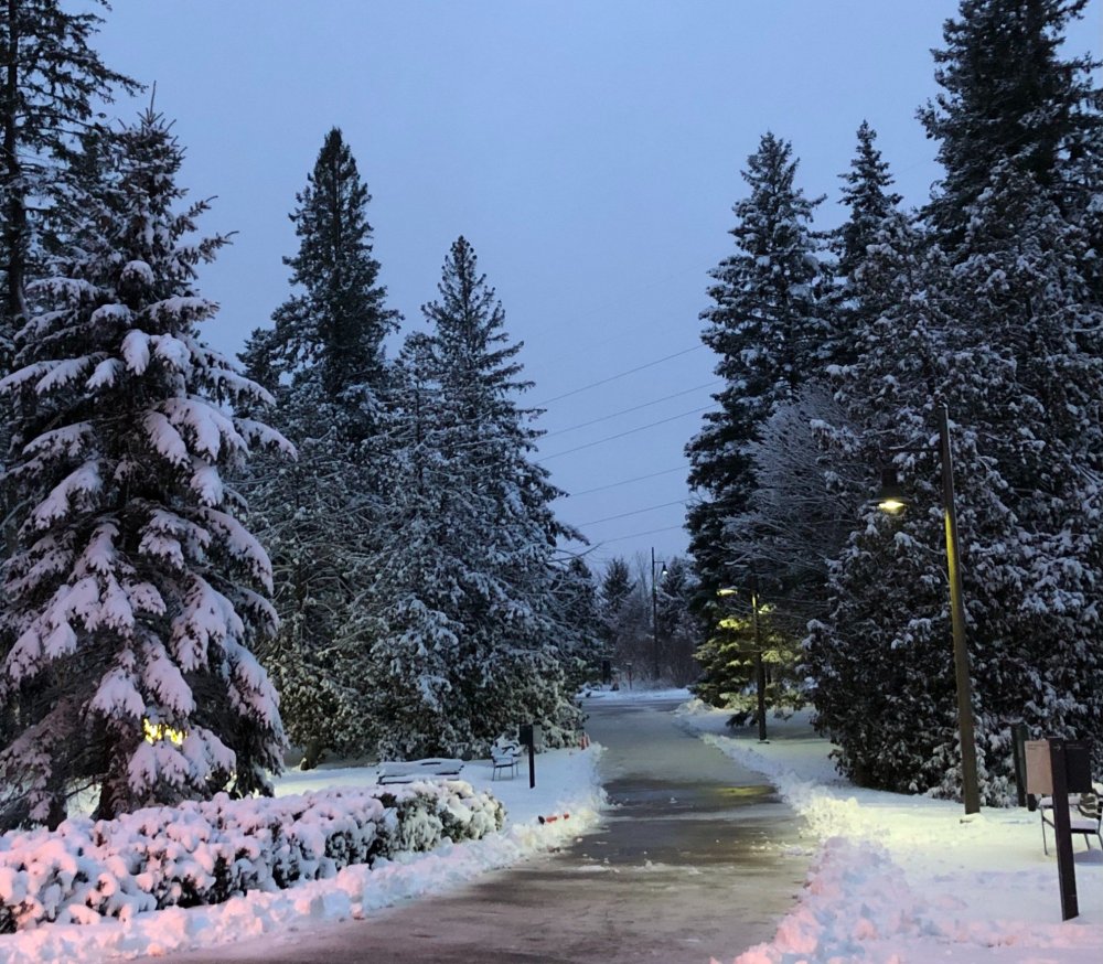
Went for a walk today and took some pictures. About 5" in my area. Decent storm and definitely gave it that perfect Christmas vibe.
-
8
-
-
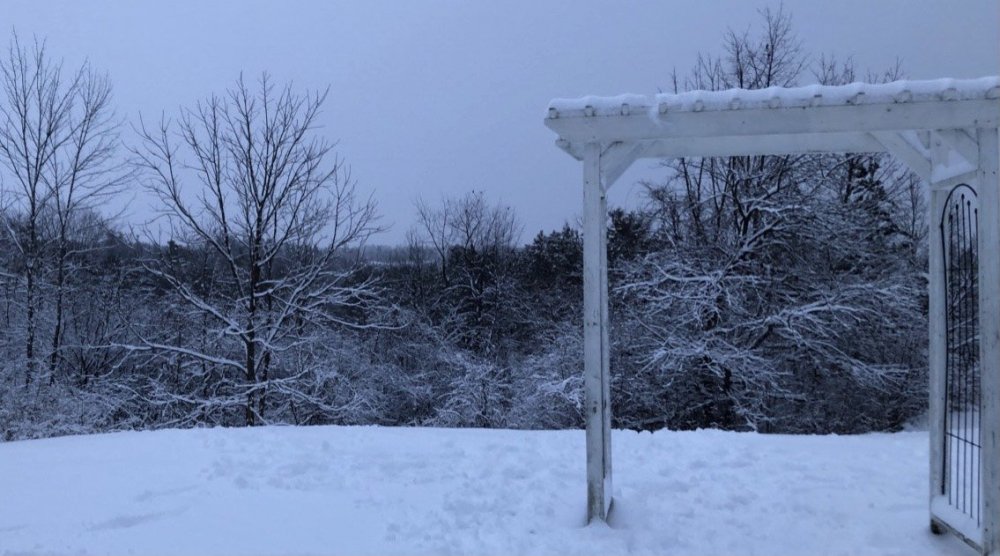
Measured 4.1" (10.5cm) this morning. Storm underperformed probably due to poor snow growth. Nonetheless, it's a winter wonderland.
Merry Christmas everyone!

-
3
-
-
Over an inch already and expected to snow through-out the night. Heaviest snow should start creeping its way towards the GTA after 9pm.
Gonna be a White Christmas.
-
2
-
-
Just now, michsnowfreak said:
in Feb 2011 we had two 10" storms and a 5" storm. in 2010 we had a 9" storm and I think a 5" storm. no doubt Feb has had the got hand!
How much did you get during the GHD Blizzard? We got shafted lol. 2009-10 is the 2nd least snowiest winter at YYZ with a measly 21". Everything was too suppressed that winter thanks to the impressive block. 2 years later 2011-12 happened, our least snowiest winter ever. Not long before that, 2006-07, our 4th least snowiest winter ever LOL.
-
On 12/22/2020 at 9:27 AM, michsnowfreak said:
The decade was filled with blockbuster Febs.
Detroit is slightly above avg this season to date at 9.2". But literally each of the 3 main snowfalls (Nov 22, Nov 30/Dec 1, Dec 16/17), esp the first two, jackpotted the far southeast corner of the state. An observer in Monroe (between Detroit and Toledo) is at 11.1". This is misleading for anyone outside the immediate metro as Flint and Saginaw have had very low snowfall (2-3" total). Im at 9.3" and have only had 7 days with 1"+ snow on the ground. Should this theme keep up the winter is definitely a dumpster fire from a sustainable perspective but as I always said, temps mean little wrt actual snowfall. It will be funny if Chicago pulls an above avg season by April lol.

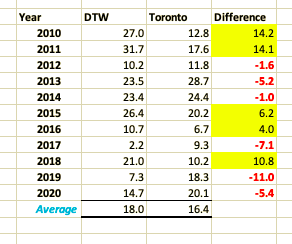
I agree. Meant to get back to this post yesterday, sorry. We have the same disparity in Toronto. I believe the seasonal total is close to 8-9" near the lake for the season compared to 17-20" just away from the lake. This winter has been terrible for snow-cover no doubt. Although we're at 18" for the season it doesn't feel like it one bit. 31" in Feb 2011? Holy shit. I compared Toronto and Detroit below. It's a mix bag but 2010 and 2011 are the main reason why Detroit's Feb average is higher than Toronto rn. Crazy run for both cities, regardless.
-
1
-
-
Christmas miracle storm today for Toronto and surrounding areas including Hamilton, Niagara county and Kitchener. Potential for 4-8" (10-20cm) by tomorrow morning. There will be an intense but brief (1-3 hour) burst of heavy snow later this evening as the deformation band moves through the area. Temps are crashing everywhere.
Let it snow!
-
1
-
-
1 minute ago, StormfanaticInd said:
Its not happening. This pattern just does not want to produce in the OV the past couple of years
The 500mb pattern advertised on the models next week is the best H5 look we've had in years. Massive ridging near Greenland and a 50/50 Low off Newfoundland. The Pacific is a convoluted mess right now but the ridging near BC is literally perfect for a nice storm for the Lower Lakes/OV. It's just about timing. I feel the storm will correct south over the coming days. There's just a lot of moving parts for model consensus. This storm won't be sampled until Tuesday, almost a week out.
-
6
-
-
I wouldn't throw in the towel yet. This storm is still a week out and I suspect a lot of variability until then. The current storm is definitely having an impact on model consensus. The key thing to watch is the late weekend storm and how fast it can move out and deepen. Right now models are keeping it relatively weak which enhances the ridge developing off the east coast out ahead of the Low. However, there's a massive ridge near Greenland (-NAO) and ideal ridging across the PNW which should help to counter the developing ridge and suppress the storm. The strong HP sitting in Wisconsin had zero impact on the storm and that's why I have a hard time buying the Euro. The GGEM is more realistic imo.
I think this could be a good storm for Chicago.
-
3
-
 1
1
-
 1
1
-
-
Models are converging on 10-20cm (4-8") from Niagara to Hamilton to Toronto tom night into Christmas morning. There will be a brief but very intense burst of heavy snow, where most of the snow should fall, due to a strong mid-level FGEN band setting up as the secondary low takes over.
Looking good for parts of Ohio as well. Most of eastern Ohio is locked in for a good 4-8"+. There could be some freezing rain and ice pellets initially as the gradient cuts through before transitioning over to heavy snow.
-
2
-
-
3 minutes ago, A-L-E-K said:

occluding as flurries into NW LA as the UP goes rainer, lol
It's colder in Houston than Chicago at Hour 192. Cool.
-
2 minutes ago, A-L-E-K said:
lol euro
That 1040 HP sitting in Wisconsin gets kicked out and does absolutely nothing in suppressing the storm.
-
24 minutes ago, Malacka11 said:
The ICON is living proof that Germans do everything better.
I use SAP at work, a German software. I can attest to this. It's good.

-
1 hour ago, StormfanaticInd said:
 Storm signal still there for the end of the year

Those images belong here.
-
1
-
 5
5
-
-
4 minutes ago, Angrysummons said:
Called a -ao buddy.
Need better cooperation on the Pacific side. We'll see if the HP descending into Mongolia and parts of Siberia next week will have any inverse effects further east across the North Pacific. The AO has been negative all month, but the Pacific is putrid. We haven't seen any legit cold shot yet.
-
1 minute ago, blizzardof96 said:
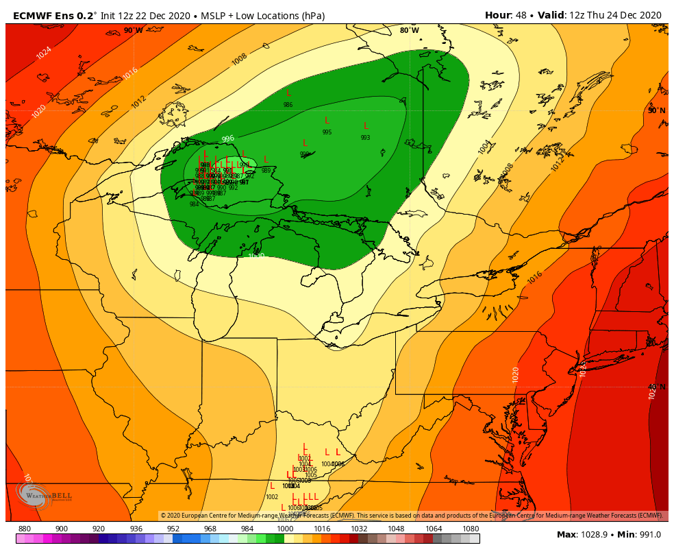
12z EPS MSLP tracks

Mean spread is still all over the place but at least they’re east of NAM or RGEM expect for one lol. All in all, good for the GTA. Let's see if that trend continues tonight.
-
1 hour ago, mississaugasnow said:
ya, so far its been the story of the winter haha. I'm 1/3 on these tracks this year, watching Brampton/Markham get 10-20cm while I get 2-5cm. Either way I think Christmas morning will be white, just depends if its a legit winter storm or just a nice coating.
Hope everything is going well with you and you're able to make the most out of this weird holiday season. A bigger storm with actual winter storm watches might be a blessing. With a lockdown of Southern Ontario looming on Boxing Day, a storm might persuade more people to forgo the drives across the region and stay home.
Yeah I agree. For people along the Lake, like yourself, it's been a terrible start to winter. YYZ is ~43cm for the season and only 75cm away from our seasonal average.
Everything is going well my friend, hbu? Been wfh since March. Just bored and tired of being trapped inside with nothing to do and nowhere to go. Now with the lockdown looming combined with winter, it's only going to make people like myself more depressed lol. I agree. I hope the storm will be bigger than expected right now so it forces people to stay home for Christmas. At the same time, I can tell you a lot of people are tired of staying home so they might just go anyways. Lockdown doesn't start till Christmas night.


Dec 29-Jan 2 potential storm event
in Lakes/Ohio Valley
Posted
My 2 day snow total is 3.8" with 2.5" coming last night. Not bad. We've had snow on the ground since Christmas eve. Our longest stretch so far lol.