JJBASHB
-
Posts
849 -
Joined
-
Last visited
Content Type
Profiles
Blogs
Forums
American Weather
Media Demo
Store
Gallery
Everything posted by JJBASHB
-
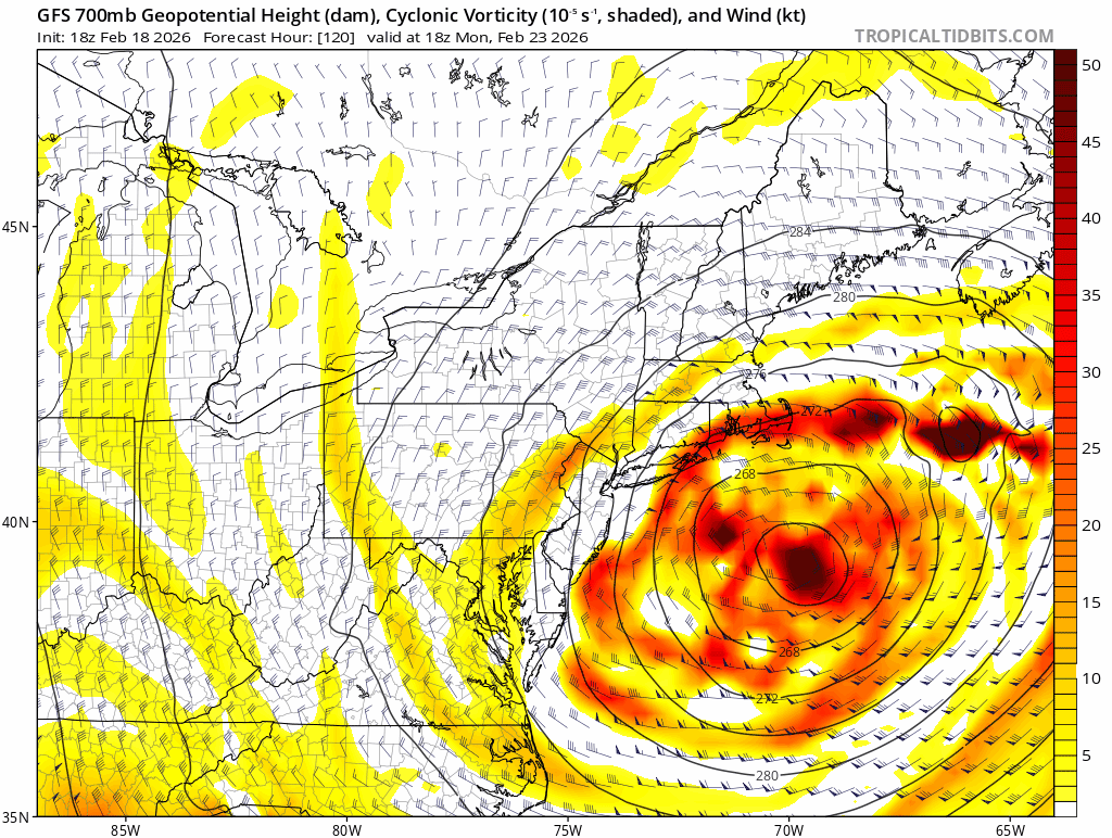
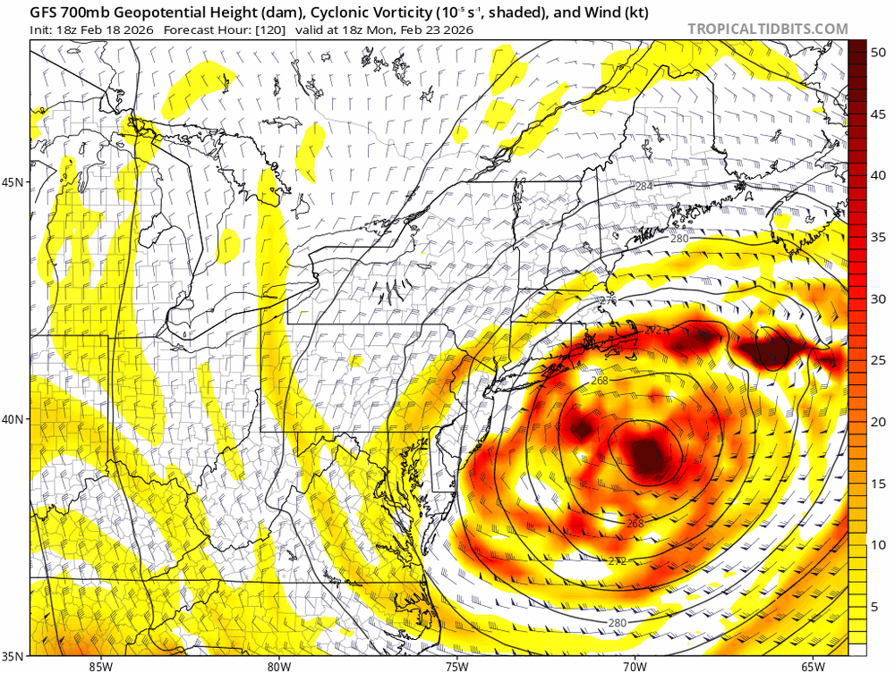
Wonder if that energy diving in ends up LBNE as it keeps it progressive before that dives in and completes the capture?
-
S/W is definitely diving in faster on the backside. Trough looks a little broader at 500 and heights a little dented over us compared to 18z . Biggest change seems to be the speed of the energy coming in the backside of the trough.
-
Alright, this run the ridge axis out by the Rockies looks a little west and more amped through 36. S/W diving in on the backside a bit faster. Heights ahead about the same but axis is a little east.
-
Ridge axis by the Rockies a shade west or slightly more stout Edit. Looks about the same by 51 hrs. Definitely higher heights on the east coast
-
They’re great. A little vanilla outside of the details on the sleet/ freezing rain lines forecast wise imo but a great winter experience. The big dawgs are way more dramatic on the lead up. But SWFE are a great winter experience. Generally come in like a wall. Has staying power. Bonus icey glaze occasionally which makes sunrise even more dramatic after the event.
-
Finally saturated. The first few flakes to make it down were beefy. Went to SN quick but still melting on the warm surfaces.
-
Yikes, still no snow despite the radar over MHT
-
No snow yet in MHT at my location. Airport was 37/23 at 1353. Dry air is eating this up a bit?
-
Boxing Day had the deformation band well west of QPF depiction IIRC and it led to some prolific snow amounts due to ratios. I know this sort of gets thrown out as a bone when people worry about QPF output. But it seems like deform bands are a little harder to predict? CCBs tend to show too broad of a gradient then sharpen as we get closer but placement is fairly consistent relative to the surface track. Is this amateur analysis too far off? What would one look for to predict placement and potential amounts well west of the QPF depiction?
-
Oh, it was sarcasm. Couched in some anticipation that it might be banded in nature if this is LBSW and expanding as it gets here. Honestly I’d be happy but also disappointed for my own experience and ready for warmth, easy commutes, and running around with the kids. I think that’s part of the reality and fun on the hobbyist side.
-
If this comes far enough west and I get 6 inches of subbyhole sand this winter will be an instant F.
-
It’s weird, the actual track sort of dances around. West, northwest, southwest, then northeast of the previous run but looks overall less squashed on the northwest side. Allowing better dynamics to back in, intact? Track is definitely better early on but isn’t a huge difference by the time it’s impacting us. But maybe, if it isn't getting elongated in an unfavorable direction could actually have the fabled west death band as it expands. Another way it could work out if the track stays a little too far away.
-
-
Feb 10-11 Mid Week Minor Event - Ride the hot hand?
JJBASHB replied to HoarfrostHubb's topic in New England
Definitely fought some drier air at the onset. Was light under heavier echos. Once it got going ground truth matched radar most of the commute home from Portsmouth. -
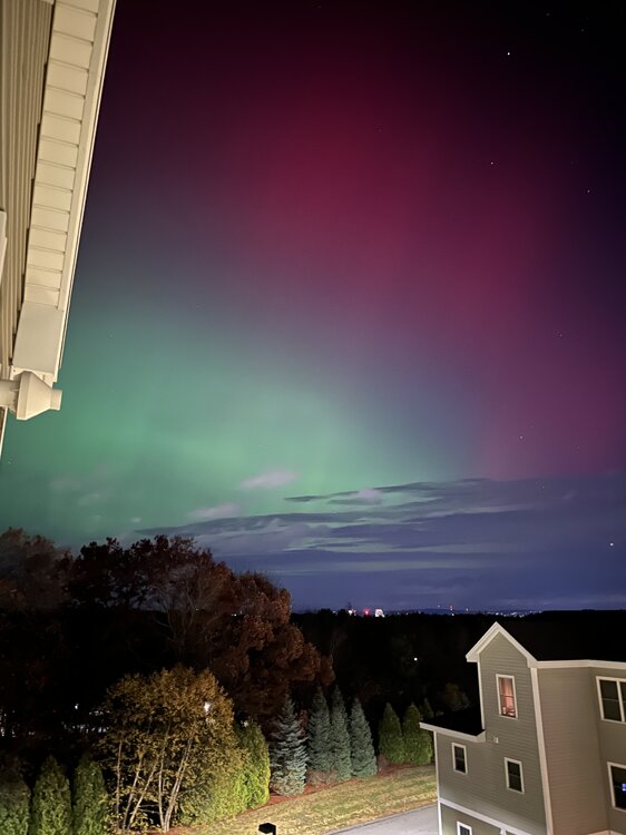
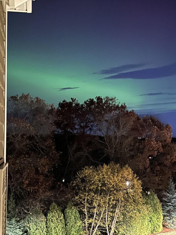
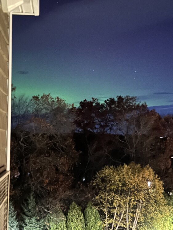
Yeah, the exposure shots make it look more vibrant, otherwise it’s only a moderate glow here. Starting to get some red.
-
-
-
-
-
Hopefully it isn’t too cloudy!
-
TDS?
-
Clearing sort of peeling north through most of SNH.
-
Hopefully this clears out a bit in the next hour or so.
-
Dublin, NH breaking the tornado drought today?
-
Hopefully these clouds clear out a little earlier than expected.