

Quixotic1
-
Posts
21,971 -
Joined
Content Type
Profiles
Blogs
Forums
American Weather
Media Demo
Store
Gallery
Everything posted by Quixotic1
-
 Heck, according to the 00z gfs nobody is getting ice. Even OK.
 -
If it's going to rain, 64 please.
-
I don't agree with JB on much, but man I can't wait for the AMO to change to a primarily negative state.
-
That's the hope in all of this. First, the SE, which has been roasting under that ridge all winter, threaded the needle and got a snowstorm this past weekend. What does this mean for us? Well I believe, that as the winter goes on the ridge will weaken or bulge northward. If we get cold, it could mean any arctic air would stick around a-la the December '13 ice storm as it's held up by a not-so-big ridge. Even more mouthwatering is the thought of us being on the western side of a stalled arctic front as shortwaves move over. It could be an epic event (The models were showing almost exactly that scenario as we drooled over the weekend). The cold has been here this year. It hasn't come often but when it has, it's been every bit as cold as anything we saw in 13-14 or 10-11. If we get a really cold air mass that stalls, we could cash in. More likely sleet and ice than snow though. I've been looking for references for February and March of 89 which also had this scenario and was another Nina year, if I remember correctly.
-
it was fairly common back in the 80s and 90s. One memorable one was in 96-97 where it was in the teens in Wichita Falls and balmy 50s in DFW. I think it's the SE ridge. If it's strong enough and elongated enough, it will hold off arctic intrusions. That said, this one, according to the AFD this is related to a large upper level low that's going to traverse southern Canada and pull most of the arctic air east with it.
-
We need the rain but I love winter weather so, either way.
-
We really haven't had to deal with the warm nose in a while. Looking at currently progged temps would put the metroplex right on the surface 32 line during the event. I would venture to say that it will get colder we get closer. ETA:. Oh well. Never mind until the next run.
-
One thing in our favor is the cold has been overperforming.
-
Denton is at 8 degrees. DFW is at 17. I don't think DFW will ever see single digits again.
-
My freaking station died two days ago. Argggh....
-
I saw the para had a rain to snow event. Maybe we can thread the needle like the southeast did.
-
Think it's initializing with too much snow cover?
-
I think we are going to get another crack or three at it this winter.
-
Oh yes. I was in downtown dallas and nothing stuck. Heard we had a dusting at the house.
-
When was that event? December 26th of 2015?
-
Hey I try! My wife complains when I'm wrong and I always say "do you see 4 feet of snow out there? That means I don't control it." Haha.
-
A dusting is the most I've seen since March 2015. Already better than last year.
-
Game isn't over yet!
-
I'm getting dry slotted! Haha
-
Saw some flakes at Lebanon and DNT in Frisco about 20 minutes ago.
-
The bigger positive busts have been due to troughs/short waves slowing down. Don't forget the cold. Higher ratios could help push us over 1". Haha
-
Your thinking is right but looks like it's going to be even further east.
-
So, Bubba and I might get dusted. I'll take it.
-
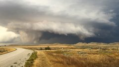 Quincy, these are great images. You have an eye for them.
 -
So, on a not so happy note, DFW has had one month of BN temps since May of 2015. That was May 2016. What a grueling stretch.