

oconeexman
-
Posts
2,043 -
Joined
-
Last visited
Content Type
Profiles
Blogs
Forums
American Weather
Media Demo
Store
Gallery
Posts posted by oconeexman
-
-
-
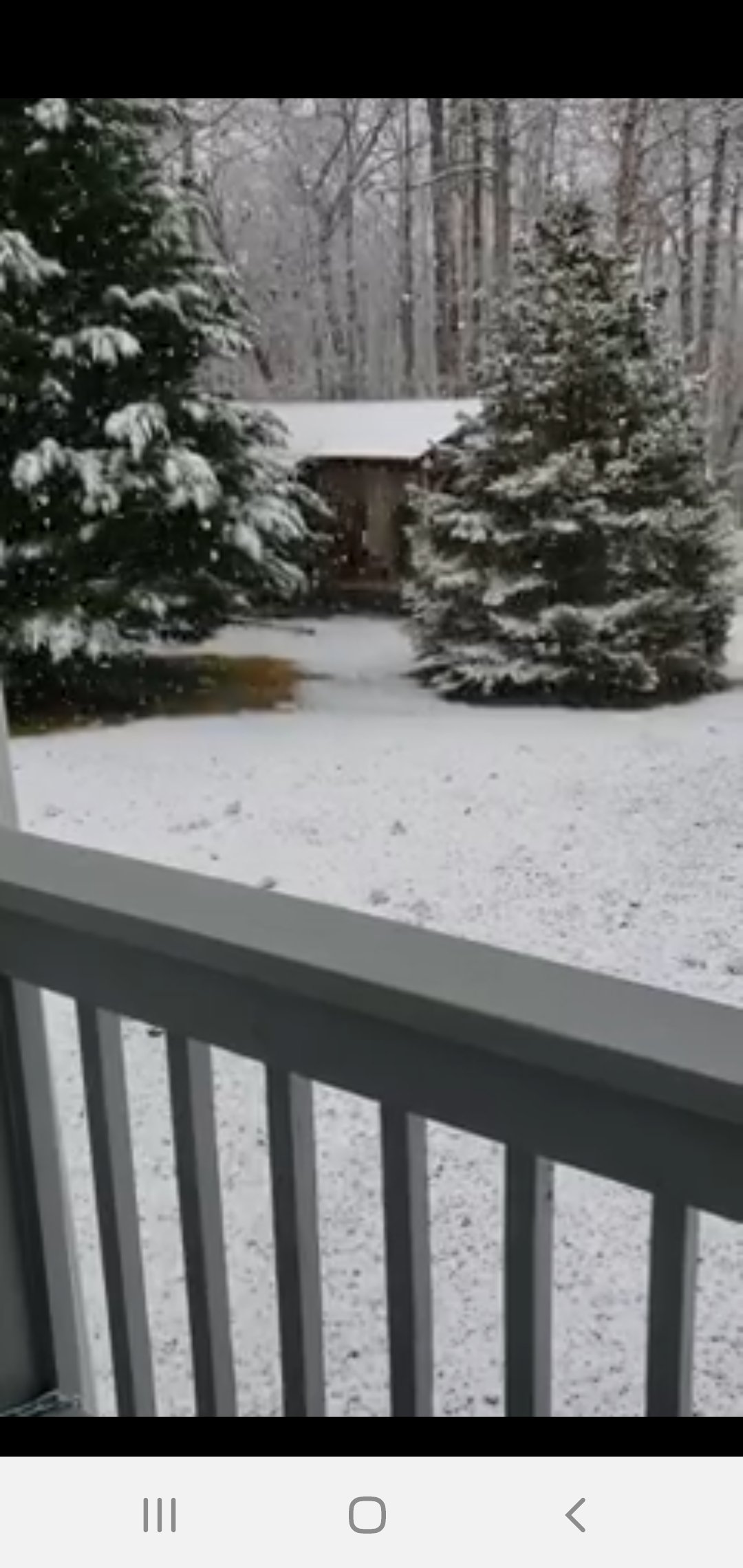
No shutout this winter..had a trace and 15 miles up the road in mountain rest had a couple inches
-
 1
1
-
-
4 hours ago, mackerel_sky said:
Euro was that good??
Yea..not so much
Gives a little upslope action that's it
-
6 hours ago, burrel2 said:
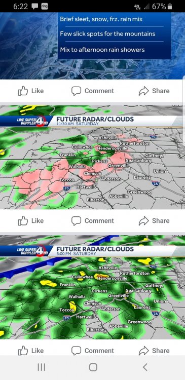
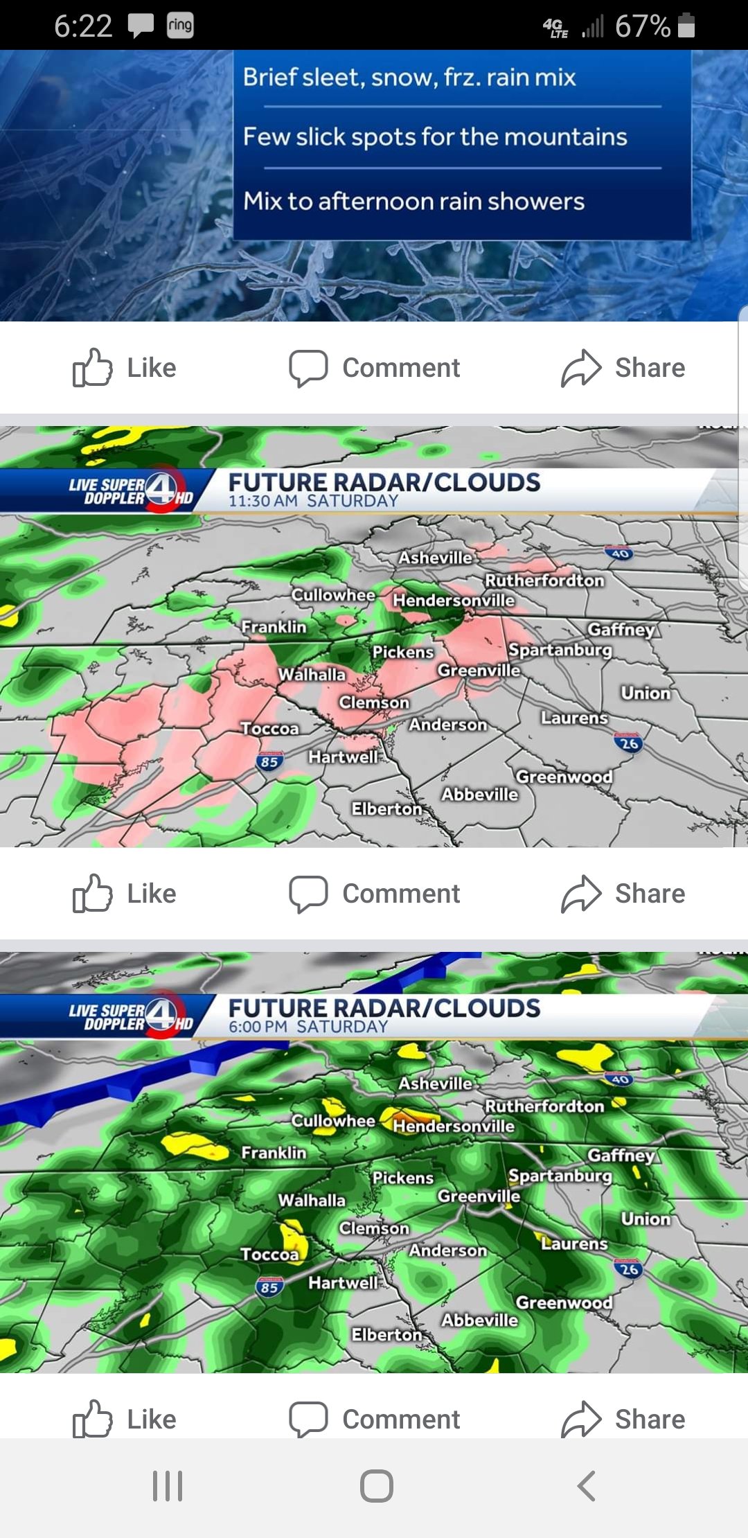
looks like a chance we could get some ice Friday morning. dew points are fairly low as precip breaks out. Warm nose is only 2/3C and caps out around 850mb. Something to watch.
Has me interested! Hfs is awfully close to a mix bag here
-
Bouncing between 35 and 36 here..we ain't hitting 40
-
Edit now 37
-
38 and misting rain..losing
-
2 hours ago, mackerel_sky said:
Our local weather guy just showed future radar, it’s looking highly likely that my area will see some sleet and flurries at onset!

He also had a 20% chance of snow on Tuesday, saying he’s watching a disturbance!

All we have to hang our hats on this winter
-
1
-
 1
1
-
 1
1
-
-
2 hours ago, Iceagewhereartthou said:
Welp, we all thought it couldn't get worse than 2011-2012 and last year, but so far it has been. Here is a GSP, CAE, and AVL summary so far:
GSP: Including fall and winter, GSP has seen just 17 mornings where the temp has fallen to freezing or below. The overall low has been just 22 and that was back on Nov 13. There has not been a trace of frozen precip reported. Through Jan 16, the monthly temp average has been +9 degrees with just 5 nights of 32 or below and a low of just 28. GSP has seen just one day this month that averaged below normal (-1 on Jan 5). The past 7 days the temp departure has been plus 10, 17, 18, 16, 18, 20, and 14, with 5 days in a row not falling below 50 degrees.
CAE: Including fall and winter, CAE has seen just 13 mornings fall to 32 or below. The overall low was just 28 back on Nov 13. There has not been a trace of snow reported. Through Jan 16, the monthly temp has averaged + 12.6 with just 2 nights falling to 32 or below and a low of just 29. CAE has not had a single day this month below average. The past 7 days have seen temps average plus 14, 22, 23, 24, 25, 23, and 19 (with a plus 20 and 12 earlier in the month for good measure) with 4 nights in a row not falling below 60. 6 days this month have reached 70+, with 4 reaching 75+.
AVL: Including fall and winter AVL has seen just 34 nights with the temp reaching 32 or lower. The overall low has been 18 set back on Nov 13. Only a trace of snow has been recorded. Through Jan 16, the monthly temp has averaged +11.3, with just 5 nights falling to 32 or below and a low of just 26. AVL has not had a single day below average this month, and the past 7 days have seen temps average plus 16, 23, 21, 17, 20, 22, and 12, with 6 days in a row not falling below 45.
Man that's some good info...BRUTAL and painful but good info!
Hasnt gotten above 45 here today..some cherry trees are blooming and actually had so.e pollen on the boat yesterday when I got off the lake. 2 things I've never seen in January
-
1 minute ago, Queencitywx said:
The canadian is very cold late in it's run which matches up well with the GEFS and EPS. There's always a chance it could be too cold but I'd rather chance that than anything else.
Yup...so much potential coming up. Starting about a week earlier than I anticipated which is a bonus. Think we could be in for great stretch late Jan through most of Feb
-
Dont take the gfs ops as the truth. It does although show the players in place..cold air close by and low around the coast. The ensembles should be pretty tasty this run. This far out take this all day long...
-
Tornado watch in early Jan..wtf?
-
14 minutes ago, Bob Chill said:
Hey SE folks, first post for me in your forum this year. I've been wanting to stop by and let you know that I like what I'm seeing for your area but honestly I haven't liked anything I've seen since Dec 1st... until now...
I know you guys have covered the reshuffle in the Pac etc. There are a lot of clues saying the -EPO is going to build and stay. Weeklies and CFS agree that it will prob continue through all of Feb but that's way out there in time. At the very least a -EPO period seems to be locking in next week. We'll see how long it lasts.
Not sure how a -EPO/+NAO works down in the SE but a blend of Jan 1994, JF2014, and Feb 2015 is a decent mix of recent similar periods to what I'm seeing now. CAD Ice/mixed events are the most likely but any well timed wave on a boundary can break the right way.
GFS and EPS ops suddenly starting considering their options about flipping the AO and/or NAO negative by d10. Ens don't agree with that yet but it was either a total coincidence or a clue that maybe hope is not lost on getting some blocking going at some point before speedos and SPF30
As always, I'm rootin for you guys. Maybe we get to share in a rare SE/MA coastal that glides slowly out to sea off the coast of NJ. lol
Thanks for stopping by Bob..enjoy your posts mucho!
-
2
-
-
Eps looks similar to gfs ensembles on a pattern flip after day 10. That is very encouraging!
-
1
-
-
27 minutes ago, Orangeburgwx said:
Can we get a wing and a prayer?

Sent from my LML212VL using Tapatalk


That would definitely help us in the southeast. Although not a guarantee but it typically our best storms happen with mjo in 7 or 8!
-
1
-
-
8 minutes ago, SnowNiner said:
Now you go in the corner, and you think about what you just said Mr.

Long range I'm waiting for the ensembles to tell the tale. Two GFS runs in a row is noteworthy I guess, but I'd like the ensemble means to show an average out likelyhood of a better pattern down the road.
Lol yea it excites me a little but not buying in quite yet. There are lots of signals pointing this in the right direction. Nice ridge building in Pacific northwest. Some blocking in the NE and the southern stream remains a fire hose..ingredients are there IF its right.
-
1
-
-
Now let's all hope the gfs is right! Looks like a great pattern for sure. Would like to see the euro get on board with the ensembles
-
1 hour ago, mackerel_sky said:
GFS lost the mega cold and gulf coast snow!

Shocker..nice cool front just came through..dropped from 57 to 52...winning
-
1
-
2
-
-
38 minutes ago, strongwxnc said:
Well I saw four flurries! Lol
Thank god for flood lights
Over performed here.
.Beautiful...could be the best this winter sad to say..happy for ya brother
-
1 hour ago, strongwxnc said:
It’s hotter than $hit out

.Yea watching football with the AC on..crazy. One decent cold shot coming then back to above average temps again.
-
Kind if scary to see no real changes in the next 2 weeks. Putting us mid january to see a real pattern change on models. Then it's always delayed a week or so. That puts us end of january. By then days are long..sun angle..blag blah
Winter 2021 I guess?
-
 1
1
-
-
9 minutes ago, strongwxnc said:
Was 36 now up to 39.4 with winds from the SE.

I figured you'd get some zr out of this one.
-
Light rain 42
-
Perfect Low track for a big one. Just need a blast of cold air to lock in
.jpg.6fada4bb0b3a4943765aa72575584b12.jpg)
February Observations.
in Southeastern States
Posted
About to hit the 4" mark since midnight here...ridiculous!