

oconeexman
-
Posts
2,043 -
Joined
-
Last visited
Content Type
Profiles
Blogs
Forums
American Weather
Media Demo
Store
Gallery
Posts posted by oconeexman
-
-
High is southwest a couple 100 miles of prev run...not sure what that's gonna do for us
-
Being that this is basically an over running event, no Miller a or Miller b or ULL, which model historically handles this the best. I would think the higher resolution 3km Nam and Rgem would really be the 2 to watch after today?
I know the Nam did really well with the last wave and marginal temps but I dont think we get that much precip here in the upstate and ne ga this time...hopefully wrong.
-
4 minutes ago, mackerel_sky said:
Isn’t the CMC usually the coldest model? I think it is during CAD events?
Yes but this isn't a CAD event..at least not a classical Cad with a High in position northeast. This is a sprawling midwest high. It's got the gusto to cool us all enough just a matter if moisture gets here too early. Nam and cmc hold a back and dig it a little more from what I see which is gonna allow this cold to seep in just in time...really threading a needle
-
CMC and Nam look pretty dam close at 84hrs. (500mb map) Right now I'd take those 2 and hopefully get the King on board!
I'll let the pros explain it
-
 1
1
-
-
The Canadian is much cooler than the gfs and would be a nice hit for parts of upstate and a big hit for coastal NC!
-
Well they followed th euro it looks like. Let's hope the euro comes back by tomorrow or monday and they all come back.
-
25 minutes ago, burrel2 said:
Got toe mighty! Gfs cmc and ukmet are all major hits for northern Ga/upstate sc. ukmet looks the best of them all at 144hrs!
I like the way u talk!
Hopefully euro comes back by sunday!
-
4 minutes ago, Billypg70 said:
Yes he is already explaining the setup and showing the Euro & GFS ensemble possible solutions.
He said something that I'm sure most would agree board wide this is the best threat we've had this season.
I doubt he'll be the KOD.
He has some weenie in him and as a snow lover I Love it.
I know he loves as much as we do..he's my fav on tv..was just beating Mack to the punch
-
 1
1
-
-
29 minutes ago, BornAgain13 said:
18z GFS continues to hold the idea of holding the energy back. Oh well...
At this range the gfs is not very reliable. As long as the doc holds on it's a threat
-
 2
2
-
-
Kiss of death...CJ just made a fb post about the threat already
-
1
-
 1
1
-
 4
4
-
-
17 minutes ago, Lookout said:
Yep, only a very shallow warm layer near the surface which would easily be overcome taking it at face value.
It actually is a few degrees colder at 925mb to the surface than Saturday's system. Euro showing 0.50 to 0.75 liquid so those snow total maps are a bit underdone...probably closer to 4 to 6.
Yea I feel like too many get caught up in the clown maps. If you look at precip totals and temps aloft the clown isn't telling you the truth a lot of times. Fun one to watch especially with possible coastal low development which could really enhance the Lee side precip totals if it times out right.
-
1
-
-
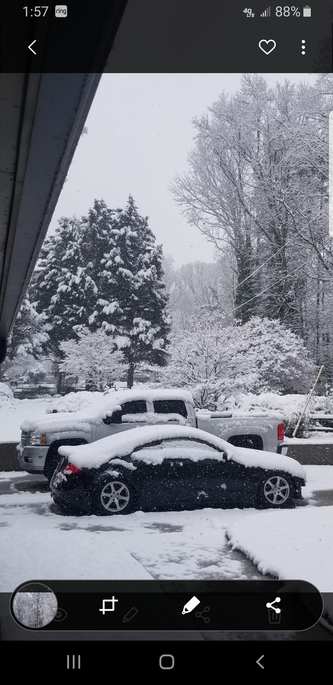
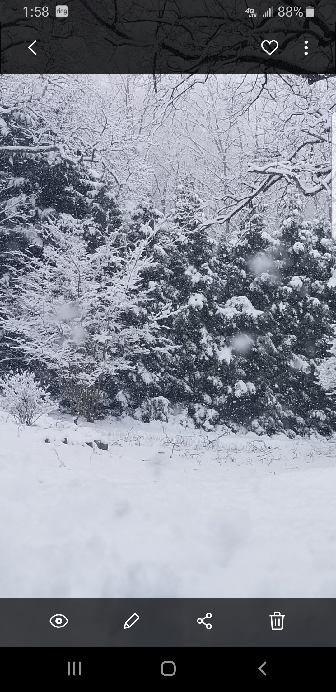
2.56 for this event so far...

-
7 minutes ago, griteater said:
A couple soundings for the archive from Seneca and Gainesville


Thanks brother..good info. We were for once in a sweet spot..like once a century...lol
-
1
-
-
50 minutes ago, mackerel_sky said:
They even admitted today, when they finally issued the wwa, they leaned heavily on the NAM! Yesterday, they didn’t seem to want to give it ANY credit?
They prob did ok for downtown gville...I tend to lean on peachtree for our neck of the woods anyway..were outcast
-
Speaking with folks from around the county
Southern end measured a dusting to 1"
Middle was 3-5"
Northern was up to 6"
Pretty dam skippy for an advisory up to a special weather statement.
-
1
-
-
Was an absolute victory for NW sc! Prob want see another flake this winter but considering how it's been this made it a good one as sad as that is. Now if Lookout could score a good one then all of us that's missed over and over will be good!
-
2
-
-
-
-
Just measured in 3 places around deck and porch..solid 4" here and still steady!!!
-
4
-
-
It's back to dumping quarters again..headed toward 4"
Best snowfall in years from a weak wave...lol
It's all about timing
-
2
-
-
3km Nam was money for here on this one!
-
And they keep harping on an award for most accurate...lol
I'm over 3" now btw
-
2
-
-
1 minute ago, NorthernUpstateSC said:
Not sure what there doing at GSP another weekend asleep at the wheel I guess. Was so funny watching Kendra Kent and other mets on fox about 30 minutes ago making up all kinds of excuses and still doubting this was happening.
Fox is straight garbage..they said no accumulation just a mix
-
Gsp said locally up to 2" in some areas.
Well locally we will be over 3"..best kind of fail possible...2 for 2 this winter.
I figure above walhalla has 4+
-
1
-

One More Shot: Feb 20-21 Event
in Southeastern States
Posted
It's really close here and in Puckens and Ne Ga. Depending on who's soundings you pull up. Some say rain, some snow and some mixed precip.