BullCityWx
-
Posts
8,924 -
Joined
-
Last visited
Content Type
Profiles
Blogs
Forums
American Weather
Media Demo
Store
Gallery
Everything posted by BullCityWx
-
Betting the clown maps show something close to a Burlington jackpot.
-
Ensembles, y’all. Ensembles.
-
Snow to sleet to snow.
-
The ICON actually has a good bit of snow for this area on Sunday
-
Still exempt?
-
Still too warm but building a southern trend. Snow line is down to the N.C./VA line
-
Not what the scores bear out


-
KGSP is still at a 9” mean on the 18z GEFS. KGSO is at 11”. KCLT is at 8”. All dramatic increases since this morning.
-
Yes. Unless they start changing then no reason to panic yet.
-
...you’re putting stock in the model that’s now way inland after it barely got precip into N.C. last run.
-
EPS Mean for Chapel Hill went from 2.75 to almost 5". Burlington went from just over 3" to half a foot. Lincolnton went from 3.5 to 7. You get the picture.
-
12z GEFS for IGX Mean: 6" 7/20 members have T-2" 3/20 members have 3-5" 4/20 members have 6-8" 6/20 members have 10"+
-
There's actually more QPF this run across most of NC.
-
Yeah, doesnt look much like the OP AT ALL.
-
GEFS numbers pretty much skyrocketed, which naturally means EPS numbers will be way down.
-
They almost never come back once they go warm.
-
Nothing more than a nuisance event outside of the immediate foothills this run, just taken at face value.
-
Probably along or about 20 miles south of the NC/SC border
-
UKMET looks cold enough at 850, safely so.
-
Snows in Charlotte from hour 126 until hour 180.
-
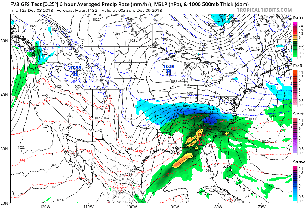
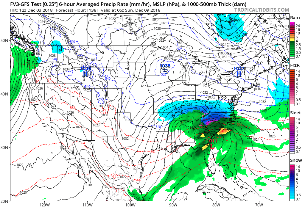
FV3 looks like a pure Miller A snowstorm with a narrow, if not barely even there, transition area.
-
Been doing this since the winter of 2000. I can assure absolutely everybody that this is exactly what we want to see right now.
-
ICON seems to be out on its own island.