-
Posts
18,237 -
Joined
-
Last visited
Content Type
Profiles
Blogs
Forums
American Weather
Media Demo
Store
Gallery
Posts posted by cyclone77
-
-
27 minutes ago, Mogget said:
Anecdotal reports of tornados going thru Monroe and Albany, WI. All I personally saw was some cloud rotation and an ill-formed funnel.
Pretty sweet comma head action up that way.
Up to 1.10" here. Some big positive stroke crashes of thunder behind the main line shaking the house.
-
 1
1
-
-
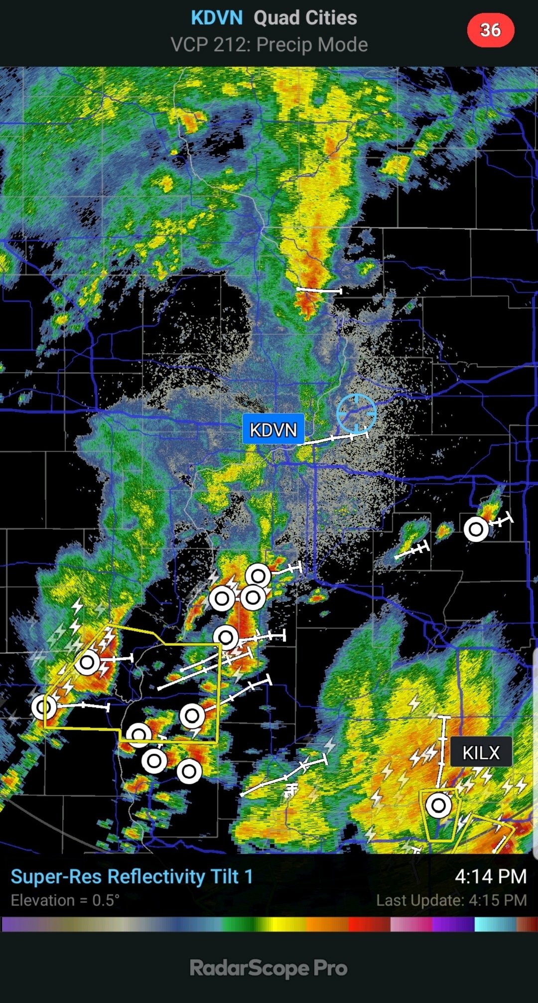
Flash flood emergency declared for Davenport/Bettendorf. Sounds pretty bad there. They got smoked there last night too.
Picked up a quick 0.55" in a 5 min torrential downpour here.
-
 2
2
-
-
Nice blast of 55mph winds from the outflow. Storm already undercut here, so nader threat already nil.
-
 1
1
-
-
Can hear sirens in the distance. Getting the popcorn ready.

-
Dews above 75 this afternoon. Feels pretty swampy out there.
-
 1
1
-
-
The late night Iowa action crapped out. Final total 0.27".
One more shot at it later today, hope better luck this time.
-
 1
1
-
-
0.00" from the evening round.
Hopefully the late night activity holds together.
EDIT: Picked up 0.12" 1-3" fell 10 miles north, and now just to the south is getting hammered. QC under FF warning.
-
 1
1
-
-
The back edge of the Dixon sup looked very nice in the eastern skies for the drive home from work. Looks like it's been dropping golfballs along it's path.
-
 5
5
-
-
Morning storms died to the west over Iowa, and this afternoon they're blowing up just east. Gotta love it.
Hope we can cash in on the leftover Iowa activity later tonight.
-
8 hours ago, A-L-E-K said:
spuds in cycloneland this morning
Picked up 0.05" from some dying anvil showers.
-
 1
1
-
 1
1
-
-
7 hours ago, HillsdaleMIWeather said:
We've had not many MCS's making it east at all this summer, wonder if this might be the first summer without being affected by a derecho in years
First we got rid of the clippers, now it looks like MCS are going extinct as well lol
-
 1
1
-
 1
1
-
 2
2
-
 1
1
-
-
-
54 minutes ago, SchaumburgStormer said:
Iowa scraps yesterday gave .02”. Drought feedback loop in full effect
Looks like our next shot at any widespread rain will come Friday night. Hopefully the setup shifts a bit further east this time. Hope that comes through because after that looks pretty zzzzz.
-
 1
1
-
-
23 minutes ago, kgottwald said:
I'm in Chicago until 7/21, and I'm sure not loving this humidity. Any chance of a real cold front in the foreseeable future that will knock the DPs down to 50 or below??
Probably not until September.
-
^ That would be nice.
Feeling fortunate to have scraped up 0.63" out of the Iowa scraps.
-
As expected the Iowa stuff is breaking up as it moves into IL. The outflow has cooled it off nicely though.
-
Just had a 2 min period of large drop sprinkles. Top 5 event of the summer so far.
-
 3
3
-
-
Today will be the 13th 90 degree day here, and the 11th for MLI.
-
zzzzzzzzzzz
-
 1
1
-
 1
1
-
 1
1
-
-
8 hours ago, SchaumburgStormer said:
Yeah, definitely need something widespread, getting awfully crunchy around here and just waiting to get bumped to "severe" imby.
The numerous days above 90 with full sun definitely have sped things along.
-
Well in about 2hrs we'll officially close out the 24-25 snow season, and lock in the new all-time futility record at MLI with just 8.2". That beats what I always thought was untouchable old record of 9.9".
Would be awesome if we could go to the other extreme next season and achieve the most snowfall ever. That would be insanely cool to pull off.
-
 3
3
-
-
The past few runs of the Euro show <1" or rainfall for the QCA through mid-July. Looks the drought monitor will be upping from abnormally dry to moderate drought by mid-month if trends continue.
-
 1
1
-
 1
1
-
-
On 6/13/2025 at 9:21 PM, cyclone77 said:
Looking like 4+ inches of rain on the way over the next 10 days or so. May end up pushing double digit monthly rainfall totals for June if the pattern persists through late month.
Not even close.
-
23 minutes ago, CheeselandSkies said:
Kind of annoying that this active Northern Plains pattern hasn't really been able to move east in any meaningful fashion. Time was when eastern SD got tornadic supercells in the evening that meant we'd be getting a bow echo overnight.
Yeah mature MCS seem few and far between this year so far. Hopefully that changes in July and August. Ready 2 derecho.
-
 1
1
-
 1
1
-


July 2025 General Discussion
in Lakes/Ohio Valley
Posted
Up to 1.83" for the day. Best soaker of the year so far. Combined with yesterday's 0.27" brings us up over 2 inches for the 2-day.