

cyclone77
-
Posts
18,659 -
Joined
-
Last visited
Content Type
Profiles
Blogs
Forums
American Weather
Media Demo
Store
Gallery
Everything posted by cyclone77
-
-
From one extreme to another in the precip department again this month. Almost 7" of rain in October, and so far this month only 0.30" with little on the horizon lol. Good chance we finish Nov with under a half inch of precip.
-
For this area I can't see MLI ever breaking their all-time max of 111. I think the biggest snow event at MLI is around 18", so I guess a 2 footer is possible if given the right scenario. Would be pretty hard to do better than that without the benefit of lake moisture out this way.
-

Could it be? November 13-15 Potential Snow
cyclone77 replied to Hoosier's topic in Lakes/Ohio Valley
Managed to pick up the first measurable snowfall of the season with 0.3" this evening. Came down pretty nicely at times, with a period of some pretty large flakes as well. -
Could it be? November 13-15 Potential Snow
cyclone77 replied to Hoosier's topic in Lakes/Ohio Valley
Light snow falling here atm. -
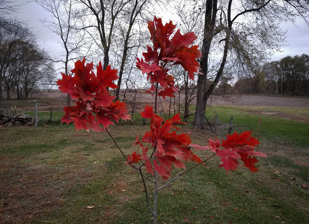
And a follow up to last Saturday. In just 6 days it really put on a show. The oaks around the area look very nice now after getting off to a very slow/late start for fall color.
-
Several good squalls today that quickly dropped vis to <1/4 mile a few times. With the winds it looked quite legit out there at times.
-
Nice. A lowly 0.15" here but this was always looking like a lame system for this area.
-
Yeah low-level lapse rates look great. Looking forward to some heavy graupelers that quickly/briefly whiten the ground.
-
MLI nailed 69 today. Was a great day to mulch/burn leaves etc, as there was very little wind and such nice temps. Rare to get temps this warm this late in the season without hurricane force winds lol.
-
Autumn blaze maple is just a bit past peak, and has already lost a good 1/4 of it's leaves.
.thumb.jpg.596b97af91c3a33ce961d1701bf1bbe7.jpg)
-
For some reason it's only letting me attach one pic at a time so guess I'll make separate posts lol Northern red oak is finally starting to turn red, but waay behind.
-
Oak trees are sure slow to turn around here this year. Many are still mostly green, and a lot of them that are turning are pretty dull looking. The new white oak is just barely starting to turn a bit.
-
Hoping to see the first mood flakes by next weekend.
-
I'm starting to see a pattern. Made it down to 20 here this morning.
-
The low here came shortly after midnight and then clouds COC blocked the temp descent. Still another freeze though.
-
Kicked off November with a hard freeze here. Got down to 26 here, DVN hit 29. MLI languished and only hit 34.
-
Hard to find much on the midwest Halloween '91 storm, as most of the attention was on the one out east at the same time. Here's about all I can find, but you can see satellite loops, regional radar, and surface maps from Oct 30/ Oct 31/ Nov 1. 34:25 min mark for Oct 30th 49:20 min mark for Oct 31st 1:07:10 hour/min mark for Nov 1st- the peak of the Midwest blizzard.
-
That was a great read. I remember that one, have family in southwest IA (near Shenendoah) that were in on that devastating ice storm. Definitely one for the ages from MSP to Duluth. It's pretty crazy how "the perfect storm" out east happened at the same time.
-
Winter 2021-22 Short/Medium Range Discussion
cyclone77 replied to Chicago Storm's topic in Lakes/Ohio Valley
StormfanaticInd be like -
He hasn't made it just yet! JK, congrats!
-
The sugar maples and the hybrid maples have really exploded with color the past few days. Oaks are way behind, with most of them still pretty much entirely green still.
-
Looks like the first 10 days of the month will be pretty quiet. Next week looks cool and dry, with widespread hard freeze potential mid to late week across a good chunk of the sub.
-
Ha we're pretty close. Got 6.94" here for the month. Picked up 0.65" the last two days.
-
Hopefully being at ground zero for a 2 foot blizzard 10 days out before Halloween is a good sign for the upcoming winter lol.


.jpg.7d95eceea83b85f7cf9db1292a09ff10.jpg)
