

LVblizzard
-
Posts
3,804 -
Joined
-
Last visited
Content Type
Profiles
Blogs
Forums
American Weather
Media Demo
Store
Gallery
Posts posted by LVblizzard
-
-
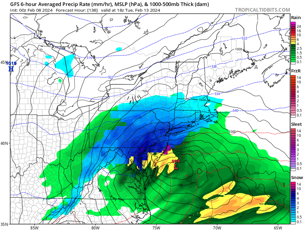
Both NAMs park the death band over the Lehigh Valley tomorrow morning. 2-3”/hr rates at the height of it.
-
3 minutes ago, anthonyweather said:
It’ll be coming. 6-10”
.You’re increasing totals? I think I’ll go up to 4-8” if/when I do…low ratios and BL issues scare me. Only way we get to 10” is if we have an earlier changeover and get under that death band for 3+ hours.
-
9 minutes ago, Duca892 said:
I’ll say this I’m not trying to get tooo excited but I’m starting to see Mets acknowledge the seeming SE trend on Twitter
Bobby from EPAWA saw the 0z guidance and essentially tossed his map from earlier this evening. No one really expected this shift, hobbyists and mets alike.
-
3 minutes ago, Albedoman said:
LV Blizzard, based on this MAJOR change, Mt Holly should issue a winter storm warning for the LV if this model shows this again at the 6z . Its hard to argue the map below as this is a pretty accurate sr model
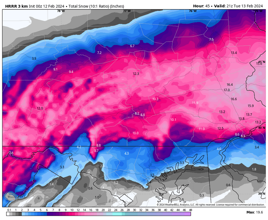
The “long range” HRRR past 24 hours typically isn’t very good. Until I see a clear trend from every other model towards this solution (which I don’t think will happen) I’m sticking with 3-6” for our area.
-
 2
2
-
-
Good lord the HRRR completely wrecks everyone!

-
2
-
 2
2
-
-
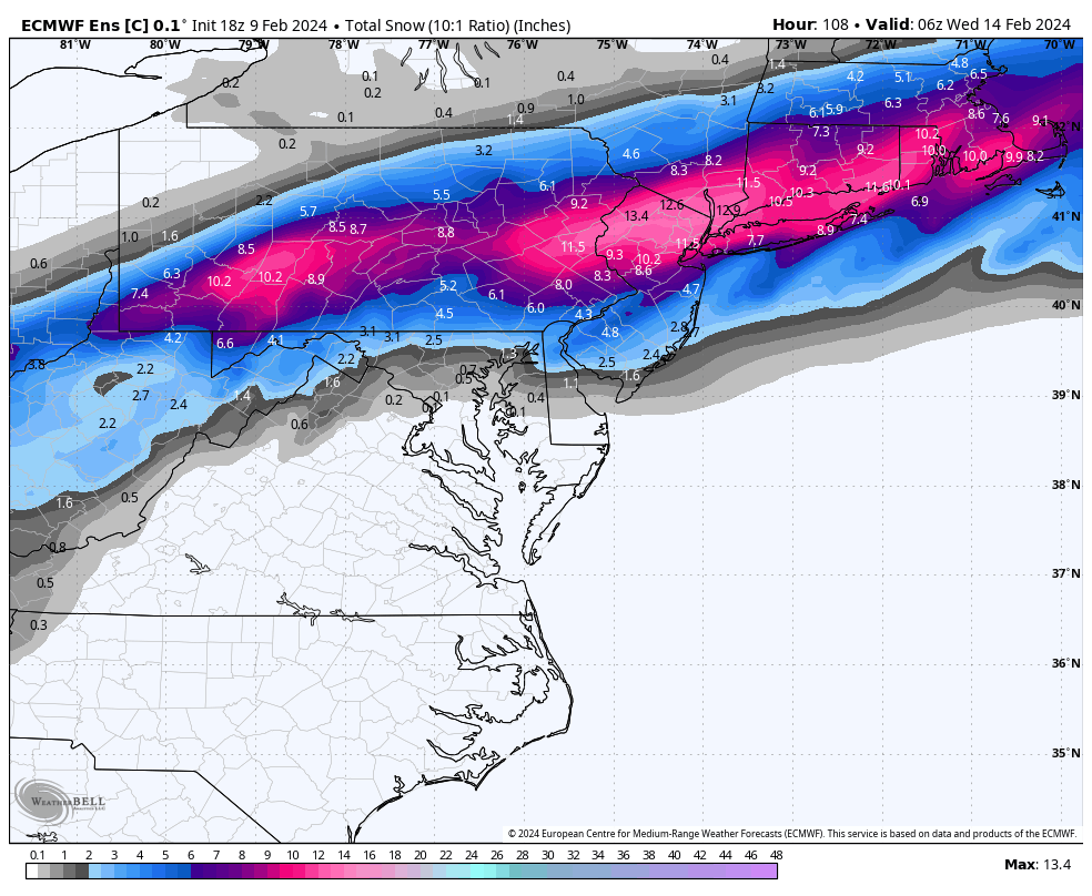
18z Euro continues the colder trend.
-
2
-
-
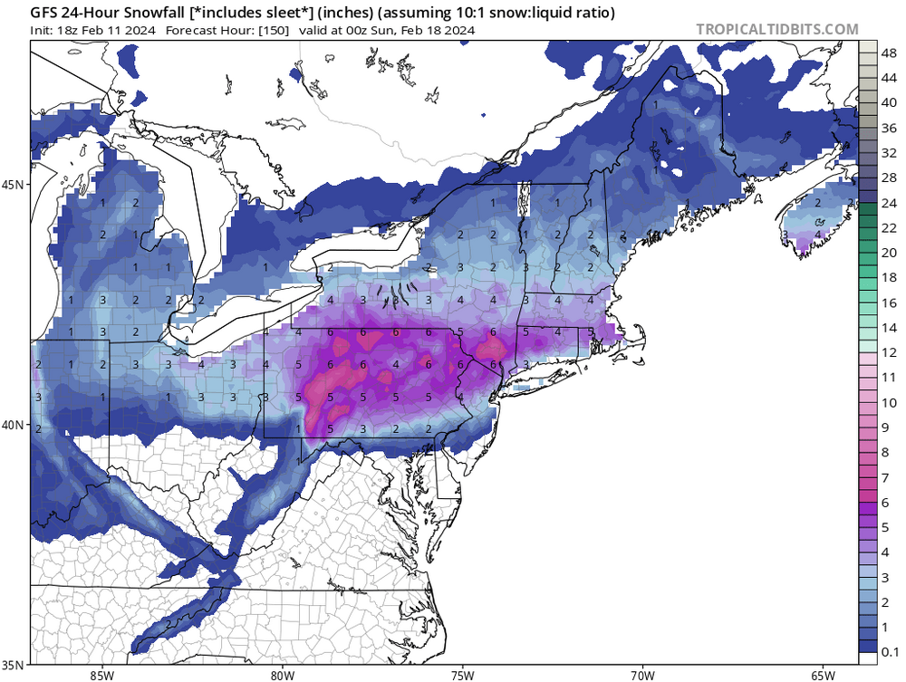
Saturday could be interesting as well if the GFS is any indication…
-
21z RAP is COLD!

-
1
-
-
Posted 3-6” for the Lehigh Valley on my page earlier this evening. Tonight’s 0z models have me feeling pretty good about that.
-
If the ICON gets this thing right I may just have to quit this hobby.
-
 1
1
-
-
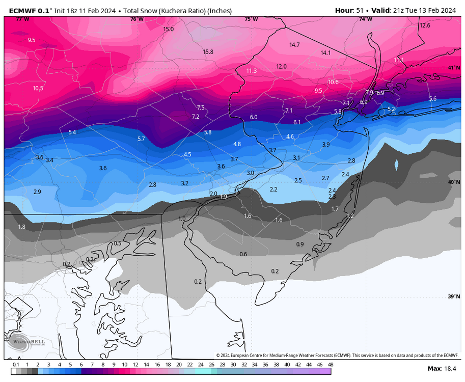
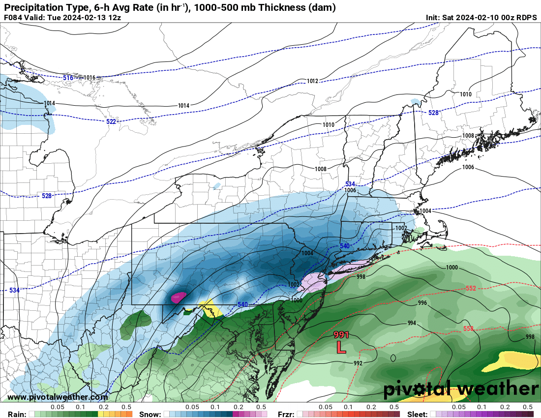
Euro is not good if you’re south of the Lehigh Valley. There’s a period of heavy snow on Tuesday as temps crash but not very much.
-
It’s been a long time since there was such a wide spread of solutions less than 3 days out. The ICON rains on everyone, even the Poconos. The GFS plasters the Lehigh Valley and Poconos. The UKMET is an I-95 snowstorm. And the NAM, CMC, and RGEM are light to moderate events at best. This thing is a nightmare to forecast. We’ll see what the Euro shows in about half an hour..
-
1 minute ago, MJO812 said:
Euro looks good. It's actually a tick southeast.


Huh? No it’s not. If anything it ticked north a little. It’s warmer than 0z and more tucked into the coast. Not a bad run by any means but it’s less of a weenie fest than last night’s run.
-
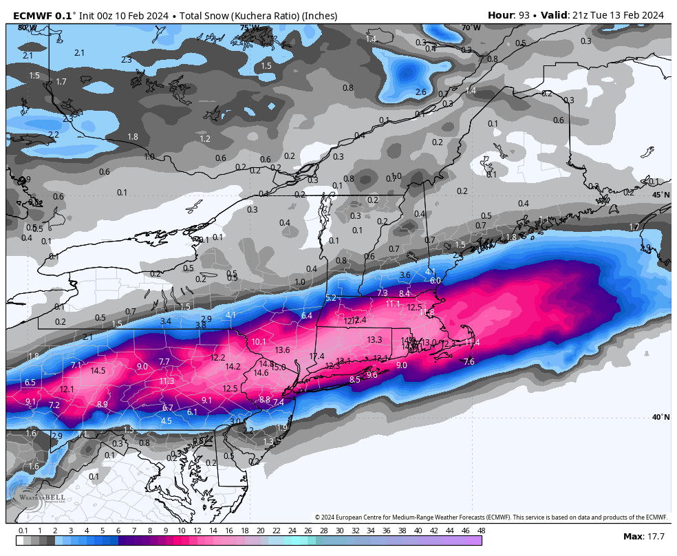
HUG HUG HUG the Euro! A foot for the Lehigh Valley with 1-3"/hr rates early Tuesday morning!

-
1
-
1
-
-
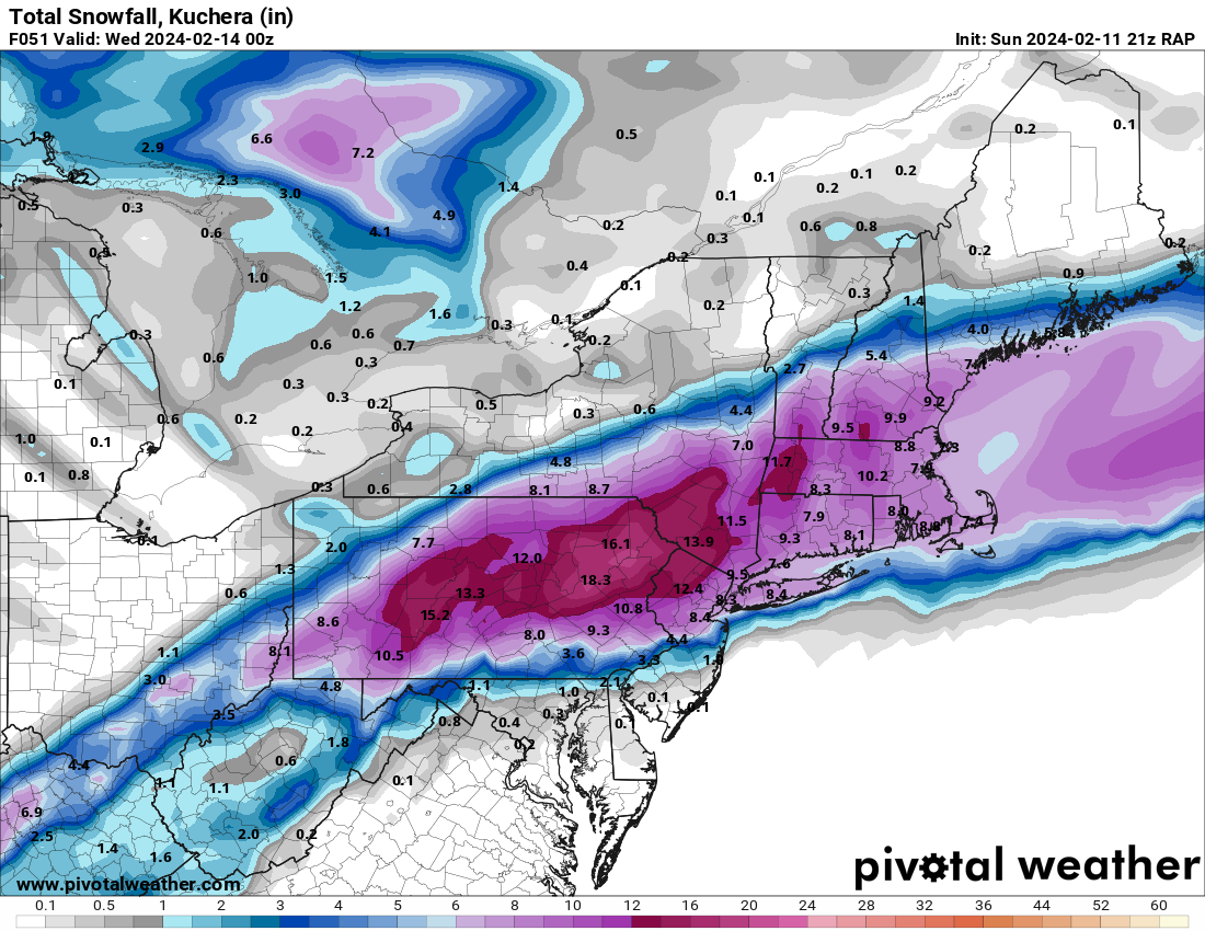
RGEM is another nice hit for the LV/Poconos. Models are starting to converge on a jackpot zone somewhere between I-78 and I-80.

-
1
-
-
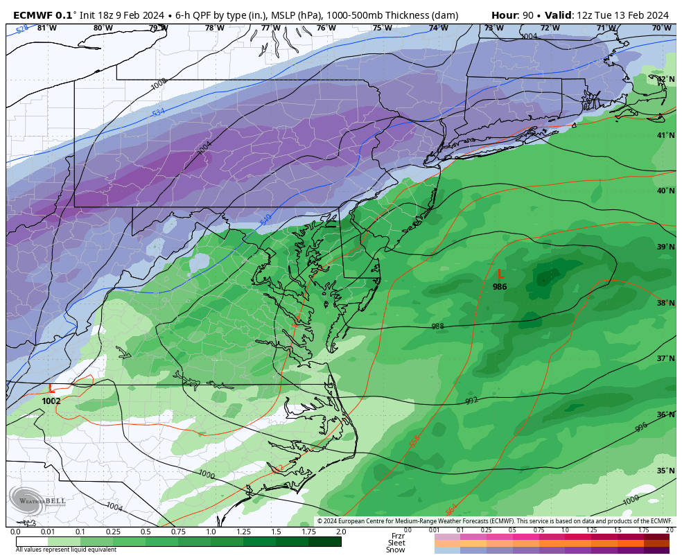
Big jump south on the Euro control. Is Philly back in it?

-
1
-
-
End of the 18z Euro. LV/Poconos jackpot zone this run. Philly burbs start as rain but flip to snow as heavier precip arrives.

-
1
-
-
5 minutes ago, MJO812 said:

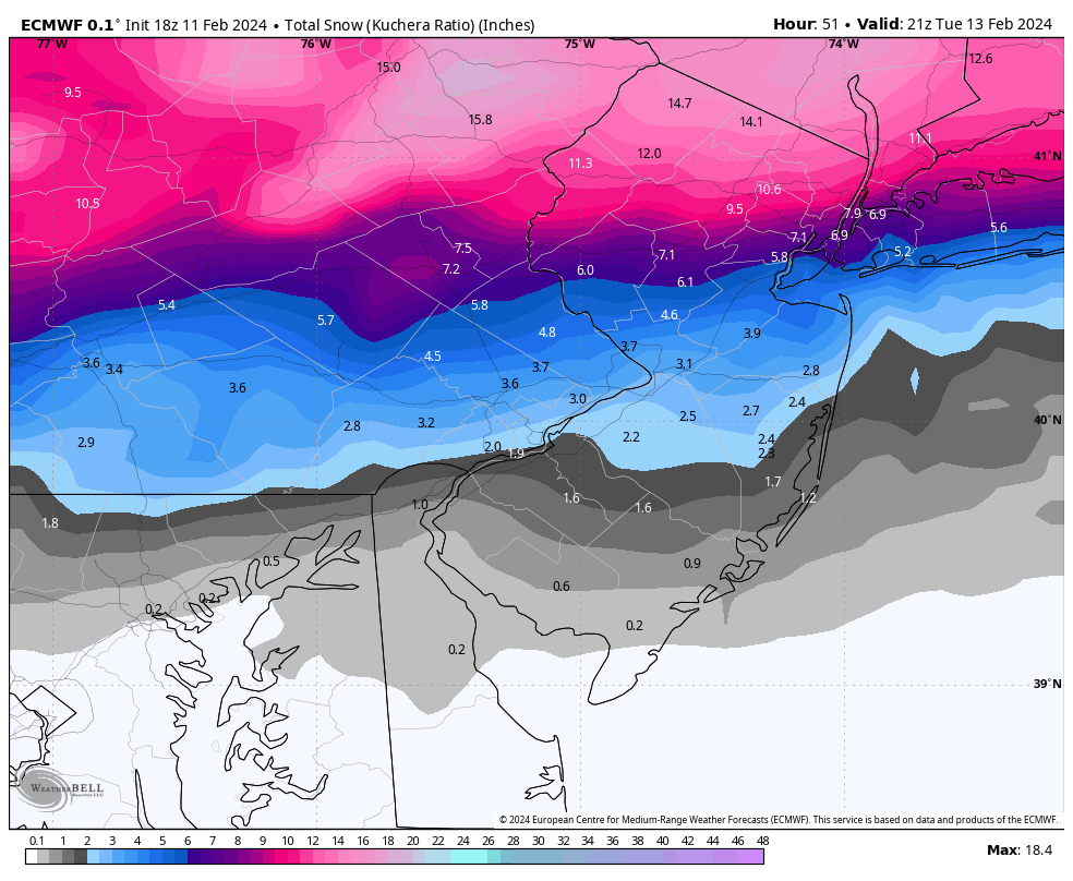
Kuchera maps are more accurate for this event since they take lower ratios into account.

-
1
-
-
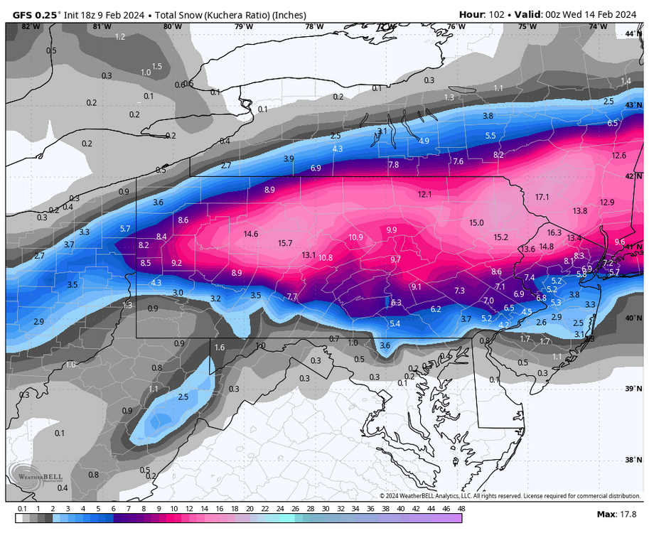
Some plowable snow down to Philly on the GFS. Big hit north of the turnpike.
-
1
-
-
24 minutes ago, MJO812 said:
That's what we need to continue
But not too much. Otherwise it’s suppressed and hardly anyone gets snow.
-
 1
1
-
-
1 hour ago, The Iceman said:
Pretty interesting trend on the EPS from 12z yesterday to today(stolen from the mid atlantic forum).

If I lived in the LV/Pocono's, i'd be getting excited.
Not getting excited yet, it’s still 5 days away and a lot can change. This could easily come back north. Plus even on the colder models (minus the GFS) we still rain quite a bit.
-
0z GFS is teasing us...
-
1
-
-
I fly back to Philly from Denver late Sunday night and I likely won’t be getting back to Allentown till 2 am. Guarantee this will happen the one time I don’t want a snowstorm.
-
3
-
-
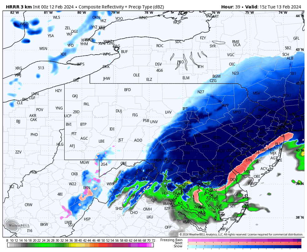
Light to moderate snow in Allentown despite the weak echoes on radar. Very high ratio stuff.
-
2
-


E PA/NJ/DE Winter 2023-2024 OBS/Discussion
in Philadelphia Region
Posted
I’m not a morning person at all but it looks like I’ll be setting an alarm for 5-6 am tomorrow to watch this all unfold. I’m in the jackpot zone on pretty much every model minus the Euro. Should be a fun one. Maybe with some thundersnow too?