

LVblizzard
-
Posts
3,804 -
Joined
-
Last visited
Content Type
Profiles
Blogs
Forums
American Weather
Media Demo
Store
Gallery
Posts posted by LVblizzard
-
-
2 minutes ago, Ralph Wiggum said:
I will take my 7.2" of snow and call it a winter.
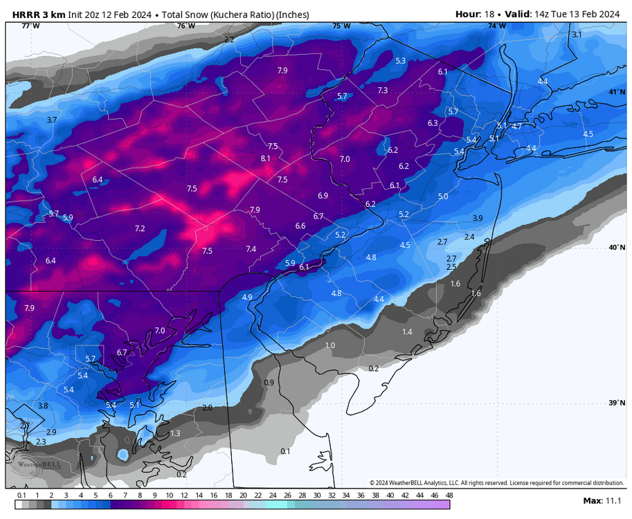
Latest HRRR ups you to 7.9”!

-
 3
3
-
-
Snow reports in Collegeville and KOP on mPING. Those have to be bogus, right?
-
2
-
-
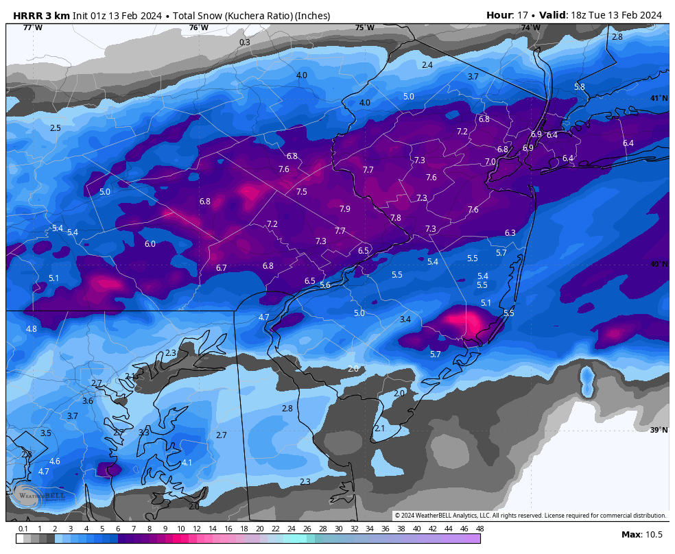
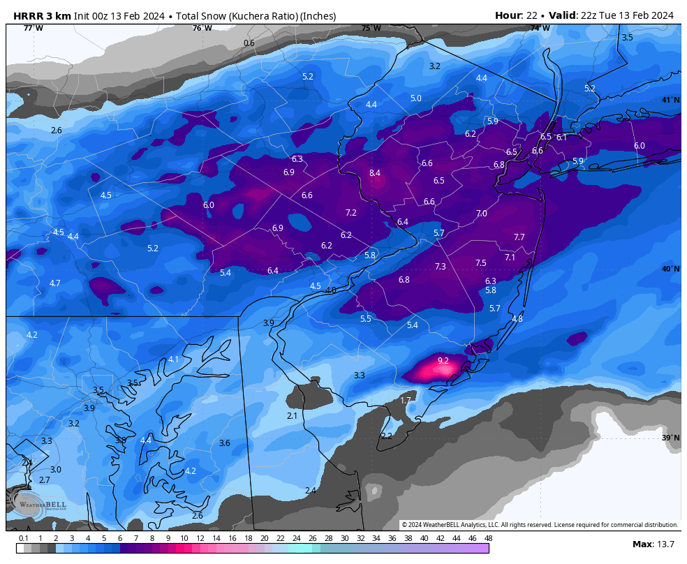
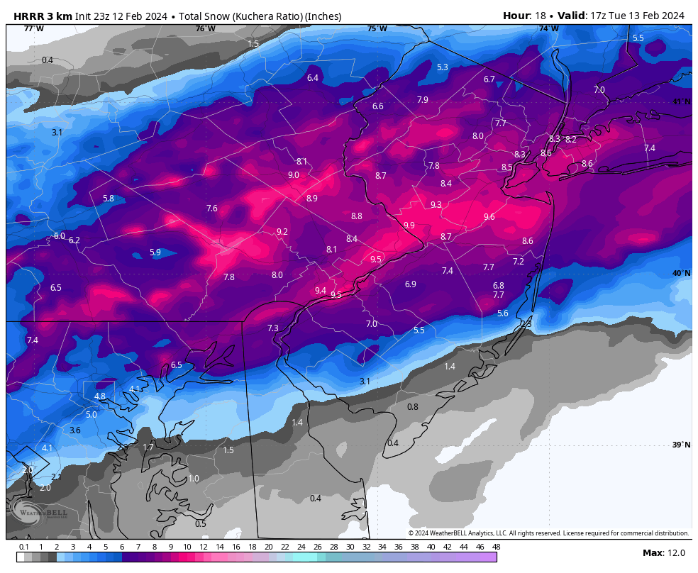
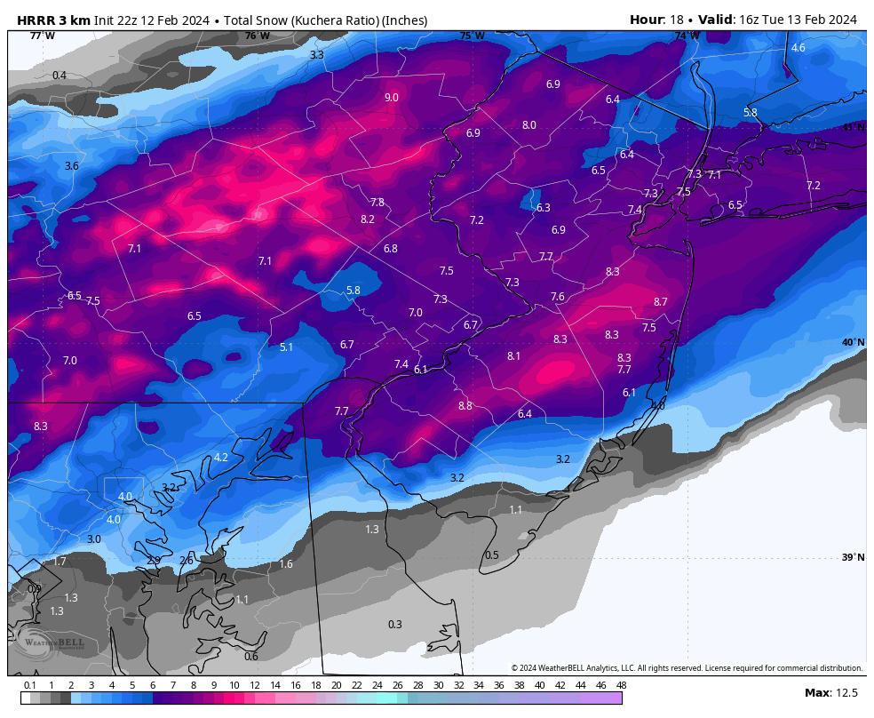
0z runs so far are not good for the Philly burbs. 3-6” now compared to the 6-12” solutions from earlier today.
-
 2
2
-
-
2 minutes ago, snowwors2 said:
Maps (final hour version‼️)⁉️
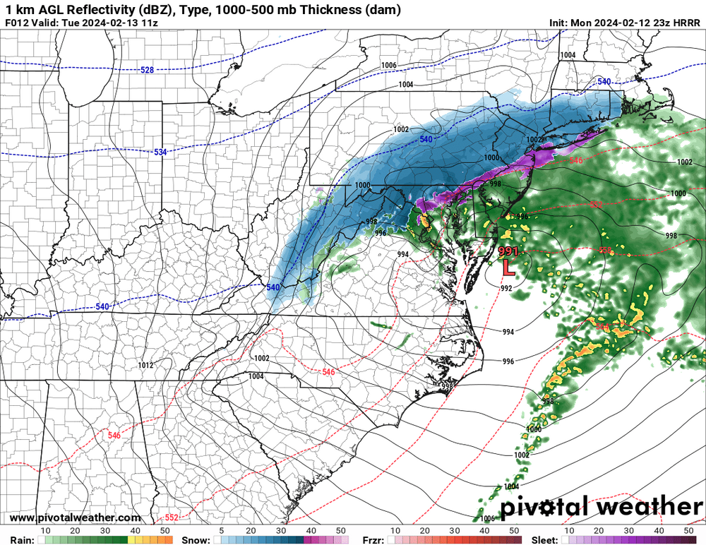
Here’s the HRRR. The RAP is similar.
-
1
-
-
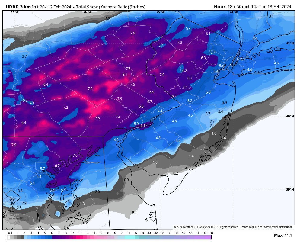
Latest RAP and HRRR back off quite a bit. I’m getting tired…
-
 1
1
-
-
2 minutes ago, Ralph Wiggum said:
If anything the hr³ is juicier over extreme sepa this run.
Still snowing for Philly eastward.

-
2
-
-
1 minute ago, Ralph Wiggum said:
Looks exactly the same
For SE PA, yes, but the precip cutoff is well north. State College, Williamsport, and Scranton are close to heavy snow again. Not that it matters for this subforum but it’s a clear sign that the south trend has stopped for good.
-
1
-
-
HRRR starting to come back north a little. Current radar supports that.
-
1
-
-
3 minutes ago, ChescoWx said:
Last 2 HRRR starting to step back on snow totals especially the further south and east from earlier runs -something to watch!

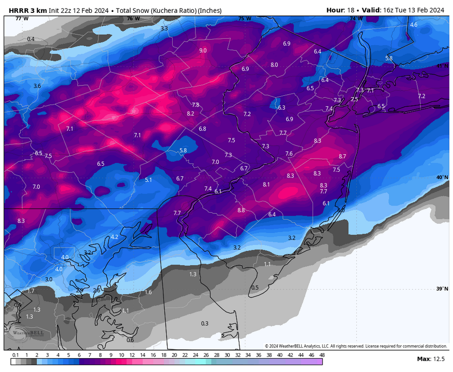
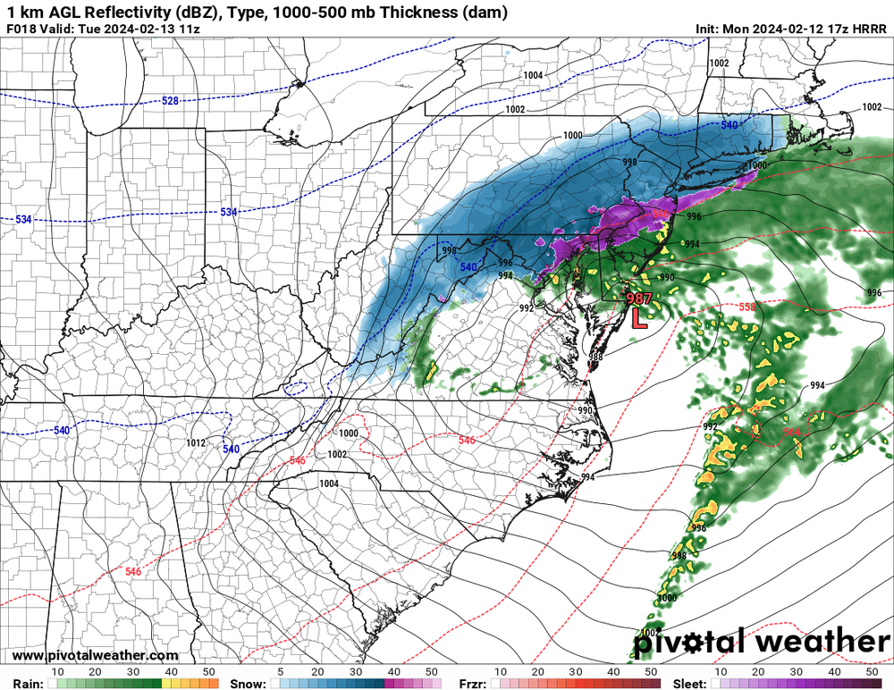
Here’s the complete run. Still snowing everywhere but the Lehigh Valley at this hour.
-
 1
1
-
-
RAP continues to bullseye this entire subforum.
-
2
-
 1
1
-
-
23 minutes ago, forkyfork said:
imo the south bleeding finally stopped
100% agree. Short-range meso models have been steady in their past few runs. And current radar matches up with the models’ sim radar pretty well.
-
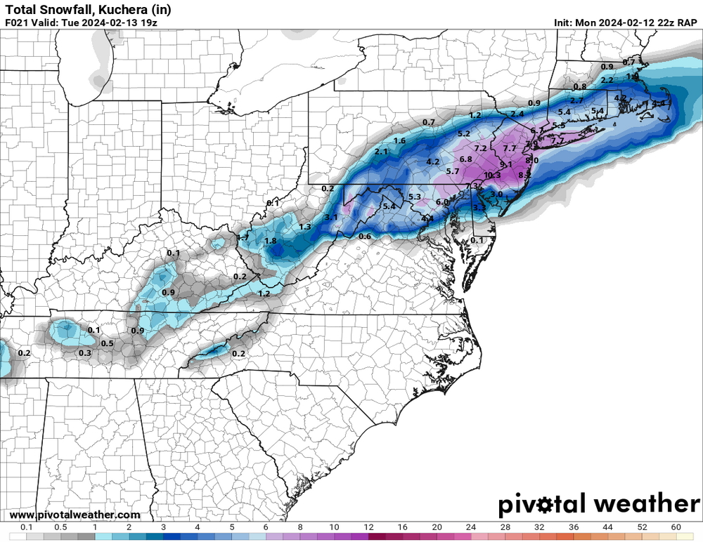
The HRRR has held steady in its past few runs instead of continuing to trend south. Latest run has 6-9” for most of us with snow still falling everywhere.
-
1
-
-
I can’t even imagine how the forecasters in Scranton/Wilkes-Barre down to the northern Poconos are feeling right now. This was all but a lock for a major snowstorm for them. And it all fell apart just like that. Fortunately it doesn’t look like there’s enough time for this to bust badly in the Lehigh Valley. Worst case, we get like 4” of moderate snow overnight.
-
2
-
-
Meanwhile the 3km becomes good friends with the UKMET.
-
1
-
-
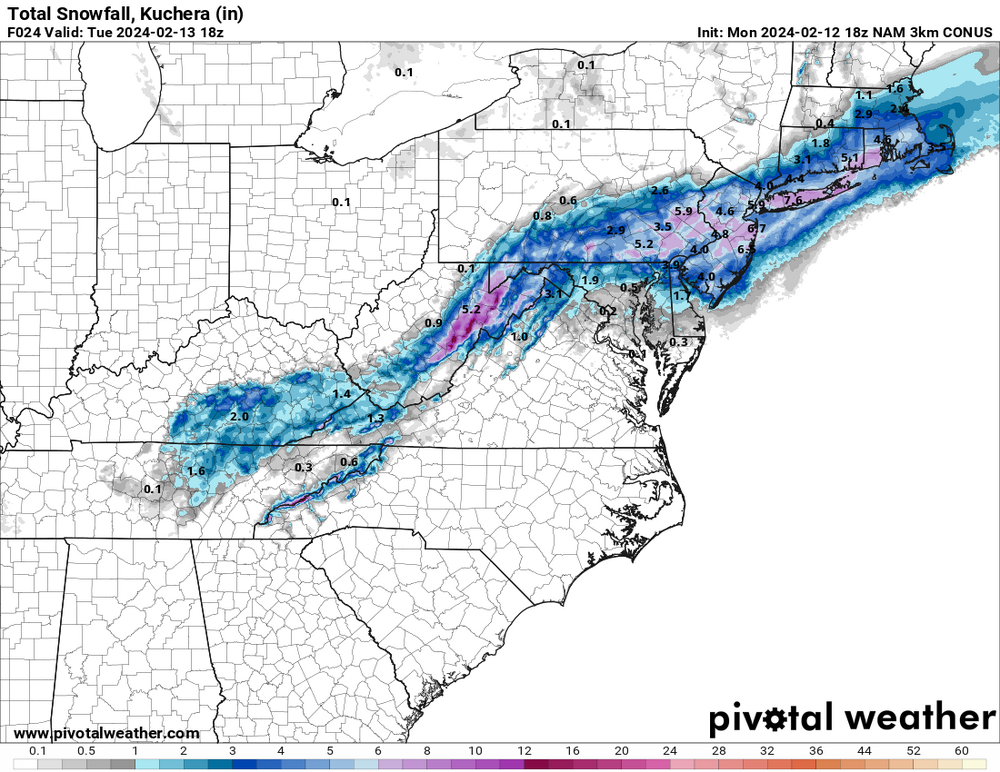
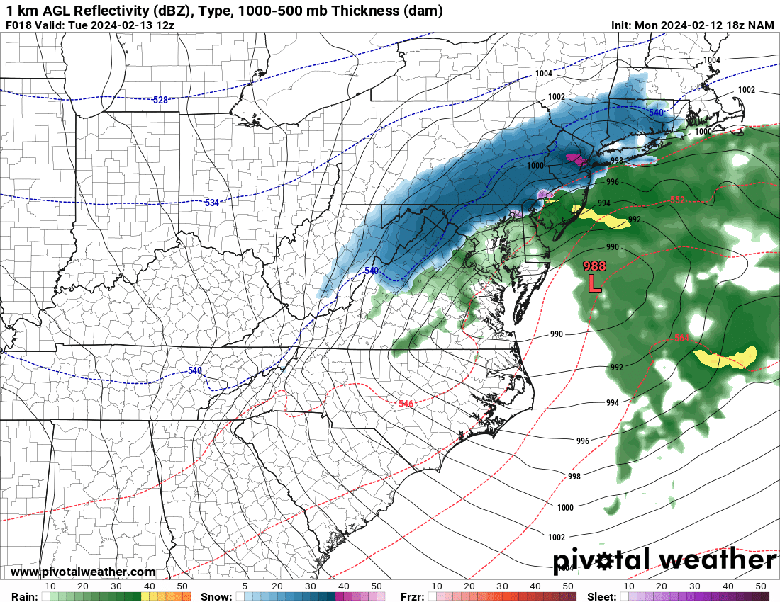
18z NAM continues the south trend and it is a total crush job. Looks like the HRRR.

-
3
-
-
Just now, The Iceman said:
HRRR is 32-34F during the heaviest rates...that'll definitely accumulate regardless of hour warm it has been leading up to the storm. This sort of set up reminds me of March 7-8th 2018... we were light rain until the heavier echoes moved in then BAM 5-6 hours heavy snow/thundersnow..all surfaces caved despite temps 32-34 during the day.
Was March 7-8 the storm that knocked out power to much of eastern PA? I remember that clearly, I was in the Poconos for it and the forecast was 1-3”, instead we got over 6” with blizzard conditions at times.
-
1
-
-
Just now, Ralph Wiggum said:
Shouldn't have started a thread under that name. I'm looking at you @LVblizzard
Be thankful if this keeps going south. If I get shafted it means you get hammered!
-
1
-
-
Just now, anthonyweather said:
I retract my statement, but rap is further s then this
.If the NAM comes as far south as the RAP then it’s time to start worrying a little. This thing isn’t gonna miss us like it might in Scranton, but another sizable shift south leaves us with 2-4” or 3-6” instead of 6-10”+.
-
1
-
-
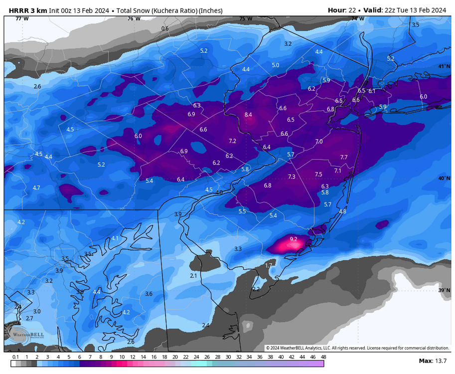
Zoomed in HRRR. I think the entire subforum would be happy with this!
-
3
-
-
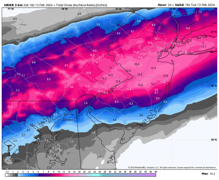
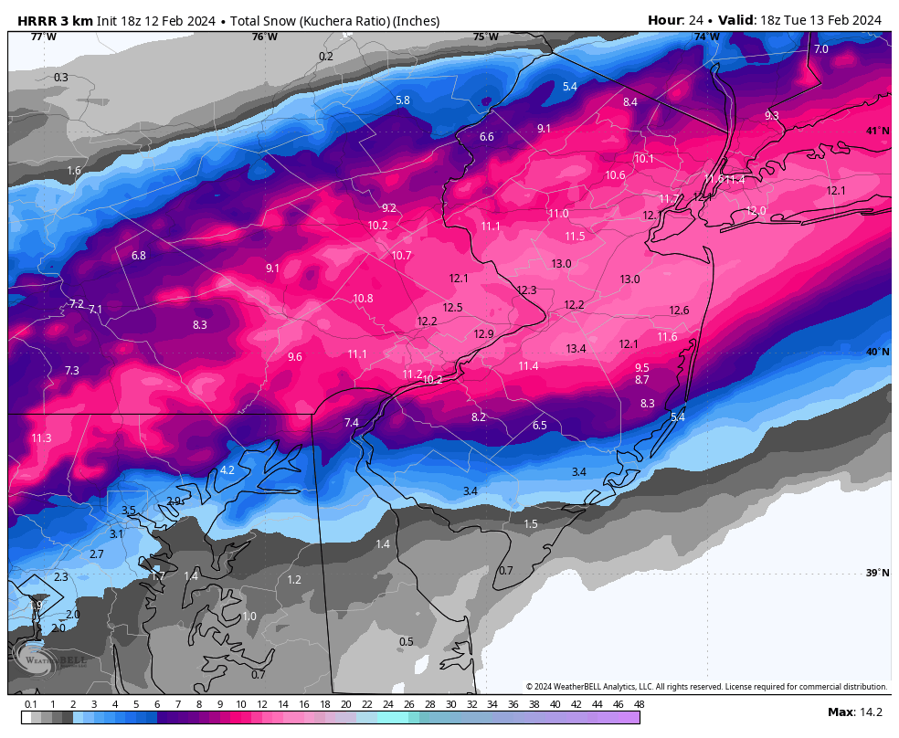
HRRR still wallops the LV/Poconos early tomorrow morning. It has 3” of snow at ABE by the time the Euro just begins to change over to snow.
-
1
-
-
Unless the mesos go way SE I’m not putting any stock in the Euro at all. Under 24 hours it’s typically better to look at mesos than globals.
-
1
-
-
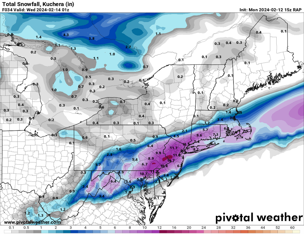
15z RAP throws Philly weenies a bone…
-
Figured I’d make a thread since we’re close enough to the storm that we’re immune to the bad fortune a dedicated thread brings. Hopefully.
As it stands now, this looks like a significant storm for the Lehigh Valley and Poconos with plowable snow north of the turnpike, and a nuisance event towards the immediate Philly area.
Should be a fun one!
-
I’m noticing that some of the hi-res/meso models now only have rain for a very short period of time towards I-78, with the majority of precip being snow. Some of them change the Lehigh Valley to snow as early as 2-3 am.


2/13 rain to snow event
in Philadelphia Region
Posted
This. This is the model I choose to believe.