Jump to content

USCAPEWEATHERAF

Members
  • Posts

    8,736
  • Joined

  • Last visited

Blog Entries posted by USCAPEWEATHERAF

  1. USCAPEWEATHERAF
    12z and 18z models beginning to indicate a secondary shortwave riding up the coastline forming a coastal storm on the frontal boundary and could become quite potent
    -winter storm threat is increasing as models gain confidence in what disturbance will do what on Sunday through Tuesday
    -Snow threat remains high, models increasing precipitation into the region as a frontal boundary plows offshore and the coastal low develops into a powerful nor'easter
    -as Nor'easter develops a potentcy wind threat increases out of the northeast
    - as nor'easter strengthens coastal flooding becomes a threat
    -Please stay tuned to the latest updates from the Taunton NWS WFO
  2. USCAPEWEATHERAF
    Could there be impacts from a nor'easter on Cape Cod on Wednesday night into Thursday?  If there will be, it might be shortlived as snow impacts will be light if it occurs.  Judging by the model trends tonight, I am growing more confident of an impact, even though less than an inch would be possible unless something large changes like the storm is at the benchmark.  H5 has been trending towards a more amped up through the present with an Arctic jet shortwave on the backside of the longwave trough.  If this phases we could get a big storm, but right now the Pacific jet shortwave that causes our nor'easter, is just too fast in the flow.  Right now the energy is too stretched out now in the long wave trough, however, models are heading towards sharpening up this shortwave energy more and more each run and also going negative sooner more so over DC and not off the coast like yesterday's runs showed.  This is a trend now with the 21z SREFs showing precip chances growing.  This is a system that I will notify you of if anything changes in the next 24-48 hours.
  3. USCAPEWEATHERAF
    These five images are the four most reliable guidance models we have in determining a snowstorm its track, intensity and future impacts to New England.  What they all agree on is the overall setup and teleconnections featured on December 5th, 2018 their forecast in the next 7 days.  The models show a classic El Nino pattern, with a sub-tropical jet cutoff low approaching or over the Baja, CA region, with a large +PNA ridging into Alaska and the NW Canada Territories.  The GFS is the furthest north with the sub-tropical cutoff upper-level low.  This could have impacts downstream over New England with the main shortwave in question being too far northwest compared to the other three guidance members, this flaw could change within the next run.  I will side with the Means for now given the setup is favorable for an east coast snowstorm.  They all agree on a developing central based -NAO ridge over eastern Greenland, building westward.  As well as in agreement over the -AO polar vortex location which is further northwest in a position of least impact.  The 50/50 low is in a good position for a blocking pattern to slow down the duration of the storm's movement allowing a longer duration, while the models don't show it quite yet happening just like that, I will wait until within 96 hours before using any one of the operational guidance as gospel.  Once the NAM gets in the range we will narrow down impacts and what not, but once we get in range of the 3KM NAM HIRES guidance, we won't have a great handle on the shortwaves and their interactions.  GFS is most amped but that is the operational model, the Means are less amped.  Also, another threat seems to take place a few days later.  We will keep you posted.  Stay Tuned!


  4. USCAPEWEATHERAF
    Latest 12z GFS digs our northern stream shortwave even further southward now and develops a coastal storm just too far out to sea currently to bring substantial snows to Cape Cod.  But trends could continue towards favoring an actual closer to the coastline coastal low that could impact our area with snows.  Considering our northern stream is digging more than predicted today, this can bode well for later on mid-week period.  We need to watch the trends for today to see what the next week brings.  Stay tuned!
  5. USCAPEWEATHERAF
    The latest cycle of the 12z model set has led to a high and very large uncertainty for forecasting SE MA and RI weather for Monday night into Tuesday afternoon.  The cycle was spilt down the middle, one side shows a potential major impact of snow and wind for the area then, but the other set as the secondary low taking off to far east and southeast and has a very little impact on the area for snow.  Right now, there is a less than 40% forecast confidence in any direction.  This is very poor for this range.  Update on the 18z model cycle.
  6. USCAPEWEATHERAF
    Latest 18z NAM brings hope to snow weenies across SE New England for next week.  In the TUE/WED time frame an explosive disturbance is running through the northern stream flow and amplifies right on the coastline, now if trends continue to a more amped up disturbance, we could see a much higher impactful storm develop near the benchmark, stay tuned!


  7. USCAPEWEATHERAF
    As of the 12z and 18z runs this morning and this afternoon suggest that we have three storm potentials this holiday week coming up.  With the NAO in flux, the PNA positive and the AO in flux, this is the best time to get snowstorms across the Northeastern US.  With the AO going negative long term and the PNA staying above neutral, we have a chance at transient ridges and shortwave amplification potential.  The first system is for Christmas Day, where an inverted trough/norlun trough bring accumulating snows for interior SE MA and RI into NE MA and S NH Christmas morning into the afternoon.  The second storm is a weak coastal storm on the GFS and the EURO is out to sea with the low, but as long as the potential threat exists I will mention it, seems like this storm is for Wednesday the 27th.  The third and final storm is potentially a long duration miller B coastal storm, with such a large high in Ontario, and Quebec, Canada banana high as in its shape and orientation favors an East Coast snowstorm impacting all of the Northeastern US.  Stay tuned, this one could be our first 2' potential since the Blizzard of 2015.
  8. USCAPEWEATHERAF
    Upper-level jet stream dives southward from Southern Canada into the northern tier of the CONUS.  Both jet streams potentially combine to produce a heavy QPF producing storm system with all types of precipitation.  Jet stream favors a -AO/+PNA/-NAO pattern which remains extremely favorable for winter storms to impact the Northeastern US.  Stay tuned, the next ten days could feature a very impactful set of three storms.
  9. USCAPEWEATHERAF
    3z SREFs has a mean snowfall of 6.45" over HYA from tomorrow evening through Monday evening.  Some members are over 20" of snow and half are about 12"+, so there is a lot of spread in the means, and plus while the 00z EURO didn't show much precipitation over Cape and Islands, the model did up the ante with the upper level low and the surface low strengthening.  Also, the HRRR 6z run shows a lot of lightning developing with the surface low as it reaches the coastline, this could impact the surface low track by pushing it more towards the coastline as it ramps up within the upper-level trough.
  10. USCAPEWEATHERAF
    Models are still too progressive with the arctic shortwave moving through Canada and Great Lakes region it is digging southward, not southeastward.  This will bode well for potential snowfall for Cape Cod on Wednesday.  If this shortwave can produce its own surface low, it will enhance the low-level flow over Gulf of Maine and Cape Cod, producing an inverted trough that can produce rapidly deteriorating conditions in a matter of minutes.  This inverted trough could produce up to 3-6" or more depending if it has time to mature and develop.  Models might be on target, but I am looking at the nowcast situation, we have a developing surface low east of NC coast, this is in a more northerly position than the models had 18 hours ago, also the precip shield is developing SW to NE and pivoting northward on the front end with a large push of heavy rainfall off the NC coast and into Hatteras, NC.  We have an additional energy behind the main arctic shortwave, that is diving through western Ontario, Canada and is pushing the overall momentum of the trough southward not eastward.  If this trough energy can dig south of Long Island, NY we can see up to 6"+ from the inverted trough.  Again the pivotal point will be tomorrow afternoon 18z observations.  Stay tuned!  I will issue a snowfall map tomorrow morning.
  11. USCAPEWEATHERAF
    50 degree temperatures for the first time on the Cape this winter season, were in the calendar/met Spring season which started on March 1st, but official spring begins on March 20th.  Today, Tuesday, March 9th, 2021 is the first time I recall Chatham, MA reaching 50F+ temperatures, and there was no nipping wind.  The winds are light out of the southwest, I do not feel fog will be an issue tonight as temps drop off as is during the Spring months.  Again, winter could spread its wings for a short unsustainable day or two, but nothing suggesting a three plus day period.  Honestly, I believe winter weather is gone for SNE this year until November, and our hurricane season could be quite active and violent.
  12. USCAPEWEATHERAF
    850mb temperatures will drop to near -30 to -40 C across the SNE region.  Cape and Islands could see a nasty band of ocean enhanced snowfall as a large upper low develops a surface low to the east of Maine and drops southeastward.  The location of this surface low will determine how close the band can get to the Cape and Islands later Friday.  With the massive cold pool aloft, winds will bring a ton of moisture, question becomes how strong will the lift become, and snow growth.  Right now, it is a toss up! DAMN!
  13. USCAPEWEATHERAF
    Cape Cod has not had a real snowstorm on Thanksgiving since my birth year, 28 years ago on Thanksgiving.  I was supposed to be baptized in the Roman Catholic Church a few months after my birth, which happened to be Thanksgiving week.  However, we had a great snowstorm that dumped almost a foot and a half of snow.  My parents have pictures they showed us growing up.  I have always wanted a white Thanksgiving and Christmas in the same year, wouldn't that be fascinating if this was the year?  Trouble though, my family and I are celebrating the holiday in Hilton Head, SC, so there is a dilemma here.  A part of me wants a white Thanksgiving and celebrate it at home with my immediate family and experience a snowstorm, the other part of me wants the snow to hold off until Sunday after the holiday when we are home to enjoy it.  Oh well.  GFS has a holiday storm shaping up on the November 14th 00z run around Wednesday of next week.  IF this indeed is the case, my family isn't going to SC for the holiday.  Model agreement would be good within 10 days, but the pattern shaping up continues the cold and stormy outlook into the first few weeks of December, and I like my chances for snow on the coast in December, not November, although it is rare, it isn't unlikely.  Teleconnections support a stormy and cold end for November and beginning of December.  We will get our front loaded chances this winter for snow.  However, I think it will take until January to get the true blizzard type of weather patterns, but I could be wrong stay tuned!
  14. USCAPEWEATHERAF
    The next seven to nine days the pattern supports a rathe benign and quiet week, especially from this weekend through next Friday, with temps moderating through the lower 40s for highs support a rather just below average temperatures for early winter and late December period.  Averages are rather low this time of the year and into the January into March period for the next year.  The 2020 New Year are supportive of a rather snowy period.  Latest models in the medium to long range support a reload of cold air into the Arctic and then unleashed into Canada and then the US.  End of the month models are showing several coastal storm threats.  Time will tell, the NAO goes negative, the PNA goes positive and the AO goes negative.  That supports highly anomalous cold in the eastern CONUS and a high likelihood of snow.  Time will tell!
  15. USCAPEWEATHERAF
    An ocean effect snow band has developed since 2 pm this afternoon, while staying offshore for most of the afternoon, this evening the band is producing moderate to heavy snow in squalls and perhaps some thundersnows are possible, the band is developing through surface convergence developing as winds are from the northeast to the right and north to the west of the band, this acts as a convergent band allowing lift and perhaps heavy snows developing over the Outer Cape Cod region with DBZs reaching 40 on the reflectiveness.  Check out the latest from BOX radar picking this band up below.

  16. USCAPEWEATHERAF
    Potential exists for Ocean Effect Snow bands to develop as an upper level low develops to the southwest of the region.  Now the evolution of said trough and upper level low remain in question as overall the guidance for 12z 12/06/2020 is still questioning this transition.  Newly updated water vapor imagery as I watch, shows the main energy that develops into the upper level closed low is still diving southward with no eastward motion.  This suggests it will try and phase with the southern stream system and create a formidable surface storm over the North and South Carolina piedmont region.  This low has two avenues of track, one to the ENE and off the coast with little fanfare, or two up the East Coast in more of a NNE track.  The latter performs a major impact event for eastern New England, while the former represents little impacts.  Ocean Effect Snows will only develop if the ocean storm tracks close enough to the region to veer the flow from an anticyclonic burst of westerly winds, to a more cyclonic burst of NNE to N winds across a very mild Gulf of Maine and Cape Cod Bay.  850mb temps which are found 2500 to 5000 feet above the surface of the ocean, dive into the -6 to -12C range for a good 36 hour period.  The winds veer to north-northeasterly at the same time and provide the necessary forcing for ocean effect cloud seeding and developing of snow showers.  Again any accumulations will be light!
  17. USCAPEWEATHERAF
    Today, this morning in New England, Monday is a rather slow, unwelcoming day.  Most New England Patriots fans are waking to an early sun rise, with the knowledge that their New England Patriots took a big loss on the chin from the Baltimore Ravens before their week 10 bye.  With the knowledge that there are weaknesses on the team's defense and offense, we pay attention to the weather scene the next two weeks before another game is played against the Philadelphia Eagles.  I awake this Monday morning, knowing that a potential winter storm is lurking in the day four window, and according to the 00z EURO run this morning, there might be a legit snow to the coast by day 9.  However, that is both beside the point.  Today, Monday, November 4th, 2019 is only four days away from a modeled interior snowstorm for New England.  Possibility becomes likely when models begin to agree on the storm in the 3 1/2 day window and confidence begins to increase substantially with the three major global models in relative agreement, the EURO, GFS and UKMET models have the same event in the same location, with similar results.  We should wait another 36 hours before we are more confident in any model and have the short range ensembles and the short range HI resolution guidance in the range necessary for a high confidence forecast.  For now, the November 8th modeled event is just that, a potential and nothing more or less.  Residents southeast of the I95 corridor in RI and SE MA should not worry too much about accumulating snowfall, for the most part if it snows at all it should melt.  The sun angle, while getting lower, is not there yet, and the ground is too warm as well as the ocean to the northeast while cooling substantially faster than last year at this time, we are still in the low to mid 50s off the South Shore of Boston to Nantucket.  The only shot is a cold screaming north wind that carries the very cold arctic air mass over the warmer waters.  Right now, nothing supports snow in the area, Cape Cod residents who love snow, we need to wait.
  18. USCAPEWEATHERAF
    Next Thursday, the 6z GFS has a large arctic shortwave that moves southeastward from James Bay, Canada with extremely cold air mass associated with it and a high north of the region and a storm southeast of the region putting the area in an inverted trough, with northeasterly winds enhancing snowfall from Plymouth, MA to Chatham, MA with up to .5" of QPF in spots.  I will wait until the short range models are in range, these systems are quite fickle in location and small in stature leading to close near misses at times.  It could produce up to 2' at times depending upon the intensity of the trough and the delta ts and instability present in the trough.  However, GFS only forecasting 3-6" at this time, but the air is going to be quite cold.


  19. USCAPEWEATHERAF
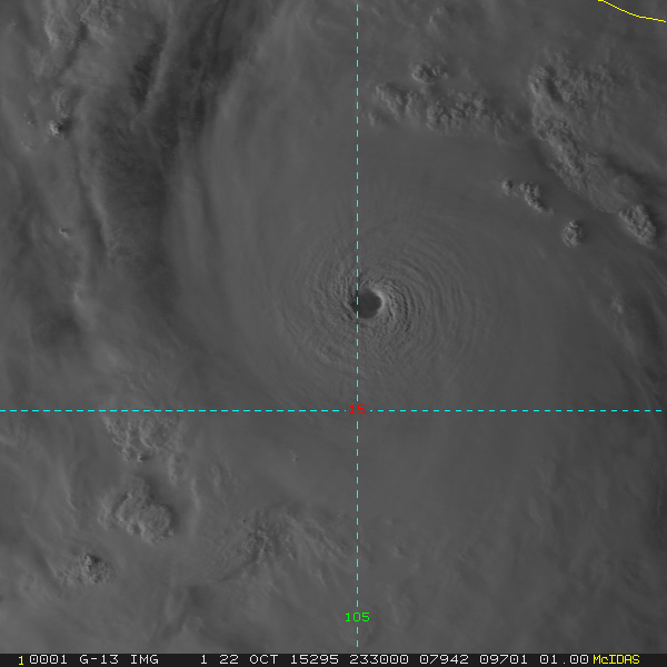
    While category five hurrianes are currently categorized at catastrohic (category five hurricane status these days) 156mph winds, these hurricanes develop with 85F+ wate temperatures, what if unforeseen circumstances bring these water temperatures to 95-97F, just a ten to twelve degree warming could lead to hurricanes with winds over 250 miles per hour.  This is trule a catastrophic level.  My novel includes the intensity of these monsters in the hurricane seasons of 2029 and 2030.  Could geolgical events in the Atlantic Ocean lead to such destructive hurricanes in the future?  Why not?
×
×
  • Create New...