
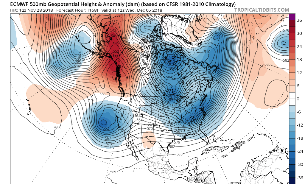
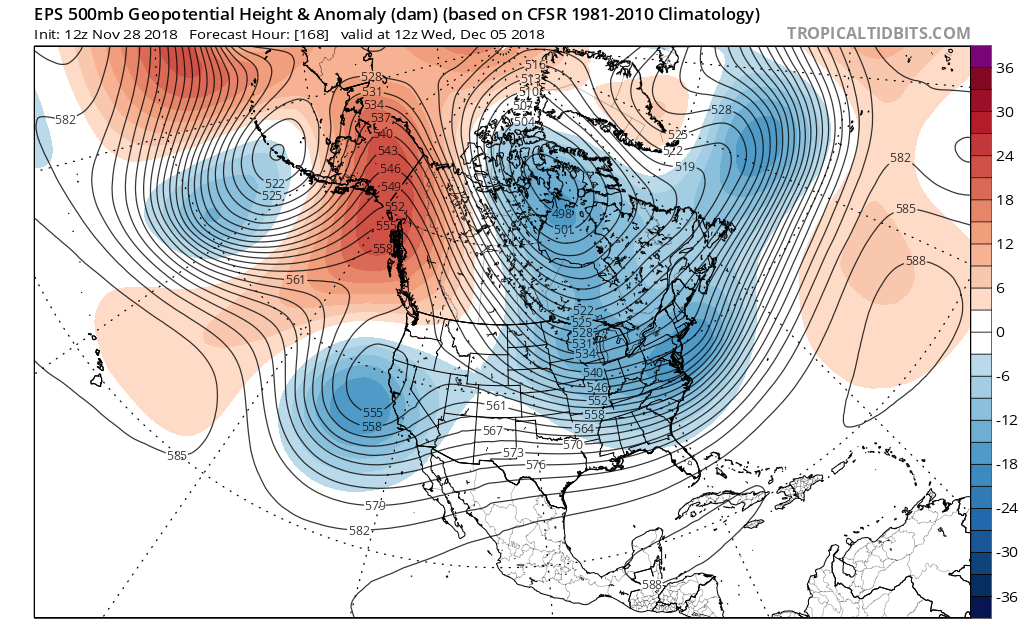
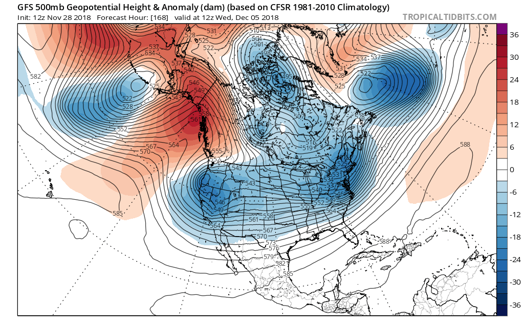
12z EURO December 5th forecast analysis H5 pattern

Entry posted by USCAPEWEATHERAF ·
1,016 views
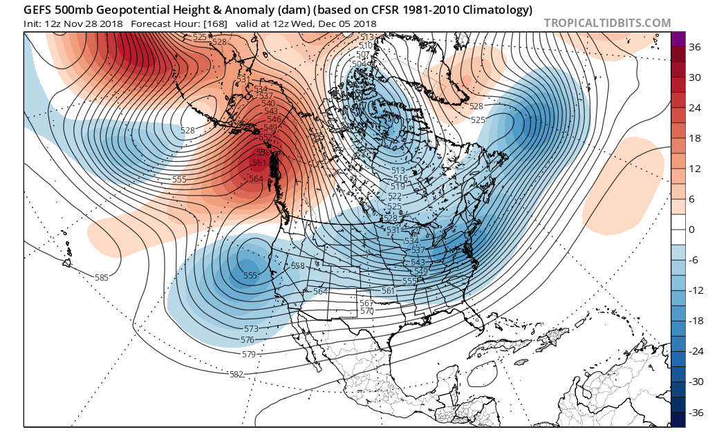
These five images are the four most reliable guidance models we have in determining a snowstorm its track, intensity and future impacts to New England. What they all agree on is the overall setup and teleconnections featured on December 5th, 2018 their forecast in the next 7 days. The models show a classic El Nino pattern, with a sub-tropical jet cutoff low approaching or over the Baja, CA region, with a large +PNA ridging into Alaska and the NW Canada Territories. The GFS is the furthest north with the sub-tropical cutoff upper-level low. This could have impacts downstream over New England with the main shortwave in question being too far northwest compared to the other three guidance members, this flaw could change within the next run. I will side with the Means for now given the setup is favorable for an east coast snowstorm. They all agree on a developing central based -NAO ridge over eastern Greenland, building westward. As well as in agreement over the -AO polar vortex location which is further northwest in a position of least impact. The 50/50 low is in a good position for a blocking pattern to slow down the duration of the storm's movement allowing a longer duration, while the models don't show it quite yet happening just like that, I will wait until within 96 hours before using any one of the operational guidance as gospel. Once the NAM gets in the range we will narrow down impacts and what not, but once we get in range of the 3KM NAM HIRES guidance, we won't have a great handle on the shortwaves and their interactions. GFS is most amped but that is the operational model, the Means are less amped. Also, another threat seems to take place a few days later. We will keep you posted. Stay Tuned!
0 Comments
Recommended Comments
There are no comments to display.
Create an account or sign in to comment
You need to be a member in order to leave a comment
Create an account
Sign up for a new account in our community. It's easy!
Register a new accountSign in
Already have an account? Sign in here.
Sign In Now