
Arctic shortwave could produce its own snow for Cape Cod next Thursday

Entry posted by USCAPEWEATHERAF ·
983 views
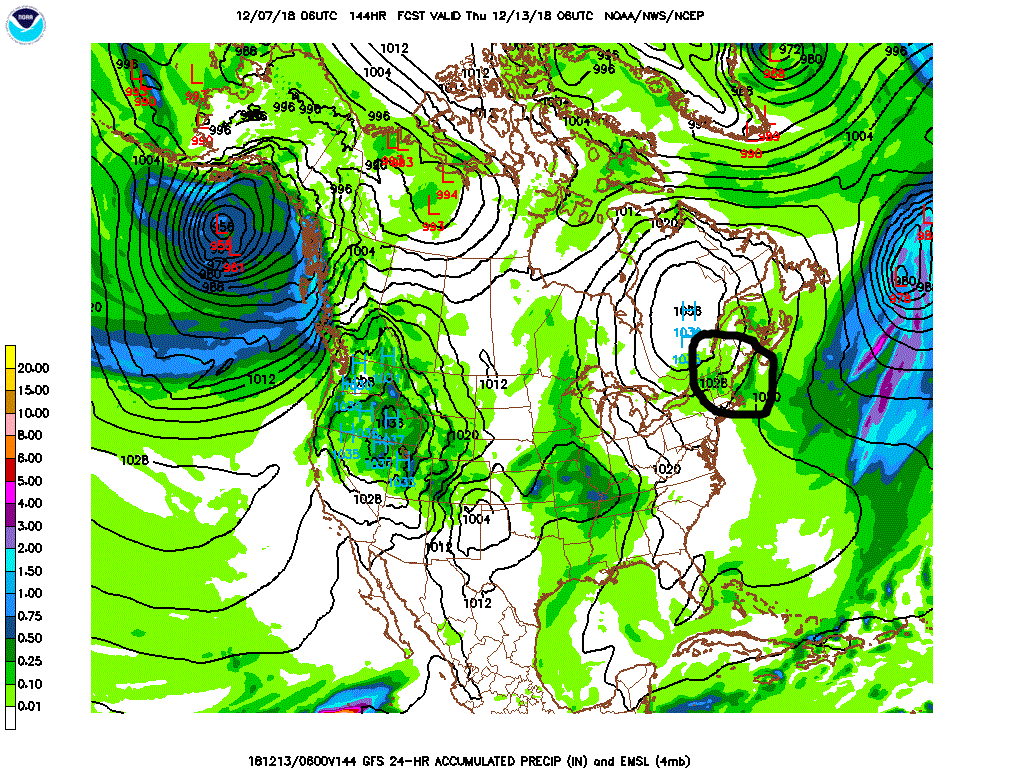
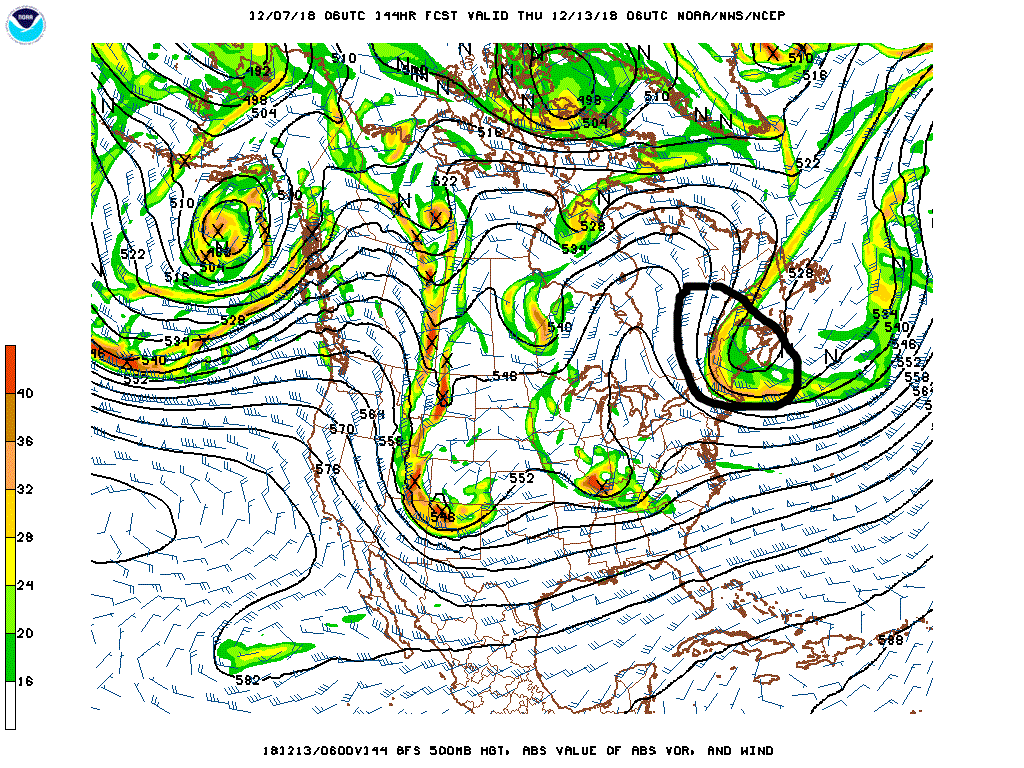
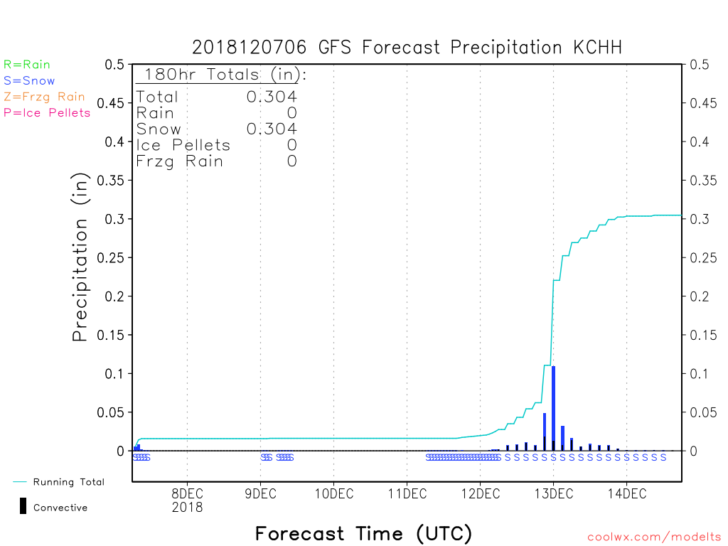
Next Thursday, the 6z GFS has a large arctic shortwave that moves southeastward from James Bay, Canada with extremely cold air mass associated with it and a high north of the region and a storm southeast of the region putting the area in an inverted trough, with northeasterly winds enhancing snowfall from Plymouth, MA to Chatham, MA with up to .5" of QPF in spots. I will wait until the short range models are in range, these systems are quite fickle in location and small in stature leading to close near misses at times. It could produce up to 2' at times depending upon the intensity of the trough and the delta ts and instability present in the trough. However, GFS only forecasting 3-6" at this time, but the air is going to be quite cold.
0 Comments
Recommended Comments
There are no comments to display.
Create an account or sign in to comment
You need to be a member in order to leave a comment
Create an account
Sign up for a new account in our community. It's easy!
Register a new accountSign in
Already have an account? Sign in here.
Sign In Now