
First real shot at Ocean Effect Snow this season? Snows from Provincetown to Plymouth, MA

Entry posted by USCAPEWEATHERAF ·
903 views
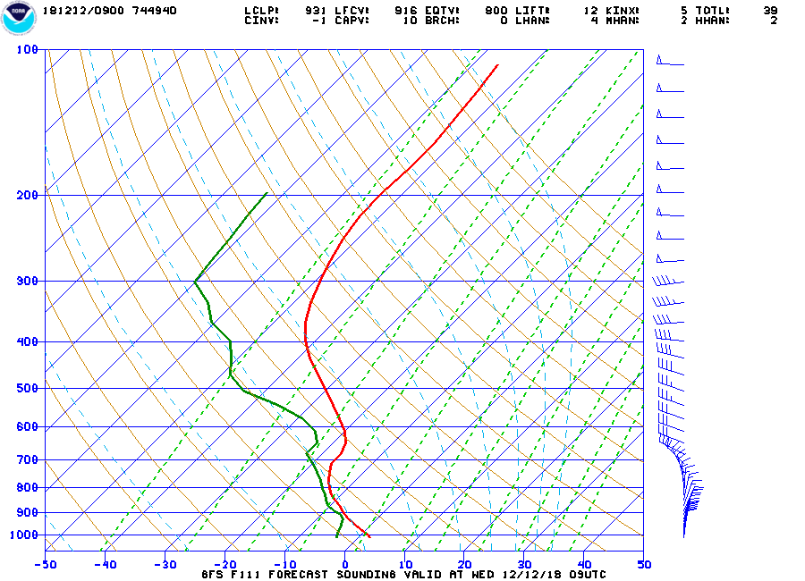
Below is the forecasted sounding from the 18z GFS for 111 hours out, which is around Wednesday afternoon. This event for Ocean Effect Snows and inverted trough mix could be quite prolific, like the Lake Erie and Lake Ontario events, why, according to the model, we have a lot of moisture present, NNE winds present from 850mb to surface, 850mb temps dropping below -16C, SSTs around +8-9C, leading to 850mb to surface differentials around +25C leading to high instability, inversion heights near 700mb which mean the surface to 700mb is highly moist as NNE winds favor that environment with dry air gone Cape Cod from Chatham to Plymouth, MA could see high snowfall totals. Ocean induced CAPE values likely to be higher than normal, and normal CAPE values should be around .18 sufficient for the salt nucleus. DGZ near the ground, with lift inside around -12 to -18 units. I favor locations such as Plymouth, Barnstable and Nantucket counties for snow accumulations. Updates will continue to come.
0 Comments
Recommended Comments
There are no comments to display.
Create an account or sign in to comment
You need to be a member in order to leave a comment
Create an account
Sign up for a new account in our community. It's easy!
Register a new accountSign in
Already have an account? Sign in here.
Sign In Now