

wdrag
-
Posts
4,409 -
Joined
-
Last visited
Content Type
Profiles
Blogs
Forums
American Weather
Media Demo
Store
Gallery
Posts posted by wdrag
-
-
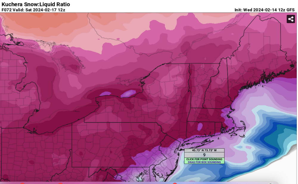
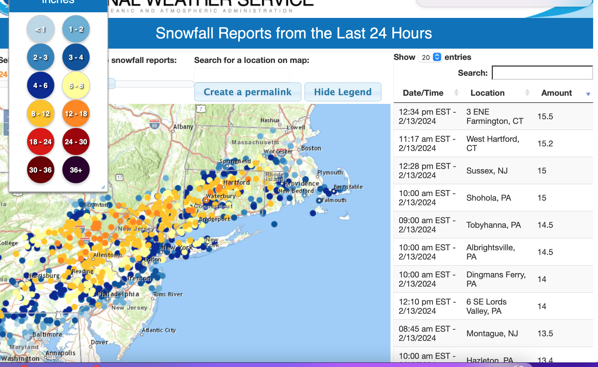
Corrected thread title date 18th to 17th at 828PM Thu the 15th. No other changes needed at this time. Max snowfall axis continues near the Mason Dixon line where watches and/or advisories are already posted for NJ/PA/MD. Some modeling have the max snowfall axis a little further north near I78. 18z/15 GFS op has increased snowfall ratio for LI 11 to 1 for early Saturday which if it verifies helps make a little more snow near LI. Presuming it snows in ne PA/nw NJ across e central PA SLR's per the 18z/15 GFS op are near 15 to 1! Just need the qpf.
-
 3
3
-
-
I’ll correct the thread date from 18 to 17 late today. My error
-
One thing I should mention and not included in thread. Very unstable Sat afternoon in wake of the event with scattered snow showers.
-
1
-
-
2 hours ago, NEG NAO said:
Curious as to why Walt thinks this is as short as a 4 hour and long as a 10 hour event ?? Uncertainty of speed and development of the system ????
Modeling keeps it short... progressive. No closing off aloft...
-
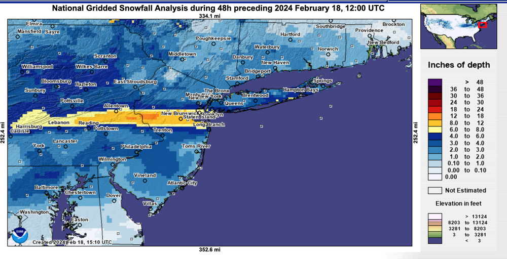
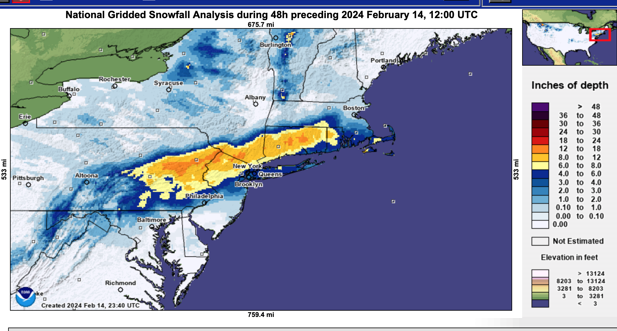
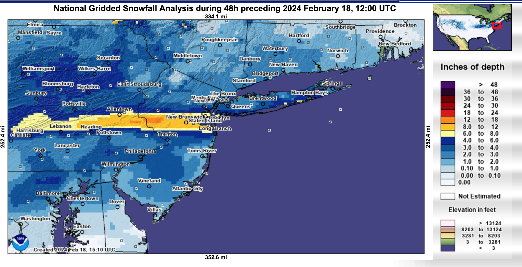
The final NOHRSC analysis of snowfall... click for clarity.

-
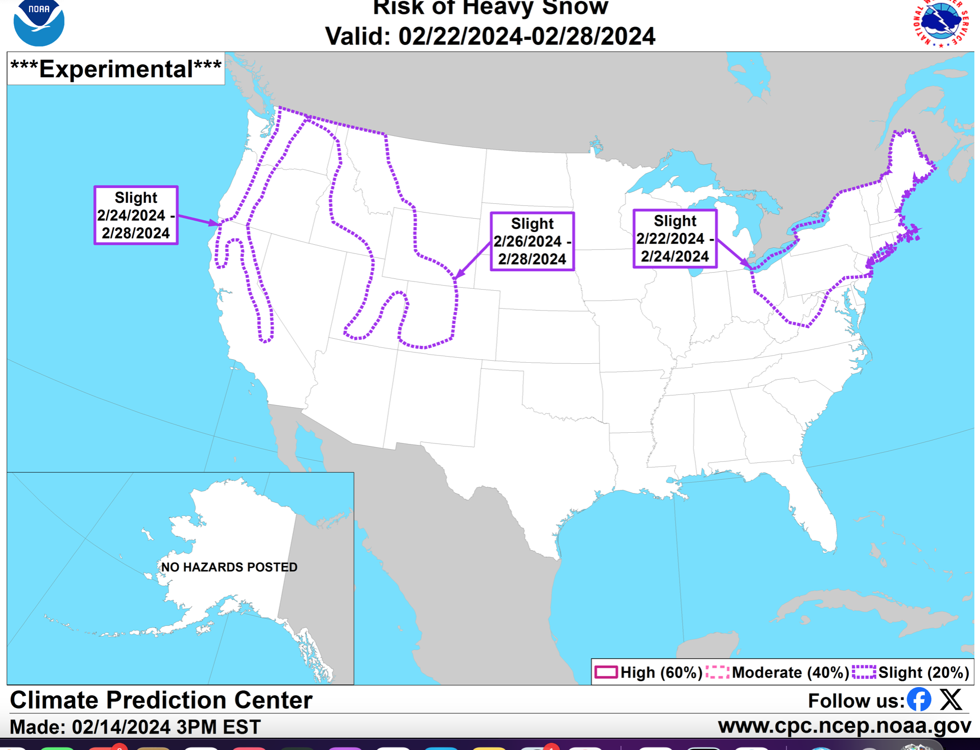
Here's another tease: CPC 2/22-24. I didn't post the wind risk they had also. Keep an open mind on what might happen in here before the big warmup transition.

-
5
-
-
Just now, North and West said:
It was chilly out there today.
.I love these spells of winter. Noting that it helps hold the snow cover out here. Continues beautiful. Was driving a patient in an ambulance at 5A over High Point - somewhat slippery roads in flurries, blowing snow and gusty Winds 3gusting 0 MPH. So different (relative calm in Newton-Sussex) once you get in the valleys and you dont realize how rough it can be.
-
8
-
-
fwiw. Todays CP below normal temps broke a string of 22 consecutive days above normal.
-
4
-
 2
2
-
-
15 minutes ago, Stormlover74 said:
Gfs ticked north.

I'm rooting it on... make this thing worthwhile. I'll check back briefly tomorrow and Friday mornings.
-
5
-
-
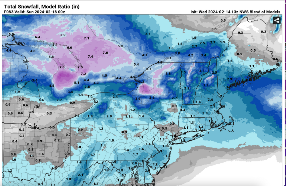
For what its worth, I tried to take into account member requests but kept this new thread relatively simple at this point adding SREF, CMCE, EPS, GEFS, NBM and a singular sample of projected SLR for refresher thread. My confidence is shaped by the ensembles and so I too am conservative.
fwiw... I think a good early posture is to be a little low on expectations and if modeling becomes more favorable for higher amounts. then go with it. Forecasters dont like to answer: what happened-especially from Emergency Managers and the Media. Reliability is so important - it develops followers and I think that's the goal for all of us, and most certainly the NWS which has to convey preparedness messages.
An important aspect of this coming event, whatever it is... its at night, and below freezing so all untreated surfaces will accumulate and hopefully we see beautification Saturday morning even if its wimpy compared to our desires. Fingers crossed.
-
4
-
 2
2
-
-
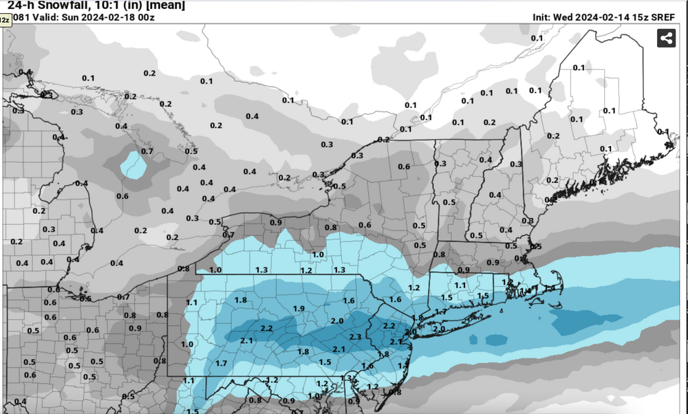
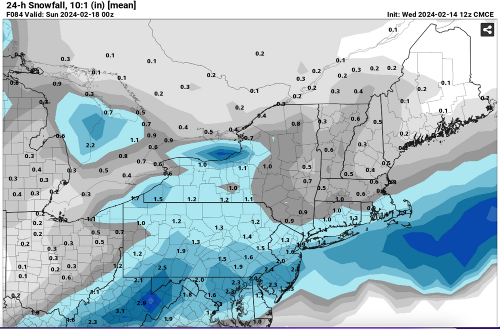
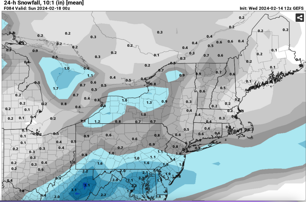
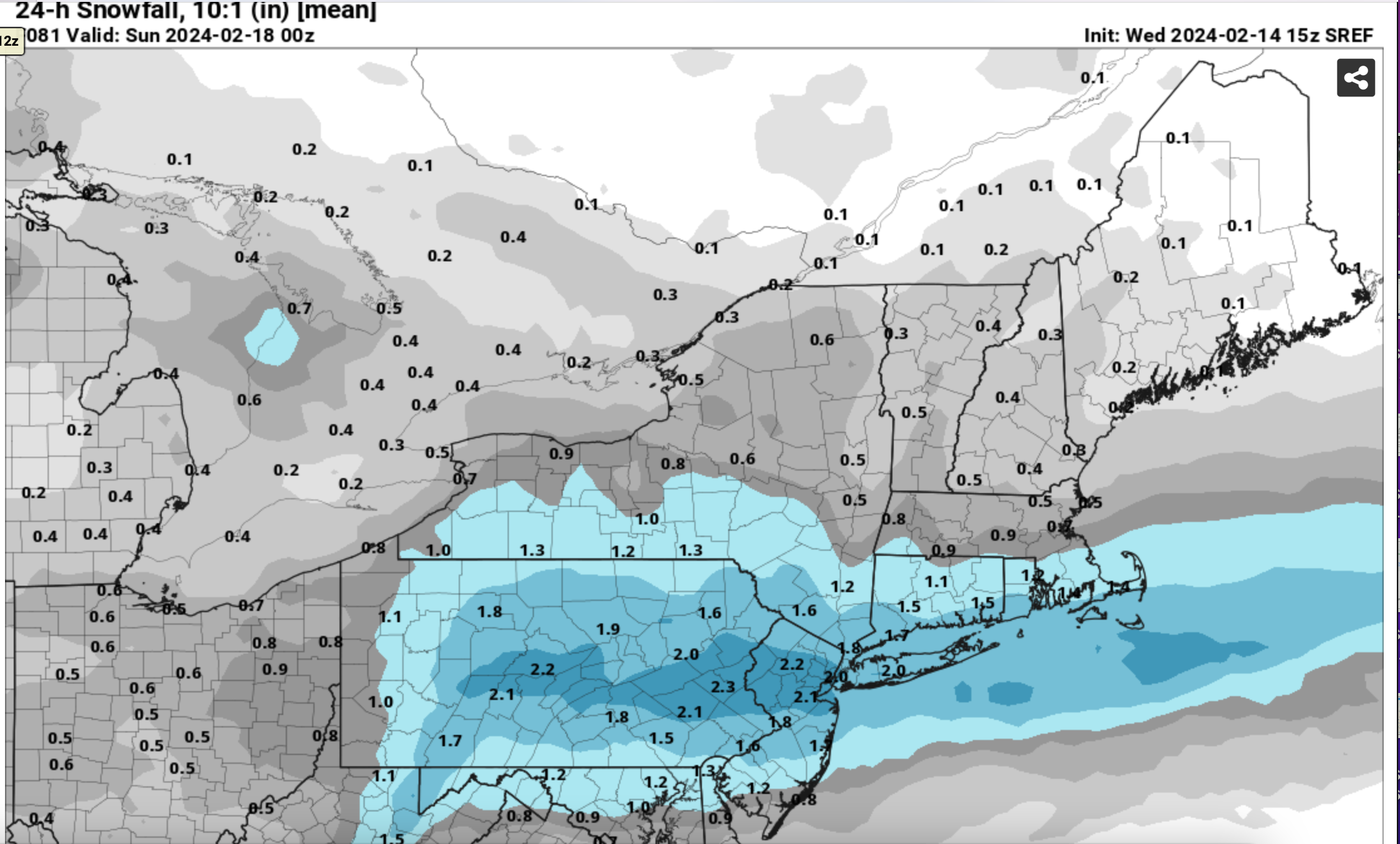
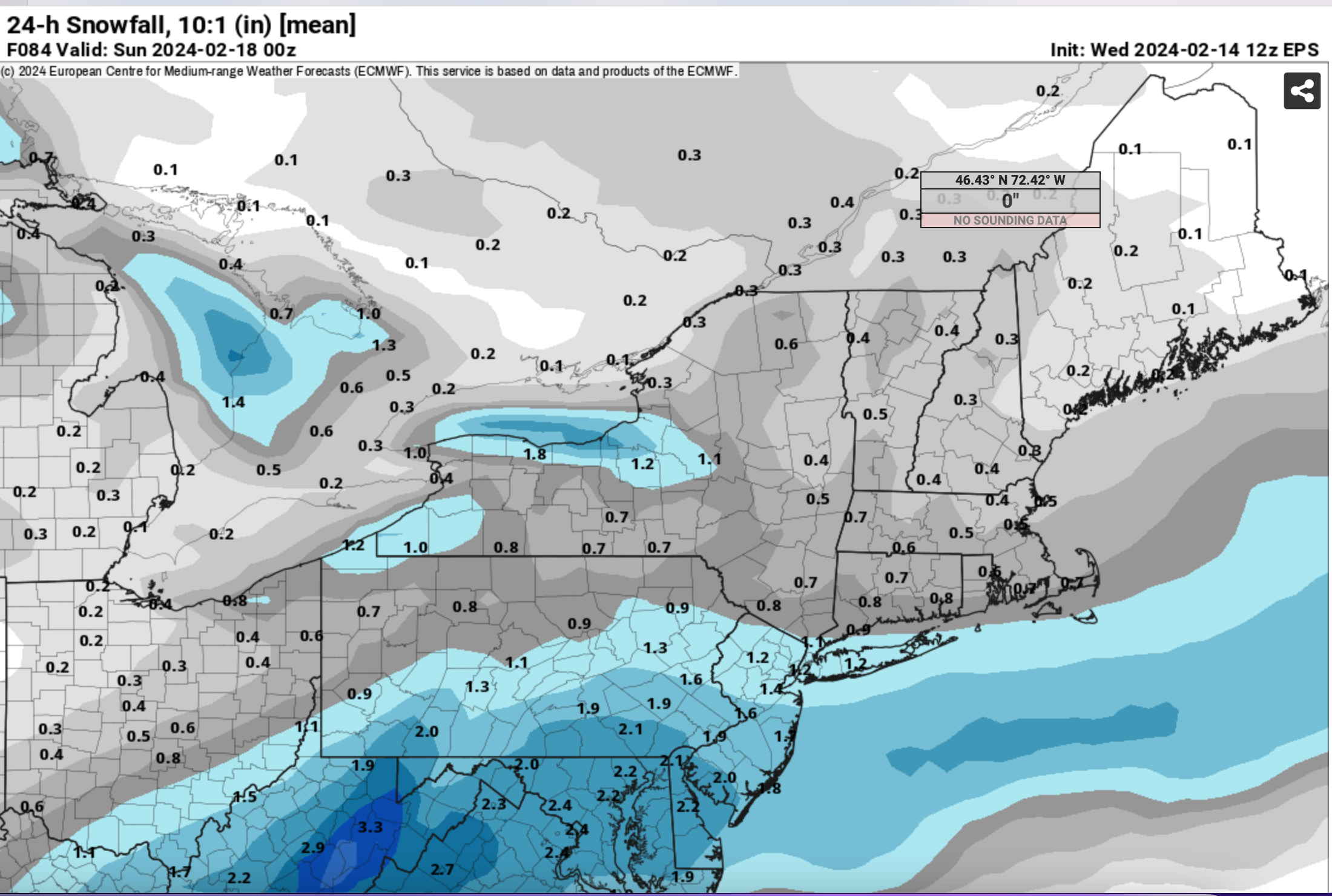
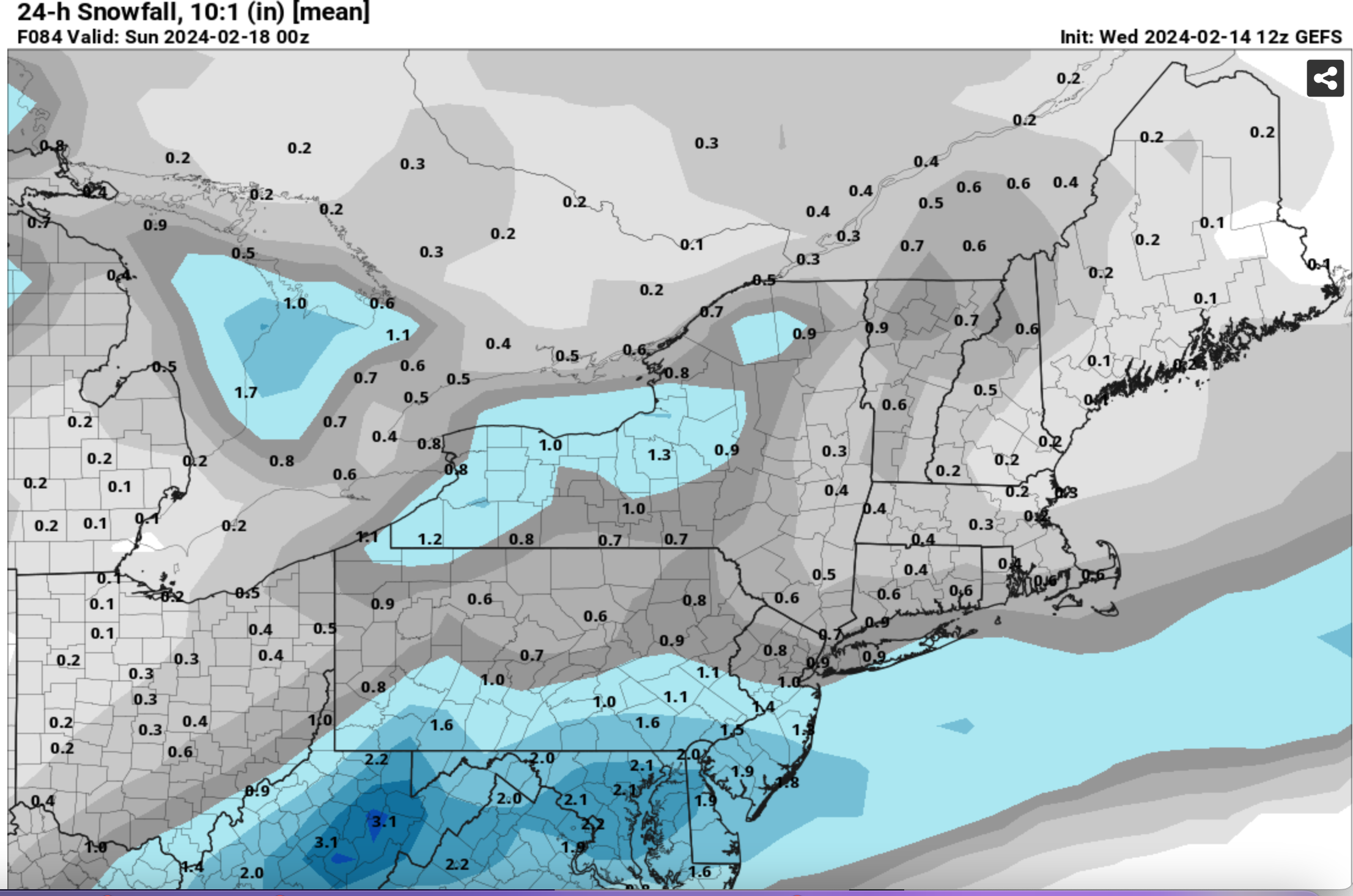
Ensembles (10-1 SLR) will be attached for the anticipated results of a western Canadian short wave digging into the northeast USA Saturday morning.
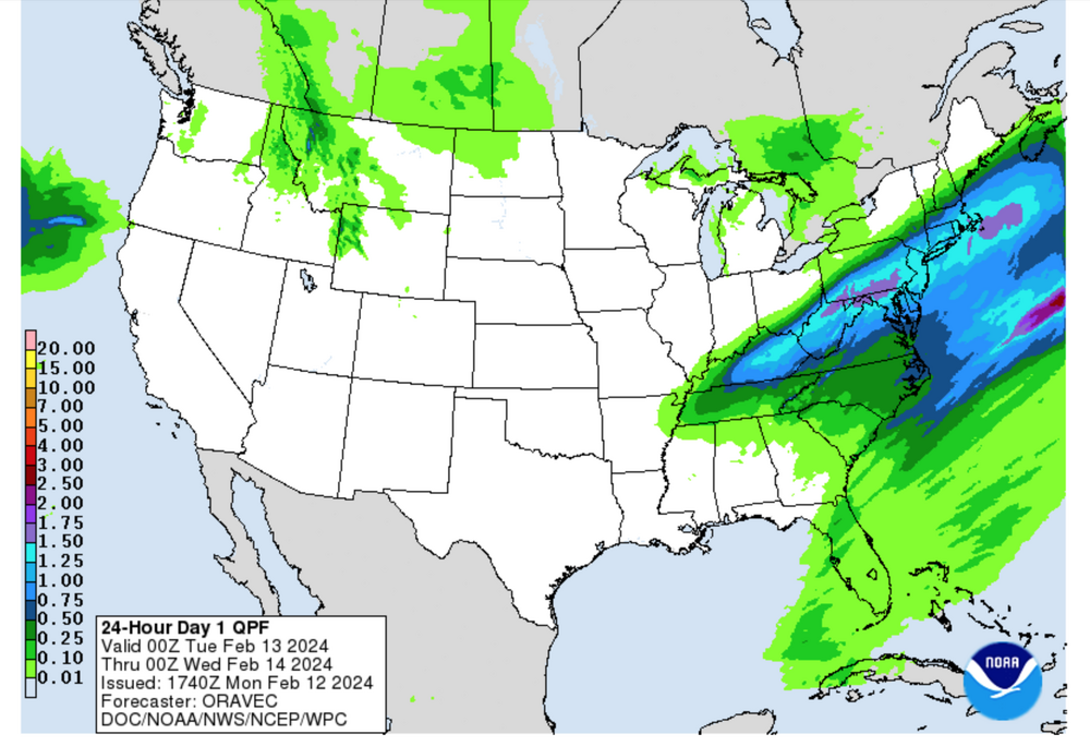
Latitude of the leading low pressure system will assist determining the axis of best snowfall which for the most part on 2/14 is near PHL. The SREF of 15z/ 14 is closest to I80-LI. Amounts with subfreezing surface temps and accumulation on all untreated surfaces could range roughly anywhere 1/2 to 4".
A conservative approach right now from the modeling, is to expect less than 2 inches I80-LI northward and a bit more to the south of I80.
There will be modest lift in the DGZ (GFS/NAM not shown) and what seems to be a nice 3 hour period of decent snowfall near sunrise as seen in the NAM Banding tool (not shown).
A sample of the GFS model SLR for 12z Saturday leads the imagery and reflect higher ratios north of I80 and about 9 to 1 for LI.
Hopefully we can enjoy more snow. Added the 12z/14 GEFS snowfall chart at 441PM. This weekend we can look back at reality vs modeling.
Corrected date 18th to 17th at 828PM Thu the 15th. No other changes needed at this time. Max snowfall axis continues near the Mason Dixon line where watches and/or advisories are already posted for NJ/PA/MD. Some modeling have the max axis a little further north near I78. 18z/15 GFS op has increased snowfall ratio for LI 11 to 1 for early Saturday.
Title simplified 704PM Fri Feb 16.
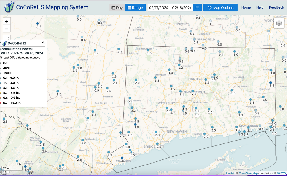
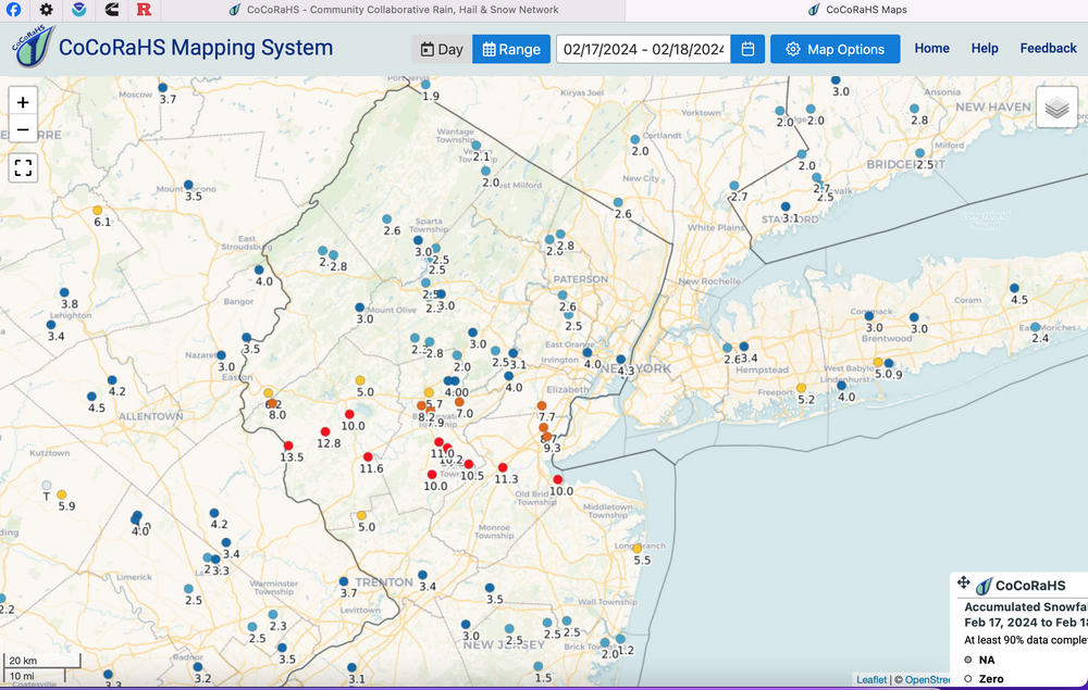
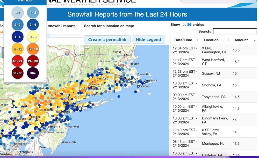
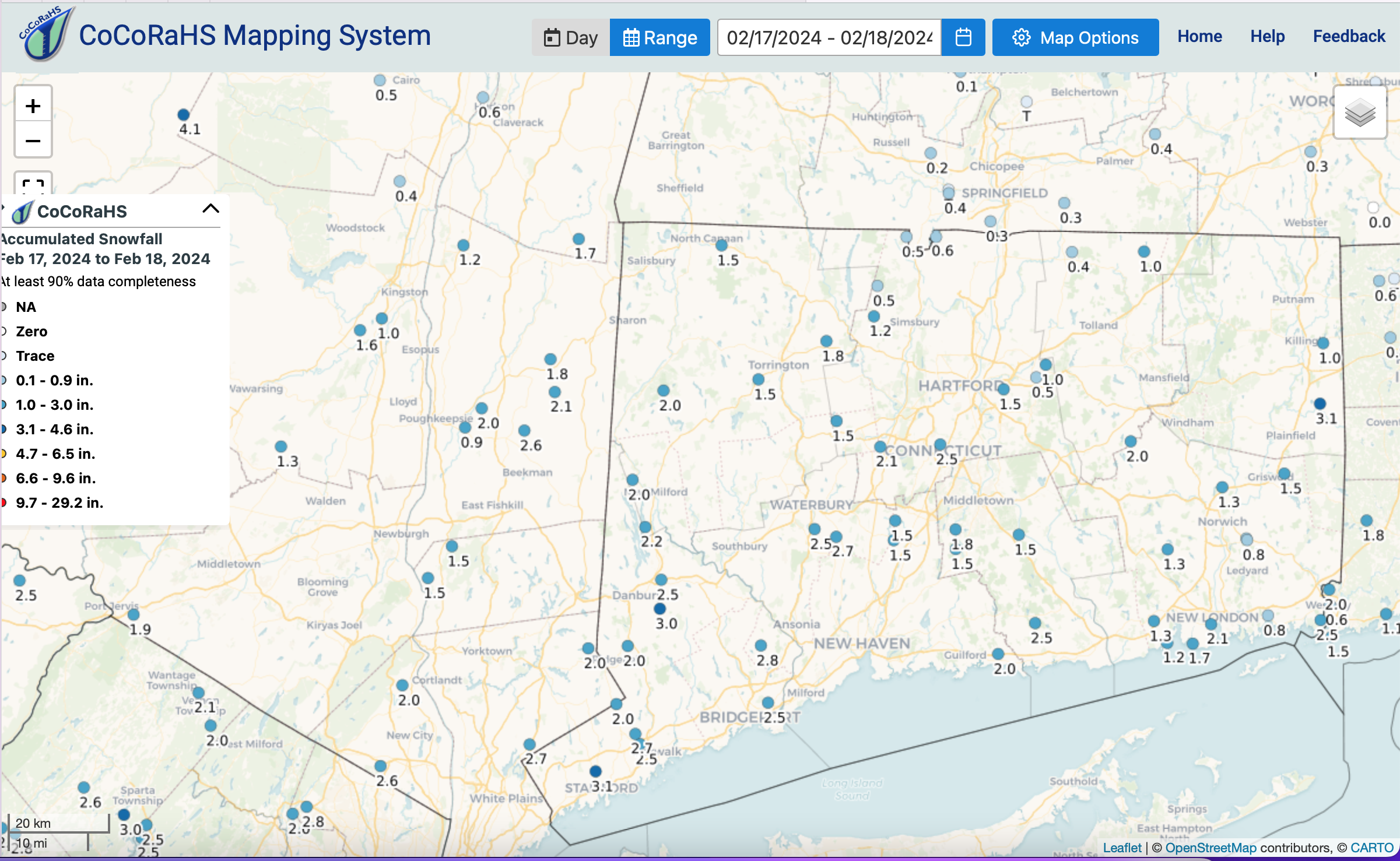
Verification added at 1PM/18 via NOHRSC and CoCoRaHS with the infamous banding near I78 that dumped 6-13" from s LI beaches west to Allentown.
DCA 0.1, BWI 2.2, PHL 2.6, ABE 5.7, NYC CP 2.0, BDL 0.7, ORH 0.5w, and BOS T. looks to me like GEFS did best using the initial ensembles within this thread.

-
3
-
-
I plan to get the thread started at530 PM with multi ens and broad wording. It wlll have “refresher” and “obs” in the title attempting to limit title changes. especially only 72 hours out.
Have not been using UKMET thos year.
Also these events are worthy of model perception perspective. Only imo, EC is no longer the constant King.
-
2
-
1
-
-
Caution on tossing the towel before 2/25. I do think we will warmup big time the first few days of March, if not around 2/28-29. BUT... weeklies seem optimistic about multiple qpf opportunities in March. We'll know I think at 4PM Friday when the updated March monthly posts from CPC.
In the meantime, minor minor Thu night.
Will re review at 530PM for a 1-4" refresher thread NJ-LI portion of the forum, so snow starve. Looks too me like a nice colder consistency Saturday morning.
2/22-24 is on... no thread but pretty sure large winter storm then. Probably a little too warm here, but maybe not, so keep monitoring the ensembles/ops reading up.
-
4
-
-
4 hours ago, the_other_guy said:
You and Don did an excellent job. Early Spring type snow event
Don good... myself shaky. I wasn't going to thread for another day or 2 cause this was north of NYC event. However, the NAM eventually had me concerned about NYC-PHL and to an extent the EPS trying to reclose the 500MB ow as it crossed the mid Atlantic to our south but that consistent NAM got my attention-concern for NYC.
Anyone who wants to go back to p1 of this thread to check the ensembles... including WPC... you can see how far in error they were at D5! EPS was closest but all were north up near I84.
Am concerned that we maneuver our forecasts too much to the EPS. I do not believe the EC is KING of the hill anymore (as a friend referenced)... recent past couple years have been shaky, especially yesterdays 12/12 version which forced too much northern retraction of snowfall.
Anyone notice the power outages near I78 e central PA and w central NJ today. Probably near 33F wet snow 6+?
I'll add NOHRSC analyzed snowfall to p1 when its ready.
-
4
-
-
Aside from the minor brief snow showers Thu night, and a possibly nice wet snow that will melt a fair amount on pavement Saturday; the 22nd-24th is ensemble supported with a potential coastal event per CMCE, GEFS, EPS all showing an inch or so, 7-9 days in advance. Seems minor but it's something and it may incorporate a southern stream short wave.
-
8
-
-
Thread was good-worked out with all the model variability.
Eyeball idea of max snow axis attached. Very sharp northern cutoff N of I84. Click for clarity.
Little doubt in mind that Postitive snow depth change is an excellent bottom amount of expectations-it's conservative and can temper enthusiasm, then you handle the upside range as you wish via 10 to1, Kuchera , HREF.
-
3
-
-
CP snowfall today?
-
1
-
-
Wantage NJ, this part anyway a solid 11 inch event with a solid com-acted SD of 9.5-10" everywhere.
Season just over 30", heaviest since the 20-21 season.
-
6
-
-
Wantage NJ (this southern part) 8.5" as of 830AM with one snow board clearing 630A. 3.5" past 2 hours. SOLID 8" on the ground due to wind compacting. 28.8F.
-
2
-
-
Wantage NJ this southern part. 5" solid snow cover. 28.8F. snow light-moderate rates.
-
3
-
-
Wantage NJ (this southern part): 4" so far. Wind causing some blowing and drifting but a solid 4 out there. Will clear snow boards at 7A. btw: 1.8" past 85 minutes. Walt
-
5
-
-
Wantage NJ 345AM. 2.2" and moderate snow (yellow on radar scope). 29.5F
-
1
-
-
Sensitive interactions from the northerly NAM/GFS/HRRR to the southerly models (EC) that do not match the just issued WPC 17z/12 D1 QPF. Also, the WPC snow amount probs are quite high N of I80. So, as someone said, spooky-unsettling but we 've got to go with as smart a forecast we can.
How about the SPC HREF: Yikes. Huge. One thing I see is that banding should be pretty large Poconos through nw NJ se NYS-CT-BOS near and just of I84 per 12z/12 NAM HRRR and HREF. Again though its your modeling of choice.
-
2
-
-
fwiw...
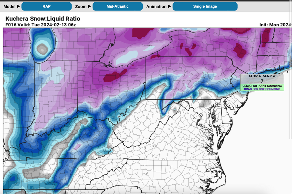
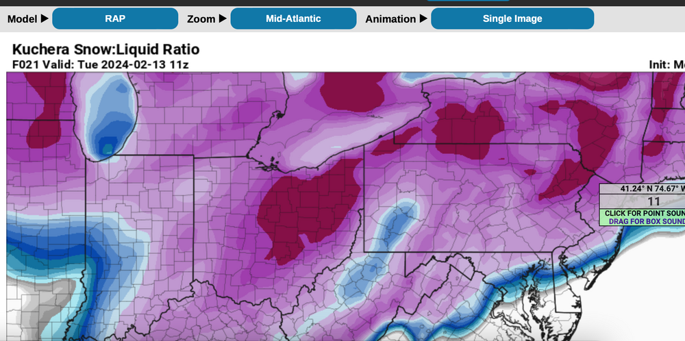
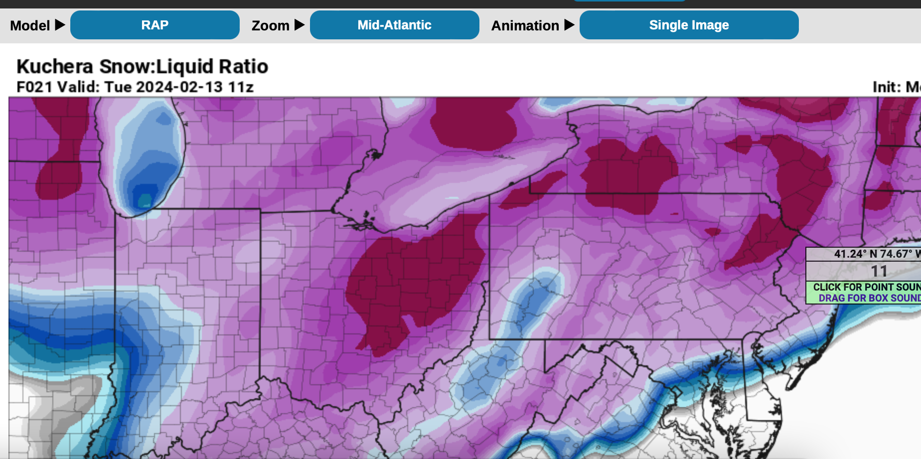
f you're interested in hourly snow ratio's it's on the RAP. I just sampled nw NJ at 6z and 11z as the vertical column cools...going from 7 to 1 at the start to 11 to 1 by 11z. NYC prior to 12z probably 7 or 8 to 1.
-
3
-


February 2024
in New York City Metro
Posted
No March thread yet... but adding here since I dee March winter or nn winter possibilities being discussed.
March is about good good timing. Looks possibly wetter than normal an∂ once we rid ourselves of excessive early March warmth?, then maybe one ore wet mow for NYC?
the 2/15 CPC march outlook update is attached.
btw..CPC proabilities continues slight chc heavy snow here near 2/24.