

weathermedic
-
Posts
2,235 -
Joined
-
Last visited
Content Type
Profiles
Blogs
Forums
American Weather
Media Demo
Store
Gallery
Everything posted by weathermedic
-
.05 here so far
-
Looks like showers popping up SW to NE from Breezy Point to Valley Stream
-
Severe thunderstorm warning for Bronx and Queens just issued until 5pm. 60 mph winds possible.
-
Echo tops with some of the storms in NJ are over 30,000 feet. Not very common around these parts. The one just north of Morristown is showing 37,000 ft.
-
Tornado watch through 9pm for a large part of the area including NYC
-
Mesoscale Discussion 1690 NWS Storm Prediction Center Norman OK 1223 PM CDT Tue Jul 21 2026 Areas affected...portions of the Mid-Atlantic into the Northeast Concerning...Severe potential...Watch likely Valid 211723Z - 211930Z Probability of Watch Issuance...80 percent SUMMARY...Increasing storm coverage is expected through the afternoon and will necessitate a watch. DISCUSSION...Recent composite radar indicates increasing shower and thunderstorm coverage across eastern Pennsylvania on the leading edge of mid 70s dewpoints as they advect northward. Most of this activity is moving away from the greater moisture/instability, but continued northward destabilization is anticipated. In addition, broken cloud cover across southeast Pennsylvania and New Jersey will result in greater instability within this zone. The leading edge of a 50 knot mid-level jet (centered around 5-6km) has been sampled by the CCX VWP within the last half an hour. As this overspreads the warm sector, shear will be in place for storm organization, including supercells. Damaging winds will be the primary threat, but some large hail and a few tornadoes will also be possible. The greatest threat will be across southeast Pennsylvania and New Jersey, where the greater instability is in place. However, as the warm front lifts northeastward, the threat could extend into southeast New York and Connecticut this afternoon. ..Bentley/Mosier.. 07/21/2026 ...Please see www.spc.noaa.gov for graphic product... ATTN...WFO...BOX...OKX...ALY...PHI...BGM...CTP...LWX... LAT...LON 39187437 38877495 39457648 39867689 41097690 42277653 42657593 42727456 42487358 42037309 41257279 40597287 40417378 39187437 MOST PROBABLE PEAK TORNADO INTENSITY...85-110 MPH MOST PROBABLE PEAK WIND GUST...55-70 MPH MOST PROBABLE PEAK HAIL SIZE...1.00-1.75 IN
-
Good technical discussion from the AM OKX AFD: .DISCUSSION... .KEY MESSAGE 1... An upper level trough digs down into the Great Lakes Saturday and swings across eastern Canada and the northeast US Saturday night. Ahead of this feature, shortwave energy will pass across the area this afternoon as a warm front lifts north of the area into the afternoon. A pre-frontal trough will follow late in the afternoon with the main cold front moving across the area this evening with the potential of another line of showers/storms. Severe thunderstorms and potential flash flooding are the main concerns this afternoon and evening. It is important to note the exact location of the severe and flooding hazards may not become clear until a few hours before the onset due to the aforementioned uncertainties. PWATs are progged to reach between 2 and 2.25 inches, which is well above the observed 90th percentile per OKX RAOB climo. Freezing levels look to range from 13-15 kft with deep warm cloud layers, supporting efficient warm rain processes. These ingredients support the potential for heavy downpours in any convection this afternoon and evening. There is still some uncertainty with the amount destabilization today, especially with lingering smoke this morning and potentially apart of the afternoon (see key message 2 for more details on the smoke). The passage of the shortwave should allow the smoke to move away from the area in the afternoon. The greatest instability may set up just to our southwest, especially as the shortwave moves across the area. There should still be at least 1000-1500 J/kg of MUCAPE, but surface based CAPE could be limited this afternoon, unless greater destabilization occurs further north. The mid level flow is also fast enough to keep the convection moving across the area, which may limit the flooding potential. The latest HREF has a small area of 30 percent chance of greater than 3 inches in 3 hours just south of of our NE NJ and NYC metro zones. This is close to our flood watch and most susceptible areas for flash flooding, so no changes were made to the flood watch. Peak hourly rainfall rates of 1.5-2"/hour are possible. Isolated instances of flash flooding in some urban areas across the I-95 in S CT and potentially western LI are possible, but not enough confidence for an expansion of the watch at this time. WPC has maintained the slight risk for excessive rainfall. SPC has expanded the enhanced risk into much of the Lower Hudson Valley, NE NJ, and NYC metro with a slight risk remaining elsewhere. As noted above, there is uncertainty with the amount of destabilization due to smoke and potential of a round of convection as early as late morning and early-mid afternoon. The 00z HREF is indicated a mean SBCAPE of around 1000 J/kg across NE NJ into the NYC metro, but an ensemble maximum of upwards of 2000-3000 J/kg this afternoon for these areas. Elsewhere, the mean is around 500 J/kg with an ensemble max of 1500-2000 J/kg. The max surface CAPE values are possible if the smoke clears sooner and if the first round of convection is weak or moves out quicker. Bulk shear around 40 kt continues to be progged and there is low level directional shear/curvature in the wind profiles. The main threat from any severe storms will be damaging wind gusts. There is also a risk of a tornado, especially if the warm front lingers nearby, which would enhance low level helicity and shear. If we are able to get clearing and the first wave does not leave behind subsidence, then the potential line of storms with the cold front/pre-frontal trough could also contain a few severe thunderstorms. The cold front moves through the area around midnight, bringing an end to the threat of showers and thunderstorms. .KEY MESSAGE 2... Smoke is beginning to filter back into the area from the south early this morning as high pressure has moved offshore. HRRR, RAP, and RRFS smoke fields all show areas of smoke lingering across the area this morning and potentially into a portion of the afternoon. The smoke should begin to clear out and move to the east as a shortwave and showers/storms move across the area. There will be reduced air quality and visibilities into at least the early afternoon. NYDEP, NJDEP, and CTDEEP all have air quality alerts in effect until midnight.
-
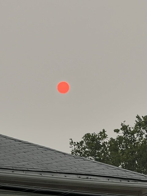
The sun is literally a red ball in the sky
-
90/72 HI 98
-
Looks like rain is increasing in intensity and coverage over the extreme south shores of Brooklyn, Queens and Nassau
-
BULLETIN - EAS ACTIVATION REQUESTED Flash Flood Warning National Weather Service New York NY 119 PM EDT Thu Jul 9 2026 The National Weather Service in Upton has issued a * Flash Flood Warning for... Kings (Brooklyn) County in southeastern New York... Richmond (Staten Island) County in southeastern New York... * Until 415 PM EDT. * At 119 PM EDT, Doppler radar indicated thunderstorms producing heavy rain across the warned area. The expected rainfall rate is 1.5 to 2.5 inches in 1 hour. Additional rainfall amounts of 1 to 3 inches are possible in the warned area. Flash flooding is ongoing or expected to begin shortly. HAZARD...Flash flooding caused by thunderstorms. SOURCE...Radar. IMPACT...Flash flooding of small creeks and streams, urban areas, highways, streets and underpasses as well as other poor drainage and low-lying areas. * Some locations that will experience flash flooding include... Flatbush, Coney Island, Todt Hill, Crown Heights, The Verrazano Narrows Bridge, Huguenot, Canarsie, Bay Ridge, Port Richmond, Tottenville, Tompkinsville, Bensonhurst, Oakwood, Park Slope, Sheepshead Bay, Annadale, New Dorp, Grasmere, Heartland Village and Greenridge.
-
Lots of lightning with that cell in central NJ
-
6 inches since last night at my station in Sheepshead Bay Brooklyn. My little bit of lawn won't be brown too much longer!
-
Westbound Belt Parkway in Brooklyn closed at Cropsey Ave due to flooding
-
4.28 inches so far since midnight at my station
-
Upton still on the rain train as per their AM Discussion: A stationary front will remain south of Long Island today. Multiple rounds of heavy rain, along with embedded thunderstorms are expected as a series of shortwaves ride along the boundary through tonight. Showers along with embedded thunderstorms are expected to continue through much of the day today as better upper level support/jet energy moves into the region. Conditions remain favorable for torrential rainfall rates/flooding today due to a humid air mass over the region. PWATs remain around 2 inches areawide today, although PWATs of 2+ inches may periodically advect into the southern portion of the area, which is higher than daily max sounding climatology values. Some of the 00z forecast models have indicated PWATs maxing out closer to 2.4 inches. With an easterly flow, mainly parallel to the frontal boundary, training of storms will be likely with potential for backbuilding. 00Z HREF probabilities for 3 inches of rain or more in 3 hours highlights portions of the NE NJ, NYC and Long Island in a 30 percent contour for this evening into tonight, which is typically a good indication of flash flooding potential for this area. As a result, WPC has placed NYC, Long Island and southern CT in a moderate risk for excessive rainfall today. In terms of rainfall amounts, storm total QPF through Tuesday will likely range between 2 and 3 inches with locally higher amounts of 4+ inches. Rainfall rates will likely be 1-2 inches per hour with locally higher rates possible. The main area of uncertainty with the forecast is where the highest rainfall totals and resulting flooding will occur and will depend on the exact placement of the frontal boundary. Flooding impacts would be highest in urban and poor drainage areas in addition to the most responsive rivers/creeks/streams.
-
2.6 overnight at my station
-
Got 1.20 from that line
-
Got .5 already with a 7”/hr peak rate so far
-
Storms with nice outflow boundary heading towards the nyc area from central Jersey
-
.08 of rain and temp dropped to 77
-
Intense rain and wind here now. A few lightning strikes
-
The National Weather Service in Upton NY has issued a * Severe Thunderstorm Warning for... Hudson County in northeastern New Jersey... Southeastern Bergen County in northeastern New Jersey... Queens County in southeastern New York... Kings County in southeastern New York... New York (Manhattan) County in southeastern New York... * Until 830 PM EDT. * At 753 PM EDT, a severe thunderstorm was located over Secaucus, moving southeast at 35 mph. HAZARD...70 mph wind gusts. SOURCE...Radar indicated. IMPACT...Expect considerable tree damage. Damage is likely to mobile homes, roofs, and outbuildings. * This severe thunderstorm will be near... Hoboken and Midtown Manhattan around 800 PM EDT. Crown Heights around 805 PM EDT. Forest Hills and Canarsie around 810 PM EDT. Howard Beach around 815 PM EDT. Kennedy Airport around 820 PM EDT. This includes the following event locations New York/New Jersey Stadium, Brooklyn Bridge Park, Liberty State Park, Governors Island, Battery Park, Hoboken Waterfront, Hudson River Park Pier 34, Riverside Park South at 66th Street, Riverside Park North at 113th Street, East River Promenade, and Hunters Point.
-
Special Weather Statement National Weather Service New York NY 734 PM EDT Fri Jul 3 2026 NJZ004-006-104>106-NYZ072-074-176-040000- Hudson NJ-Eastern Essex NJ-Western Essex NJ-Eastern Bergen NJ- Eastern Passaic NJ-Northern Queens NY-New York (Manhattan) NY- Richmond (Staten Is.) NY- 734 PM EDT Fri Jul 3 2026 ...A STRONG THUNDERSTORM WILL IMPACT HUDSON...EASTERN PASSAIC... SOUTHEASTERN BERGEN...ESSEX...RICHMOND AND NEW YORK (MANHATTAN) COUNTIES THROUGH 800 PM EDT... At 734 PM EDT, Doppler radar was tracking a strong thunderstorm near Bloomfield, moving southeast at 35 mph. HAZARD...Wind gusts up to 50 mph. SOURCE...Radar indicated. IMPACT...Gusty winds could knock down tree limbs and blow around unsecured objects. Locations impacted include... Newark, Jersey City, Paterson, Passaic, Bayonne, Hoboken, Bloomfield, Orange, Lyndhurst, Rutherford, Secaucus, Harrison, Ridgefield, Caldwell, and Midtown Manhattan. This includes the following event locations New York/New Jersey Stadium, Brooklyn Bridge Park, Sports Illustrated Stadium, Liberty State Park, Sullivans Homeport Pier, Battery Park, Hoboken Waterfront, Hudson River Park Pier 34, Riverside Park South at 66th Street, Riverside Park North at 113th Street, East River Promenade, Hunters Point, Hinchliffe Stadium in Paterson NJ, and Staten Island University Hospital Community Park.
-
Severe thunderstorm watch extended to cover NYC and Nassau: THE NATIONAL WEATHER SERVICE HAS EXTENDED SEVERE THUNDERSTORM WATCH 448 TO INCLUDE THE FOLLOWING AREAS UNTIL 11 PM EDT THIS EVENING IN NEW JERSEY THIS WATCH INCLUDES 2 COUNTIES IN NORTHEAST NEW JERSEY BERGEN HUDSON IN NEW YORK THIS WATCH INCLUDES 9 COUNTIES IN SOUTHEAST NEW YORK BRONX KINGS (BROOKLYN) NASSAU NEW YORK (MANHATTAN) PUTNAM QUEENS RICHMOND (STATEN ISLAND) ROCKLAND WESTCHESTER


