SchaumburgStormer
-
Posts
5,198 -
Joined
-
Last visited
Content Type
Profiles
Blogs
Forums
American Weather
Media Demo
Store
Gallery
Posts posted by SchaumburgStormer
-
-
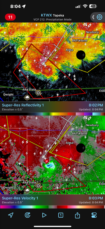
Pretty awesome radar signature out in Kansas
-
 4
4
-
-
5 hours ago, cyclone77 said:
Never been a big fan of these kind of setups where the east/west front starts to crash southward during the warmest part of the day, as some models show. Seems like with the good setups the warm front will at least slowly advance northward during the daytime at least.
Yeah, seems for the good ones at this time of year we are tracking the front northwards waiting for it to get hung up along I-80, lol
-
1 hour ago, A-L-E-K said:
glad we'll get some more rain this week, feels like d1 never too far away
For sure. All it takes is a 2 week stretch of below normal precip and above normal temps and suddenly we are getting creeped on by the brown on the map
-
 1
1
-
-
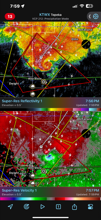
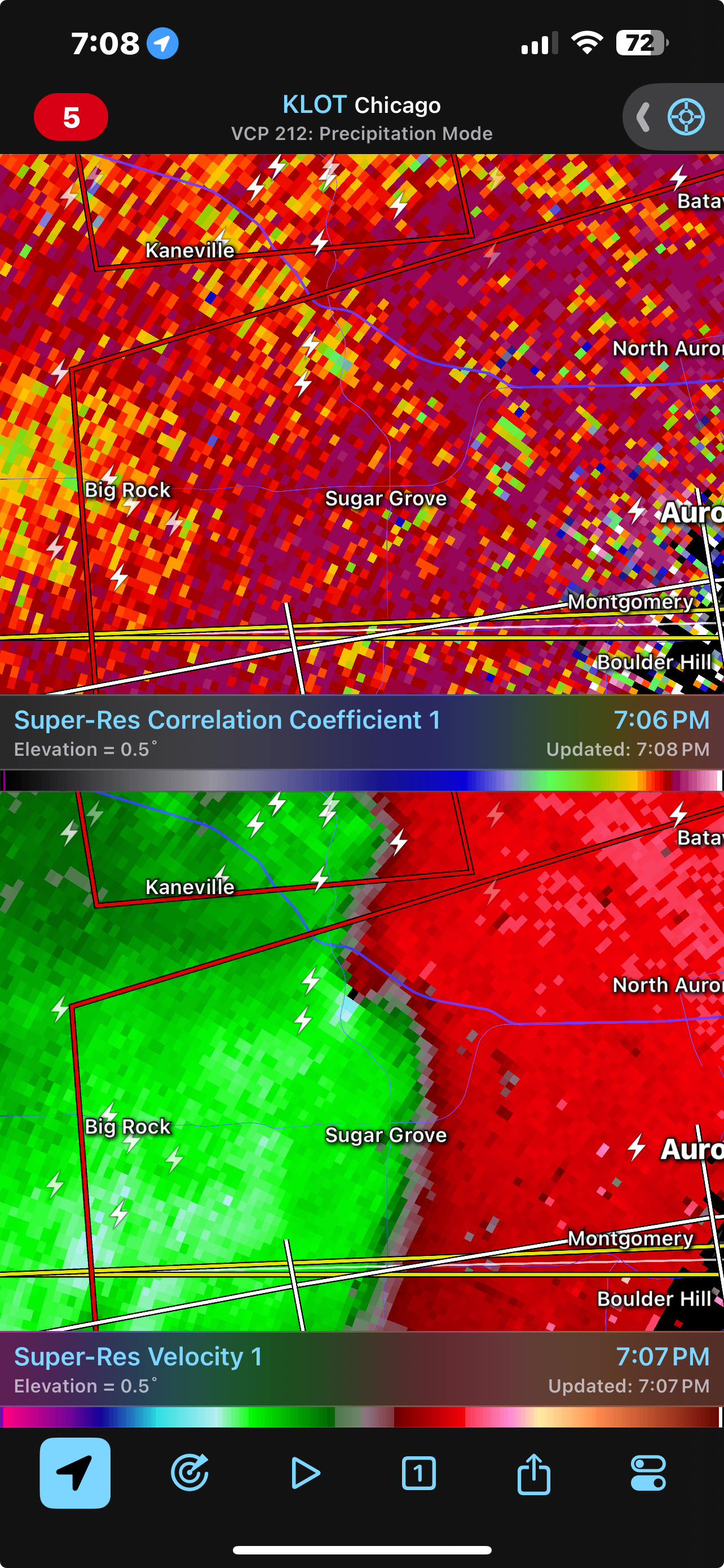
Looks like another spin up just west of Geneva
-
1
-
-
2 minutes ago, SchaumburgStormer said:
Tornado just crossed 88
Need to extend the warning for St Charles/Geneva. Still OTG
-
Tornado just crossed 88
-
-
TDS on the Waterman/Hinkley cell
-
2 minutes ago, SchaumburgStormer said:
Warned
Really tightening up
-
5 minutes ago, SchaumburgStormer said:
Broad rotation just south of dekalb
Warned
-
Broad rotation just south of dekalb
-
2 minutes ago, Malacka11 said:
That's one wacky looking velocity signature or is it just me
Been condensing and tightening for awhile. Good broad rotation with several embedded areas of tighter rotation
-
1
-
-
3 minutes ago, SchaumburgStormer said:
Big cell headed towards DeKalb county could be trouble for the metro if it gets better organized
And it’s T warned
-
Big cell headed towards DeKalb county could be trouble for the metro if it gets better organized
-
1 minute ago, andyhb said:
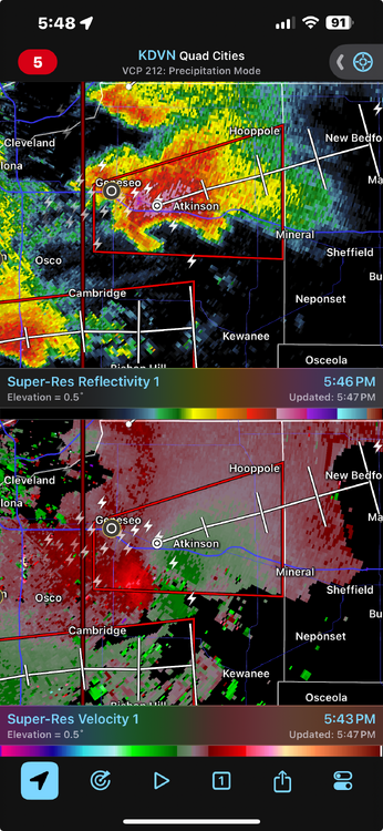
Anyone here on that Atkinson storm? Looks pretty close to producing.
Thing looks beautiful. Would be shocked if it doesn’t have something OTG. Not a lot in that part of the state for it to chew on
-
Just now, SchaumburgStormer said:
Beautiful hook echo on that geneseo cell
-
Beautiful hook echo on that geneseo cell
-
1
-
-
Gnarly looking hail core near @cyclone77
-
Unzipping to the SW of the initial storm. Off to the races
-
1
-
-
1 minute ago, SchaumburgStormer said:
Absolutely explosive growth on that cell in NW IL
Been a storm for 10 minutes and already mping reports of 1” hail
-
2
-
-
Absolutely explosive growth on that cell in NW IL
-
1
-
-
Watch is out for N IL, 60/40 tornado probs
-
1
-
-
74/54. Dews holding steady in the mid 50's.
-
1 hour ago, A-L-E-K said:
riding it
This is our moment.


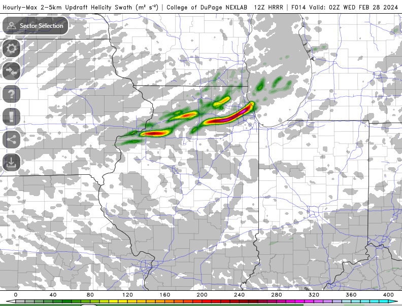
Severe Weather 3-13 through 3-16-24
in Central/Western States
Posted
This thing is probably picturesque. Awesome
radar presentation.