

SchaumburgStormer
-
Posts
5,189 -
Joined
-
Last visited
Content Type
Profiles
Blogs
Forums
American Weather
Media Demo
Store
Gallery
Posts posted by SchaumburgStormer
-
-
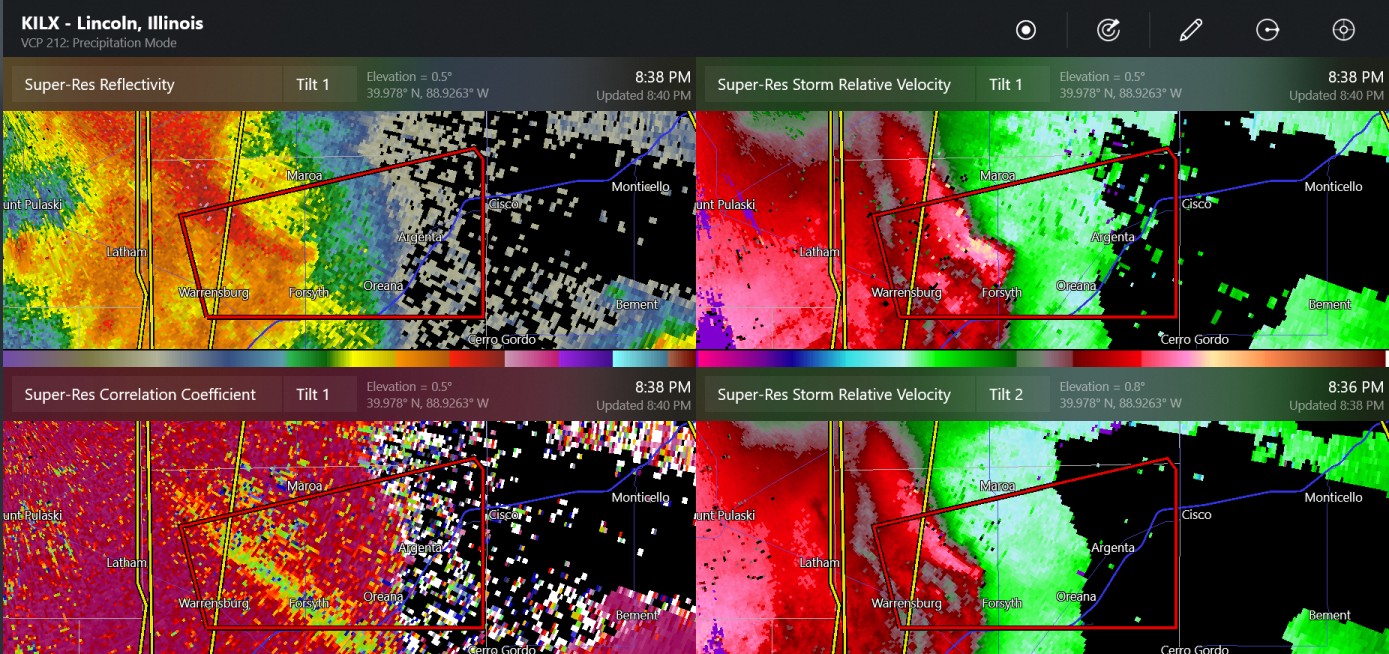
At least 1 tor confirmed in central IL last night thus far
-
 1
1
-
-
8 hours ago, rainsucks said:
I'm not even convinced yet that next week's will pan out as currently modeled by guidance. I'm not saying it won't, but the models continue to overdo the intensity of cold shots time and time again, so I'm a bit skeptical.
Its nice to be back at the time of the year where a "cold" shot still leaves us in the upper 50's for highs.
-
3
-
-
9 minutes ago, Chinook said:
possible tornado south of Lincoln Illinois
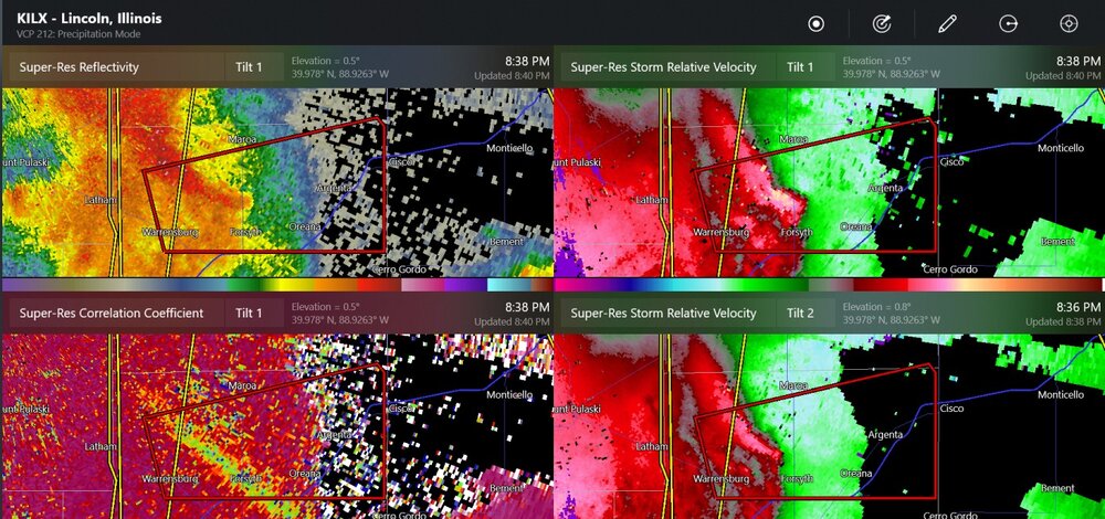
Rocking some pretty solid wind gusts in that area as well
-
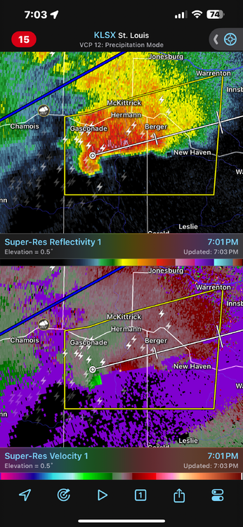
Blanket tornado warning on that big line on S IL.
-
Planted a bunch of peas over the weekend, can use the rain and if we avoid the frost over the weekend that would be golden
-
Whole lot of “meh” so far
-
1 hour ago, A-L-E-K said:
another brief cool down before real sustained warmth?
This cool down appears to be moderating as we get closer as well.
Getting into the season where full sun will push you to overperform by 2-3 degrees.
-
4
-
-
Extended looks to be seasonal or slightly above. No significant cold to speak of, green up will be off to the races.
-
9
-
-
Snow globing, but melting on contact now.
-
1
-
-
Things seem to be “meh” across Illinois so far this evening
-
Another storm west of STL looking nasty too
-
9" report coming out of Rockford within the band
-
6
-
-
46 minutes ago, Geoboy645 said:


You could say that yeah. So much for those futility records lol.
You guys can keep it. Once we get that first hit of spring my "snow weenie switch" turns off.
-
1
-
 2
2
-
-
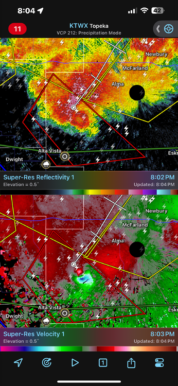
Reports of some big hail NW of STL
-
PDS warning, then the new one upstream is “radar indicated rotation”. They can probably update that, it is for sure producing
-
2
-
-
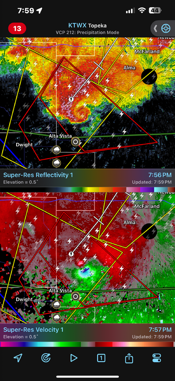
This thing is probably picturesque. Awesome
radar presentation.
-
1
-
-
Pretty awesome radar signature out in Kansas
-
4
-
-
5 hours ago, cyclone77 said:
Never been a big fan of these kind of setups where the east/west front starts to crash southward during the warmest part of the day, as some models show. Seems like with the good setups the warm front will at least slowly advance northward during the daytime at least.
Yeah, seems for the good ones at this time of year we are tracking the front northwards waiting for it to get hung up along I-80, lol
-
1 hour ago, A-L-E-K said:
glad we'll get some more rain this week, feels like d1 never too far away
For sure. All it takes is a 2 week stretch of below normal precip and above normal temps and suddenly we are getting creeped on by the brown on the map
-
 1
1
-
-
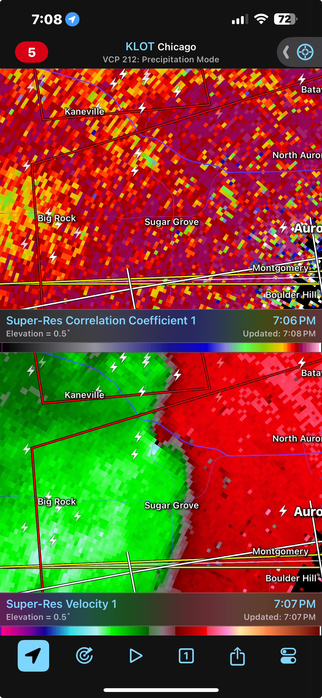
Looks like another spin up just west of Geneva
-
1
-
-
2 minutes ago, SchaumburgStormer said:
Tornado just crossed 88
Need to extend the warning for St Charles/Geneva. Still OTG
-
Tornado just crossed 88
-
-
TDS on the Waterman/Hinkley cell


April 2024 General Discussion
in Lakes/Ohio Valley
Posted
Yep dropped to 26 IMBY. Wasn’t expecting it to go quite that low