rochesterdave
-
Posts
6,707 -
Joined
-
Last visited
Content Type
Profiles
Blogs
Forums
American Weather
Media Demo
Store
Gallery
Everything posted by rochesterdave
-
Upstate/Eastern New York
rochesterdave replied to BuffaloWeather's topic in Upstate New York/Pennsylvania
Pretty big bust for CNY. Sucks for them I’m sure. The models have a strong tendency to bring these EC storms too far West. It happens everytime. We gotta remember to adjust those 24-36 hr maps East by about 100 miles or so (200 this time). Winter appears to be over unless you live on the Tug. Hopefully we get one more surprise. Peace! -
Upstate/Eastern New York
rochesterdave replied to BuffaloWeather's topic in Upstate New York/Pennsylvania
NYC gets their i95 storm. -
Upstate/Eastern New York
rochesterdave replied to BuffaloWeather's topic in Upstate New York/Pennsylvania
Doubt anyone west of 81 sees 6”. Even with LES. -
Upstate/Eastern New York
rochesterdave replied to BuffaloWeather's topic in Upstate New York/Pennsylvania
Getting interesting. I might have to eat my hat on this one. At least Concerning Syracuse. Enhancement looking more and more possible. It is fun to watch the SNE boards freak out. I know how they feel. Good luck CNY peeps. -
Upstate/Eastern New York
rochesterdave replied to BuffaloWeather's topic in Upstate New York/Pennsylvania
You gotta quit this storm. I don’t understand you. You hated on the last one up until it buried you and yet you hug this one for zero reason. -
Upstate/Eastern New York
rochesterdave replied to BuffaloWeather's topic in Upstate New York/Pennsylvania
interesting stuff on the Nam. Showing a strong response from Georgian Bay from primary. Rocs only game is to get a similar response. We’d want the primary further SE. meso stuff to keep an eye on. Still expecting Butkus from Buf-Syr. Bing is a roll of the dice. I think mostly east. -
Upstate/Eastern New York
rochesterdave replied to BuffaloWeather's topic in Upstate New York/Pennsylvania
EURO still pretty Far East. It’s a I-95 storm. Euro had interesting ensembles out, yesterday, for next week. I hope to see that again. -
Upstate/Eastern New York
rochesterdave replied to BuffaloWeather's topic in Upstate New York/Pennsylvania
It’d be nice to keep it interesting. Well East of 81 as I see it. Just not enough time. Not enough dig. Not enough negative. Forms to far N. It has a kicker (slow pusher). Just not enough anything. Hope I’m wrong. NAM has been crushing it this year. I’m probably being dumb to discount it. And we have about 2 more model cycles where EC storms trend west (before correcting East in last couple). So 18z- tomorrow’s 6z Nam could be entertaining, if not misleading. -
Upstate/Eastern New York
rochesterdave replied to BuffaloWeather's topic in Upstate New York/Pennsylvania
None of them have a track anywhere near that now. Unfortunately, they all goto the benchmark. It’s NYC- Boston storm. Let’s watch for next week! -
Upstate/Eastern New York
rochesterdave replied to BuffaloWeather's topic in Upstate New York/Pennsylvania
Next one looking less and less interesting. Still time. Not much. -
Upstate/Eastern New York
rochesterdave replied to BuffaloWeather's topic in Upstate New York/Pennsylvania
Lake enhancement never happened for Roc. As a couple of you observed, it was too warm. It was a wetter scenario. We got 10-16” region wide, but came up short my 18” prediction. Syracuse did well... -
Upstate/Eastern New York
rochesterdave replied to BuffaloWeather's topic in Upstate New York/Pennsylvania
My totals were close. Just sayin. LOL -
Upstate/Eastern New York
rochesterdave replied to BuffaloWeather's topic in Upstate New York/Pennsylvania
I love the Canadian model, honestly, it’s a great model. I’m not biting. Not yet. Let’s see the Euro. Im expecting a weak primary that rolls to near Buf and then transfers to Delmarva and scoots to the stupid freaking benchmark. Giving NYC a silly inch. But leaving WNY out of anything real. But damn, Canada gives me hope. We are inside that climo window. I can feel long distance eye rolls by the way. -
Upstate/Eastern New York
rochesterdave replied to BuffaloWeather's topic in Upstate New York/Pennsylvania
12z EPS wants to really keep that LP tucked in. A bit further west and we can talk. I don’t really see what would do that. Anyone? Until then, Nah. -
Upstate/Eastern New York
rochesterdave replied to BuffaloWeather's topic in Upstate New York/Pennsylvania
At first limited glance. This next one should be much less in western zones. GFS does show the coastal retrograde into Maine which might be interesting. As of now, we rely on a weak, rather N primary. I’m not a fan. Yet...Syracuse East might do ok. -
Upstate/Eastern New York
rochesterdave replied to BuffaloWeather's topic in Upstate New York/Pennsylvania
Yeah. Tim and I were rattling that cage. Middle of the night. Nobody cares. Very little drifting due to wetness (I expected drier). -
Upstate/Eastern New York
rochesterdave replied to BuffaloWeather's topic in Upstate New York/Pennsylvania
The ARW/NMM did well. As did RGEM. I’d give it to NAM. Euro was bad. -
Upstate/Eastern New York
rochesterdave replied to BuffaloWeather's topic in Upstate New York/Pennsylvania
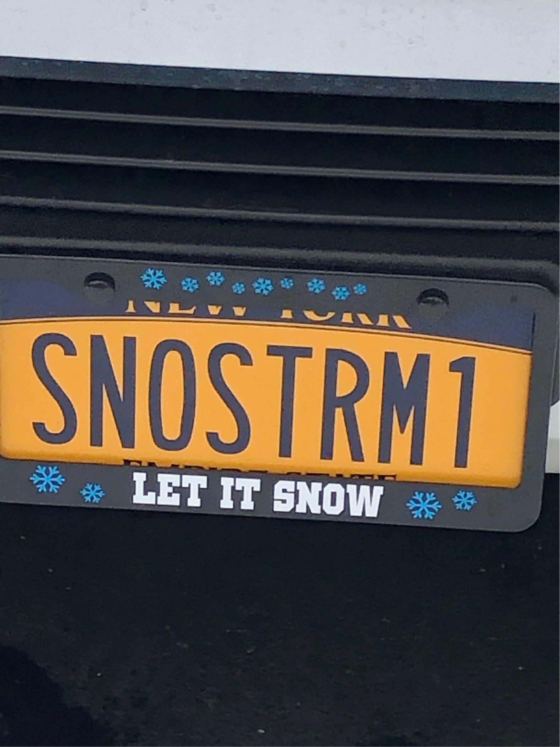
Woodcliff -
Upstate/Eastern New York
rochesterdave replied to BuffaloWeather's topic in Upstate New York/Pennsylvania
Every storm the radars crash. Unbelievable. Took a walk, 14” in the open grassy areas. 2.5” LE. Gonna drive up to Woodcliff peak. Betting on 18-20”. Anyone know what Bristol ended with? -
Upstate/Eastern New York
rochesterdave replied to BuffaloWeather's topic in Upstate New York/Pennsylvania
-
Upstate/Eastern New York
rochesterdave replied to BuffaloWeather's topic in Upstate New York/Pennsylvania
-
Upstate/Eastern New York
rochesterdave replied to BuffaloWeather's topic in Upstate New York/Pennsylvania
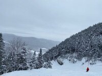
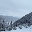
About 10-12” in Pittsford. Great storm. Stayed wetter than I though. Lots of compaction. Probably 2” LE. 15” if measuredwith a board etc. I’m going with a foot. As usual, photos suck and don’t do it justice. -
Upstate/Eastern New York
rochesterdave replied to BuffaloWeather's topic in Upstate New York/Pennsylvania
That’s 5”?!? I need to educate you on how to side stick a ruler. 10”, easy. Lol -
Upstate/Eastern New York
rochesterdave replied to BuffaloWeather's topic in Upstate New York/Pennsylvania
Primary ended up over Williamsport. Just a perfect track. Roc should end with under or about 18”. A big one for us. About as big as this track allows. -
Upstate/Eastern New York
rochesterdave replied to BuffaloWeather's topic in Upstate New York/Pennsylvania
IDK. Roc will end up with 10-18. So Euro isn’t that bad. We are in the pivot now. So halfway at 6-8” ? Good storm.


