

tombo82685
-
Posts
13,428 -
Joined
-
Last visited
Content Type
Profiles
Blogs
Forums
American Weather
Media Demo
Store
Gallery
Posts posted by tombo82685
-
-
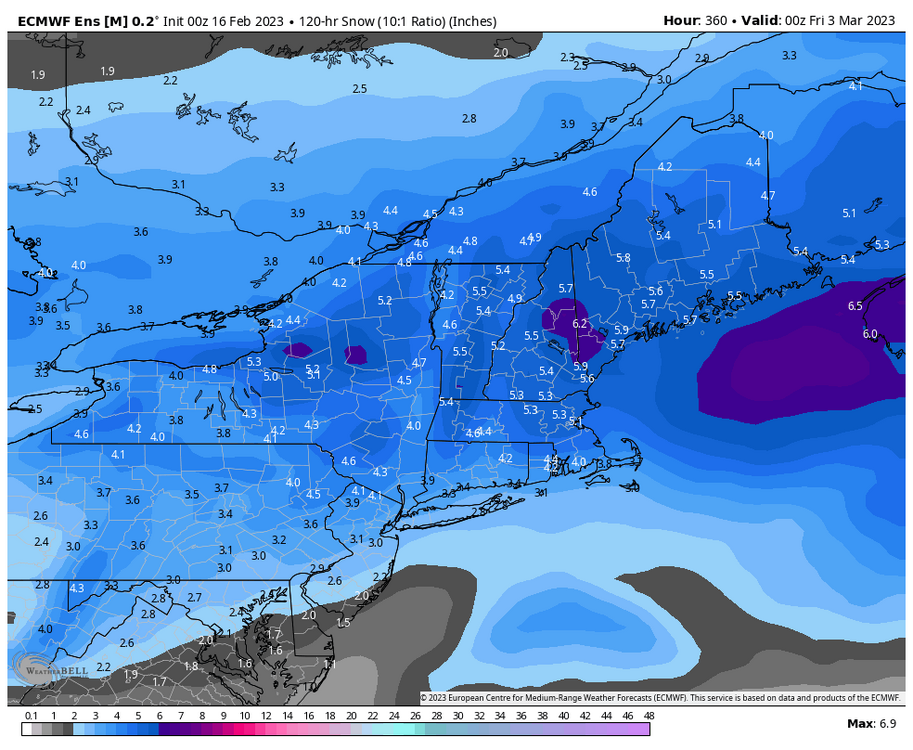
6.2 here so far, season total up to 177”
-
 1
1
-
-
1” new today of wet paste.
-
2" for this last event, models did a good job showing the sucker hole here in the northern tughill. We will see what friday brings
-
2 for the low this morning, hoping to grab 3" or so with this event then see what friday into saturday brings
-
Picked up 3” of fluff today, down to 5
-
1
-
-
nice over performer here with a a bit of upslope helping, 2.2 so far, temp 15
-
1
-
-
1.2” of fluff so far today, temp 13
-
Had .4 last night into this morning, storm total was 6.6. 14 for the high today, currently 8
-
1
-
-
6” last night, hoping for another 1-2 tonight into tomorrow
-
17 right now, 3” down so far with some good returns moving in.
-
Thinking 6-8 here in the northern tug, but could see double digits if we can stay just north of sleet line.
The VT/NH area on northeast looks pretty darn good for early next week system right now as your deeper into the cold than here. Hoping to get something on the back side with some lake effect.
-
3 hours ago, mreaves said:
Where are you reporting on?
I’m in the northern tughill plateau
-
Finished with 1.5 since yesterday morning. That’s a nice euro run, but being close to the edge and seeing that thermal gradient to the south I worry this bumps north as we get closer
-
some lake effect going on this morning, .4 down with some cotton balls falling right now. temp 17
-
1.1 total for the day. Need about 18" rest of the season to get to average. Hopefully next couple weeks produce
-
1” today so far today. Some upslope now temp 16
-
26 and periodic pounding of sleet during heavy precip, zr during lulls
-
8 minutes ago, Sey-Mour Snow said:
EPS day 10-15 is pretty nice. Might have to punt next week down south for us but post next week is looking nicer.

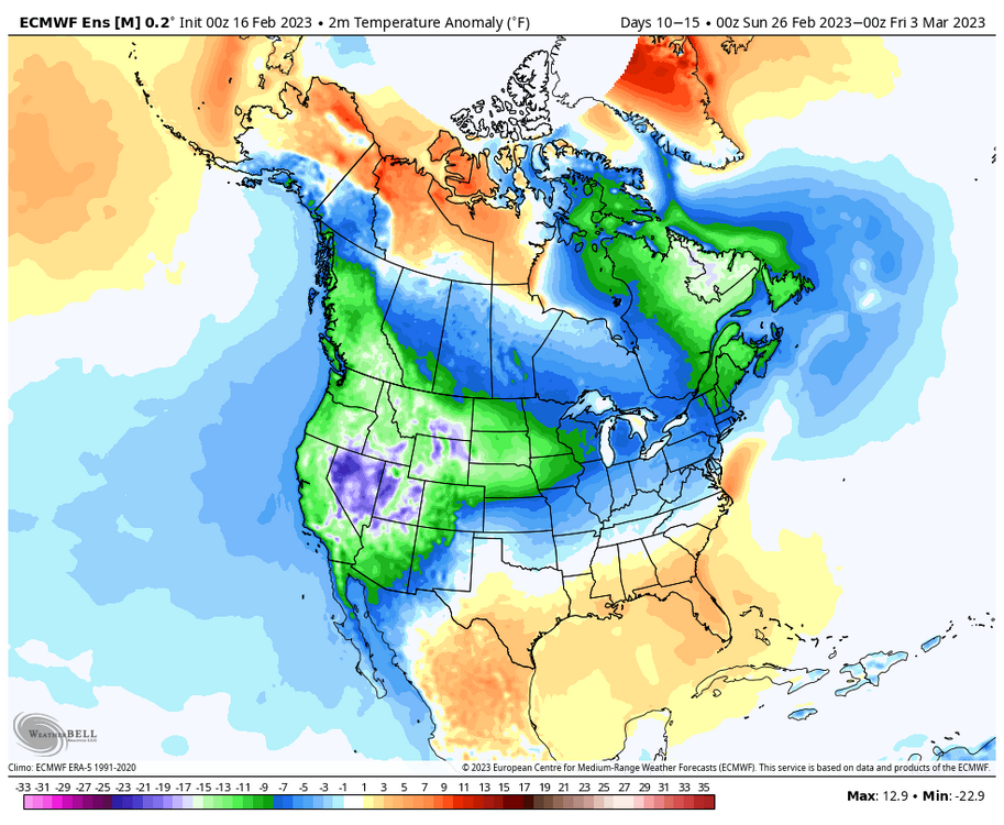
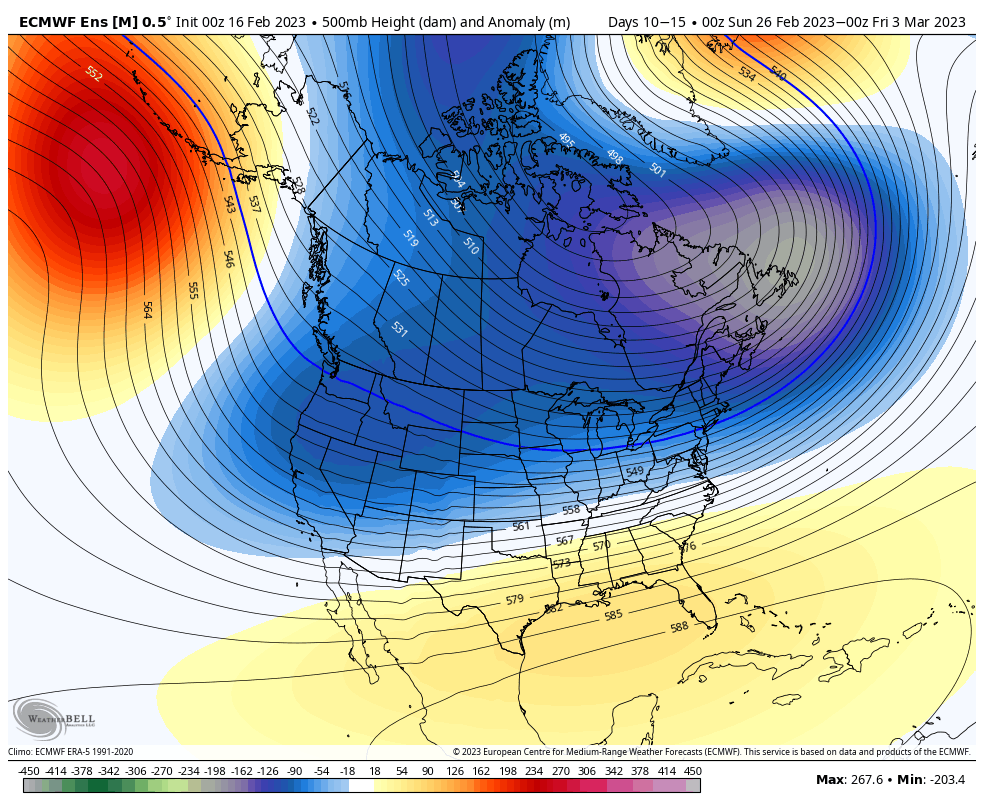
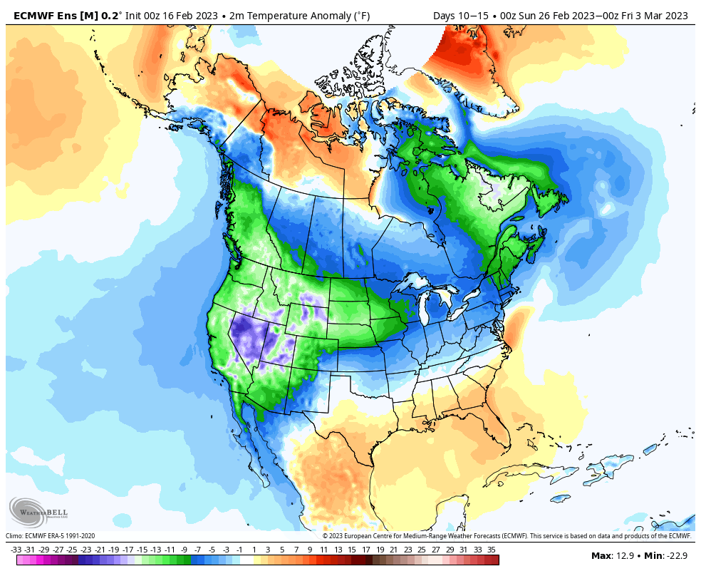
The thing I think you have to be careful about with these 10-15 day outlooks is the over smoothing due to disagreement. My worry here is, right now they look good because they may be over smoothing the below normal hgts. As we get closer though, you get more agreement of a -pna and start losing the below normal hgt look in the east and replaced with a stronger se ridge in response to the -pna. I just don't see the -pna going away with how the tropical forcing is materializes. More and more agreement from what I see any convection croaks before reaching the whem and to me, that spells continuance of the torugh out west.
-
2
-
-
WWA up for up to .25 ice followed by a little snow
-
On 2/14/2023 at 10:26 AM, powderfreak said:
Stake at season high after last nights refresh.

Impressive, what elev is that at?
-
1” new tonight. Came in generally about an hour
-
1
-
-
Had .7 over night from some lake enhancement. Snow pack got obliterated Thursday with mid 40s and dews in mid 30s and an inch of rain. About 3” left on the ground, down from 20” last weekend
-
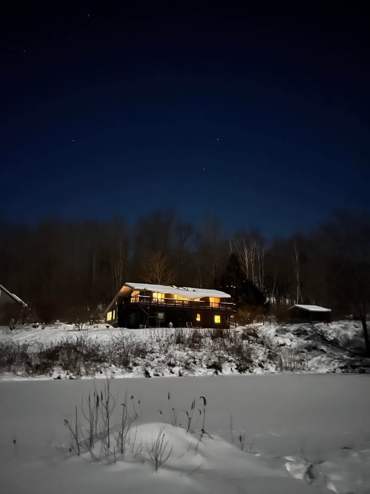
7 hours ago, dmcginvt said:
Nice night, need to yell at the wife for all the lights on, but it does make a good pic
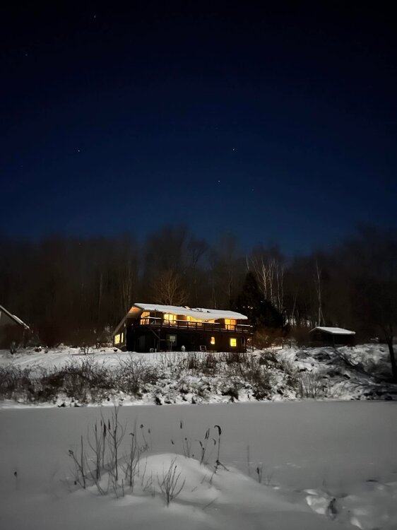
that looks like a beautiful area.
-
Got decently “warm” today with a high of 41, down to 37 now. Expecting a little snow over night
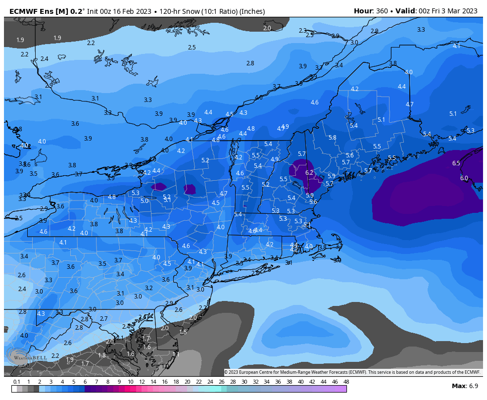

March 4 2023 Storm Obs
in New England
Posted
6.2 here in upstate ny, season total 177”