
DopplerWx
-
Posts
3,398 -
Joined
-
Last visited
Content Type
Profiles
Blogs
Forums
American Weather
Media Demo
Store
Gallery
Posts posted by DopplerWx
-
-
hrrr was pretty accurate last jan but the snow line ended up ~50miles or so north of where it was forecasted, had me safely in the snow and ended up with rain and sleet. just a forewarning.
-
gfs even warmer thru 36, precip a bit west
-
brutal warm nose on the hi-res nam. upstate sc looks like snow initially with the heavier rates but quickly goes back to rain. clt east looks like all rain.
-
this will be killer for snow chances just like last year, another snowstorm a couple thousand feet up. going to be very difficult to overcome a 3c warm nose.
Snow lovers, Rut Roh! The 12/07 06Z NAM BUFR forecast for KRDU is picking up on a developing warm nose Friday night. At 2am, snow aloft is falling but likely melts in the ~3C warm nose near 775 mb. The +2C surface temp and warm ground limit accumulations.
#ncwx -
1 minute ago, ajr said:
I just don’t see how Raleigh’s temp profile supports anything the models are spitting out
going to have wet grass and wet roads, little to nothing will stick outside of car tops and elevated surfaces. model sees .2" qpf falling as snow and paints it on a clown map that people get excited about when .18" of that qpf will melt as soon as it makes contact.
-
3k nam has pretty much all rain for clt to rdu east. warm nose rears its head.
-
 1
1
-
-
theres a good look at the power of the warm nose at 51hr.

-
Just now, No snow for you said:
It will be stronger? It always is.
yep, we all tried to ignore it 36-48hrs out last jan and it ended up being even stronger than modeled.
-
4
-
-
anyone hoping the warm nose isnt as strong as modeled on the hi-res nam is going to be very dissapointed.
-
3
-
-
more precip but warmer at 78. a cold rain for most in nc.
-
5 minutes ago, PackGrad05 said:
You remember what a warm nose did to our storm back in January? (that was way less marginal looking than this one)
I think some wet snow is possible for the climatologically favored areas in the NW (of raleigh), but anything else is a cold rain with some flakes mixed in at times.
yep. every ensemble for the gfs and euro were showing 10"+ the morning of the storm and we got a cold rain and some sleet because of the warm nose. i really don't see any reason to expect more than some token flakes rdu north with this one.
-
1
-
-
clipper with some light snow sunday morn
-
at least i saw snow and the ground is somewhat white. what a freaking nightmare this was. tracking it nearly 8 days out only for this garbage. perfect track only to have a sleetfest with token flakes. disgusting.
-
1 minute ago, WeatherNC said:
Whatever happened to Jim? One would think a weather conglomerate like TWC would do a better job putting these guys in the thick of it.
they are airing a show on weather phobias...no time for live coverage.
-
Just now, cbmclean said:
Jeez, what are they smoking?
this was 18hrs ago, just shows what a bust this was
-
ABC11 WTVD with Don Schwenneker WTVD.
18 hrs ·The latest snow chances for most of the viewing area:
*100% chance of seeing snow
*90% chance of seeing 2 inches or more
*80% chance of seeing more than 4 inches
*50/50 chance of seeing more than 8 inches in the Triangle! -
hey remember when TWC was calling for 8-12" for raleigh and cantore was here this morning? good times!
-
Just now, WeatherNC said:
OK, I am panicking, flipped to sleet and that line is booking north. Should have listed to Fraz and hit up the 85 corridor. Sleet is nothing more than a winter weather sideshow.
seems to have stalled now, big chunk of precip otw so im hoping it sags south again. hrrr shows it but who knows.
-
hrrr's view of the snow line. lol. godawful.

-
BOOM all snow now! never had a doubt!!
-
for pack and cold rain...latest hrrr

-
hrrr has calmed me down a bit.
-
rain falling in the light of the streetlamps is so beautiful.
-
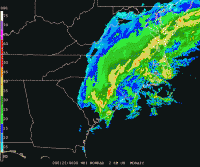
radar matches hrrr really well, doubt we see snow tonight, maybe token flakes tomorrow morning before precip ends. my god what a kick in the nuts this storm was.
The December to Remember 7th-8th blue turd winter threat thread.
in Southeastern States
Posted
past 2 hrrr runs have really warmed for much of nc for tomorrow.
21z run:
23z run: