

Bubbler86
-
Posts
29,685 -
Joined
-
Last visited
Content Type
Profiles
Blogs
Forums
American Weather
Media Demo
Store
Gallery
Posts posted by Bubbler86
-
-
2 minutes ago, sauss06 said:
I was just going on record stating i'm ok holding off until July. Just in case @candersonwas thinking of putting a hit out on me.
LOL, Canderson is stewing over the 12Z GFS right now.
-
 1
1
-
-
1 minute ago, sauss06 said:
I'm ok with no 90's in June. But come July damnit, i want them


You might get a 90 on June 2nd!
-
After our weekend "deluge" of 1/2-1", the GFS is a total shutout into the second 1/8th of summer. CMC is also a wet weekend then small chances of showers as vorts fly by next week.
-
PAweather 540 line in PA on June 7th. LOL. Fun stuff for 12Z. This is analogous to it being in PA on Aug 23rd.

-
Just now, TheClimateChanger said:
NOAA predicted the drought in SE Pennsylvania would end this month, so they are going to make sure that it ends even if it was the driest month on record.
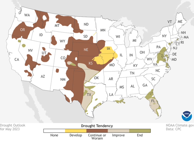
LOL, I was wondering a bit about why they did not expand the map last week.
-
4 minutes ago, Itstrainingtime said:
WPC's 7 day QPF looks a bit more promising than their outlook that @Jns2183 posted yesterday:
The GFS is a true delight for people that want some rain and well BN temps. June would quickly be in a double-digit temp deficit despite Friday. The ULL stays for over a week. 40's for lows every day next work week.
-
 3
3
-
-
Back door ULL goodness. The GFS (just a prog, not my forecast) squashes early summer.

-
1
-
 1
1
-
-
A not too shabby 71 Nooner temp. MDT 73. GFS and NAM now starts the rain parade on Friday for the Eastern LSV. A prelude to a very unsettled weekend.
-
1
-
-
7 minutes ago, Itstrainingtime said:
And a few miles NW of you, my low this morning was 52. (forecast low was 42)
MU got down to 45 so a quick cut off to that Easterly push of cool air.
-
1
-
-
49 for the low here.
Woot, woot.....back door cold front wet and cold. I know some wish it to not happen but super anomalous temps


-
3 minutes ago, Jns2183 said:
CTP mentions in their AFD that mid next week the pattern appears to change bringing in more rain chances
Sent from my SM-G970U using Tapatalk
The 18Z GFS was much wetter than 12Z fwiw.
-
2 minutes ago, CoralRed said:
Weather guy on WNEP Channel 16 was just talking about the area's lack of rain. He noted Williamsport's "especially pathetic .44" for May and ended his segment by noting the record breakers (like us) as of today should stay where they are.
There was a news segment about farmers over near Muncy on our county. The strawberry farmer cancelled Pick Your Own Strawberries and hopes to salvage half his crop. A lady farmer said the soil in her fields is like concrete and is getting dusty and blowing around.
I really feel sorry for them, especially since we do not know when things will go back to normal long term. I realized in December we were no longer having lots more sunny days than normal but of course now we are again.
Most farmers can get Fed aid if they substantiate their losses so hopefully that works out for them.
-
1
-
-
32 minutes ago, Jns2183 said:
We're #1 at something
Sent from my SM-G970U using Tapatalk
Were it not for 2 days in April, we would be looking at an incredible deficit to start a year. Those 2 April days are masking how bad it really is with the lack of those .25 to .75" type rains we are missing out on.
-
33 minutes ago, canderson said:
Gonna be hot. I bet you and I hit 94.
I thought I saw the zone for Harrisburg say 95 this AM. Actually I still had the page loaded. They had already loaded up on MDT this AM.

-
15 minutes ago, Itstrainingtime said:
MU recorded .29" of rainfall in May. This month becomes the driest month since February 2002. 21 years and 3 months since we've had a month drier. Also, the previous May record was .50".
And a trace of snow. They have been stuck at 77 so far for their high today.
-
1
-
-
3 minutes ago, sauss06 said:
Yep, Harrisburg just hit 79
We are heating up nicely here as well at 76 now. The MDT Norm for today is 77.
-
32 minutes ago, TheClimateChanger said:
Must be some local cooling effect. Mount Pocono is the coolest in the state at 69, even Bradford is 77 and Erie is 81.
Almost an hour later it is up to 73. There are quite a few low 70's spread through the LSV at this hour...even some non-elevated areas of Adams, York and Lancaster including a couple 71's.

-
It JUST hit 70 here...almost 1PM on a fully sunny day, 2 days before the start of summer....and about as dry of a topsoil layer you could possibly imagine (no moisture laden earth keeping temps down.)
-
LOL......

-
1
-
-
2 minutes ago, TheClimateChanger said:
Haven't seen this mentioned anywhere, but the RAP-SMOKE model brings in a substantial amount of near-surface smoke later tonight. Looks to spread across eastern PA tomorrow, so expect hazy skies and poor air quality. The smoke wrapped all the way across the Hudson and into the Atlantic, dropped near the surface over the oceanic inversion layer and is being pushed westwardly by easterly winds.
Interesting. Will have to see how that may affect the progged colder temps in the Eastern part of the state tonight. 12Z Meso's raised the temps a little bit from the upper 30's to low 40's.
-
If MDT can get down to at least 59 degrees tomorrow AM, seems likely, it will mark the first time since 1997 that every day in May featured a low of 59 or below. Including this year, it has only happened 6 times....6 being ironic that this May will probably end up being the 6th driest month ever at MDT.


-
2
-
-
I noticed a few Meso's have upper 30's (one in the mid 30's) tomorrow AM for the Eastern LSV.
-
48 for the low this Am.
In the interest of anomalous weather, I noticed this below at the end of the GFS. It is a heat wave that starts building on June 10th. Before this though it is not really "all that" hot due to ULL's being nearby as well as a trough dropping out of Canada. Several nights in the 40's next week after a fairly warm/hottish end to this week. Highs in the upper 60's and low 70's this weekend. This is as progged on the GFS. CMC is in the 90's Sat and much warmer overall. Icon would be near 100 Fri and Sat.

-
2
-
-
Heree is why USGS has not pulled many triggers. Groundwater in the green, 90 day precip yellow and surface water in the green (black line is current location on the graph). The April deluge in mdt causing a bubble of results that appear ok for some longer term stats but several inches in quick order does little for the yards and vegetation which do not care about 90 day stats.


Central PA Spring 2023
in Upstate New York/Pennsylvania
Posted