KAOS
-
Posts
1,536 -
Joined
-
Last visited
Content Type
Profiles
Blogs
Forums
American Weather
Media Demo
Store
Gallery
Everything posted by KAOS
-
Another aleet
-
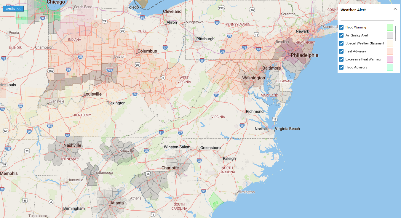
Intellistar storm mode activated for 21123
-
-
The nws weather data fetching script (MobileX1.js) needs to be edited in order to pass the correct url using lat, lng, etc parameters to the iframes. radarImage.setAttribute("src", "alkurl.html?lng=" + longitude + "&lat=" + latitude + "&zoom=8"); Here is an example using predefined url parameters (everything after the "?") https://kaosfactory.github.io/alkurl.html?lng=-76&lat=39&zoom=8 If you change the lng, lat, zoom values (in the link above) it will automatically "go to" that location. Result... https://kaosfactory.github.io/mobileX1.html
-
Mapbox hash not working as well as expected. Using ALK OpenLayers maps in this example, but can be used with others such as mapbox. Inserted the following code to retrieve url parameters for lng, lat, and zoom. getParameter = (key) => { // Address of the current window address = window.location.search // Returns a URLSearchParams object instance parameterList = new URLSearchParams(address) // Returning the respected value associated // with the provided key return parameterList.get(key) } // Gets the value associated with the keys "lng, lat, zoom" console.log(getParameter("lng")) console.log(getParameter("lat")) console.log(getParameter("zoom")) //Variables var lng = (getParameter("lng")) var lat = (getParameter("lat")) var zoom = (getParameter("zoom"))
-
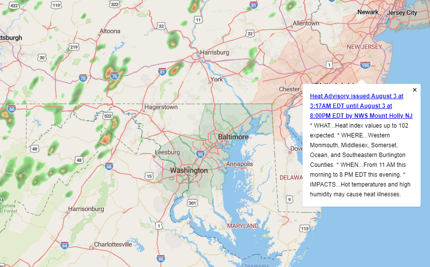
DEPRECATED But what is even more better is this... https://kaosfactor.github.io/geourl.htm#7.31/39.119/-77.660 geo specific radar/location using url address.
-
-
updated zipcode map...
-
test... https://kaosfactor.github.io/screenshots/D∆%20F∆%20KING%20DEATH%20M∆CHINE.mp4
-
1000% https://kaosfactor.github.io/screenshots/videoplayback.mp4
-
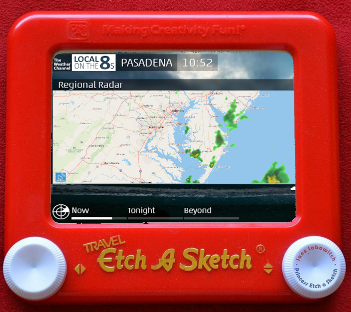
And on Etch A Sketch...
-
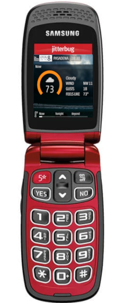
After quite a few tweaks I have been able to get this working on jtterbug hardware.
-
Using Trimble maps and data for radar slides - static. Mapbox and TWC data when you click on city name - static. Mapbox and Xweather when you click on radar button in Regional Radar slide - animated. Trimble maps and data when you click on radar button (TWC) in Local Radar slides (warning popups and radar map) - static. NWS radar and data when you click on NWS banner in configuration menu - animated. Xweather and Mapbox when you click on "Postal" text in configuration menu - static Xweather and Mapbox when you click on "Airport" text in configuration menu - static.
-
https://kaosfactor.github.io/staticradarX.html
-
https://kaosfactor.github.io/fullscrn.html
-
https://kaosfactor.github.io/staticleaflet.html
-
https://kaosfactor.github.io/staticmapbox.htm
-
https://kaosfactor.github.io/twcradar.html
-
This one has cool test popup when you click on warning area. https://kaosfactor.github.io/MobileTrimble.html
-
https://kaosfactor.github.io/MobileMapBox.html
-
Also.... https://kaosfactor.github.io/screenshots/R_U_ready.mp4

-
https://kaosfactor.github.io/mapbox.html
-