KAOS
-
Posts
1,536 -
Joined
-
Last visited
Content Type
Profiles
Blogs
Forums
American Weather
Media Demo
Store
Gallery
Everything posted by KAOS
-
I added more data...
-
controller.addDataInspectorControl({ event: 'click'});
-
Emulate this!!!?
-
The dark side...
-
Global Weather Domination...
-
-
DEPRECATED Tada... https://kaosfactory.github.io/miniapp.html
-
I will clean this code up some and post link.
-
I have made some modifications.... I
-
Mini App...

-
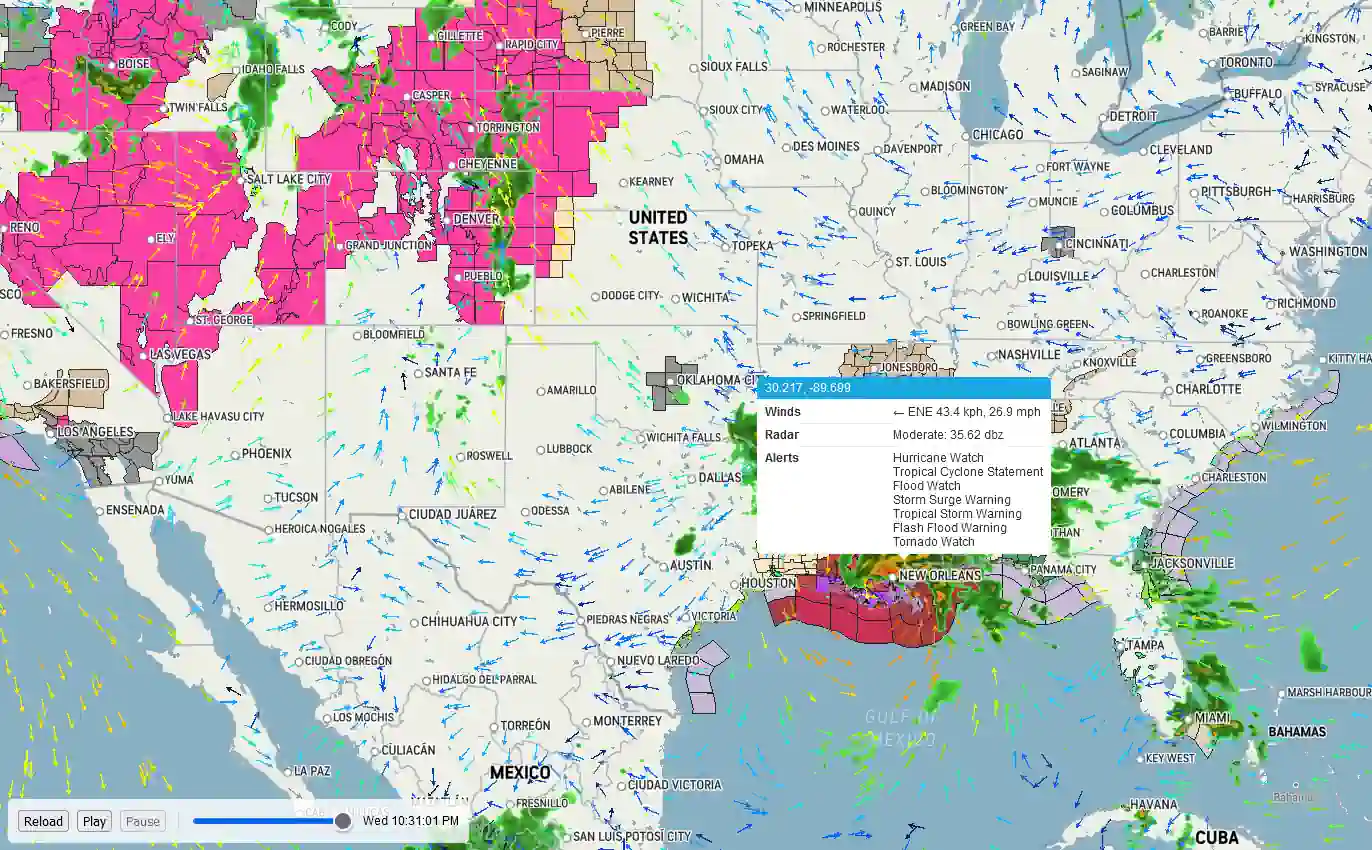
https://kaosfactory.github.io/Winds.html New stuff is all beta... more or less.
-
-
Link to even less resource dependent mobile version of Intellistar Emulator.... https://kaosfactory.github.io/mobileX.html Link to TWC (MapBox) static radar... https://kaosfactory.github.io/staticradarX.html
-
-
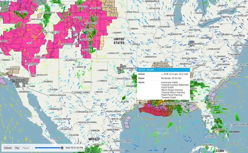
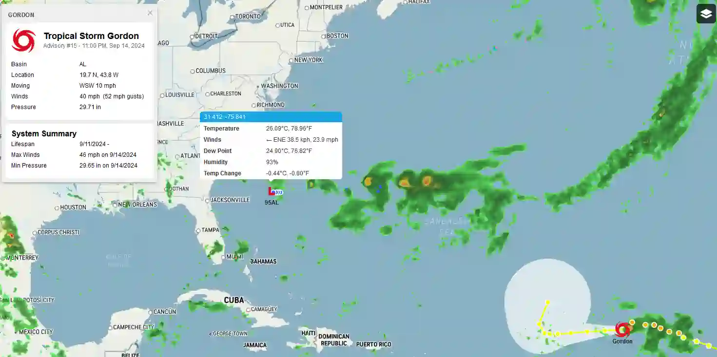
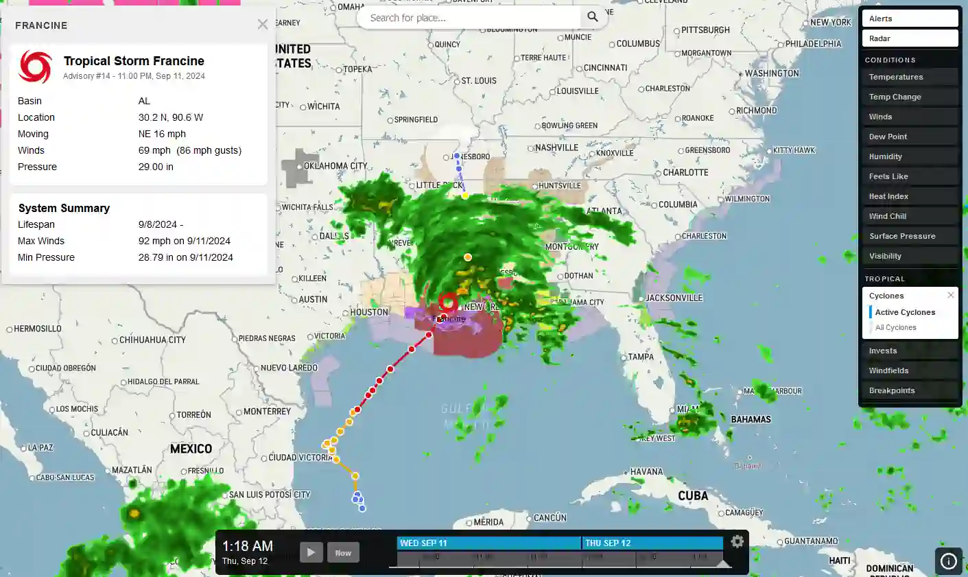
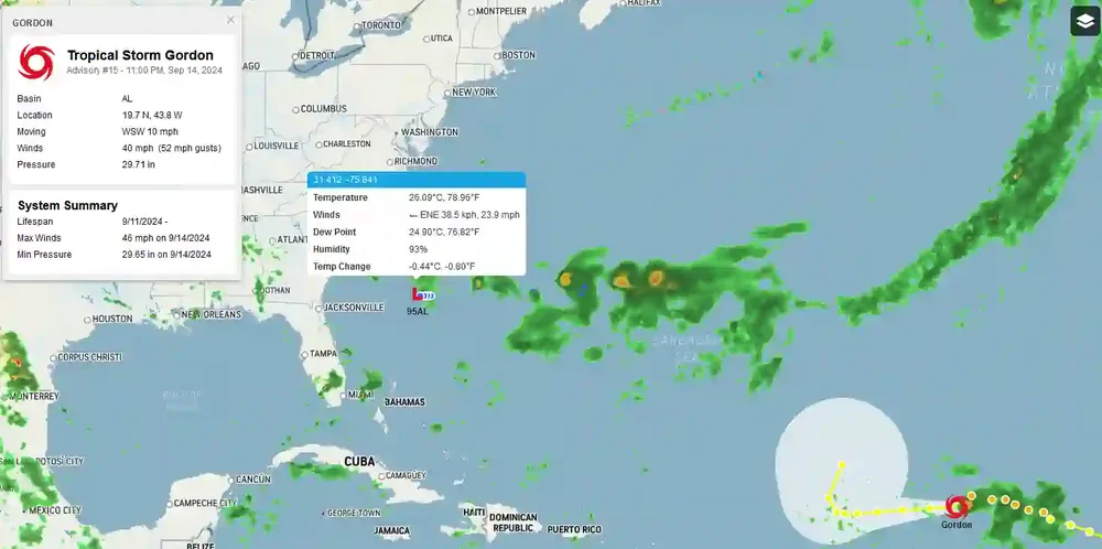
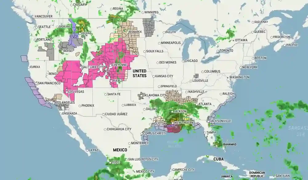
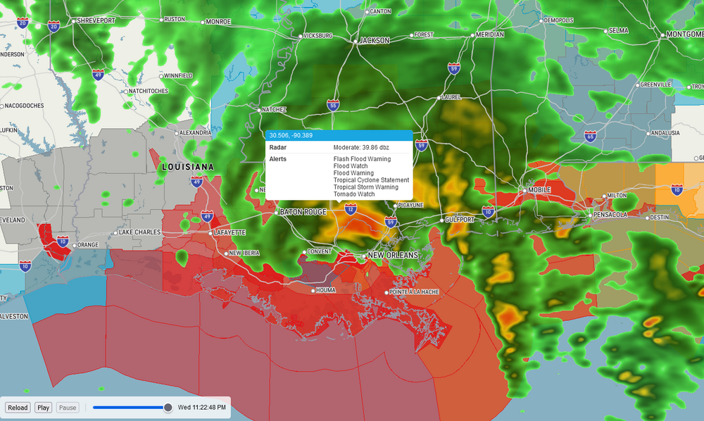
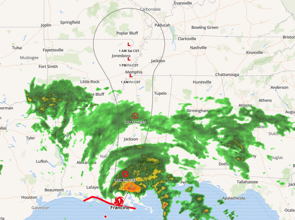
Tropical... https://kaosfactory.github.io/Tropical.html#6.53/31.896/-89.48
-
-
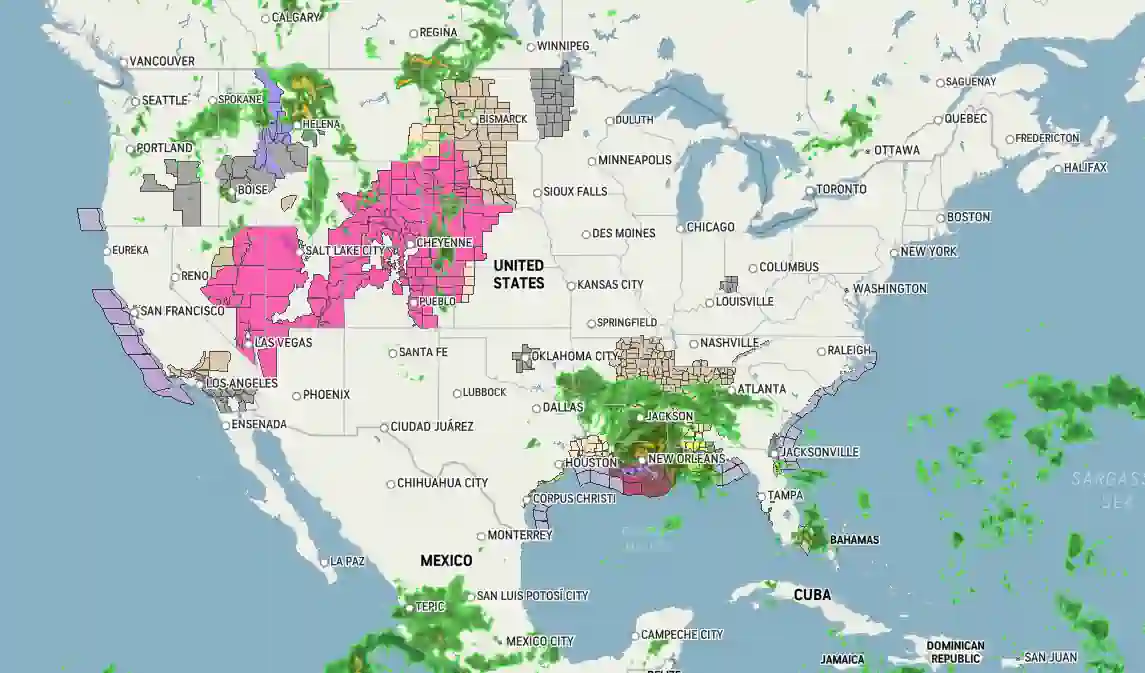
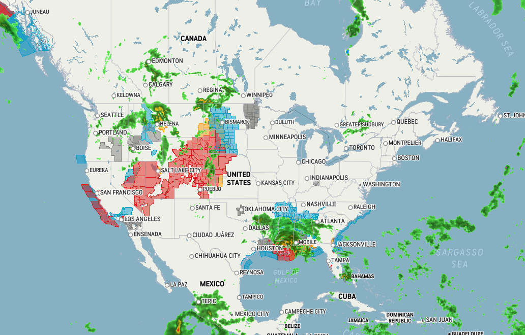
Standard alerts... https://kaosfactory.github.io/MapBoxGLalerts.html
-
https://kaosfactory.github.io/MapBoxGLcustomalerts.html

-
-
-

-
There is more...
-
Tropical module...
-
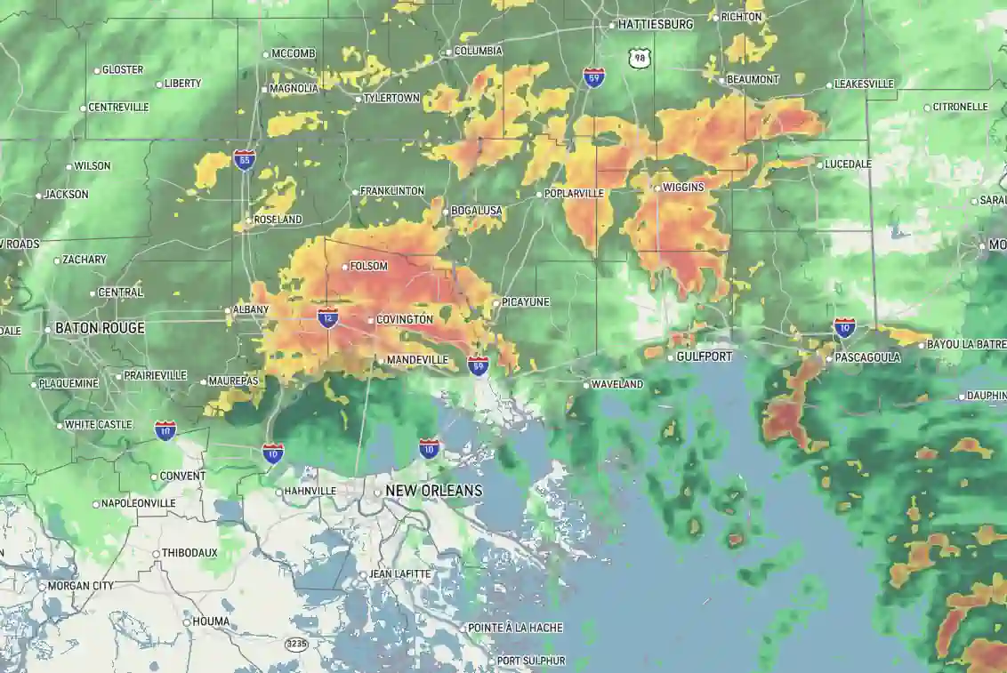
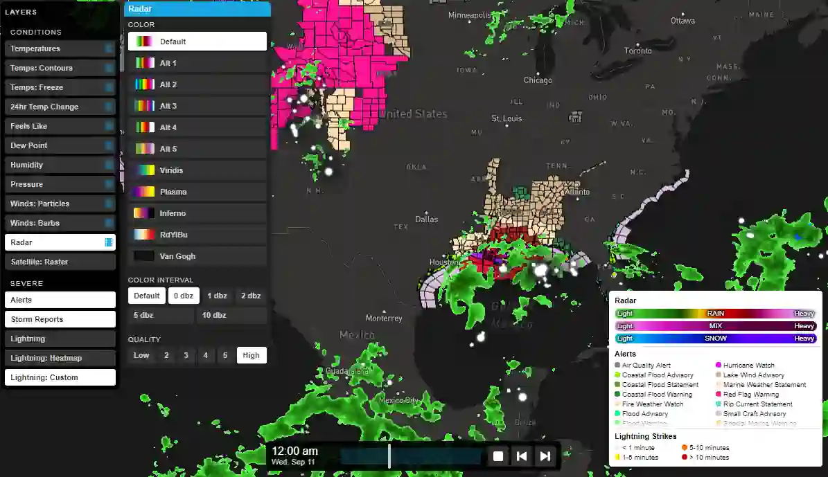
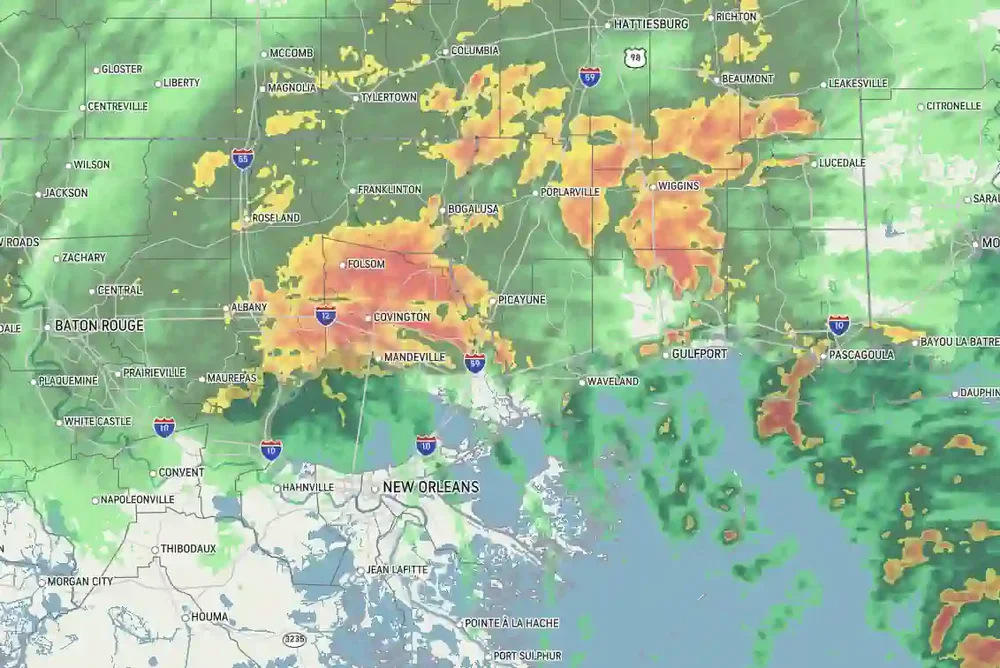
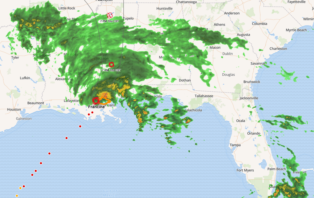
Everything is animated.... winds, radar, alerts. 12 hour history in a loop with controls to start, stop and reload. The timeline slider is interactive. You can select any time frame within -12 hours. Move mouse over data points (radar, aleets, etc). and a "popup" containing the data appears..