Rjay
-
Posts
28,114 -
Joined
-
Last visited
Content Type
Profiles
Blogs
Forums
American Weather
Media Demo
Store
Gallery
Everything posted by Rjay
-
January 28-29 2022 Miller abcdefu Storm Obs/Discussion
Rjay replied to mappy's topic in Mid Atlantic
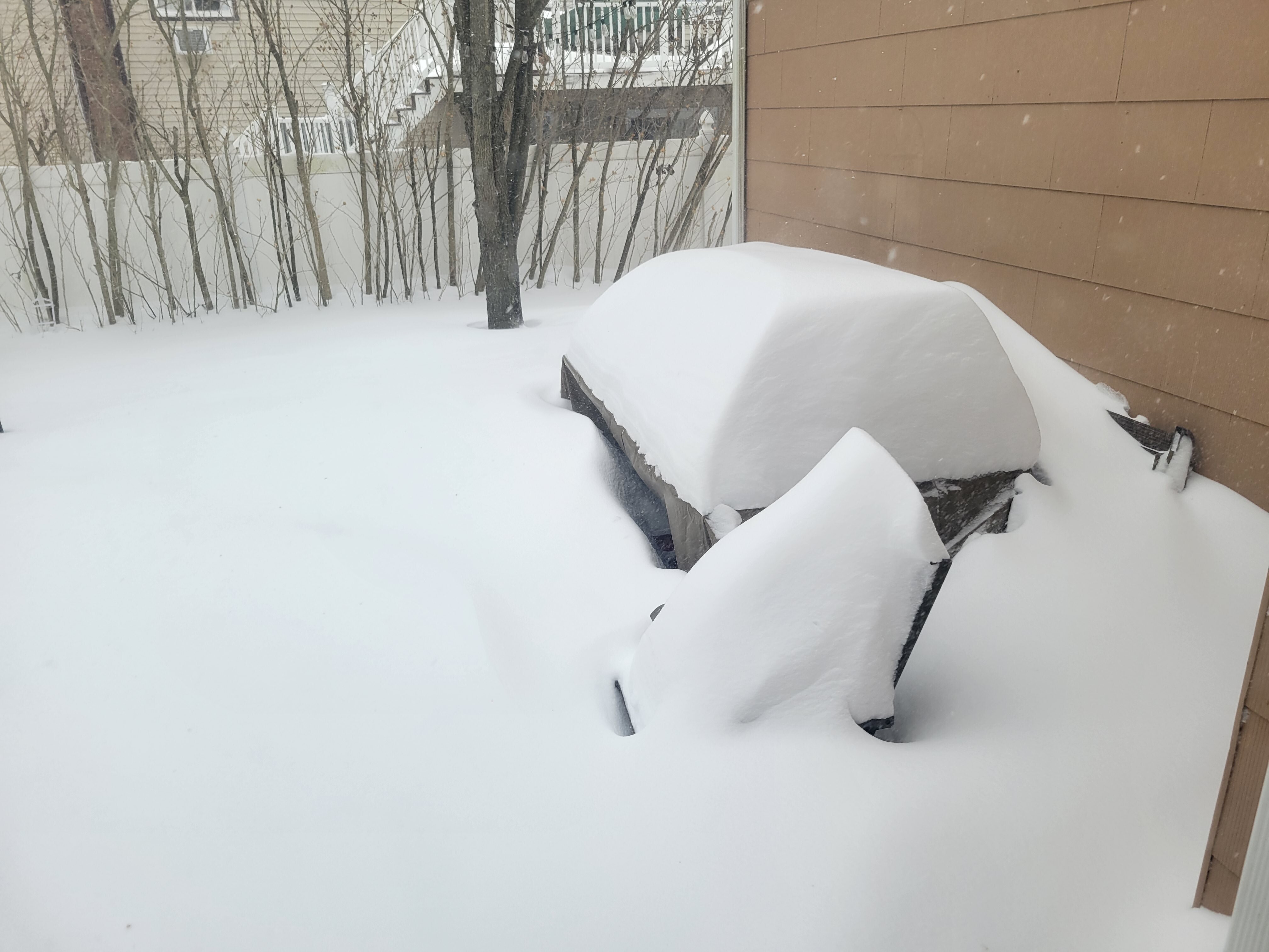
Randy wanted to see some pics lol -
January 28-29 2022 Miller abcdefu Storm Obs/Discussion
Rjay replied to mappy's topic in Mid Atlantic
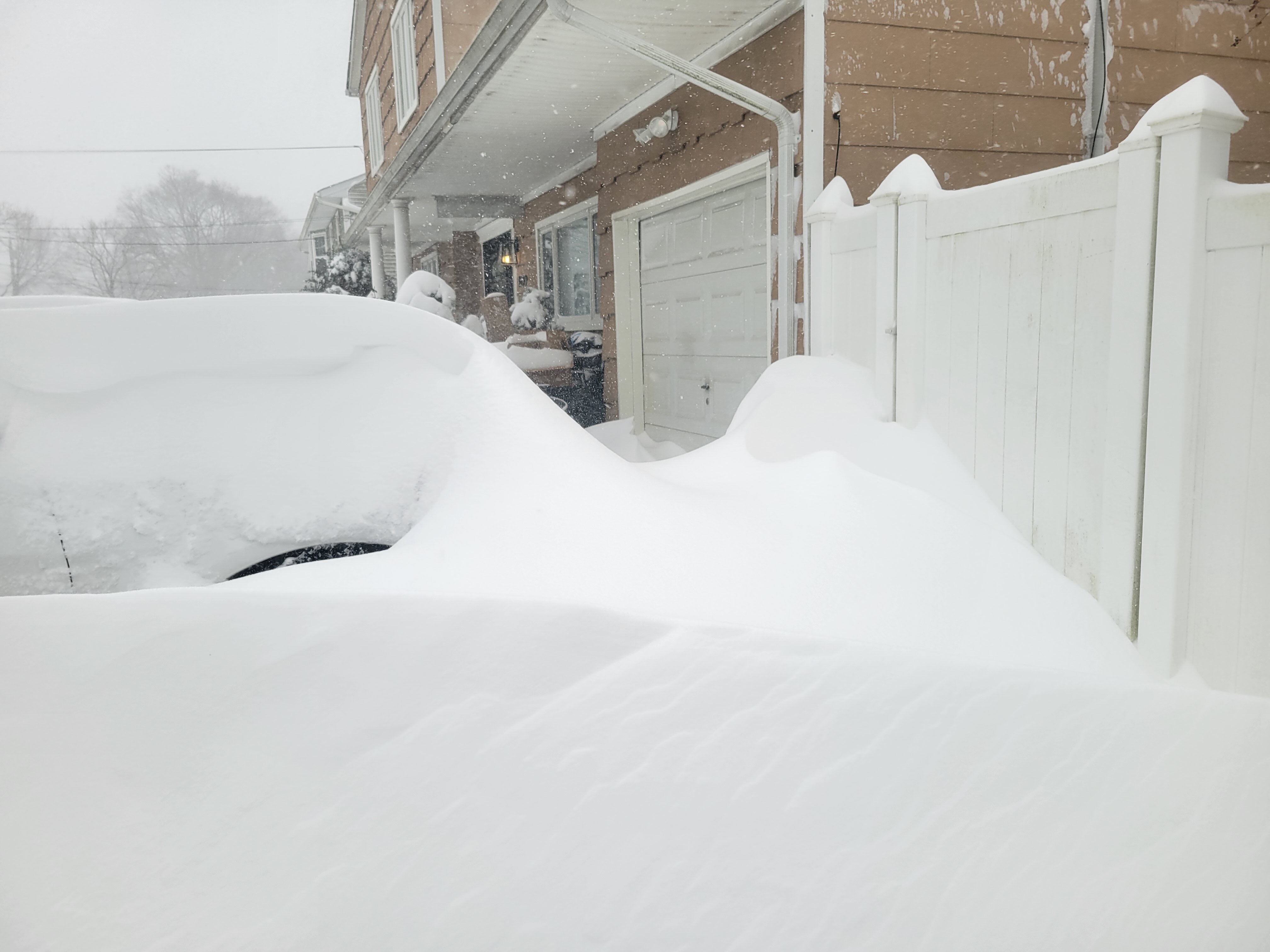
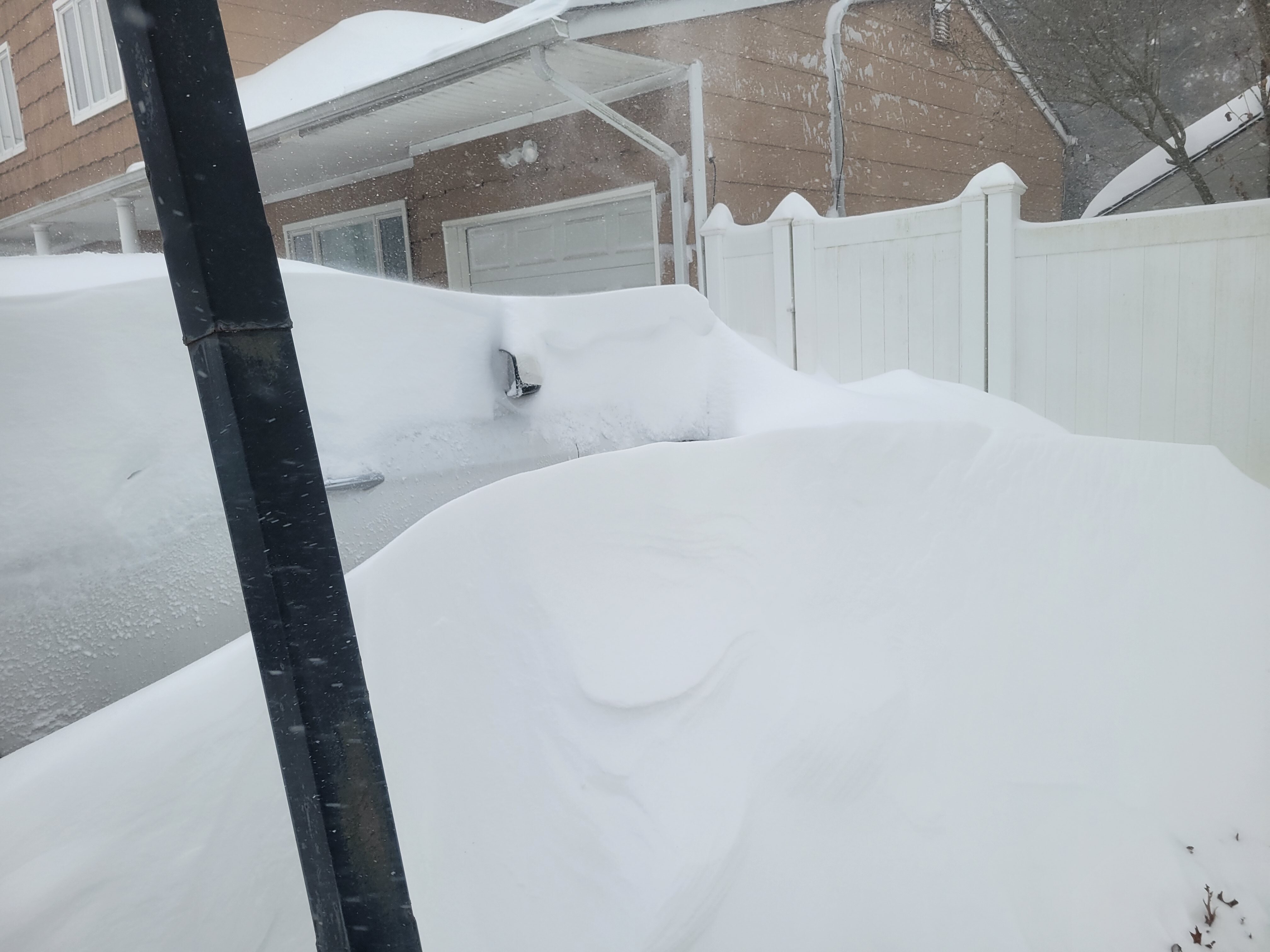
Buried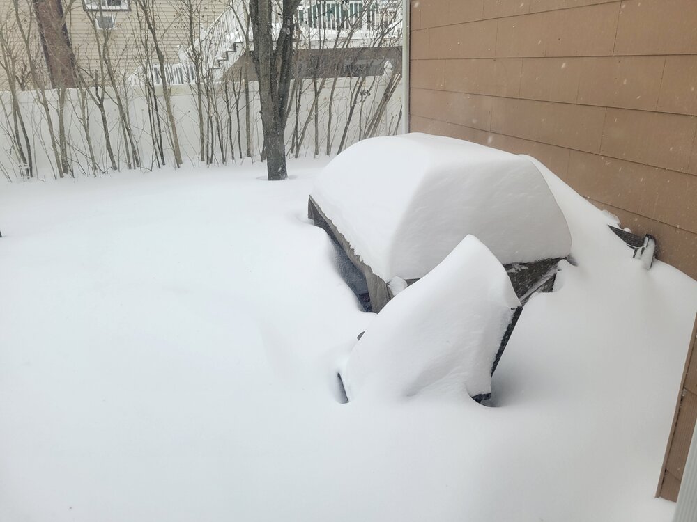


-
Congrats folks. Storm winding down here. Over 2' at ISP. Pretty sure there will be a 30 spot on the east end of LI.
-
January 28/29 Blizzard Observations/Discussion/Nowcasting
Rjay replied to Northof78's topic in New York City Metro
Awesome Don. -
January 28/29 Blizzard Observations/Discussion/Nowcasting
Rjay replied to Northof78's topic in New York City Metro
And to clarify: I did measure in 2016 in an open field. But this one is impossible. I'm just going with whatever ISP says. -
January 28/29 Blizzard Observations/Discussion/Nowcasting
Rjay replied to Northof78's topic in New York City Metro
Lol. You'll never know! -
January 28/29 Blizzard Observations/Discussion/Nowcasting
Rjay replied to Northof78's topic in New York City Metro
25" in 2016 in Merrick. This will likely be 25" too. This is number #1 though for me I think. The drifts are insane. -
January 28/29 Blizzard Observations/Discussion/Nowcasting
Rjay replied to Northof78's topic in New York City Metro
Lol good luck with that -
January 28/29 Blizzard Observations/Discussion/Nowcasting
Rjay replied to Northof78's topic in New York City Metro
KISP 291956Z 33021G35KT 1/4SM R06/1800V2000FT SN BLSN FZFG OVC005 M10/M11 A2950 RMK AO2 PK WND 31035/1953 SLP990 SNINCR 1/24 P0003 T11001111 Indeed they have -


-
January 28/29 Blizzard Observations/Discussion/Nowcasting
Rjay replied to Northof78's topic in New York City Metro


-
January 28/29 Blizzard Observations/Discussion/Nowcasting
Rjay replied to Northof78's topic in New York City Metro
KISP 291856Z 33021G30KT 1/4SM R06/1600V2000FT SN BLSN FZFG BKN005 OVC009 M10/M12 A2950 RMK AO2 PK WND 33037/1809 SLP991 SNINCR 1/023 P0003 T11001117 -
January 28/29 Blizzard Observations/Discussion/Nowcasting
Rjay replied to Northof78's topic in New York City Metro
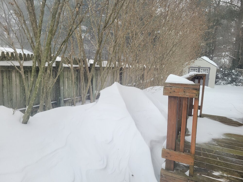
57" and the drift is ~3" over the deck height -
January 28/29 Blizzard Observations/Discussion/Nowcasting
Rjay replied to Northof78's topic in New York City Metro
5' drifts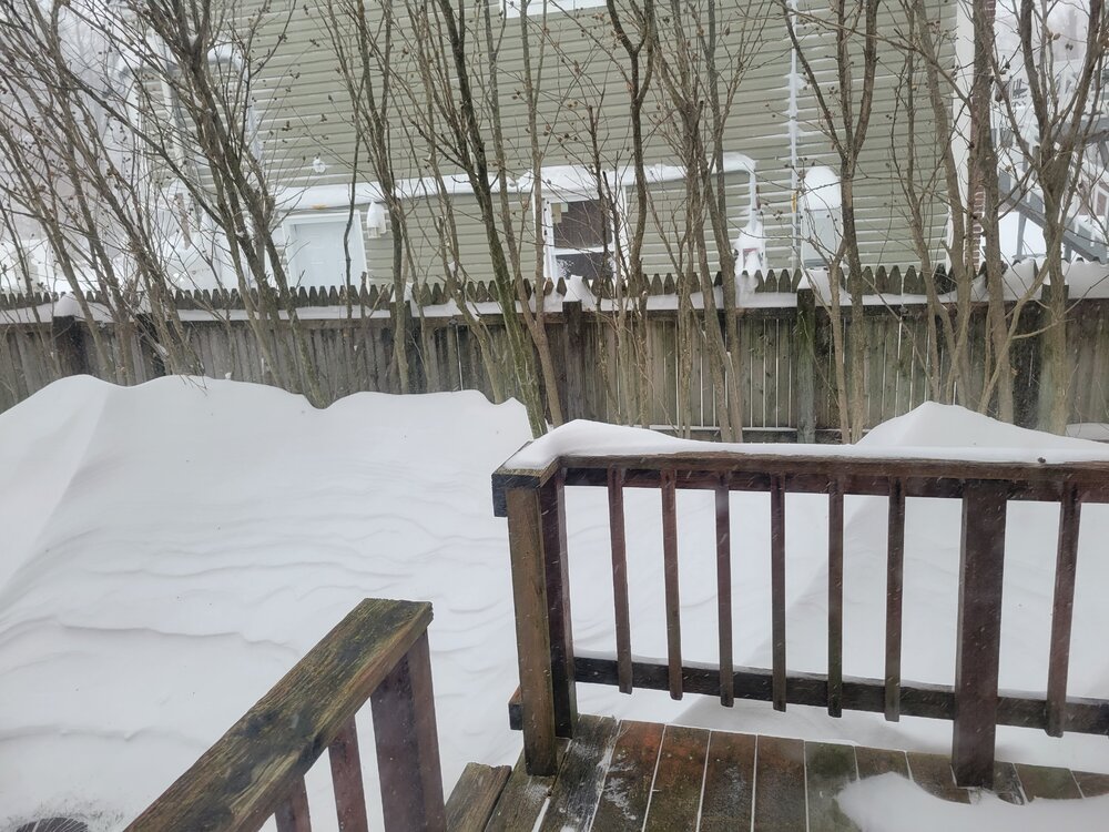
-
January 28/29 Blizzard Observations/Discussion/Nowcasting
Rjay replied to Northof78's topic in New York City Metro
Maybe they don't break the record then. Idk. They could break both though. -
January 28/29 Blizzard Observations/Discussion/Nowcasting
Rjay replied to Northof78's topic in New York City Metro
Public Information Statement National Weather Service New York NY 1228 PM EST Sat Jan 29 2022 ...BLIZZARD CONFIRMED ACROSS SUFFOLK COUNTY NEW YORK AND NEW LONDON COUNTY CONNECTICUT... The National Weather Service in New York, NY can preliminarily confirm that blizzard criteria was met this morning across Suffolk County New York and New London County Connecticut. Further analysis will be conducted in the days ahead to determine which additional zones, if any, reached blizzard criteria during this evening. Further analysis will also be conducted to determine the exact start and end times of blizzard conditions in the areas where such conditions have already been confirmed. -
January 28/29 Blizzard Observations/Discussion/Nowcasting
Rjay replied to Northof78's topic in New York City Metro
ISP will break the record this hour or next. -
January 28/29 Blizzard Observations/Discussion/Nowcasting
Rjay replied to Northof78's topic in New York City Metro
Good lord KISP 291756Z 33025G35KT 1/8SM R06/2000V3000FT +SN BLSN FZFG SCT003 OVC009 M09/M11 A2949 RMK AO2 PK WND 33036/1745 SLP987 SNINCR 2/22 4/022 933012 P0001 60020 T10941111 11039 21094 58023 -
January 28/29 Blizzard Observations/Discussion/Nowcasting
Rjay replied to Northof78's topic in New York City Metro
I was going to ask if anyone knew what 78 had for duration of blizzard conditions so thank you. -
Or DC to AC is crushed
-
January 28/29 Blizzard Observations/Discussion/Nowcasting
Rjay replied to Northof78's topic in New York City Metro
ISP has reported heavy snow every 5 minutes since 705am lol -
January 28/29 Blizzard Observations/Discussion/Nowcasting
Rjay replied to Northof78's topic in New York City Metro
Stay safe Don. -
20" here and going nuts still https://streamable.com/zafk31
-
January 28/29 Blizzard Observations/Discussion/Nowcasting
Rjay replied to Northof78's topic in New York City Metro
Where are you on the expressway Don? -
January 28/29 Blizzard Observations/Discussion/Nowcasting
Rjay replied to Northof78's topic in New York City Metro
Move next to an airport lol