Rjay
-
Posts
28,400 -
Joined
-
Last visited
Content Type
Profiles
Blogs
Forums
American Weather
Media Demo
Store
Gallery
Everything posted by Rjay
-
Maybe they're right and it's not. I happen to think they should have upgraded and it should be a Cat 5 currently. The nutty posts are flying right now though. Thank you for posting in the proper thread.
-
Lol. Trying to lighten the mood. People get too wound up too easily on here.
-
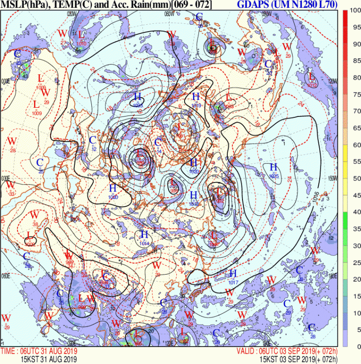
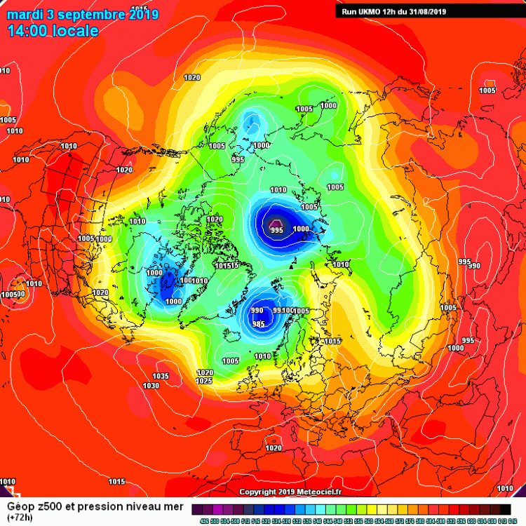
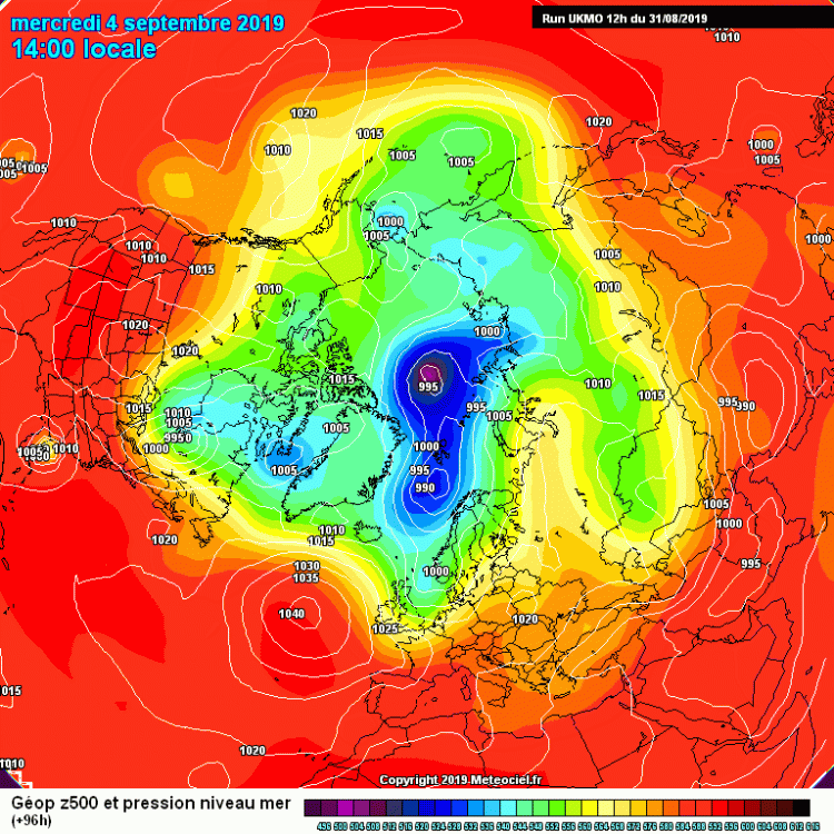
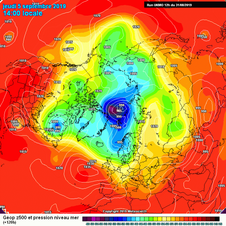
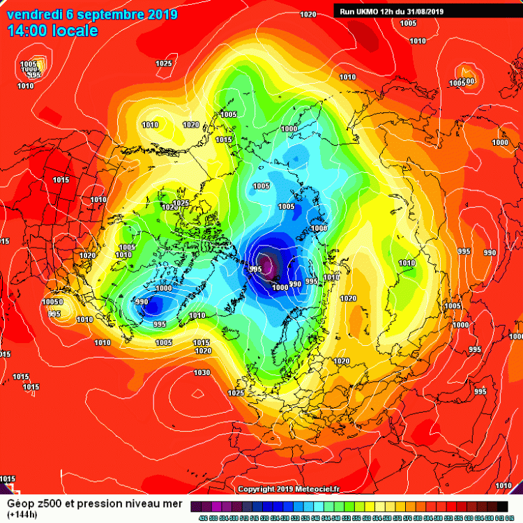
Why read the main thread when you can look at the sideways Ukie and upside-down Korean in here?
-
@StantonParkHoya Here's a link to the Ukie http://meteocentre.com/numerical-weather-prediction/forecast-systems.php?lang=en&map=na&run=12&mod=ukmet&stn2_type=prog&date_type=dateo&mode=latest&yyyy=latest&mm=latest&dd=latest
-
@StantonParkHoya
.gif.97e057ea6940c01b736845354ee55785.gif)
.gif.7894bceaf860f0560c7ccb5097d6977f.gif)
.gif.4af9d156ede4dfa6b5aca28b6ec52e73.gif)
.gif.9a02e143f082150e7a89838091f1f48a.gif)
-
@Akeem the African Dream
-
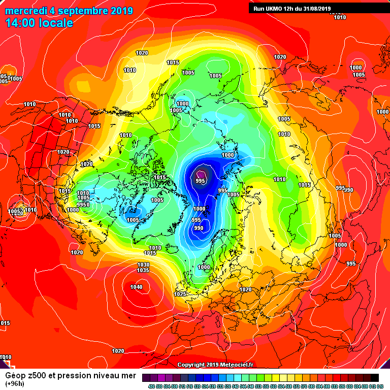
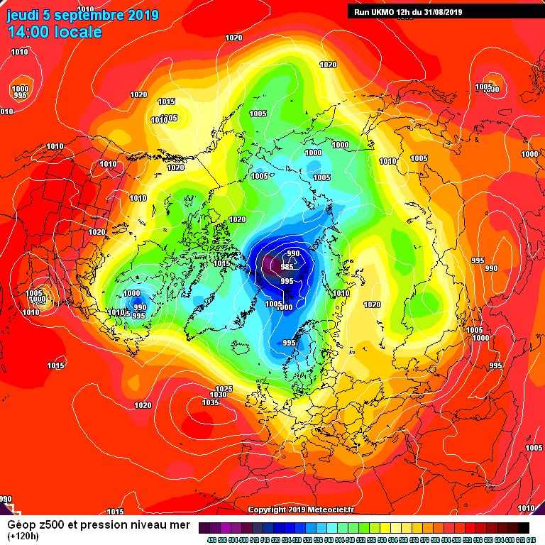
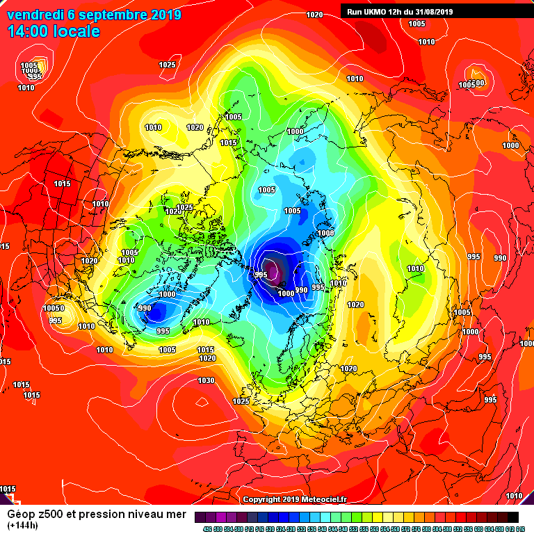
Here's some sideways ukie images from the french site. Meteocentre comes out in less than 20 mins for those who can wait. Stays offshore. Lol enjoy
-
Agreed
-
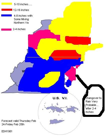
I forgot who did this map. One of the old timers will know.
-
I updated my forecast
-
Help make it better
-
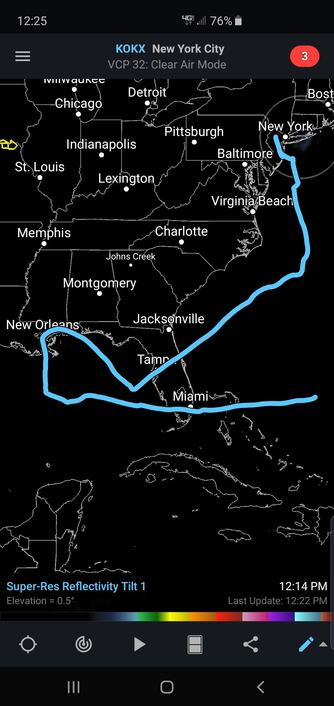
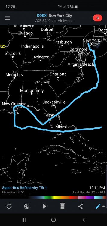
Idk. This one has a chance. My forecast track as of now:
-
Lol
-
You ready yet?
-
Boxing Day had the worst blizzard conditions I've seen in my area. Also the srongest winds during a snow storm that I've experienced.
-
I remember walking home from school twice in one week in knee deep snow. Not being able to lift my legs out of the snow so I dragged my feet through it
-
URGENT — WEATHER MESSAGE NATIONAL WEATHER SERVICE NEW ORLEANS LA 1011 AM CDT SUN AUG 28, 2005 ...DEVASTATING DAMAGE EXPECTED... HURRICANE KATRINA...A MOST POWERFUL HURRICANE WITH UNPRECEDENTED STRENGTH... RIVALING THE INTENSITY OF HURRICANE CAMILLE OF 1969. MOST OF THE AREA WILL BE UNINHABITABLE FOR WEEKS...PERHAPS LONGER. AT LEAST ONE HALF OF WELL CONSTRUCTED HOMES WILL HAVE ROOF AND WALL FAILURE. ALL GABLED ROOFS WILL FAIL...LEAVING THOSE HOMES SEVERELY DAMAGED OR DESTROYED. THE MAJORITY OF INDUSTRIAL BUILDINGS WILL BECOME NON FUNCTIONAL. PARTIAL TO COMPLETE WALL AND ROOF FAILURE IS EXPECTED. ALL WOOD FRAMED LOW RISING APARTMENT BUILDINGS WILL BE DESTROYED. CONCRETE BLOCK LOW RISE APARTMENTS WILL SUSTAIN MAJOR DAMAGE...INCLUDING SOME WALL AND ROOF FAILURE. HIGH RISE OFFICE AND APARTMENT BUILDINGS WILL SWAY DANGEROUSLY...A FEW TO THE POINT OF TOTAL COLLAPSE. ALL WINDOWS WILL BLOW OUT. AIRBORNE DEBRIS WILL BE WIDESPREAD...AND MAY INCLUDE HEAVY ITEMS SUCH AS HOUSEHOLD APPLIANCES AND EVEN LIGHT VEHICLES. SPORT UTILITY VEHICLES AND LIGHT TRUCKS WILL BE MOVED. THE BLOWN DEBRIS WILL CREATE ADDITIONAL DESTRUCTION. PERSONS...PETS...AND LIVESTOCK EXPOSED TO THE WINDS WILL FACE CERTAIN DEATH IF STRUCK. POWER OUTAGES WILL LAST FOR WEEKS...AS MOST POWER POLES WILL BE DOWN AND TRANSFORMERS DESTROYED. WATER SHORTAGES WILL MAKE HUMAN SUFFERING INCREDIBLE BY MODERN STANDARDS. THE VAST MAJORITY OF NATIVE TREES WILL BE SNAPPED OR UPROOTED. ONLY THE HEARTIEST WILL REMAIN STANDING...BUT BE TOTALLY DEFOLIATED. FEW CROPS WILL REMAIN. LIVESTOCK LEFT EXPOSED TO THE WINDS WILL BE KILLED. AN INLAND HURRICANE WIND WARNING IS ISSUED WHEN SUSTAINED WINDS NEAR HURRICANE FORCE...OR FREQUENT GUSTS AT OR ABOVE HURRICANE FORCE...ARE CERTAIN WITHIN THE NEXT 12 TO 24 HOURS. ONCE TROPICAL STORM AND HURRICANE FORCE WINDS ONSET...DO NOT VENTURE OUTSIDE!
-
I remember when the NAM gave me 52" 24 hours before Juno lol. I saved the map but can't find it
-
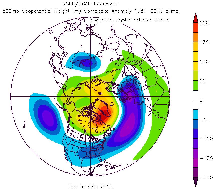
Dec 2009 to Feb 2010 What a time to be alive

-
If anyone has anything good from the Feb 13th, 2014 insane front-end dump they should post it
-
The models completely missed how far west this beastly northern steam s/w would be. It dropped due south out of Canada. The GFS caught it first.
-
HPC went on to toss the next 3 gfs runs and tossed the NAM's next 3 runs as well.