-
Posts
4,105 -
Joined
-
Last visited
Content Type
Profiles
Blogs
Forums
American Weather
Media Demo
Store
Gallery
Posts posted by nycsnow
-
-
-
-
-
2 minutes ago, LibertyBell said:
10:1 ?!
Nah 10:1 was only 2 feet… 36-40 on kuchera lol
-
 1
1
-
-
-
Just now, LibertyBell said:
what did the 12z run have? 20+ for everyone?
3 feet
-
2 minutes ago, EastonSN+ said:
AI also.
Ai has been so hit or miss lately. I’m curious to see if Ukie caves to euro or vice versa
-
Ukie was probably to amped so move that offshore and meet in the middle of all the extremes and it’s a huge storm
-
 1
1
-
-
Just now, CPcantmeasuresnow said:
It really doesn't do much for me that the icon is the one model hitting us.
Euro 12z was the one on its own today…. So far
-
 2
2
-
-
Icon has a foot of snow in 6 hours over part of Long Island with more to come…absolutely no nod to euro here
-
 1
1
-
-
Just now, NEG NAO said:
Am I hallucinating or something ???now in their discussion Upton said the chances of a Major Winter Storm has increased ????
They don’t live and die by 1 euro run
-
 1
1
-
-
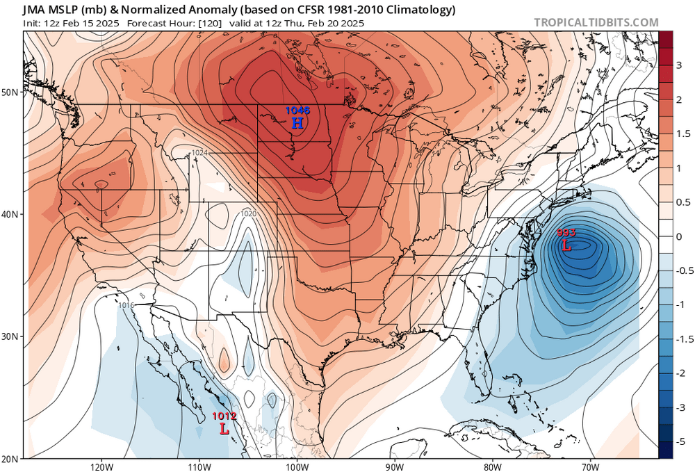
Icon is a tremendous hit and it is still snowing after 120. The evolution was different then 12z but it is still a 18-24+ event can’t ask for more 5 days out
-
 3
3
-
-
Still snowing after this
Image Image
Image
-
 2
2
-
-
-
-
2 minutes ago, Allsnow said:
TPV is also weaker
Well…guess just rip the band aid off and get it over with
-
 1
1
-
-
Icon coming out. Let’s get a good trend going again
-
 1
1
-
-
-
3 minutes ago, qg_omega said:
Know the bias, makes things easier.
Yes, but gfs also trended closer to coast. Unless somewhere they meet in middle and it’s just moderate storm
-
 1
1
-
-
The only thing scaring me is how euro fit the pattern all winter long. Thankfully times on our side for a day or 2
-
2 minutes ago, Metasequoia said:
Doesn't look like the models have lost it or neccearilly are about to. They all show a potent snowstorm for the midatlantic with varying tracks... giving warning level snow for the metro.
Yes everyone minus euro 12z (which is advisory level) show a warning level event. Now if the euro starts to do this and other models Follow id worry
-
3 minutes ago, winterwx21 said:
What are you talking about with Tuesday? Tuesday is dry and cold.
The past event we had
-
Euro is basically the Tuesday event just a couple of inches…
-
 1
1
-
-
Way to tucked for Long Island but still gives about a foot of snow for Li with a jackpot of 20 over nyc


Discussion-OBS snow event sometime between 06z Thu 2/20-12z Fri 2/21?
in New York City Metro
Posted
Looks great for cape cod