GrandmasterB
-
Posts
805 -
Joined
-
Last visited
Content Type
Profiles
Blogs
Forums
American Weather
Media Demo
Store
Gallery
Everything posted by GrandmasterB
-

Central PA Winter 25/26 Discussion and Obs
GrandmasterB replied to MAG5035's topic in Upstate New York/Pennsylvania
The GFS solution went from weenie wishcasting to having the NAM and SREFS on its side plus the AI’s are just a little too east with the coastal (but have trended west). Euro and UKIE with no coastal storm impact. We pretty much get another day of constant model watching one way or the other! -
Central PA Winter 25/26 Discussion and Obs
GrandmasterB replied to MAG5035's topic in Upstate New York/Pennsylvania
Just sit back and enjoy the chaos at this point!
-
Central PA Winter 25/26 Discussion and Obs
GrandmasterB replied to MAG5035's topic in Upstate New York/Pennsylvania
From NE forum “GEFS west at 78”. That’s wild considering what I posted earlier. -
Central PA Winter 25/26 Discussion and Obs
GrandmasterB replied to MAG5035's topic in Upstate New York/Pennsylvania
GFS not letting up -
Central PA Winter 25/26 Discussion and Obs
GrandmasterB replied to MAG5035's topic in Upstate New York/Pennsylvania
Currently yes but PSUHoffman was pushing it earlier too. We really want both as far west as possible. -
Central PA Winter 25/26 Discussion and Obs
GrandmasterB replied to MAG5035's topic in Upstate New York/Pennsylvania
One thing annoying me in the MA thread is the “it’s only the IVT giving us snow.” They’re connected. The strength and location of the coastal impacts the IVT. One works off the other. I don’t think we are relying 100% on the IVT and 0% coastal low influence. -
Central PA Winter 25/26 Discussion and Obs
GrandmasterB replied to MAG5035's topic in Upstate New York/Pennsylvania
Yeah, I got you. I’m just going full weenie mode to reel this storm in. You have logic and I’m going with wishcasting I’m also like 6 beers deep -
Central PA Winter 25/26 Discussion and Obs
GrandmasterB replied to MAG5035's topic in Upstate New York/Pennsylvania
I’m not fully convinced GFS goes east based on its 18Z ensembles. We will find out shortly! -
Central PA Winter 25/26 Discussion and Obs
GrandmasterB replied to MAG5035's topic in Upstate New York/Pennsylvania
RGEM well west vs its 18Z run -
Central PA Winter 25/26 Discussion and Obs
GrandmasterB replied to MAG5035's topic in Upstate New York/Pennsylvania
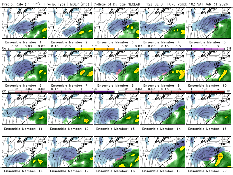
Insane ensemble graphic for 78 hours out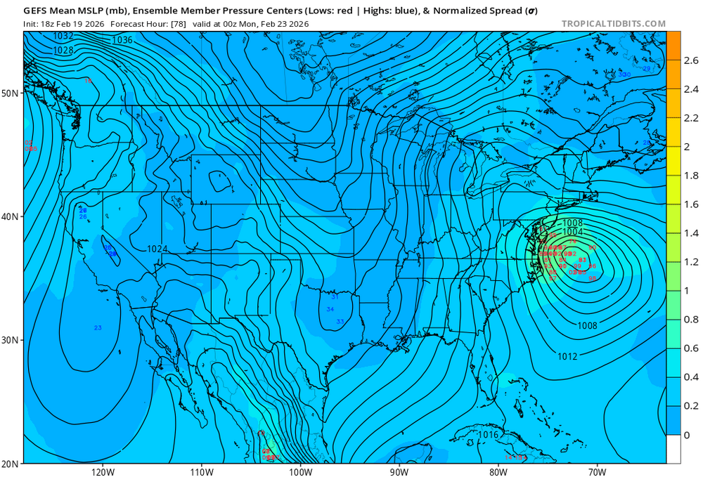
-
Central PA Winter 25/26 Discussion and Obs
GrandmasterB replied to MAG5035's topic in Upstate New York/Pennsylvania
24 hours ago the NAM had a low moving east off Jacksonville. -
Central PA Winter 25/26 Discussion and Obs
GrandmasterB replied to MAG5035's topic in Upstate New York/Pennsylvania
I’ve been on the road traveling for work this week, but the tracking for this event has been wild. Check out the Euro AI on TT and how much the coastal low moved northwest vs 12Z. This season has not disappointed on the tracking front! -
Central PA Winter 25/26 Discussion and Obs
GrandmasterB replied to MAG5035's topic in Upstate New York/Pennsylvania
That would be great for us verbatim. Significant CCB, comma-head action. -
Central PA Winter 25/26 Discussion and Obs
GrandmasterB replied to MAG5035's topic in Upstate New York/Pennsylvania
Early worry (of which I’ll have many!) is that a miller B type evolution will trend towards a later transfer and a northeast bullseye solution over time. Of course, it’s just one worry and it’s early yet. -
Central PA Winter 25/26 Discussion and Obs
GrandmasterB replied to MAG5035's topic in Upstate New York/Pennsylvania
Would love to do another long track storm. Sign me up! -
Central PA Winter 25/26 Discussion and Obs
GrandmasterB replied to MAG5035's topic in Upstate New York/Pennsylvania
I thought 500 was a bit improved with a faster phase, but as you show the surface was about the same really. -
Central PA Winter 25/26 Discussion and Obs
GrandmasterB replied to MAG5035's topic in Upstate New York/Pennsylvania
I don’t disagree, but the current solution as modeled is better than the precip missing us to the south by 300 miles. At least we have a shot with the precip now. -
Central PA Winter 25/26 Discussion and Obs
GrandmasterB replied to MAG5035's topic in Upstate New York/Pennsylvania
All good. Just busting some chops! -
Central PA Winter 25/26 Discussion and Obs
GrandmasterB replied to MAG5035's topic in Upstate New York/Pennsylvania
Today is Mickey’s day to shine! -
Central PA Winter 25/26 Discussion and Obs
GrandmasterB replied to MAG5035's topic in Upstate New York/Pennsylvania
Could be an interesting day of model watching. -
Central PA Winter 25/26 Discussion and Obs
GrandmasterB replied to MAG5035's topic in Upstate New York/Pennsylvania
Snow up to State College on the NAM -
Central PA Winter 25/26 Discussion and Obs
GrandmasterB replied to MAG5035's topic in Upstate New York/Pennsylvania
SREFs with an uptick in precip vs. prior run for those looking for model support. (But yes it’s the SREF)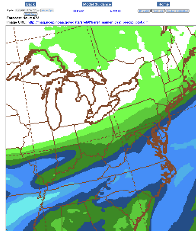
-
Central PA Winter 25/26 Discussion and Obs
GrandmasterB replied to MAG5035's topic in Upstate New York/Pennsylvania
GFS brushes us southern folks -
Central PA Winter 25/26 Discussion and Obs
GrandmasterB replied to MAG5035's topic in Upstate New York/Pennsylvania
With the OP Euro being decent and some of the ensembles interested, I think I can emotionally invest in this one. At least until TimB5412487 comes in and tells me the latest model is way south and weak.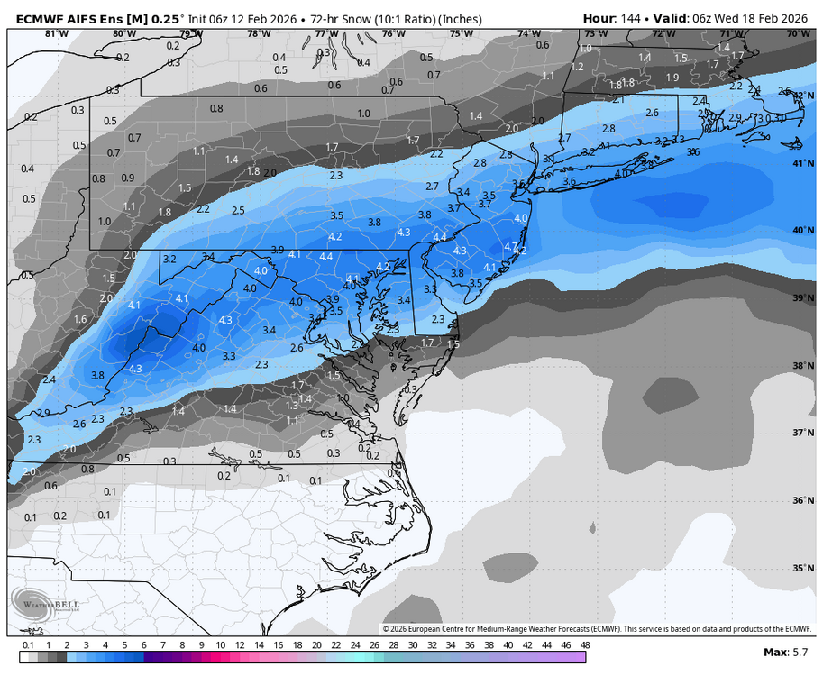
-
Central PA Winter 25/26 Discussion and Obs
GrandmasterB replied to MAG5035's topic in Upstate New York/Pennsylvania
I agree we are running out of time, but I’m not quite out on this threat yet when the GFS ensembles look like this. Check out number 5. Close enough to keep the thrill of “the track” alive!