Jns2183
-
Posts
5,838 -
Joined
-
Last visited
Content Type
Profiles
Blogs
Forums
American Weather
Media Demo
Store
Gallery
Everything posted by Jns2183
-
How the hell did that happen so fast Sent from my SM-G970U using Tapatalk
-
No, we rot all of April and May in very cold wet pattern and then go directly to 95. Our spring was this month and part of next Sent from my SM-G970U using Tapatalk
-
Haven't some down below cancelled until 2027 Sent from my SM-G970U using Tapatalk
-
Is it right or is it sniffing glue. I think we need a weekly glue sniffing ranking for models this year. The Euro probably gave you 70" of rain the past year. Sent from my SM-G970U using Tapatalk
-
We are getting an April where it struggles to hit 50 aren't we Sent from my SM-G970U using Tapatalk
-
The wind stays away from me like I'm carrying the pestilence or something. It's very warm in the sun. Sent from my SM-G970U using Tapatalk
-
We might need a two week breather till winters last hurrah Sent from my SM-G970U using Tapatalk
-
Your dungeon? Sent from my SM-G970U using Tapatalk
-
Hell yes Let the damnation fly like chocolate at a fat kids camp Sent from my SM-G970U using Tapatalk
-
The way we are going it will be 80 March 5th then a week below freezing April 5th Sent from my SM-G970U using Tapatalk
-
2nd or 3rd week in March is final target Sent from my SM-G970U using Tapatalk
-
Shermansdale has like 10" Sent from my SM-G970U using Tapatalk
-
I had 4" of pure fluff on the west shore Sent from my SM-G970U using Tapatalk
-
I had about 4" in camp hill but nothing on streets Sent from my SM-G970U using Tapatalk
-
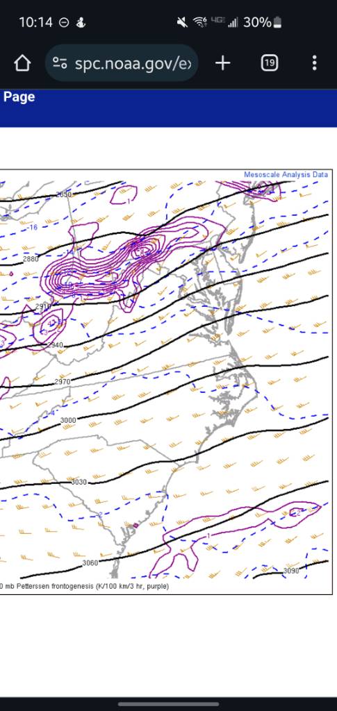
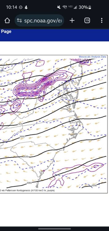
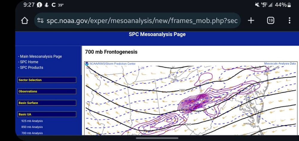
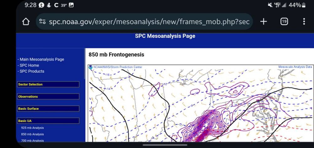
700mb Sent from my SM-G970U using Tapatalk
-
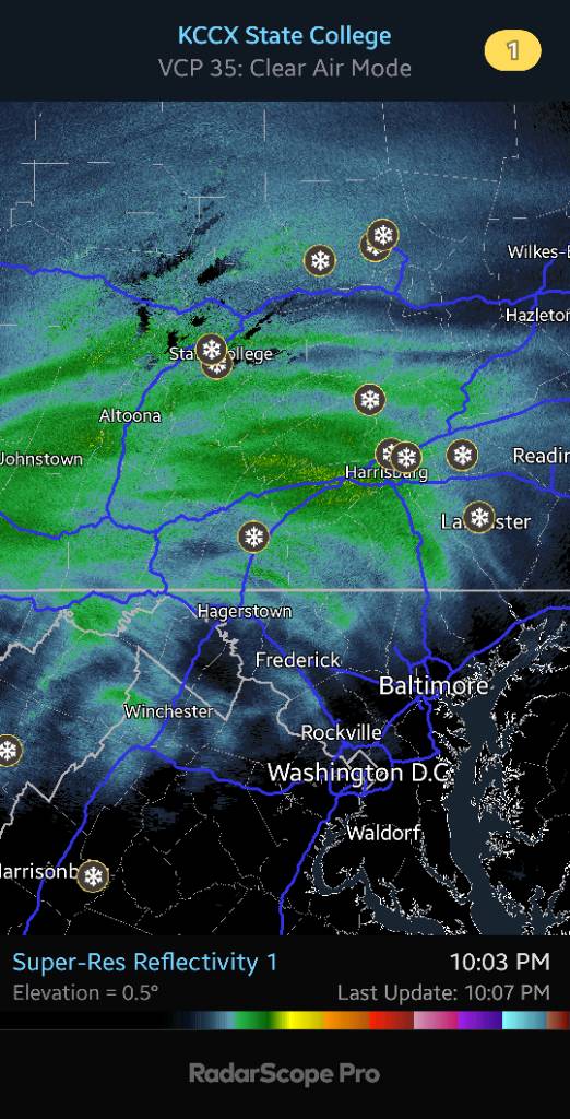
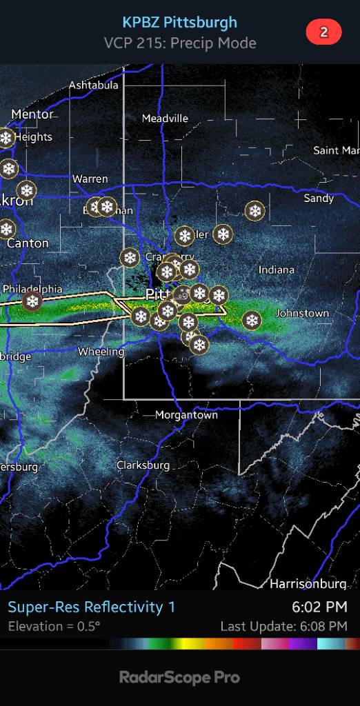
Some banding Sent from my SM-G970U using Tapatalk

-
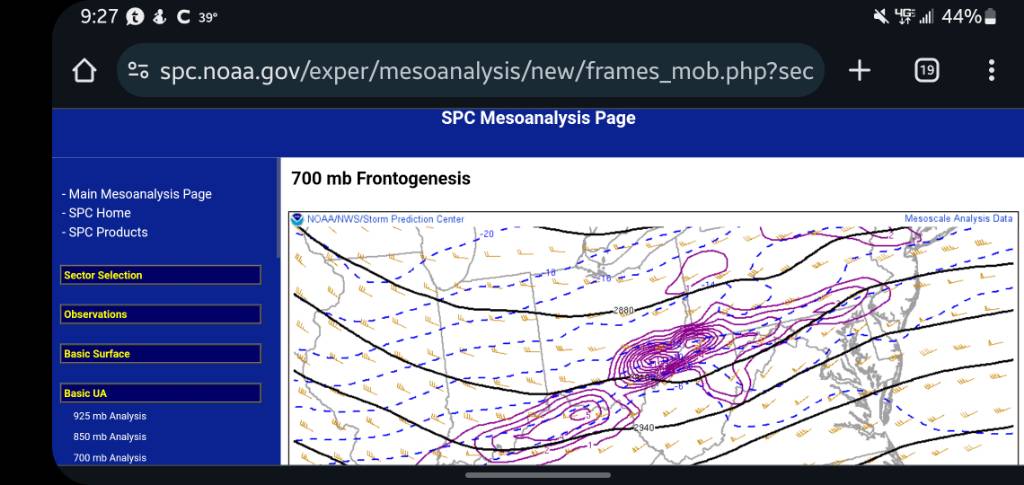
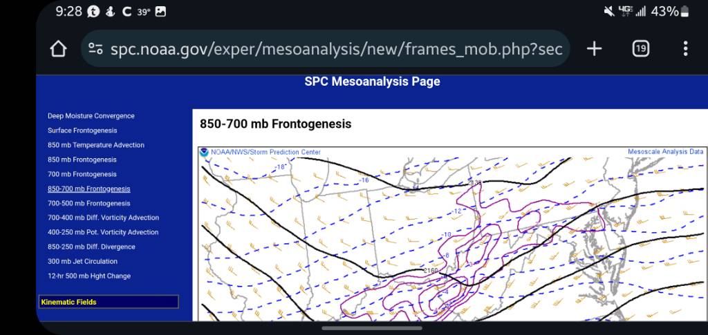
700mb 850mb 850-700mb Sent from my SM-G970U using Tapatalk

-
I have light snow now Sent from my SM-G970U using Tapatalk
-
Regardless, the lesson will be in all this that all our models are trash currently and anything is going to be possible now. Welcome back to the 1930s Sent from my SM-G970U using Tapatalk
-
We should wait till it occurs. Especially since people in Pittsburgh are saying it's an overachiever for them Sent from my SM-G970U using Tapatalk
-
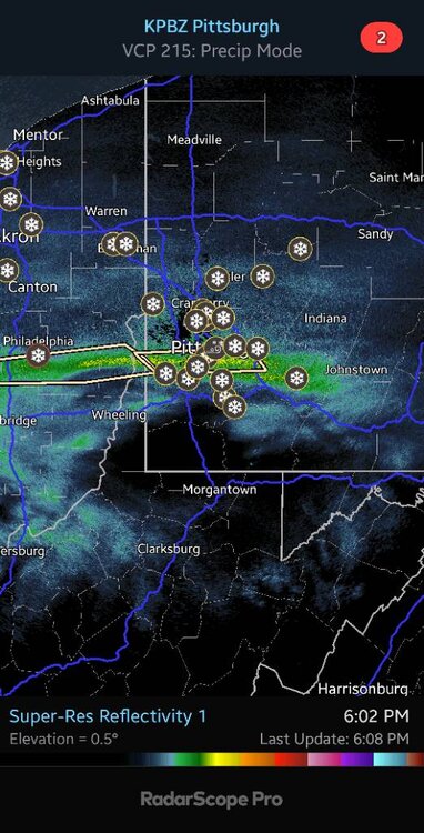
It's ugly in the forum to our south Sent from my SM-G970U using Tapatalk
-
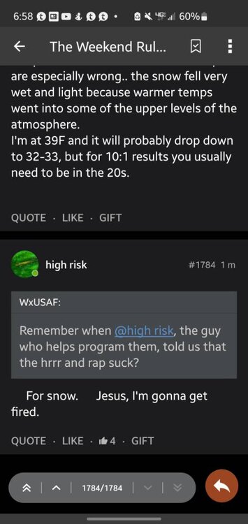
This is kinda funny Sent from my SM-G970U using Tapatalk
-
What are you drinking? Sent from my SM-G970U using Tapatalk
-
Narrow Sent from my SM-G970U using Tapatalk
-
That heavy snow band in Ohio that there is a special weather statement for is 10 miles wide, haha Sent from my SM-G970U using Tapatalk