
TJay
-
Posts
796 -
Joined
-
Last visited
Content Type
Profiles
Blogs
Forums
American Weather
Media Demo
Store
Gallery
Everything posted by TJay
-
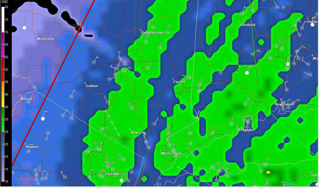
wow sharp cutoff. The band of heavy snow is hanging just east of mid orange county, just down the road a few miles from me
-
Waiting on the wind here. I would have guessed those bands were good for 2' per hour. Enjoy!
-
There have been some high intensity returns from L.I. in to CT heading west/NW but no lightning detected yet then again it might be sleet mixed in.
-
Must be a treat being from CA.
-
Nice, let us know the rate if you can
-
Bombs away soon. Radders is getting pounded.
-
Whats your location?
-
Hey GL where are you located? I have no wind in Goshen.
-
Since my last post I took my dogs out. What a change, heavy snow, nice sized flakes. with no wind yet.
-
I've been cooking a family dinner all afternoon and haven't paid attention to the radar. Like Andy said, its coming soon. It's at our door.
-
Thats a hopeful sign Jay, I was concerned since I don't recall have good snow totals with the snow structure I've had all day. Andy says not to worry so I won't What would cause the wet graupel type snow some of us have had all day? Warming in the upper layers?
-
Nice ! Thanks Andy
-
Moderate to now sometimes heavy snow. Snowing for 4+ hours. I have 0.70 Still crapy graupel.
-
Yeah every now and then some larger flakes appear and disappear, never more than 5% I think. Its a concern for large accums. I've had some good radar returns passing over me
-
moderate snow for the last 2 hours, little accm less than 1/2' majority of snow is very small "flakes" - graupel like and very wet. 21F Heard from family on Staten Island, 5+ on the ground. What type of snow structure are you guys seeing?.
-
Yep kinda surprised Orange was included. I guess the NWS alert system malfunctioned my alert radio didn't go off and I didnt get the orange blizzard warning from the OKX skywarn emaili list.. This is going to be an interesting afternoon/night for sure. First flakes here about 11:30am light snow now for about 20 minutes. The snow is not in flake form, its graupel. 21F
-
Wow Albany beats Upton with the Bliz inland warnings. I guess Upton will expand a bit more soon maybe Rockland and Putnam and inland CT
-
Trends are a bit east today, I think we have a large drop off the further west of the river you are .Still a decent hit. ATM I think Orange gets 6-12, higher side for elev and/or closness to the thruway and of course Harriman lol, .
-
0Z NAM cut back QPF KSWF 11.9 snowfall QPF ,89 KPOU 18.4 snowfall QPF 1.09 0Z GFS KSWF 29.5 snowfall QPF 1.31 KPOU 29.7 snowfall QPF 1.37
-
As long as it tracks west of the BM we should do well I think. The bufkit totals are insane - they print out some outrageous ratios during the height of the storm. Earlier I posted them along with the total qpf and snow fall using a simple 12.1 ratio for comparing - even then it was an impressive snowfall. We should have better ratios than the coast due to colder column temps and less wind. Looking at the 0Z NAM it looks like it shifted east a bit
-
http://www.meteor.iastate.edu/~ckarsten/bufkit/data/index.html
-
18Z GFS KSWF BUFKIT snow total 28.5 QPF 1.44 @ 12 to 1 ratio 17.28 KPOU snow total snow total 28.5 QPF 1.52 @ 12 to 1 ratio 18.24
-
Not seeing KDXR as a BUFKIT station.
-
18Z NAM KHVN 12 with mixing issues KHFD 13.8 with mixing issues
-
18Z NAM BUFKIT totals KSWF 26.5 KPOU 28.0