snowlover2
-
Posts
2,734 -
Joined
-
Last visited
Content Type
Profiles
Blogs
Forums
American Weather
Media Demo
Store
Gallery
Everything posted by snowlover2
-

Winter 2020-21 Medium/Long Range Discussion
snowlover2 replied to Hoosier's topic in Lakes/Ohio Valley
0z GFS teasing IN/OH on the 10th and 11th.
-
Happy New Year!
-
End of 0z Ukie.
-
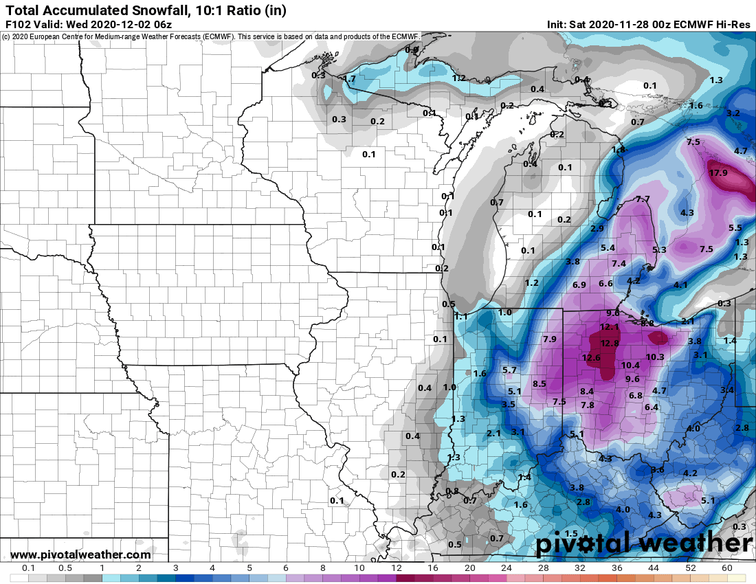
November 30-December 2 *Potential* Winter Storm
snowlover2 replied to Hoosier's topic in Lakes/Ohio Valley
The problem is that temps are going to be above freezing until monday night so snow will have a real hard time accumulating until then. -
November 30-December 2 *Potential* Winter Storm
snowlover2 replied to Hoosier's topic in Lakes/Ohio Valley
Problem is temps are above freezing until monday evening. -
November 30-December 2 *Potential* Winter Storm
snowlover2 replied to Hoosier's topic in Lakes/Ohio Valley
0z Euro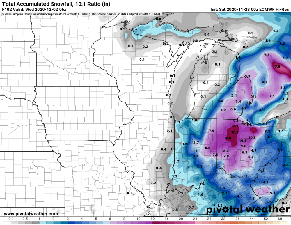
-
November 30-December 2 *Potential* Winter Storm
snowlover2 replied to Hoosier's topic in Lakes/Ohio Valley
0z GGEM also a big hit for Ohio.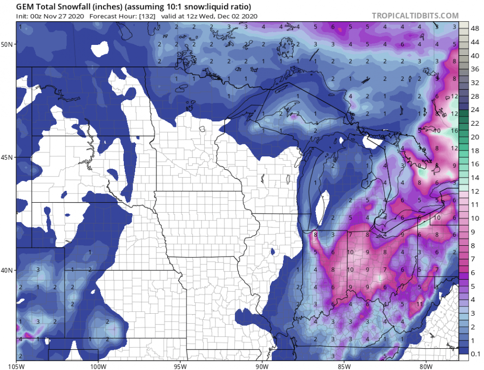
-
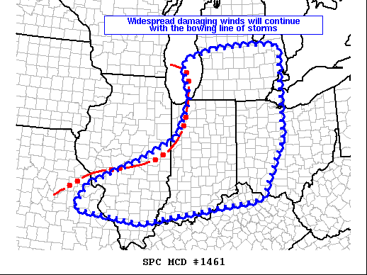
73mph winds near Winnebago IL.
-
If i had only gone higher on the total number of storms.
-
-
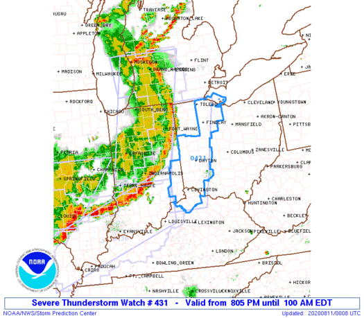
Um Wow! Indy under a warning for a storm moving 90mph!
-
Tornado warning for Fort Wayne.
-
Tornado warning west of Fort Wayne.
-
Watches farther east sound like they are coming.
-
Tornado warning north side of Chicago.
-
-
-
Only change from SPC on 20z outlook was to trim the west side of the risk areas where storms have already passed.
-
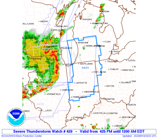
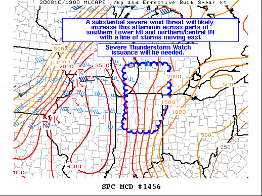
Watch coming for SW MI/IN.
-
New tornado warning in south WI.
-
-
Couple of tornado warnings in SW WI on the north side of the bow.
-
Probabilities for the watch. Tornadoes Probability of 2 or more tornadoes Mod (40%) Probability of 1 or more strong (EF2-EF5) tornadoes Low (20%) Wind Probability of 10 or more severe wind events High (90%) Probability of 1 or more wind events > 65 knots High (90%) Hail Probability of 10 or more severe hail events Low (20%) Probability of 1 or more hailstones > 2 inches Low (10%) Combined Severe Hail/Wind Probability of 6 or more combined severe hail/wind events High (>95%)
-
Second test he took this afternoon came back negative.
-
Ohio goes under a statewide order at 6pm today for 10 year olds and older. Obvious exceptions for medical conditions and eating and drinking.